All Activity
- Past hour
-
hang in there. the event is just starting across NC. all those echoes across TN/W NC and upstate SC will eventually be pulling east. Not saying Raleigh is gonna get a foot, but ya'll are still looking good for at least 2-3 inches.
-
 Hard to tell due to the wind but I’d guess 2.5-3” here in Farragut. Rates never really got high nor did they ever get to become high ratio feathers like in used to seeing in the plains. This one thus far is more like an intense long duration fog storm.
 -
We need snow
-

The “I bring the mojo” Jan 30-Feb 1 potential winter storm
QC_Halo replied to lilj4425's topic in Southeastern States
I guess it’s a fine line being a broadcast met….make a popular call, or an accurate one. -
-
Down to 3 here 7 / -4 currently. Cold overall with brief moderation to or abover freezing in areas Mon - Tue - Wed. Clippers bring reinforcing cold shots and potential light snow later Wed - Thu morning , Fri - Sat. Some show clipper deepening once off the cost Saturday which could enhance snows in LI/SNE (well see). 1/31 - 2/1 : Stong cold much below avg 2/2 - 2/4 : Below normal but may crack freezing or mid 30s in areas 2/5 - 2/ 7 : Colder / clipper - potential light snow, Watch for enhanced snows Fri night / Sat eastern areas 2/8 - 2/13 : Cold overall - long range storm risk 2/11 - 2/13 timeframe 2/14 - Beyond : overall cold / Below normal
-

Arctic Hounds Unleashed: Long Duration Late January Cold Snap
512high replied to WxWatcher007's topic in New England
-8 Home Davis, no walking the dogs this am... -
I will never forget this storm. The big U shape is incredible. Also, don’t know if the NAM is the model that should be discontinued. .
-

E PA/NJ/DE Winter 2025-26 Obs/Discussion
MickeyTim6533 replied to LVblizzard's topic in Philadelphia Region

-
Radiational cooling did its job last night. Starting the day at -7 this morning. Off to get the DN and Skeeter ice boats ready for this afternoon
-
Welcome everyone!!!! I knew it would start getting busy in here. Just wait until this evening. We fell for this shit last week. Why did we think it would be any different. Those clown maps were like a hot chick flashing us....we jumped all over it.
-
Issued at 645? WOW. I dont see how that verifies. Maybe an inch in south NN
-
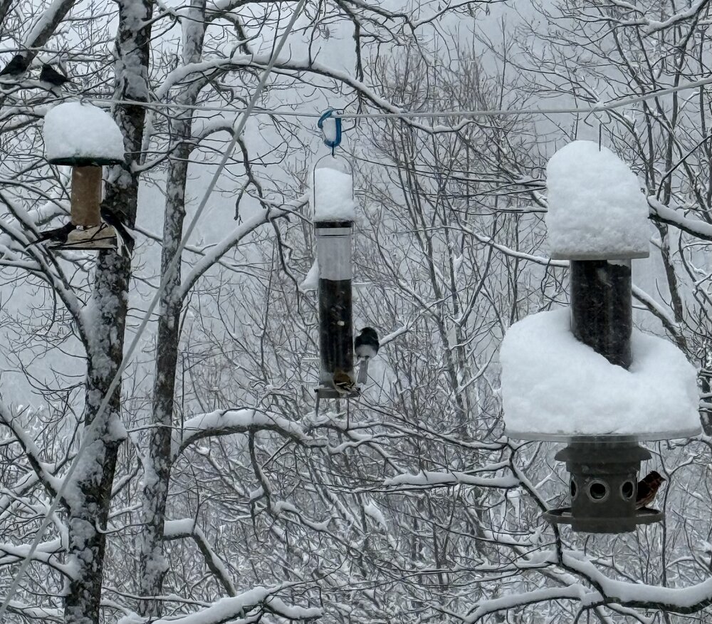
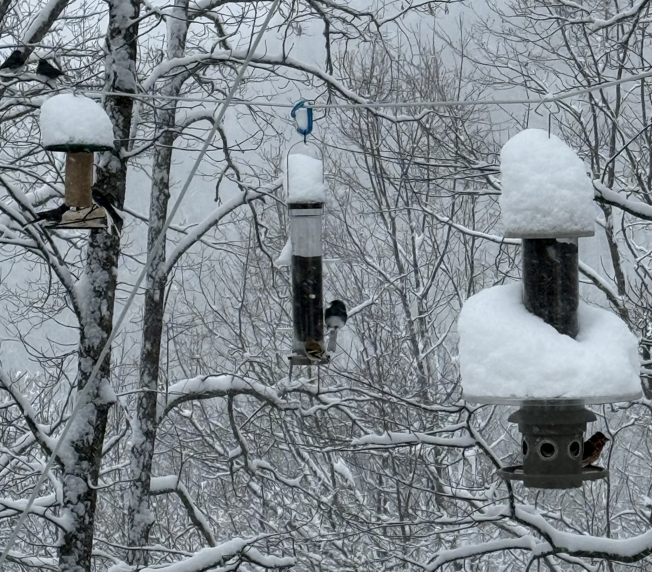
 Enough daylight now for the obligatory deck pick:
 -

2025-2026 Fall/Winter Mountain Thread
ncjoaquin replied to Buckethead's topic in Southeastern States
Absolutely hammering here! My best snow so far. Haven't measured, but I will estimate 4 inches. -

Arctic Hounds Unleashed: Long Duration Late January Cold Snap
VivaManchVegas replied to WxWatcher007's topic in New England
"Best" so far. -7. Tearing through the wood pile like it was 1999. My parents are freaking out in FL. I am going down there on Thursday. Might have to pack a sweater.
-

The “I bring the mojo” Jan 30-Feb 1 potential winter storm
Coach McGuirk replied to lilj4425's topic in Southeastern States
18.2 here, nothing. But anything will stick. -

Arctic Hounds Unleashed: Long Duration Late January Cold Snap
Baroclinic Zone replied to WxWatcher007's topic in New England
-9F -

January 30th- Feb 1st ULL and coastal storm obs
sakau2007 replied to JoshM's topic in Southeastern States
near Rising Fawn, GA about a mile from the AL/GA state line. Pretty good snow shower over this area for several hours.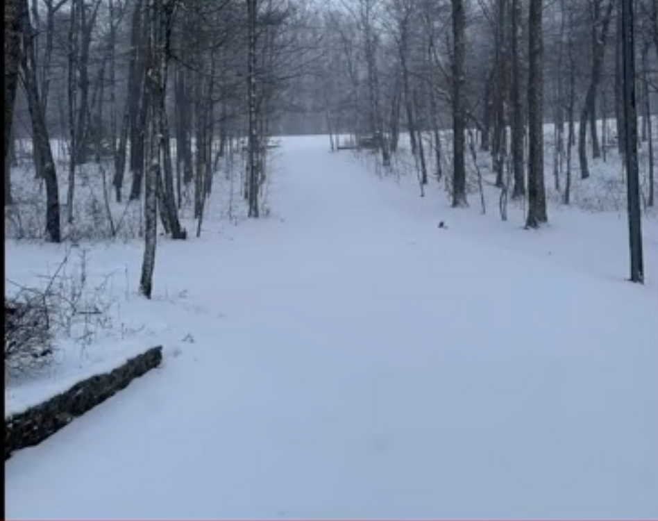
-

Winter cancelled/uncancelled banter 25/26
donsutherland1 replied to Rjay's topic in New York City Metro
I will get a bigger list shortly. -
January 30th- Feb 1st ULL and coastal storm obs
QC_Halo replied to JoshM's topic in Southeastern States
Light snow in South CLT. -
Noticed something else that I've heard about, but never seen here, and that is the waves of subsidence and lift associated with a strong upper low. Just like the ocean, if you have a wave, you have a peak and a trough. Same thing here (I think) seen in the cold cloud tops. Also John has the best lift right now, because why not, lol
-
Its cold. Just got back in from feeding all the animals (Horses, Chickens and such). 23 currently with small gusts of wind. should be at an 1" if not more. But its raking with below 1/2 mile vis
-
 Lowpressure1 changed their profile photo
 -
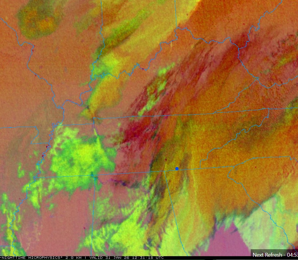
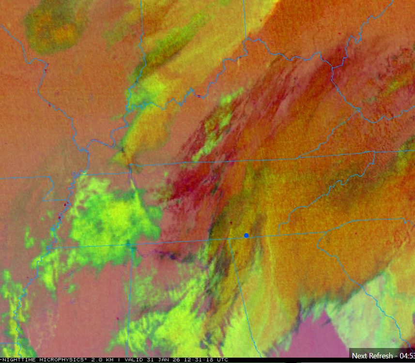
Per OBS thread, KCHA lower elevations has another couple hours as the last lobe on radar comes through. Shows as multi-layer clouds on Satellite (below) just coming in, and following the overnight round now east. Signal Mountain and points north especially the Upper Plateau should have good snow showers all day, some moderate north, in the moist low-level flow beneath cold core aloft. Several hours of steady snow will continue farther east in the Winter Storm Warning areas. Then any upslope areas will have snow showers well into tonight with the upslope half of the event. Mountains will still go hard overnight and probably still have snow showers going Sunday morning. Cold upper-level low is just swinging into northwest Tennessee at this 12:30 UTC shot below. That'll keep things going
-
Also, the pattern on the GFS for the next two weeks looks great. Doesn't look like this will be our only one!
-
Agreed. The atmosphere needs some time to reorganize I guess.


.thumb.jpeg.f5c6ba9d911ec96b3b124f8606aee58e.jpeg)