All Activity
- Past hour
-
Nice to wake up to this... looking like a snowy Thanksgiving day. HZ012>014-089-251430- /O.EXB.KCLE.WS.A.0006.251127T1200Z-251129T0000Z/ Lake-Geauga-Ashtabula Inland-Ashtabula Lakeshore- Including the cities of Ashtabula, Jefferson, Willowick, South Russell, Roaming Shores, Eastlake, Middlefield, Wickliffe, Geneva, Mentor, Chardon, Bainbridge, Chesterland, Orwell, Willoughby, Conneaut, Burton, Andover, and Painesville 122 AM EST Tue Nov 25 2025 ...WINTER STORM WATCH IN EFFECT FROM THURSDAY MORNING THROUGH FRIDAY EVENING... * WHAT...Heavy lake effect snow possible. Total snow accumulations over 8 inches are possible. Winds could gust as high as 45 mph. * WHERE...Ashtabula Inland, Ashtabula Lakeshore, Geauga, and Lake Counties.
-
It looks transient and more like a reshuffle though on the GEPS/EPS, you can see D15-16 already it seems a ridge is trying to begin popping again in W Canada or along the coast. I'd be surprised if we have that rabid of an MJO wave going into 8 that we see a pattern like that, though once in a great while we've seen a raging -PNA/+AO/NAO with a phase 8 MJO, I think maybe January of 1990 we did, but I'm not sure if its ever been with a wave potentially that strong.
-
Morning update: Colder. Where? Every single ensemble.
-
What a torch lol. Canadian with its first ice doomsday clown map of the season. .
-

Nov 28-30th Post Turkey Day Wintry Potential
DocATL replied to Chicago Storm's topic in Lakes/Ohio Valley
ICON feels more realistic, talking completely out of my arse. Whatever has the lowest totals. Also rain nosing northward on Euro after the early thump so there’s that too. -

November 2025 general discussions and probable topic derailings ...
WinterWolf replied to Typhoon Tip's topic in New England
Lol..thanks for keeping it real. Just take the opposite of whatever the Pope says, and you’ll be pretty close. -
Dense fog and scattered showers this AM. Upgraded to a WSW overnight. I’m still only expecting 3-4” imby but with the combination of wind, busy travel period, and the first significant snowfall of the season I understand why the NWS felt like upgrading most of the southern half of the state.
-

2025-2026 ENSO
donsutherland1 replied to 40/70 Benchmark's topic in Weather Forecasting and Discussion
This is pretty much the consensus idea for the first 10 days of December. The cold will spread through the Upper Midwest, the Great Lakes and then eastward. Some pieces could reach the Southeast as the ridge is flattened for a time. Unfortunately, if the latest guidance is right, like a champion fighter, the SE Ridge will pick itself up and keep coming back. Then, if some of the more recent guidance is right, namely the development of an AO+ pattern, the ridge could rebuild. The Great Lakes Area (Chicago, Detroit, Milwaukee, Toronto) and northern New England/eastern Canada should see a continuation of the cold past mid-December and perhaps onward. I suspect that snow will develop in the Chicago area late Saturday or Saturday night and then spread into Detroit and Toronto afterward. A moderate snowfall appears likely. -
Will always does great work. He’s one of the few I’ll listen to for LR updates. .
-
Lots of variability in solutions but snow acc possibilities exist next week, esp I84 corridor.
-
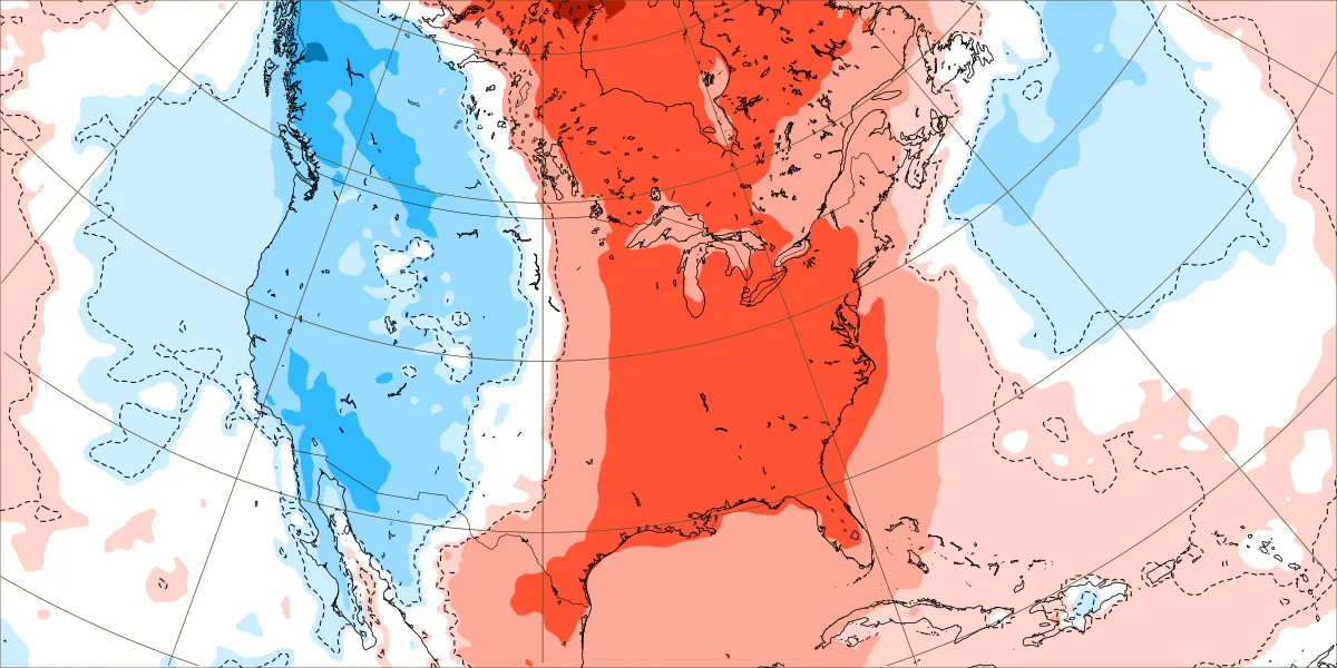
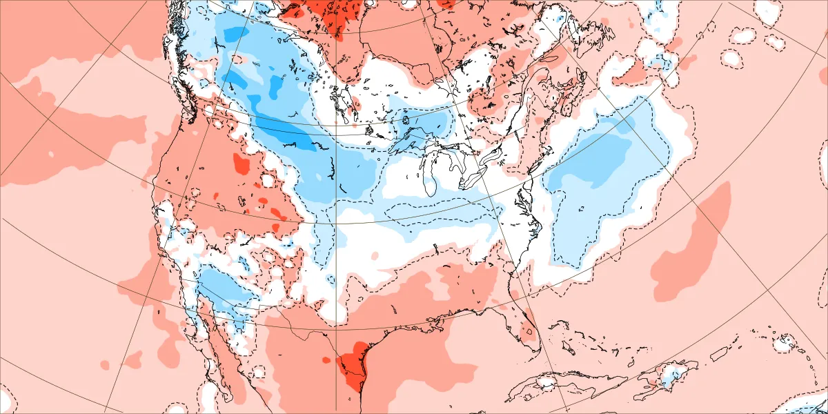
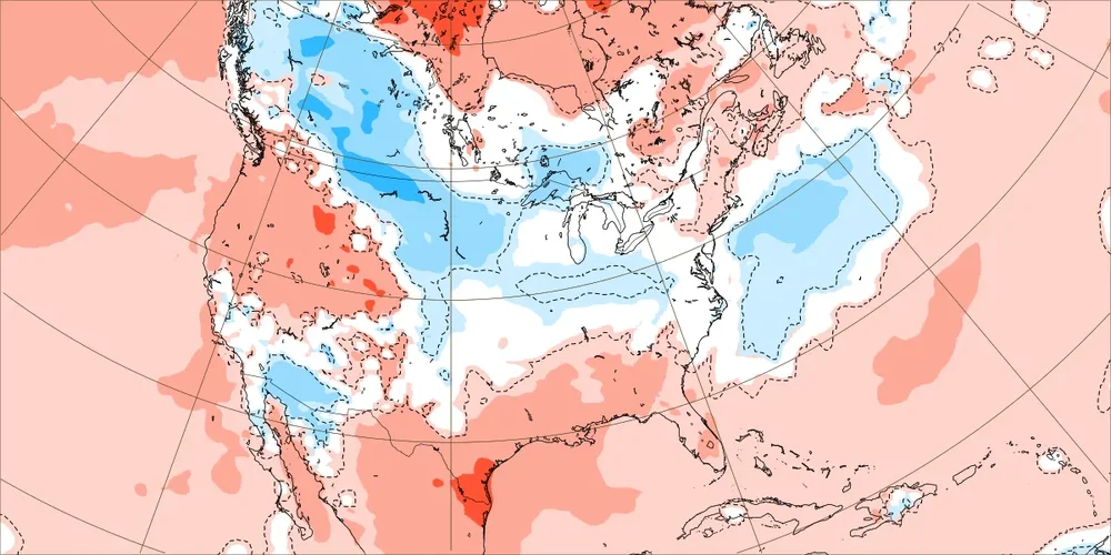
Euro Weeklies 2m temps for 11/24-30 and this is before the very recent cooldown for early Dec: 11/17 run: 11/24 run:

-
Planning a sct 45-50 MPH thread 6A-6P Friday for the entire NYC subforum. EPS has most sampling sites 40-43 MPH and has been trending conservative in recent daytime w-nw situations. Expecting a few detours, power outages. Wind advisory potential. I will try to issue at 5P today or 6A Wednesday. As for Macy's Parade... most gusts below 30 MPH Thursday, but cant rule out 35 MPH.
-
This is why I would much rather roll the dice with a very strong El Niño even if the winter is very warm like 23-24. We got a one week relaxation from the overpowering Northern Stream which has been dominating last 7 years. The El Niño driven Southern Stream was 2nd strongest on record for DC.
-

2025-2026 ENSO
michsnowfreak replied to 40/70 Benchmark's topic in Weather Forecasting and Discussion
Thank you Don. I knew todays run was colder, which is why I said that to spartman. You don't ever look at the cfs weeklies (or any weeklies) and speak in absolutes. They change all the time. -

November 2025 general discussions and probable topic derailings ...
MJO812 replied to Typhoon Tip's topic in New England
That's what the models are showing. Models are getting colder for the first week thanks to the negative epo. Mjo is on the way through 7 into 8 through December. Bigger press. -
Just enough water from the sky this am to touch the 0.01 spot on the CoCoRaHS gauge. Currently 41.8/36.0 with sprinkles. Temp fell into mid 30's around midnight, then slowly rose as the clouds filled in and the sprinkles/light rain started about 6 am. NWS calling for a 56 high here, let us see if they get this one right, unlike back on the 17th when I topped out at 41 degrees on a 55 degree high forecasted when it drizzled/rained thru the day.
-

November 2025 general discussions and probable topic derailings ...
CoastalWx replied to Typhoon Tip's topic in New England
Euro AI ensembles are pretty cold on the entire run, but not really enthused about later next week. -
 Ill take some Snow on my birthday!!
 -
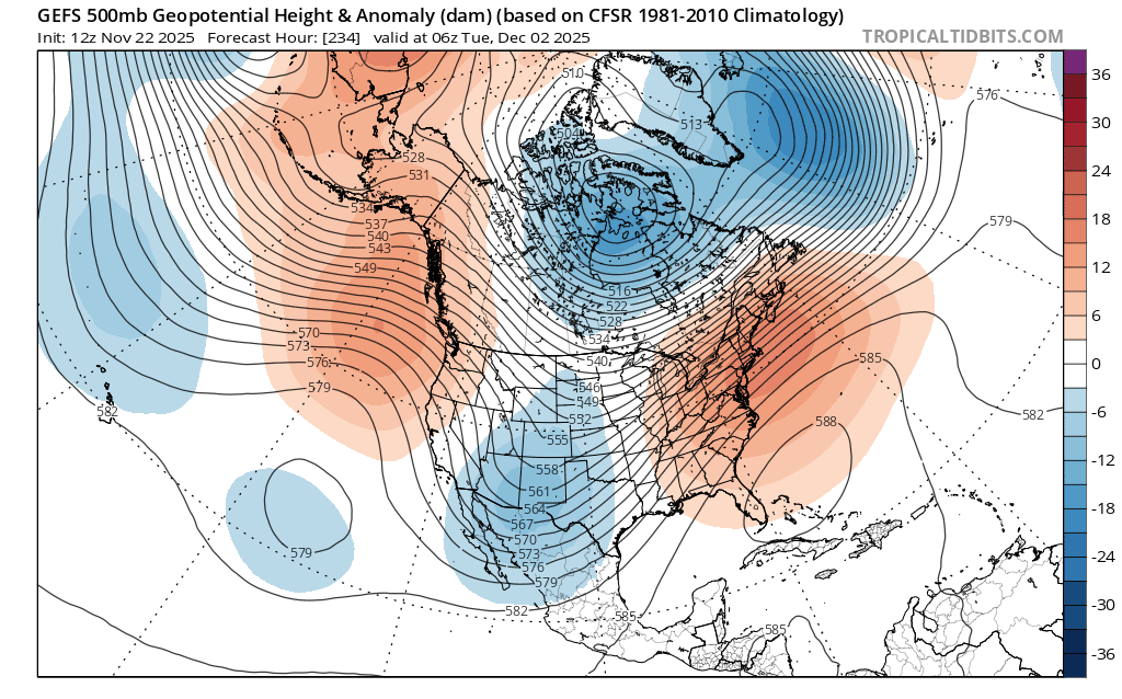
Typically yes but we will not know how much press there will be for days . There has been a trend on the models with the PV getting further south thanks to the negative epo.
-

2025-2026 ENSO
brooklynwx99 replied to 40/70 Benchmark's topic in Weather Forecasting and Discussion
yeah, the poleward extension should make things rougher for a week or so, then it should become more favorable again after the 15th as the MJO orbits even then, the TPV being nearby and a cold source region won't make it impossible to get lucky -
It looks like this is our first window (I'm on the very very southern edge of it so not expecting much). After this first window, the PNA looks to go pretty deeply negative then rise back to neutral-ish by mid-month. Then we should get another window sometime after that.
-
Hopefully you are right with guidance showing this at day 7
-

2025-2026 ENSO
40/70 Benchmark replied to 40/70 Benchmark's topic in Weather Forecasting and Discussion
Yes, I def. wouldn't love this in your area. Yea, difference should be enough to get me in the game, at least. -
2025-2026 ENSO
brooklynwx99 replied to 40/70 Benchmark's topic in Weather Forecasting and Discussion
this is a pretty obvious colder shift. SE ridge is squashed, potentially opening up a risk for accumulating snow for the Northeast mid-week. can thank the more robust -EPO for that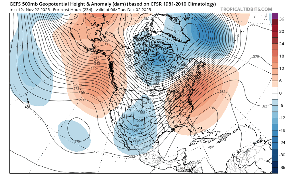
-

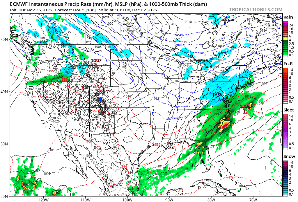
December 2025 Short/Medium Range Forecast Thread
Carvers Gap replied to John1122's topic in Tennessee Valley
The irony of looking at a monster SER for a few days on modeling…only to need a NW trend this morning. That is what makes this hobby so great and maddening at the same time. The CMC cuts west of the Apps. We prob need the GFS to stay SE of us. If that SER flexes at all, that system is going to St Louis. But the cold pressing eastward on modeling and ensembles is strong. I would suspect a system is brewing, but with model mayhem, I have not idea where it is going. I would think someones in our forum area might do ok with it.