All Activity
- Past hour
-
Days and days.....
-
2.32” here since Friday.
-
At least you got something. My area had clouds with scattered sprinkles. Another boring non event to add to the drought pile.
-
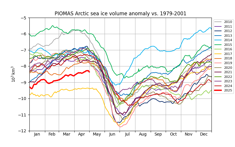
This year is #2 in sea ice volume at the start of the melt season, beyond 2017 another post nino year. Will need favorable weather, like 2017, to avoid a low September minimum.
-
Let’s not. We’re fine. Got Friday again too.
-
Gonna be tough for anybody outside of far SW CT to get more than 2-3” total I think. That band is fading a bit.
-
Got about 0.2” from the evening rain yesterday. So over 1” from this event over 4 days but that’s far from a drought buster. Really need like 200% of normal precip this month and next.
-
Jesus who cares
-
.thumb.jpg.6a4895b2a43f87359e4e7d04a6fa0d14.jpg)
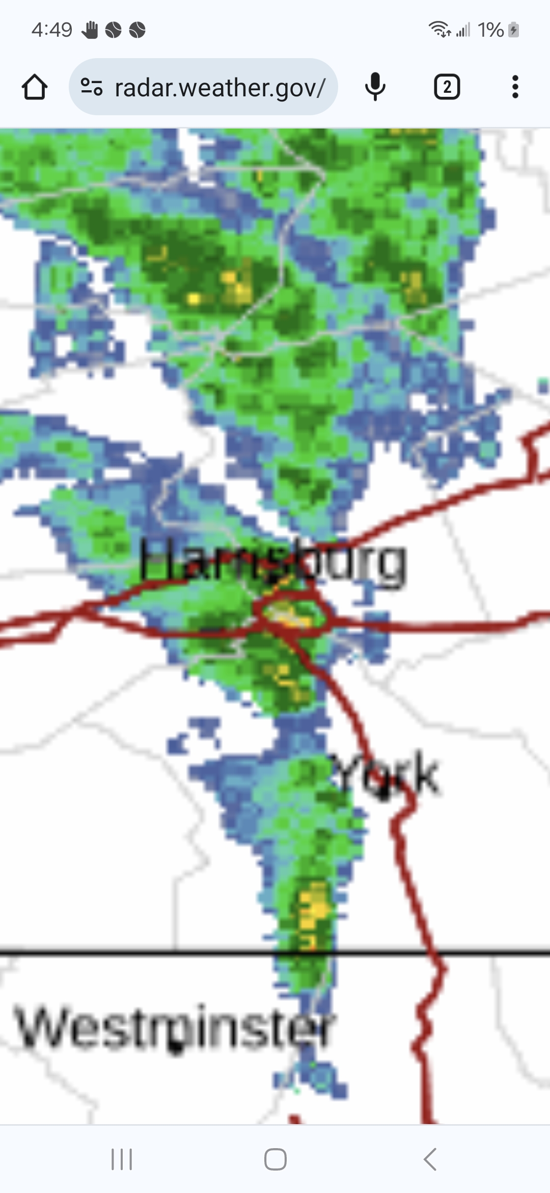
Central PA Spring 2025
Yardstickgozinya replied to canderson's topic in Upstate New York/Pennsylvania
I'm still getting bouts of light rain but this is probably the last gasp until we destabilize again later today.
-
congrats @Damage In Tolland AWT
.gif.247d0ed2420cb89e8811ab65d064cc81.gif)
- Today
-
Lost the heating of the day
-
 Gilkian8980 joined the community
 -
Central PA Spring 2025
Yardstickgozinya replied to canderson's topic in Upstate New York/Pennsylvania
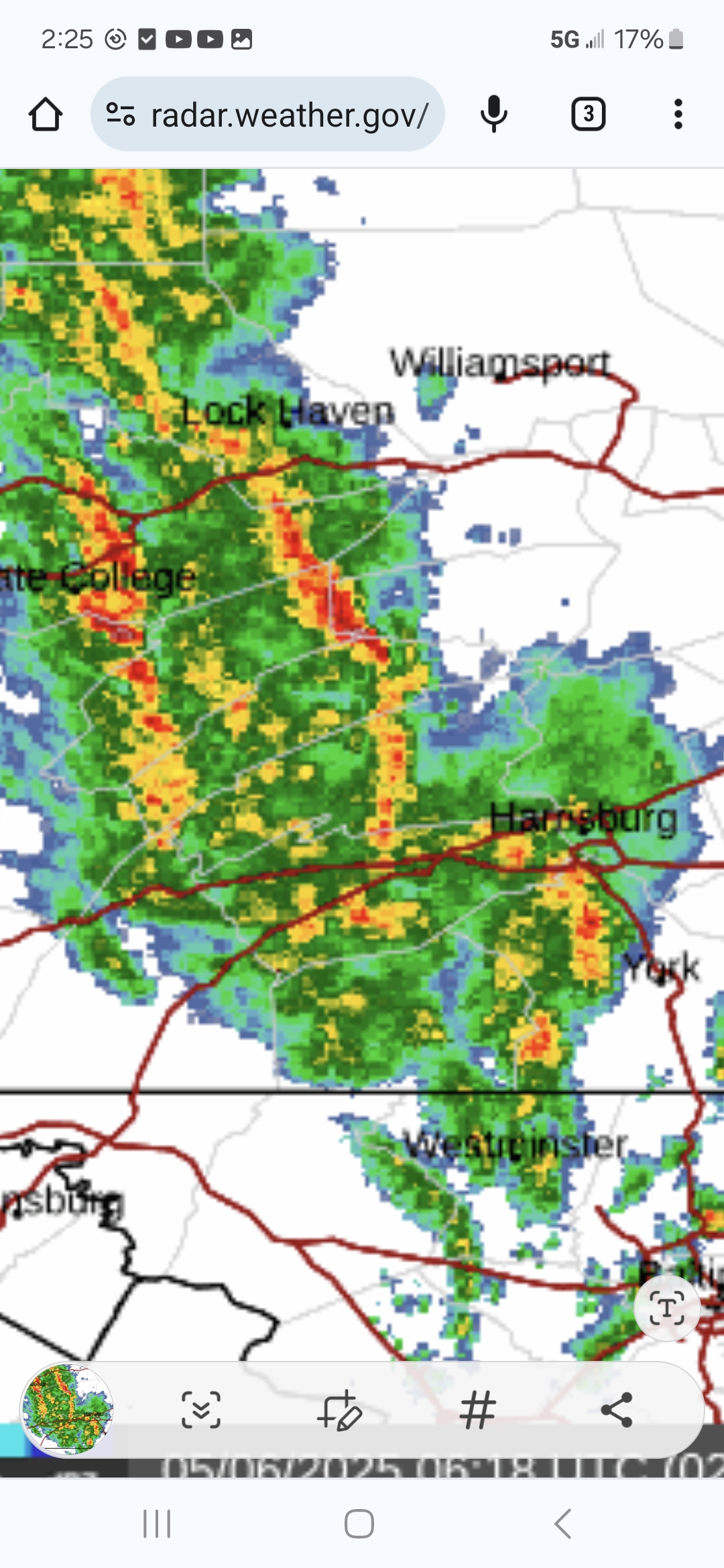
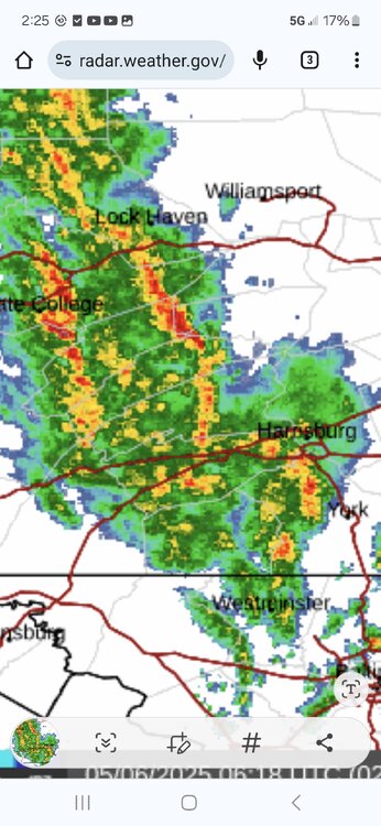
Its still trying to train some up.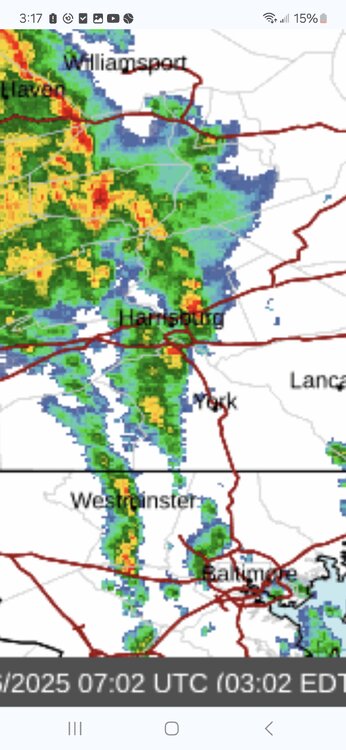
-
Central PA Spring 2025
Yardstickgozinya replied to canderson's topic in Upstate New York/Pennsylvania
-
Let’s shift some of that steady moisture further east about 100 miles. We’ve probably picked up about 3/4 inch from just quick hitting showers+downpours, but it pales in comparison to what others have got.
-

Central PA Spring 2025
TheDreamTraveler replied to canderson's topic in Upstate New York/Pennsylvania
The storms curved and angled slightly over. Been pouring heavily here now for a while. I thought we were gonna miss it too earlier -
congrats eastern LI.
-
2.33 so far
-
Central PA Spring 2025
Yardstickgozinya replied to canderson's topic in Upstate New York/Pennsylvania
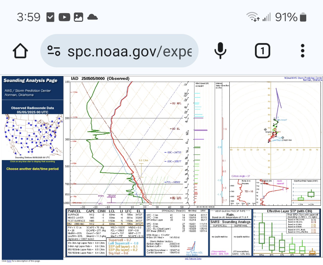
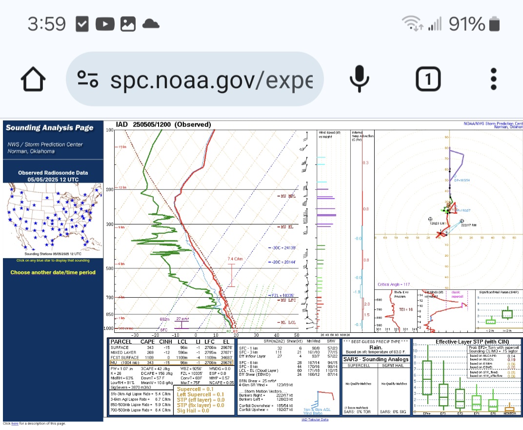
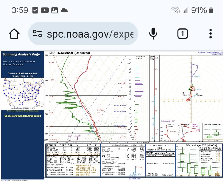
Hence, the disclaimer. I now realize that the soundings were actually observed at 12:00am and 12:00 pm, which is crazy to me. I have been adding 5 hours to account for central time zulu, so I thought that the soundings were taken at 5am and 5pm. Now it all makes sense, I think. lol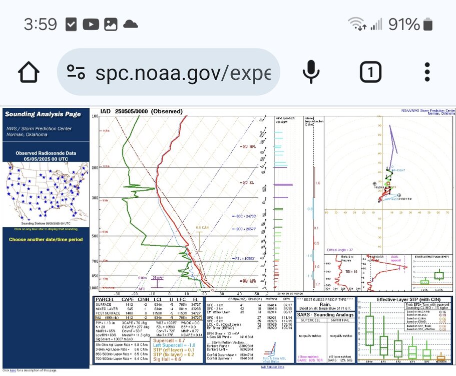
-

E PA/NJ/DE Spring 2025 Obs/Discussion
RedSky replied to PhiEaglesfan712's topic in Philadelphia Region
.20" Monday 2.40" total -
It’s astounding how that works
-

2025-2026 ENSO
Stormchaserchuck1 replied to 40/70 Benchmark's topic in Weather Forecasting and Discussion
In 2001, I was driving from Phoenix to San Diego. It was 111 degrees. In the middle of the trip, we hit a hail storm that must have stalled out over the same spot for 2 hours. There was 5-6" of hail on the ground. We had to pull over and wait for it to partially melt. The car temp dropped to 46 degrees in the middle of the hail storm.. it was a wild sight with cactus' completely covered in ice. That area can get a good dumping because storms don't move much.. I think the hail on the ground only covered a 1-mile radius. -
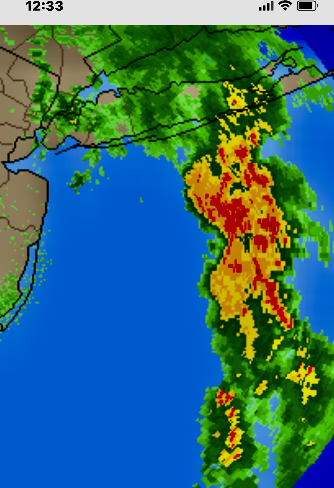
Right now worst of it looks to be east towards KFOK. Almost has a similar look to the plume from the infamous Islip floods. Though that was a higher dew, higher moisture and higher rates event due to the warmer water temps later in the season.
-
Let’s hope not. 1.65” for the event and the ground is saturated. The new house is essentially a construction site so flooding will be no good
-
This is an image of the hail storm I was talking about the other day. Pretty amazing demarcation of white v. brown.