All Activity
- Past hour
-
I still think the 6/1/11 event that evening was the best night show I've ever seen. Just constant flickering and lots of close CGs. My old co-worker who chases in the Plains called it OKC lightning. Said the best he's seen around here. Knocked out power for the Bruins Stanley cup game lol. I think it was game 1.
-
Crazy differences

-
66/55 up here… different vibe than the dews in the 10s yesterday.
-
Someone else posted this here a year or two ago..One of the most insane clips I’ve ever seen:
-
So it goes as with most of the storms here. I'm left wondering if we'll get much of anything the next few days. The latest drought monitor continues to show the same persistent trends nearly perfectly, in that the precip hits a wall about 2/3 of the way across PA and NY state. Look what happened with last weeks line, shredded to nothing once it passed state college. It's interesting how parts of NY state and New England have had persistent rain and snow these past months, and have run normal or above in the precipitation category. These same trends can be seen on soil moisture maps too. Bottom Line: don't cancel any outdoor plans. You might be fine.
-
Yeah cutting off farther west and moving out a little quicker next week seems like the 2 biggest problems. PWATs are still juicy, so showers should be good rainers.
-
The problem is that the upper low now looks to cut off further west, so Sunday is probably now a warm day with convection that the GFS is likely not resolving well. That said, it could very well end as an event with winners and losers instead of everyone getting some love.
-
Tippy butt bangin' done here. sun out and pushing 70+
-
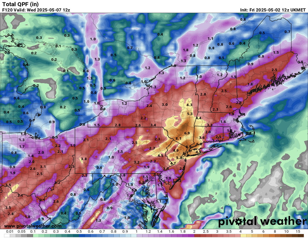
I'll be satisfied as long as we get around an inch of rain. We don't need the big 3 to 5 inch amounts that the Euro is showing, but we do need a good watering. It'll be interesting to see if the Euro holds with the much bigger amounts on the 12z run. It seems as if our very big rain event is falling apart.
-
I wasn’t expecting today to be mostly sunny and have the highest real feel temps of the season so far on the south shore. It’s almost uncomfortable in the sun.
-

E PA/NJ/DE Spring 2025 Obs/Discussion
RedSky replied to PhiEaglesfan712's topic in Philadelphia Region
GFS/NAM around .25" through mid afternoon Sunday then the bulk falls late day into Monday 1.25" additional RGEM .75" total southeast PA through Monday ouch -
Tip-I don’t feel your implication of dank socked in (ostensibly via a back door) is applicable. Even when overcast temps easily moved into the upper 60s. Now as the sun breaks out, we should end up a solid +10 on the daily max.
-
We will get some rain b/w now and next Tue/Wed but the big totals are looking less and less likely
-
12z GFS is kind of a bust in our area.
- Today
-
This was always a shaky evolution. We'll see what the final results are but the super hefty event totals (3-4"+) are looking very questionable especially along and east of I95.
-
i troll spartman, and then guidance flips. i see how it is...
-
sun just poked out should warm quick now
-
81 and a DP of 61 at noon. It’s uncomfortable, especially for May 2. Edit: just flipped on the AC. 77 in the house isn’t awful but the humidity makes it miserable.
-
Looks like Saturday afternoon into night is the coasts chance of decent rains .
-
Severe thunderstorm watch, West and Middle Tennessee
-
Someone needs to put a comma in the thread title so it reads, "Weekend Drought, Buster."
-
Gfs is a groin kick for the metro area
-
I may relocate inside...maybe the sun makes in appearance in the next hour but its not pleasant outside.
-
46.8F. Quit your bitchin
-
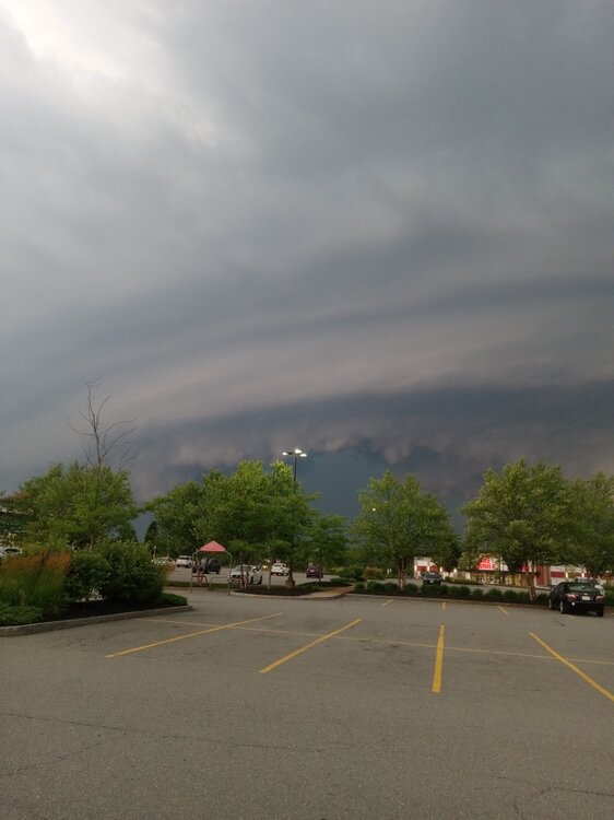
Another spot I love going is Market Basket in Athol.. hard to tell by this pic but you get pretty good views