All Activity
- Past hour
-
That 4.3" in the park is probably higher now. has been snowing at a good clip since 7 in the city.
-

Central PA Winter 25/26 Discussion and Obs
anotherman replied to MAG5035's topic in Upstate New York/Pennsylvania
Look for an owl somewhere in the middle. -

E PA/NJ/DE Winter 2025-26 Obs/Discussion
The Iceman replied to LVblizzard's topic in Philadelphia Region
13-14 definitely was a good December too iirc. No biggies but several nickle and dimes. -
at this point we just need precipitation in any form. It's getting bad.
-
About 3.5 inches here, 10.5 for the month
-
Flurries flying around today.
-
I hope we get warm enough to get the ice out of the trees before the next blast of CAA. A couple hours at 40° would do it.
-
In 2023,I believe Christmas eve, we had a noreaster flood out everything then froze solid followed by sound effect snow that was accumulating several inches in fact. While rest of island saw nothing.
-

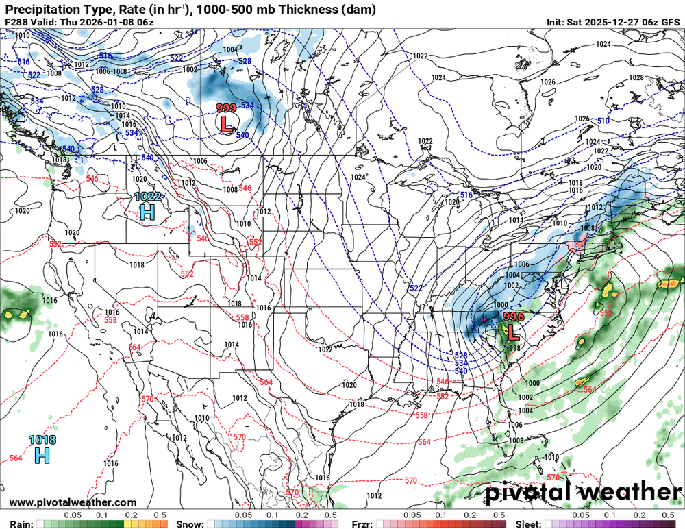
2025-2026 ENSO
PhiEaglesfan712 replied to 40/70 Benchmark's topic in Weather Forecasting and Discussion
Problem is this is still a -ENSO/-PDO/-IOD winter. Those types of winters don't cold all the way through December and January, unless you have a relaxed Pacific Jet (like 2010-11), and we don't have that this year. If it was a +ENSO/+PDO (like 2014-15), I'd be easily predicting a cold and snowy January. I think January will turn warm, at least be a near normal, or even above average temperature departure. -

January 2026 regional war/obs/disco thread
Kitz Craver replied to Baroclinic Zone's topic in New England
It’ll get up there, hopefully it doesn’t wipe this lovely pack out -
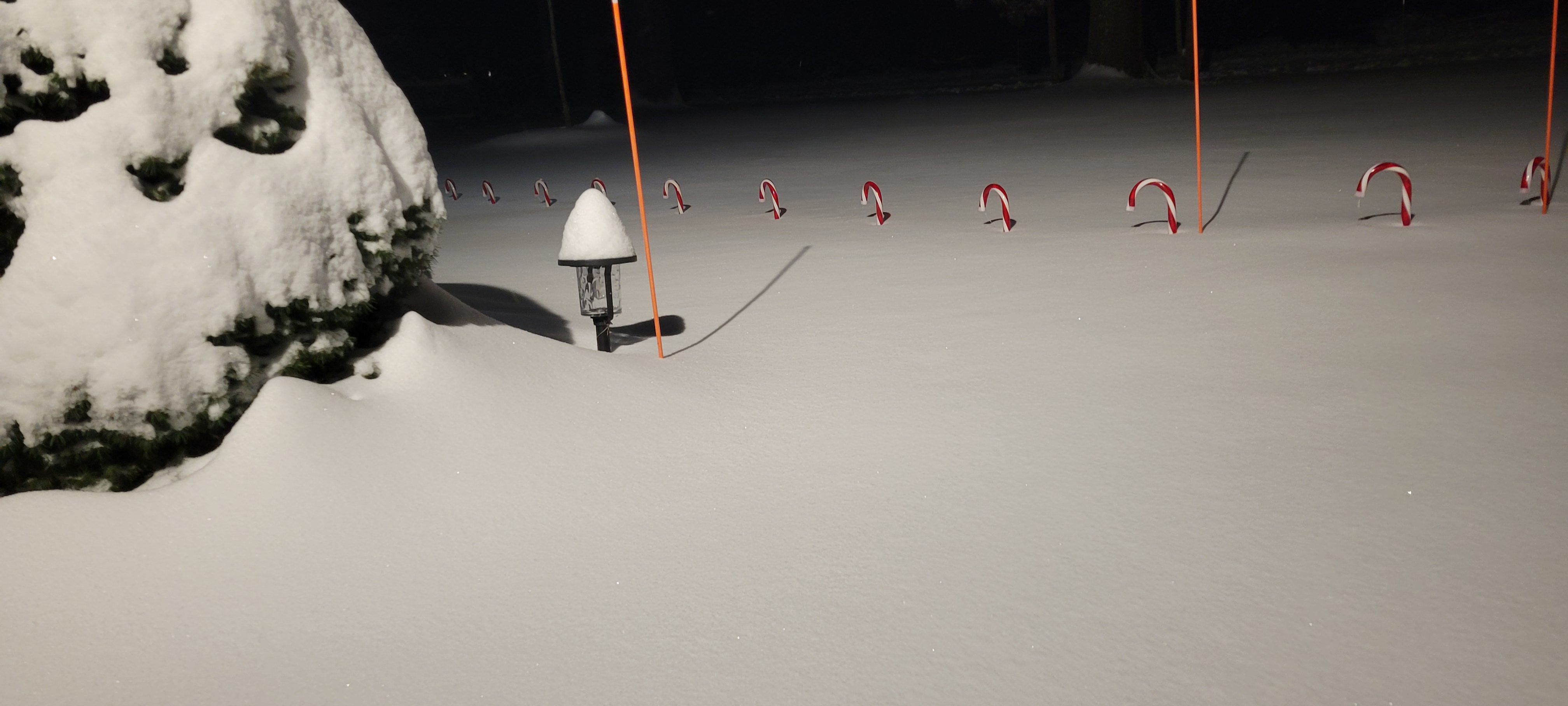
I finished with 7-8 inches solid. The snow was wetter on bottom and fluffier the rest of the way, kinda backwards from what was orginal thinking. On top of ocean affect snow south east to north west direction, Can't say I've ever seen that ever before... Great event, makes up for the crappy event we had last time

-

Wounded Duck Strikes Back: Dec 26 & 27th Winter Storm Obs
MarkO replied to WxWatcher007's topic in New England
NWS map shows about 3" for me here in Lowell, but my offiial measurement this AM was 2.6". -
I was trying to figure out why the snowfall mean onbthe Eps was as low as it was for that period and it has 850's AN. As a result, the decent snowfall on the Eps is further north into central PA. Actually, I'm sorta surprised by the AN 850's considering that 5H look, but maybe we disregard 850's at this point and live in denial.
-
I don't really recall, although I think Long Island does occasionally receive some ocean/sound enhancement?
-
It's looking like 50/50 odds of a giant storm to me. We either get one or we dont. 50/50. Just like megamillioms, 50/50 every ticket. Dems goodz maphs amirite?
-
Boxing Night Snow/Sleet/Ice Dec 26-27 Storm Thread/Obs.
The Iceman replied to Mikeymac5306's topic in Philadelphia Region
I’m guesstimating an inch of slop. They were plowing the roads last night. -
I think that may limit like big dog potential... but 4-8" type storms very much in play looking at that
-
Finally some improvement in the PNA
.thumb.png.c24147e973d24e0e46d6a73a3a9f6368.png)
-
He's still human so we're all alloted some bad days per year and bad days are subjective. For Ji, a reasonable logical post is a red flag bad day
-
Eric is very excited about the snow potential for the Mid Atlantic Jan 6 th to the 11 th Eric Webb@webberweather This pattern has real big dog potential, esp in the Mid-Atlantic. Very El Niño-esque here with the Pacific trough & -NAO coupled with a strong subtropical jet. The strong subtropical jet is a lagged effect from the big MJO event over the Indo-Pacific in late Nov & early Dec.
-
 Ended up with 0.30" of compacted graupel and sleet, coated with some freezing rain. Temp has been hovering around 27 for the past couple hours but finally ticked up to 28 with dp 26. Have been watching some narrow stationary band, extending from south central NJ to NE NJ, just sitting and I guess snowing.
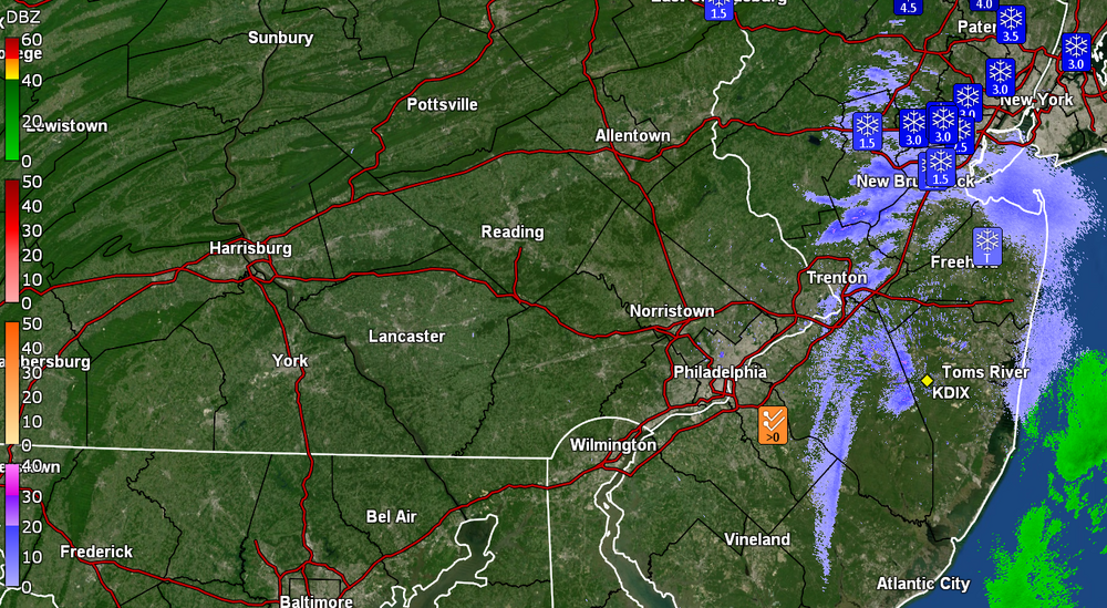
-
I will take this one.
-

Central PA Winter 25/26 Discussion and Obs
Jns2183 replied to MAG5035's topic in Upstate New York/Pennsylvania
I lost my count at 86, but we somehow have about 200 crows it seems perched in the highest branches of a few 100ft+ trees near us going absolutely ape shit with talking Sent from my SM-S731U using Tapatalk -
Was the snow off the ocean really OES...or was it the IVT?
-
That west coast trough suggests to me we get a progressive flow. But what does this weenie know?


.png.25bf44fd65b9f2ab14c205d2b6ac56b7.png)


