All Activity
- Past hour
-
Here they come . Just like last fall with wagons north for end of week showers
-
Low of 55 at 6:45am, high of 87 at 4:45pm. I was able to keep the A/C off today, but it'll be on tomorrow. Leaves are coming off the trees, I'm sure the lack of precip is accelerating their demise.
-
With Likely out, this becomes Andrew's redemption game. Man on a mission. LFG!!
-
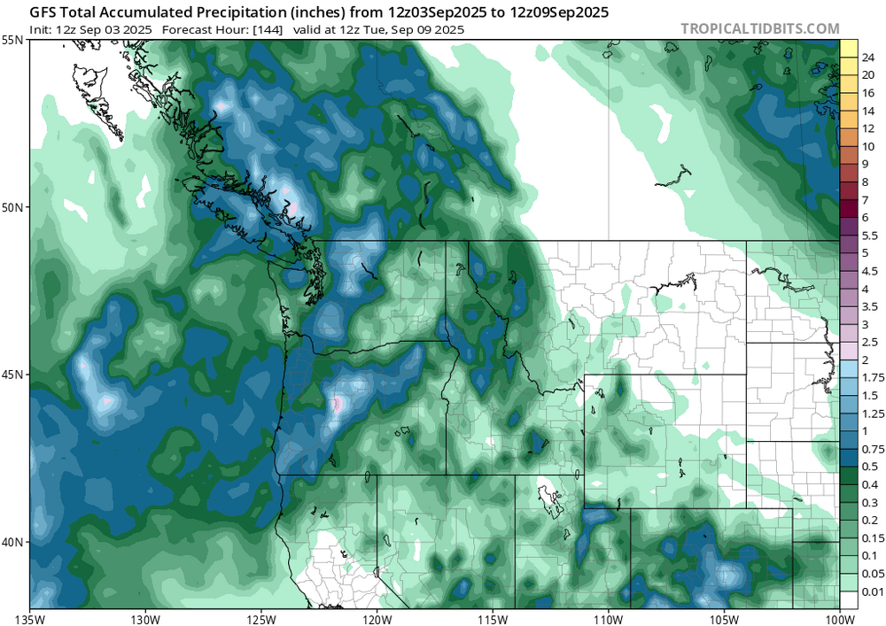
GFS says relief is coming soon. We shall see.
-
Recent Ninas have been normal to slightly above snowfall for here overall. A couple big clunkers in there too. Mostly depends on the NE PAC ridge position/orientation, and getting some luck in the NA. Cold ENSO seems to be predominant in the current regime. Probably should get used to it.
-
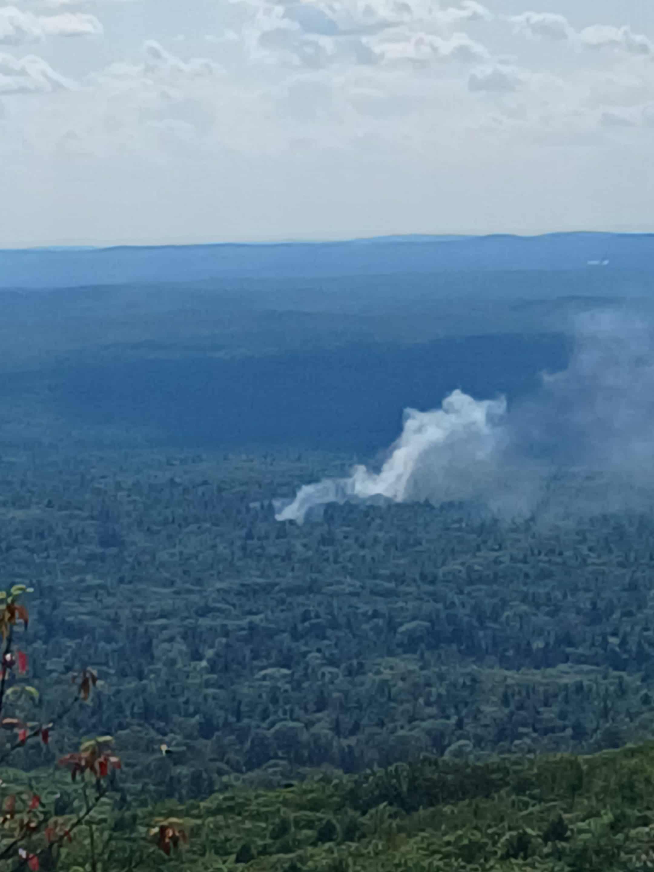
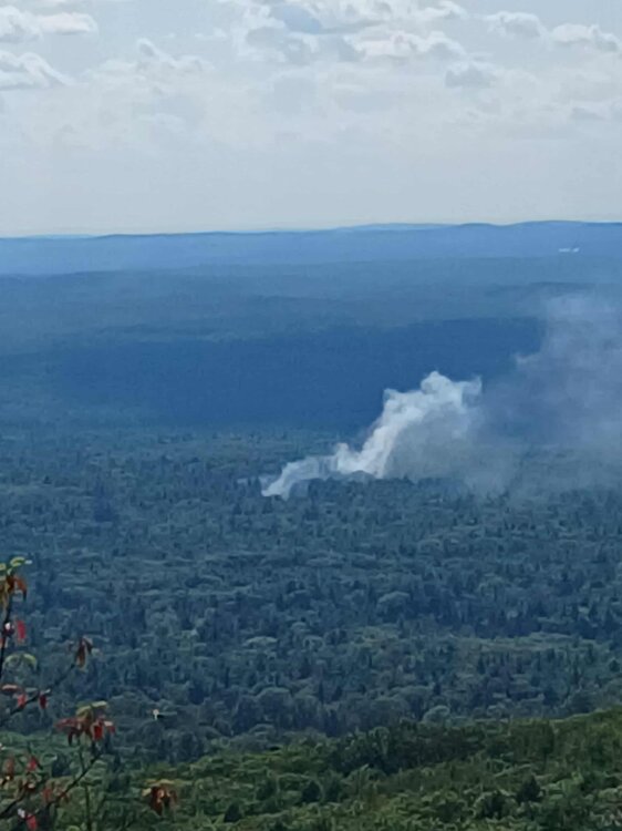
Found a better view of the smoke from the last fire about 20 minutes later..
-
I haven't cut grass in weeks. Probably do it a couple more times and put the mower away. Going to overseed with a white clover/grass seed mixture in the next couple weeks.
-
I'm also a fan of the daily rain as we head into dry season. I've has 1.25 inches the first two days this week and it's coming down outside now.
-

September 2025 OBS-Discussion centered NYC subforum
donsutherland1 replied to wdrag's topic in New York City Metro
Generally cool and dry conditions will persist through tomorrow. Highs will generally top out in the upper 70s with lows in the 50s outside New York City and low 60s in New York City. It will turn somewhat warmer late in the week with highs on Thursday through Saturday reaching the lower and middle 80s before another cooler air mass moves into the region. A few of the warmer spots could top out in the upper 80s. A system could bring some showers on Friday. Another round of showers is possible late Saturday into Sunday as a cold front crosses the region. The ENSO Region 1+2 anomaly was -0.3°C and the Region 3.4 anomaly was -0.4°C for the week centered around August 27. For the past six weeks, the ENSO Region 1+2 anomaly has averaged +0.33°C and the ENSO Region 3.4 anomaly has averaged -0.32°C. Neutral ENSO conditions will likely continue into early autumn. The SOI was +6.42 today. The preliminary Arctic Oscillation (AO) was +0.510 today. -

Central & Eastern Pacific Thread
gallopinggertie replied to Windspeed's topic in Tropical Headquarters
I saw that. It also sounds like there’s at least an outside chance of a TS landfall on the east side of the big island. -
36 degrees in Ontario
- Today
-

Central & Eastern Pacific Thread
Boston Bulldog replied to Windspeed's topic in Tropical Headquarters
Latest Kiko discussion suggests that post EWRC, Kiko’s environment could support annular characteristics. Not a ton of banding at the moment -

Central & Eastern Pacific Thread
BarryStantonGBP replied to Windspeed's topic in Tropical Headquarters
foid power Hurricane Lorena Satellite | Buoys | Grids | Storm Archive ...AIR FORCE RECONNAISSANCE FINDS LORENA STILL A CATEGORY 1 HURRICANE... ...HEAVY RAINFALL AND LIFE-THREATENING FLASH FLOODING EXPECTED ACROSS BAJA CALIFORNIA SUR... 2:00 PM MST Wed Sep 03 Location: 22.8°N 112.4°W Moving: NW at 15 mph Min pressure: 985 mb Max sustained: 80 mph Public Advisory #8 200 PM MST Forecast Advisory #8 2100 UTC Forecast Discussion #8 200 PM MST Wind Speed Probabilities #8 2100 UTC Productos en español: (más información) Aviso Publico Pronóstico Discusión Wind Speed Probabilities Arrival Time of Winds Wind History Warnings/Cone Interactive Map Warnings/Cone Static Images Experimental Cone Warnings and Surface Wind Key Messages Mensajes Claves Rip Currents Rainfall Potential Flash Flooding Potential Hurricane Kiko Satellite | Buoys | Grids | Storm Archive ...KIKO BECOMES A CATEGORY 4 HURRICANE... 11:00 AM HST Wed Sep 03 Location: 13.9°N 131.6°W Moving: W at 9 mph Min pressure: 955 mb Max sustained: 130 mph Public Advisory #15 1100 AM HST Forecast Advisory #15 2100 UTC Forecast Discussion #15 1100 AM HST Wind Speed Probabilities #15 2100 UTC Productos en español: (más información) Aviso Publico Pronóstico Discusión Wind Speed Probabilities Arrival Time of Winds Wind History Warnings/Cone Interactive Map Warnings/Cone Static Images Experimental Cone Warnings and Surface Wind Rip Currents -
Hurricane Lorena Satellite | Buoys | Grids | Storm Archive ...AIR FORCE RECONNAISSANCE FINDS LORENA STILL A CATEGORY 1 HURRICANE... ...HEAVY RAINFALL AND LIFE-THREATENING FLASH FLOODING EXPECTED ACROSS BAJA CALIFORNIA SUR... 2:00 PM MST Wed Sep 03 Location: 22.8°N 112.4°W Moving: NW at 15 mph Min pressure: 985 mb Max sustained: 80 mph Public Advisory #8 200 PM MST Forecast Advisory #8 2100 UTC Forecast Discussion #8 200 PM MST Wind Speed Probabilities #8 2100 UTC Productos en español: (más información) Aviso Publico Pronóstico Discusión Wind Speed Probabilities Arrival Time of Winds Wind History Warnings/Cone Interactive Map Warnings/Cone Static Images Experimental Cone Warnings and Surface Wind Key Messages Mensajes Claves Rip Currents Rainfall Potential Flash Flooding Potential Hurricane Kiko Satellite | Buoys | Grids | Storm Archive ...KIKO BECOMES A CATEGORY 4 HURRICANE... 11:00 AM HST Wed Sep 03 Location: 13.9°N 131.6°W Moving: W at 9 mph Min pressure: 955 mb Max sustained: 130 mph Public Advisory #15 1100 AM HST Forecast Advisory #15 2100 UTC Forecast Discussion #15 1100 AM HST Wind Speed Probabilities #15 2100 UTC Productos en español: (más información) Aviso Publico Pronóstico Discusión Wind Speed Probabilities Arrival Time of Winds Wind History Warnings/Cone Interactive Map Warnings/Cone Static Images Experimental Cone Warnings and Surface Wind Rip Currents
-
I know it’s probably mostly or all heat and drought stress but there’s definitely foliage color on quite a number of plants. Not just maples.
-
ob time probably perfectly matched with a brief cloud overhead lol
-
2025 Atlantic Hurricane Season
BarryStantonGBP replied to BarryStantonGBP's topic in Tropical Headquarters
-

September 2025 OBS-Discussion centered NYC subforum
bluewave replied to wdrag's topic in New York City Metro
-
Yeah, what's the deal with that anyways? Getting kinda nervous about my camping trip already. I actually wanted a day or two of rain (it's kinda relaxing) but if it all turns to mud, I'm OUT lol.
-
This is an interesting random fact. Assuming we dont hit 90F this September, it will be the 7th consecutive September without hitting 90F at Detroit. That has never happened before in the climate record (the previous longest was 6 consecutive years, 1875-1880). The last time DTW hit 90 in Sept was Sept 5, 2018.
-
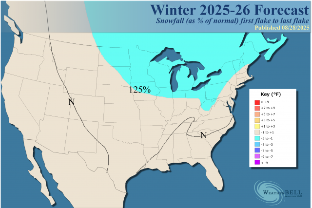
Must be time for a Fall thread. JB's preliminary winter forecast. I'd be happy with it. Sorta lines up with the Cansips, at least temp-wise, and somewhat the Euro seasonal.
.png.8e340af4307eb6926b026cedb629dab9.png.3d6964e2e980a8cf71dd0a669ff560d7.png)
-
2025 Atlantic Hurricane Season
BarryStantonGBP replied to BarryStantonGBP's topic in Tropical Headquarters
-
A Beloved August
-
All i give a shit about is the Ravens game on Sunday night. Let's GOOOOOOOO.
-
Don’t have any, But when I do.