All Activity
- Past hour
-

2026 Spring/Summer Mountain Thread
Maggie Valley Steve replied to Buckethead's topic in Southeastern States
I got the property cleaned up and ready for our guests arriving tomorrow afternoon in the Short term rental. The sound of chain saws nearby all day and the neighbors above cutting down trees. I believe that's was the worst storm since Fred 5 years ago for our part of the Mountains. -

E PA/NJ/DE Summer 2026 Obs/Discussion
Hurricane Agnes replied to PhiEaglesfan712's topic in Philadelphia Region
I actually picked up some back-built leftovers yesterday for 0.49" total for the day and a 2-day event total of 1.06". Had a low of 73 and a high of 87. The dews have been annoying and it's currently 84 with dp 73. -
-
A strong El Niño favors a cool Fall that turns mild for December but who knows.
-
October will be rocking
-
2 cold Winter's in the Northeast followed by an El Nino looks like this precip wise (10 analogs is a pretty good amount) Now keep in mind that includes Weak Nino's and we are going to have the strongest on record by 15%, so maybe it's still really hard to get a dry Winter but I thought the analog composite was interesting (since we know how the dry pattern has been present for the past 2 years, minus wet July and Aug which has been the decadal trend 2017-2026).
-
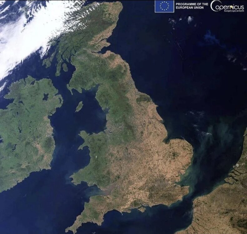
Cooked
-
pepperidge farm remembers
-
I think it would take a lot of bad luck to get shut out. It could happen, like it did in 1998 and that early 70s winter. But with a highly juiced up STJ, I’d definitely take my chances. In 2016 we got a perfectly timed -AO/-NAO even after a disastrous December, and if that happens again then all bets are off. The long range precip anomaly maps for the winter months make me feel pretty good about big storm chances.
-
I believe somewhere on the East coast will get a HECS, just not sure exactly where.
-
Was just going to mention those sneaky buggers just offshore that find a calm spot to go full Andrew. Along with weaker waves that find there way in.
-

2026-2027 Record-breaking El Nino
michsnowfreak replied to Stormchaserchuck1's topic in Weather Forecasting and Discussion
Bookmarked it! Looks great! Just one question, any idea why the CANSIPS seasonal looks quite different than on tropical tidbits? -
I’d expect the Nino will push around the NPac and at least bring the PDO more toward neutral if not weakly positive.
-
2026-2027 Record-breaking El Nino
michsnowfreak replied to Stormchaserchuck1's topic in Weather Forecasting and Discussion
Troll comments arent even worth a response. If there is a +10F month, I cant see how it's anything other than December. It wouldnt shock me knowing the history of strong Ninos, but it seems a low chance the way everything looks now. Regardless of actual departures, Id put money on December being the warmest month relative to avg, not just of the winter, but the entire cold season. - Today
-
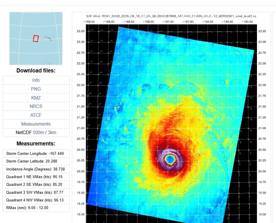
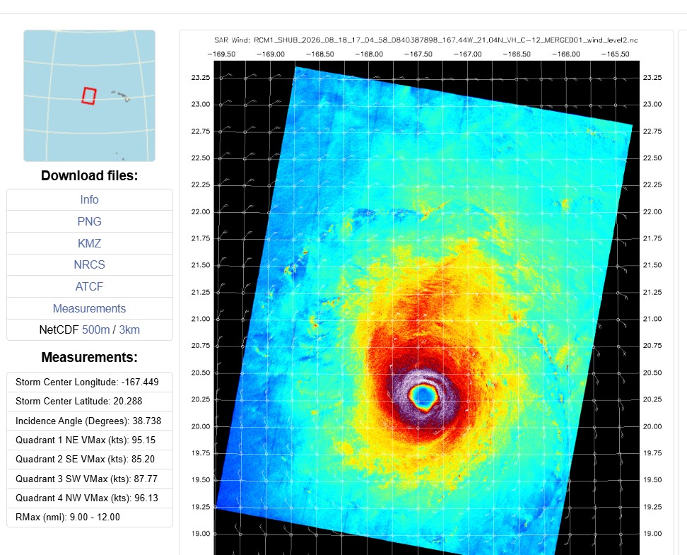
1704z SAR pass shows Lala is near MH strength. 96 kt and well-defined eye. When the day comes when SAR sensors are on geostationary satellites, that will be an immense advancement for remote TC sensing!
-
2026-2027 Record-breaking El Nino
michsnowfreak replied to Stormchaserchuck1's topic in Weather Forecasting and Discussion
The Marquette example was just sort of a fun stat of what can and does happen in the far north. Certainly not a projection for anyone lol. For me, being in the Great Lakes region but outside the heavy snow belts, theres no question that "deep winter" needs average to below average temps to maintain a constant snowpack, thick lake ice, etc. Last year is an absolute textbook example. Well above avg snowcover and below avg temps gave us a severe winter despite actual snowfall finishing around 90% of average (was on pace for better but March fell totally flat). But actual total snowFALL is really dependent on how a season goes. It's a long window from November to April to get snowstorms, so its quite feasible to get average snowfall (40-45") with above to well above avg temps. Pretty much getting over 50", however, tends to require near normal (or below) temps. -
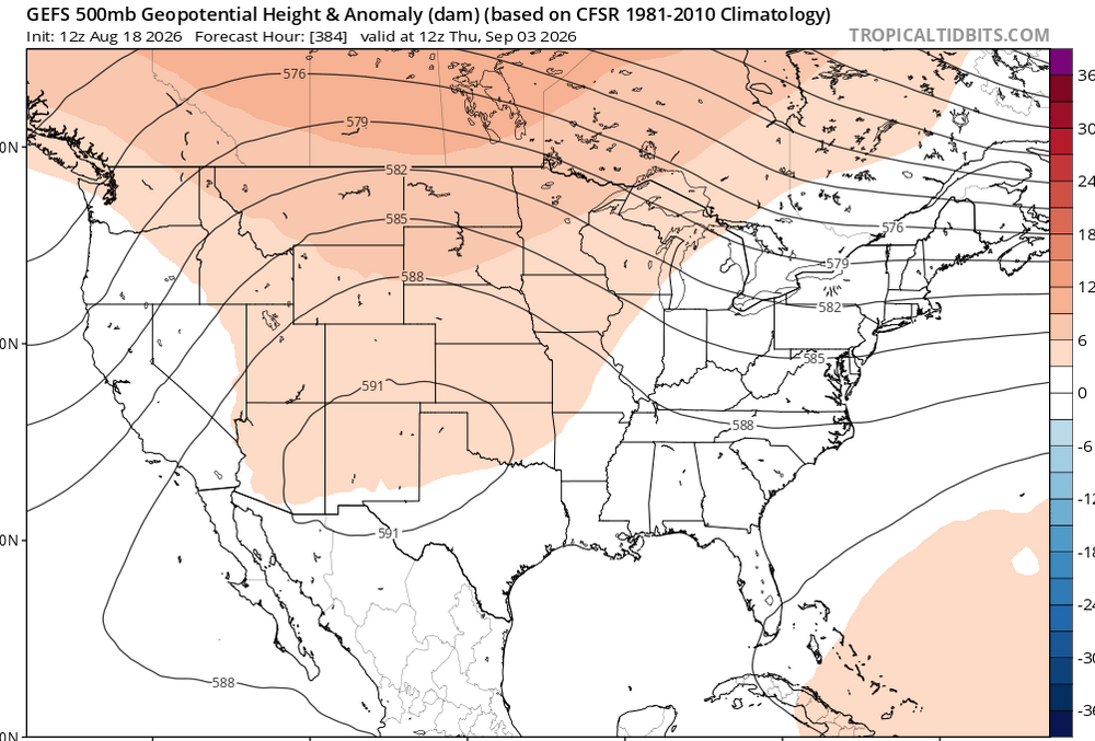
this look is proving somewhat resilient
-
Yeah. I'm more concerned with home growns this year . Not necessarily hurricanes either. Tropical systems that can form in the GOM, even weak ones, this year are going to be loaded water guns moving inland. While El Nino's usually cut down on overall numbers, they usually load up weaker storms. And we certainly don't want a GOM system riding up the MS river this year after what just happened. We're going to be flood prone for the next month with no rain. Rivers and creeks are still in Moderate to Major flood stages. If you stop and walk up to a corn or soybean field theres a lake under most of them.
-

2026-2027 Record-breaking El Nino
Ephesians2 replied to Stormchaserchuck1's topic in Weather Forecasting and Discussion
-
bailed on that storm that went through Urbana like 90 minutes before the tornado after the parent cell didn't have any lightning or hardly any IR presentation. had a great dinner in centerville while the tornado was otg, no regrets
-
warm and rainy
-
88 before now down to 85. Beautiful
-
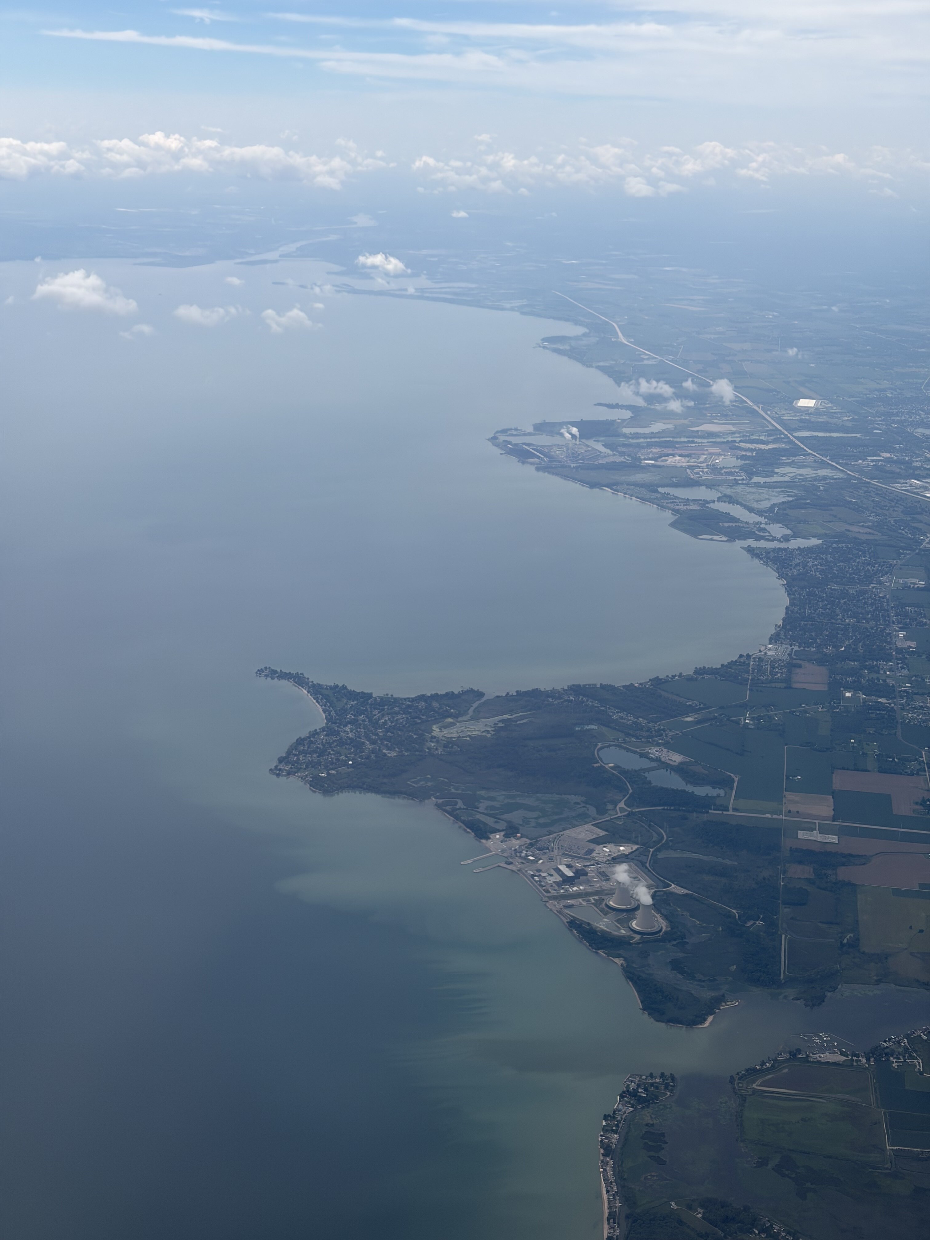
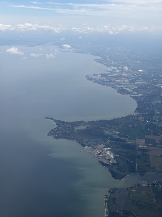
Flying today for the first time in over a decade! Especially because I haven’t flown in so long, flying is still fascinating to me and I’m always at a window looking out! On way to CO, 1st stop is in Detroit, my first time in Michigan. The views of W Lake Erie, my first time seeing Erie, were awesome. Noting the fair wx cumulus over land areas due to heating in the early afternoon while mainly clear over the cooler lake: @roardog@michsnowfreak

-
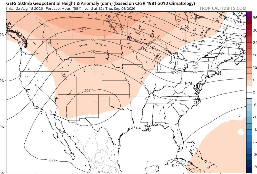
It's not unreasonable to be pessimistic on snow chances in winter anymore, especially south of 40N. We've been in such a long term snow drought that it's almost safer to forecast Above Normal temps and Below Normal snowfall. You stand a good chance of being right most years outside of New England. Heck, I could see this being a shutout in the snowfall department south of DC this winter. Several folks on here appear to have already punted December and the first half of January!













.thumb.jpg.ad3a2e31d30aff035044689b311a0540.jpg)