All Activity
- Past hour
-
Radar filled in gloriously after 10pm. Got 0.36” and am thrilled about it.
-

2025-2026 ENSO
PhiEaglesfan712 replied to 40/70 Benchmark's topic in Weather Forecasting and Discussion
First time since 1992 we have no tropical activity at the peak of the season. That, of course, followed Hurricane Andrew. It's looking more and more like Erin is going to be a one-off, like Andrew. -
A not so fall-like 65 this morning.
-
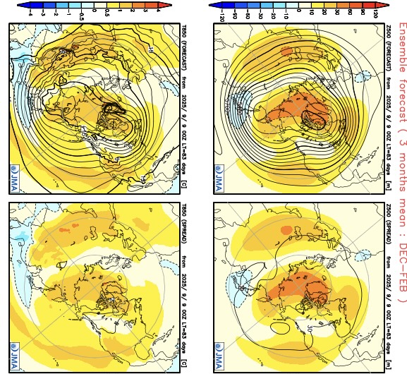
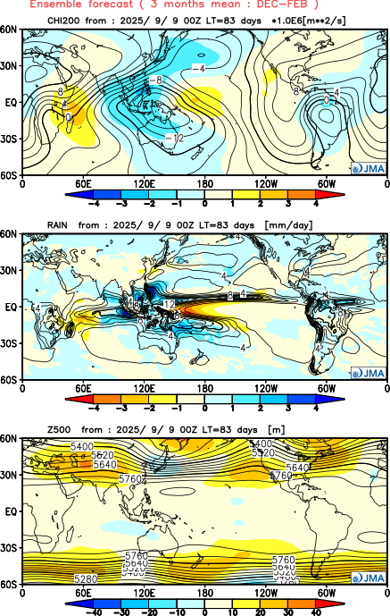
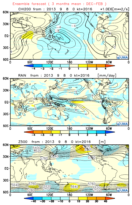
The JMA seasonal just updated for the winter. It was the only model that got the 2013-2014 winter correct with its fall forecasts. This time it has a much different look. It has a more +PNA pattern than we typically get with a La Niña. So it has a Baja ridge instead of the deep trough we had there in 2022-2023. My guess is that this is a continuation of the ridging and warm water we have been seeing near the West Coast this summer. In the East we have the familiar -AO Greenland block linking up with the Southeast ridge. So a milder winter in the East than last winter. As always these extended forecasts much of the time are low skill. So I just include here for informational purposes. https://ds.data.jma.go.jp/wmc/products/model/map/7mE/map1/zpcmap.php Famous forecast from September 2013 showing the record TNH winter
-

2025-2026 ENSO
donsutherland1 replied to 40/70 Benchmark's topic in Weather Forecasting and Discussion
The new measurement approach is an improvement. La Niñas, particularly weaker ones, would have been masked from a warming of the oceans. They were present, even if not acknowledged. -
0.15”. Here
-
I checked the gauge before bed at 11pm and had just over a tenth, so I was surprised to wake up to 0.71”
-
Mountain West Discussion
donsutherland1 replied to mayjawintastawm's topic in Central/Western States
I'm not arguing and have never argued that site changes didn't play any role in the shift in Denver (initial comment about Denver and afterward). I cited Denver, as it's Colorado's largest city, but the frequency in hot days has increased elsewhere, too. My subsequent comments highlighted that far more than site changes are involved in the big recent increase in 90° and 95° days. - Today
-

September 2025 OBS-Discussion centered NYC subforum
wdrag replied to wdrag's topic in New York City Metro
Yes... and it was my mistake not checking EC AI... it never had this EPS/CMCE solution. Drier GEFS was right. Now warmer pattern and I suspect smokey eventually next week from Canada. -

September 2025 OBS-Discussion centered NYC subforum
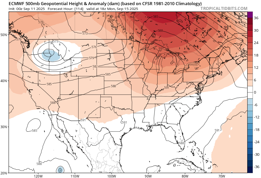
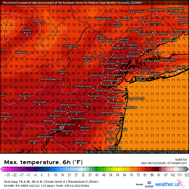
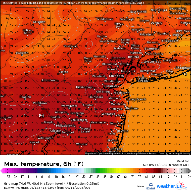
bluewave replied to wdrag's topic in New York City Metro
The Euro lost the cutoff low for early next week. It’s replaced by a 591 dm ridge to our west. So it has mid 80s from Sunday right into next week. New run Old run


-
On a non-football note, I saw the new Spinal Tap movie last night. It was well done and I suggest seeing if you enjoyed the first one.
-
Over 0.5” last night! That was completely unexpected.
-
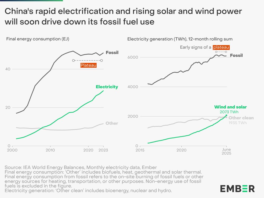
Clear we have passed an energy tipping point, with fossil fuels becoming increasingly uncompetitive. China's large manufacturing scale key in driving down costs. Countries without entrenched fossil fuel interests are leading the way and China will sell them the gear. https://ember-energy.org/latest-insights/china-energy-transition-review-2025/
-
Unlike last year when we were in a +AAM regime, this year we are and have been in a strong -AAM, so definitely much more Niña like in that respect @so_whats_happening Australia’s BOM has changed its parameters for La Niña classification:
-
The forecast here for the next 7 days looks like San Diego. Mostly sunny with a high around 80.
-
To my surprise (not surprised) it has rained all night here. Steady rain, sometimes heavy. I'd estimate another half inch at least. When does the dry spell start lol
-
Another UKMET run (0Z) with an MDR TS headed for an early recurve:NEW TROPICAL CYCLONE FORECAST TO DEVELOP AFTER 66 HOURSFORECAST POSITION AT T+ 66 : 11.2N 26.1WLEAD CENTRAL MAXIMUM WINDVERIFYING TIME TIME POSITION PRESSURE (MB) SPEED (KNOTS)-------------- ---- -------- ------------- -------------0000UTC 14.09.2025 72 11.7N 26.9W 1009 281200UTC 14.09.2025 84 13.1N 30.4W 1008 300000UTC 15.09.2025 96 13.2N 32.8W 1007 301200UTC 15.09.2025 108 14.4N 35.6W 1006 310000UTC 16.09.2025 120 15.7N 37.7W 1005 351200UTC 16.09.2025 132 16.8N 39.8W 1004 410000UTC 17.09.2025 144 18.8N 40.8W 1003 451200UTC 17.09.2025 156 19.9N 42.2W 1002 440000UTC 18.09.2025 168 21.1N 43.3W 1002 46
-
-
69 for the high
-

Mountain West Discussion
mayjawintastawm replied to mayjawintastawm's topic in Central/Western States
I love to see an argument on this page- don't think I've seen one in a long time, maybe ever! The New England forum has them like hourly. -

2025-2026 Fall/Winter Mountain Thread
Buckethead replied to Buckethead's topic in Southeastern States
It has been a great week to work outside! 70° today in Micaville. Sent from my SM-S908U using Tapatalk -
Did it happen to be somewhat of a squall event type thing? I have images of a snow squall chase on the 21st of November, but that’s down on a mountaintop near Blacksburg, VA.
-
September? Man, you must’ve taken a time Machine about 3 months into the future! Plenty more days of cool, misty and melting snowflakes lie ahead.
-
Had a high of 72 with a current temp of 56. This week has been pure bliss weather wise.