All Activity
- Past hour
-
3 tornado watches for parts of NJ in less than a week.
-
The HRRR has not been very good with this event so far.
-
 Pouring hard in Hancock, MA...will be here for the next 60 days.
 -
 Tenth to a quarter? (thru Fri) Would like to bust low.
 -
Bays Mt band area for that Tornado warning. Darn good hook on it too:
-
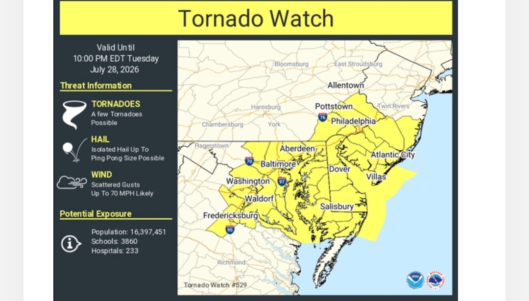
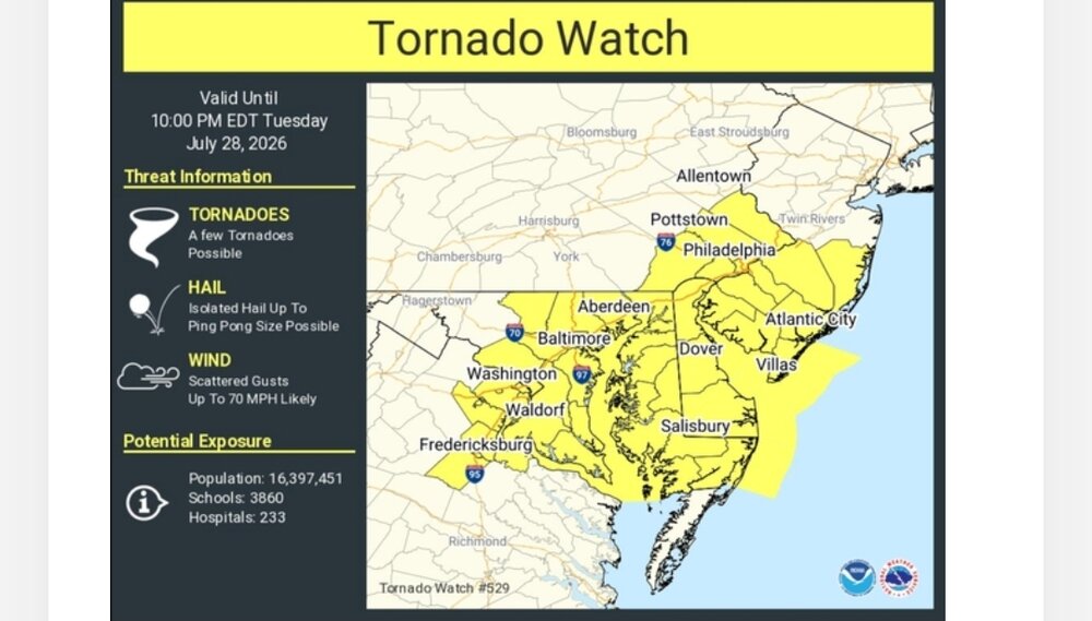
BULLETIN - IMMEDIATE BROADCAST REQUESTED Severe Thunderstorm Warning National Weather Service Baltimore MD/Washington DC 436 PM EDT Tue Jul 28 2026 The National Weather Service in Sterling Virginia has issued a * Severe Thunderstorm Warning for... Carroll County in north central Maryland... Howard County in central Maryland... Montgomery County in central Maryland... Frederick County in north central Maryland... Western Baltimore County in northern Maryland... Northern Loudoun County in northern Virginia... * Until 530 PM EDT. * At 436 PM EDT, severe thunderstorms were located along a line extending from near Littlestown to Harry Grove Stadium to near Purcellville, moving east at 35 mph. HAZARD...60 mph wind gusts and quarter size hail. SOURCE...Radar indicated. IMPACT...Damaging winds will cause some trees and large branches to fall. This could injure those outdoors, as well as damage homes and vehicles. Roadways may become blocked by downed trees. Localized power outages are possible. Unsecured light objects may become projectiles. * Locations impacted include... Columbia, Germantown, Frederick, Rockville, Gaithersburg, Leesburg, Olney, Pikesville, Cockeysville, Westminster, Damascus, Lansdowne, Thurmont, Poolesville, Emmitsburg, Harry Grove Stadium, Historic Ellicott City, Ellicott City, Aspen Hill, and Potomac. PRECAUTIONARY/PREPAREDNESS ACTIONS... Remain alert for a possible tornado! Tornadoes can develop quickly from severe thunderstorms. If you spot a tornado go at once into the basement or small central room in a sturdy structure. For your protection move to an interior room on the lowest floor of a building. A Tornado Watch remains in effect until 1000 PM EDT for northern, central and north central Maryland. && LAT...LON 3972 7658 3922 7677 3903 7724 3906 7732 3913 7783 3932 7772 3933 7768 3948 7762 3972 7730 TIME...MOT...LOC 2036Z 290DEG 30KT 3969 7710 3940 7740 3917 7770 TORNADO...POSSIBLE HAIL THREAT...RADAR INDICATED MAX HAIL SIZE...1.00 IN WIND THREAT...RADAR INDICATED MAX WIND GUST...60 MPH
-
The complex of storms including the main line and supercells are pinwheeling around the low pressure area North of us. Could get ugly.
- 1,567 replies
-
- 1
-

-
- severe
- thunderstorms
- (and 7 more)
-
LWX going with the mega warnings
- 1,567 replies
-
- 3
-
-
- severe
- thunderstorms
- (and 7 more)
-
 Taunton
 -
Nam seems to think there will be more activity to the south but hrrr keeps it over Delaware
-
 I think a bit further west towards the Hudson Valley....
 -
Saw a tree down in Goshen and there are various twigs and small branches down in my yard yet again, the theme of this summer. Up to 10.17” for the month and counting.
-
-

Central PA Summer 2026 Discussion/Obs Thread
canderson replied to Voyager's topic in Upstate New York/Pennsylvania
You walked in that? How???? -
Well, look who not only clicked it, but just had to post it here.
-

2026-2027 Super El Nino
Stormchaserchuck1 replied to Stormchaserchuck1's topic in Weather Forecasting and Discussion
Be careful connecting QBO to STJ, as the QBO is a Stratosphere wind oscillation. The correlations with the troposphere run pretty low, AO-correlation being the highest. -
 I still like my two jacks. The only one I’m a little shaky on is in the east because it could be Worcester or could be somewhere east of that.
 -

2026 Mid-Atlantic Severe Storm General Discussion
AlexD1990 replied to Kmlwx's topic in Mid Atlantic
rotation seems pretyy significant on radarscope.... KDOX was even picking it up, and appears to be having a lightning surge as well. -
Like that scene in war of the worlds when the bodies are floating down the river.
-
Cells forming ahead of the main line NW of DC.
-
Central PA Summer 2026 Discussion/Obs Thread
canderson replied to Voyager's topic in Upstate New York/Pennsylvania
Haven’t see this lighting in years -
My gutter fell off and is flooding all my mulch around
-
BULLETIN - EAS ACTIVATION REQUESTED Tornado Warning National Weather Service Baltimore MD/Washington DC 429 PM EDT Tue Jul 28 2026 The National Weather Service in Sterling Virginia has issued a * Tornado Warning for... Central Warren County in northwestern Virginia... Northeastern Rappahannock County in northwestern Virginia... West central Fauquier County in northern Virginia... * Until 500 PM EDT. * At 429 PM EDT, a severe thunderstorm capable of producing a tornado was located near Front Royal, moving southeast at 40 mph. HAZARD...Tornado and quarter size hail. SOURCE...Radar indicated rotation. IMPACT...For those in the direct path of a tornado touchdown, flying debris will be dangerous to those caught without shelter. Damage to roofs, siding, and windows may occur. Mobile homes may be damaged or destroyed. Tree damage is likely. * This dangerous storm will be near... Hume around 435 PM EDT. Other locations impacted by this tornadic thunderstorm include Karo, Glen Echo, Huntly, Arco, Riverton, Hackleys Crossroads, Flint Hill, Cresthill, Chester Gap, and Orlean. PRECAUTIONARY/PREPAREDNESS ACTIONS... TAKE COVER NOW! Move to a basement or an interior room on the lowest floor of a sturdy building. Avoid windows. If you are outdoors, in a mobile home, or in a vehicle, move to the closest substantial shelter and protect yourself from flying debris.
-
0.03" according to my new gauge from the shower that moved through...a veritable monsoon for us.
-
Thunder, heavy rain and 68 degrees at Deep Creek Lake.