All Activity
- Past hour
-

2026 Mid-Atlantic Severe Storm General Discussion
high risk replied to Kmlwx's topic in Mid Atlantic
Everything you said about the environment later tomorrow is spot on, but the one parameter you left out is cape, and that could certainly prevent a bigger day tomorrow. There is certainly solid model consensus for a “round 2” of storms later Sunday, but forecast soundings don’t look great. I certainly agree, though, that IF we can destabilize, supercells and tornadoes are on the table. Otherwise, it’s a noisy heavy rain event. -
E PA/NJ/DE Summer 2026 Obs/Discussion
KamuSnow replied to PhiEaglesfan712's topic in Philadelphia Region
Actually saw the dewpoint at 59° this afternoon. Still easy to work up a sweat, but not bad for sitting around! -
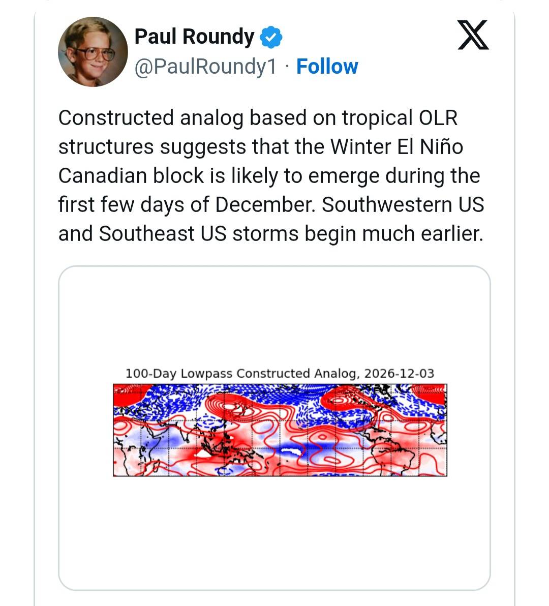
An increasingly active subtropical jet. The 2 analog years are 97/98 and 15/16. In 15/16, Sept. went from a dry August to 9.90" for Sept and 5.70" for Oct. 97/98 went from a dry August to 4.58 in Sept. and 6.46" in November.
-

2026-2027 Record-breaking El Nino
roardog replied to Stormchaserchuck1's topic in Weather Forecasting and Discussion
Looking at those temp departures, It looks like we were in between the “cold” east of here and the very mild not too far west of here. I could see how it could have been a clipper pattern around here that winter. I wonder if that is what helped Detroit to get to average snow. -
No work in winter? I figured you could put a finish on my deck in Dec when its in the 70s here.
-
Yup! December 1 until March 1. Katabatic is throwing in but won't be there full time. I still plan on chasing snowstorms and LES if it's missing my location. I'll be keeping my eye out for big Nino Nor'easters. I agree. A blizzard on the coast of Maine is on my bucket list. Katabatic was saying something about doing a chase up towards Hudson Bay. I'm down for whatever this winter. I might end up in Harrington Delaware again. You never know lol
-
Just accept it’s gonna be a warmer winter. Things may break, things may not. Such is life.
-
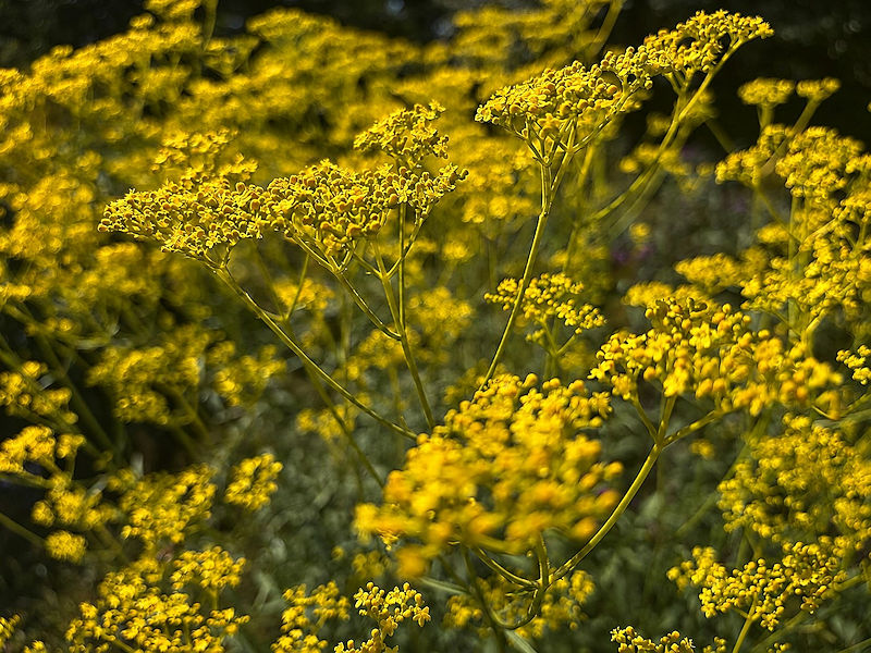
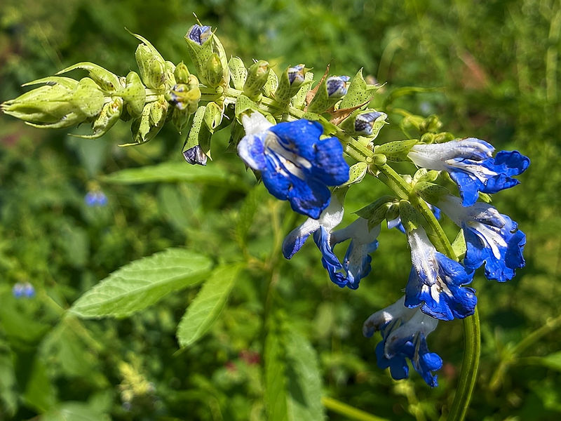
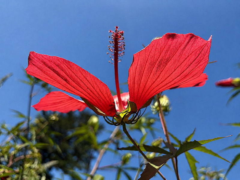
Some photos from the New York Botanical Garden on a sun-filled August day with a light breeze and low humidity:



-

2026-2027 Record-breaking El Nino
michsnowfreak replied to Stormchaserchuck1's topic in Weather Forecasting and Discussion
Most of the places I looked up didn't have snow records yet. Detroit had a near avg snow season at 43.4". NYC was well below at 8.1" -
You aren't planning to be there the whole winter are you?
-
Hurricane Lala (65kt) at 6:30PM Aug 15
-
2026-2027 Record-breaking El Nino
michsnowfreak replied to Stormchaserchuck1's topic in Weather Forecasting and Discussion
Duluth, MN was even crazier than Minneapolis. Again, these are today's averages. DULUTH Dec: +15.6° Jan: +9.3° Feb: +15.6° -
But you did? Only to constantly post the snowiest winter outlooks you could find from x/twitter, In multiple sub forums!
-

2026-2027 Record-breaking El Nino
MJO812 replied to Stormchaserchuck1's topic in Weather Forecasting and Discussion
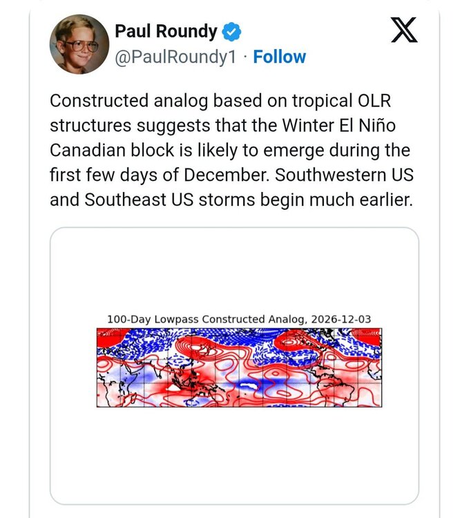
-
Yeah coastal NE could be a cool chase. Esp Maine, where it's almost always cold enough for a bombing coastal low as it moves towards the Canadian Maritimes.
-

2026-2027 Record-breaking El Nino
40/70 Benchmark replied to Stormchaserchuck1's topic in Weather Forecasting and Discussion
Still sucked for snowfall on the east coast. -
2026-2027 Record-breaking El Nino
40/70 Benchmark replied to Stormchaserchuck1's topic in Weather Forecasting and Discussion
There is obviously a connection between solar and ENSO..I pointed that out last week, then some new poster disputed it. -
2026-2027 Record-breaking El Nino
michsnowfreak replied to Stormchaserchuck1's topic in Weather Forecasting and Discussion
The core of warmth in 1877-78 was in the upper midwest and into Canada. It wasn't even a mild winter on the east coast. It ranks only 12th warmest from 1869-1900 at NYC. 1877-78 departures using today's averages MSP Dec: +11.8° Jan: +5.6° Feb: +10.9° DTW Dec: +6.8° Jan: +1.5° Feb: +1.2° NYC Dec: -1.7° Jan: -3.8° Feb: -3.6° -
Odd day, when the sun was out it was quite warm. When clouds rolled through, it actually felt a bit chilly. This happened mid afternoon.
-
Probably not, but not like it's feet of snow off or something. This is from NWS Buffalo.. clearly not a banner year for snowfall in that area. https://www.weather.gov/media/buf/obs/COOPSNOW_2015-2016.pdf
-
 Something to think of: With the aurora borealis making it so close to the equator for the first time in 500+ years, a few years ago, and this Record El Nino by +20% occurring 2 years after that, is there a connection? Are we possibly underestimating just how big this solar max was, or maybe the Earth's magnetic field is weaker? Solar Cycle +2 years before 2020 Just a coincidence? I know ENSO historically "evens out", and this one is "evening out" Nina's going back to 1998.
 -
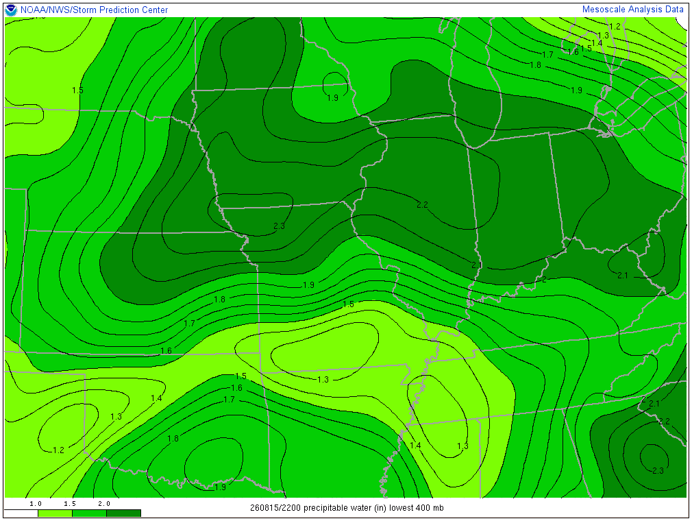
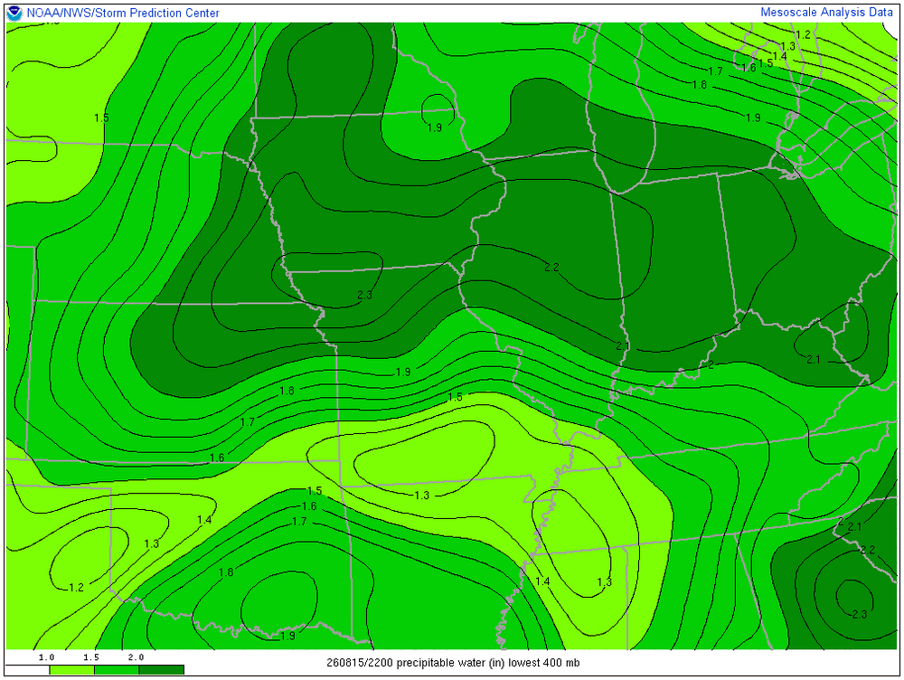
PWAT is about as high as it gets. No rain though, mowed today. Tomorrow should be the last day of this pattern. Signals are showing maybe a dry last 1/2 of August.
-
Clouds will increase tomorrow holding the temperature to the upper 70s or lower 80s. Showers and thundershowers are likely tomorrow night into Monday. A few locations could see heavy downpours. Following the frontal passage, Monday through Wednesday should feature temperatures in the lower 80s, along with partly to mostly sunny skies. Another cold front could bring some showers or thundershowers to the region Wednesday night or Thursday. The frontal passage will be followed by a reinforcing shot of cooler air. Thursday and Friday could see highs in the upper 70s to lower 80s. The ENSO Region 1+2 anomaly was +4.1°C and the Region 3.4 anomaly was +2.6°C for the week centered around August 6. For the past six weeks, the ENSO Region 1+2 anomaly has averaged +3.72°C and the ENSO Region 3.4 anomaly has averaged +2.15°C. The ongoing strong El Niño, which has reached super El Niño threshold, will continue to strengthen through the summer. The SOI was -24.10 today. The preliminary Arctic Oscillation (AO) was -0.530 today. Based on sensitivity analysis applied to the latest guidance, there is an implied near 52% probability that New York City will have a warmer than normal August (1991-2020 normal). August will likely finish with a mean temperature near 76.3° (0.2° above normal). Supplemental Information: The projected mean would be 1.1° above the 1981-2010 normal monthly value.
-
I'm seeing something that says they had 150" plus. Regardless, that pretty light for up there. My goal is to experience 300" inches of falling snow this season. My basecamp will be on the Tug, but I'll definitely chase big snowstorms from the Mid Atlantic up through New England. I've always wanted to experience a blizzard out on Cape Cod.
-
2026-2027 Record-breaking El Nino
40/70 Benchmark replied to Stormchaserchuck1's topic in Weather Forecasting and Discussion
Been working on the Pacific....2009 is actually damn good extra tropical Pacific analog.