All Activity
- Past hour
-
I think given today's events, it's prudent to continue to keep an eye on this. It's still too early for either camp to declare victory, imo Sent from my Pixel 9 Pro XL using Tapatalk
-

2025-2026 ENSO
PhiEaglesfan712 replied to 40/70 Benchmark's topic in Weather Forecasting and Discussion
Yes, but most places in the mid-Atlantic/northeast should have followed a similar pattern (especially with temperature). -

2025 Short Range Severe Weather Discussion
sbnwx85 replied to Chicago Storm's topic in Lakes/Ohio Valley
Watched two outflow boundaries collide just to my south on radar. Nice line of storms developed with, as @Jackstraw described, constant lightning. -
Twitter is a cesspool of bots but this is amazing eyewall of Erin footage https://x.com/wxnb_/status/1956827623062962483?s=46&t=8XFCjgbF1qQWLVKslle9tw
-

2025 Short Range Severe Weather Discussion
Jackstraw replied to Chicago Storm's topic in Lakes/Ohio Valley
Flash Bang lightning out there. 3-5 strikes a minute. Watched from the porch for 90 min as these mini complex's moved SSE. Best light show of the year. They are just now weakening which could mean some left over outflows for initiation tomorrow morning similar to earlier today. Best light show of the year, until its on top of you lol. - Today
-
That’s not many for Florida, is it?
-
Is that for Philly?
-
 By us, we usually get leaf drop this time of year. My weeping cherry is usually the first and there is some type of tree leading into our development that always has significant leaf drop. I think the typical dry spells and heat cause it. It is not leaves changing...it the trees shedding to conserve energy and water, as I understand it.
 -

Hurricane Erin: 150 MPH - 934mb - W @ 15
wthrmn654 replied to BarryStantonGBP's topic in Tropical Headquarters
Gfs is even closer now..... Euro ai still very consistent still. -
 Seems to happen every August that goes dry
 -
 Forecast keeps changing for tonight partly cloudy or mostly cloudy?
 -

Hurricane Erin: 150 MPH - 934mb - W @ 15
WxWatcher007 replied to BarryStantonGBP's topic in Tropical Headquarters
Islands continuing to get lashed by the outer bands of Erin -
We kind of do . May be too far NNE. Maybe nothing close to that scenario happens . Just looking for something that might not be thought of . Hoping for some kind of excitement and expecting Stein and calm
-
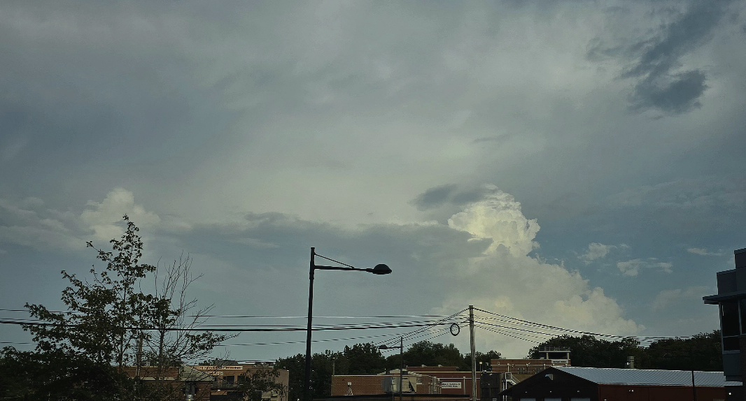
Hanging tough here at .5 for the month. I saw some clouds though.
-

Hurricane Erin: 150 MPH - 934mb - W @ 15
Wannabehippie replied to BarryStantonGBP's topic in Tropical Headquarters
8:00 PM AST Sat Aug 16 Location: 20.0°N 64.6°W Moving: W at 15 mph Min pressure: 934 mb Max sustained: 150 mph -
But we don’t have a strong HP to the north?
-

Hurricane Erin: 150 MPH - 934mb - W @ 15
Joshb32689 replied to BarryStantonGBP's topic in Tropical Headquarters
There she is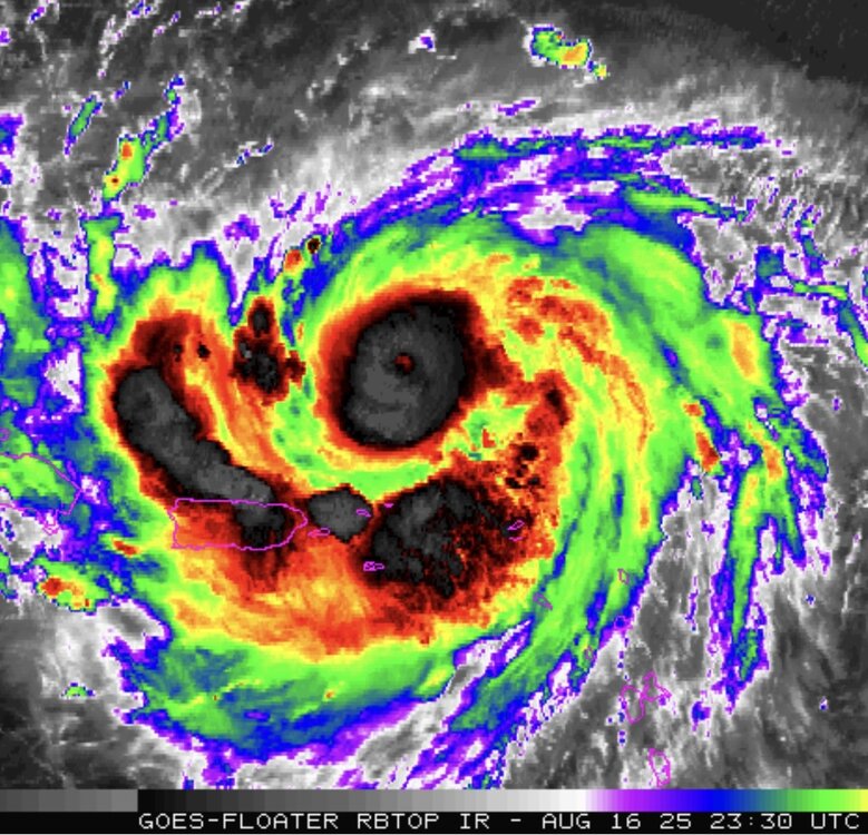
-
 Seen them on my drive to work this week on Franklin Lakes, NJ. Tonight's storm that skimmed the nj/ny line
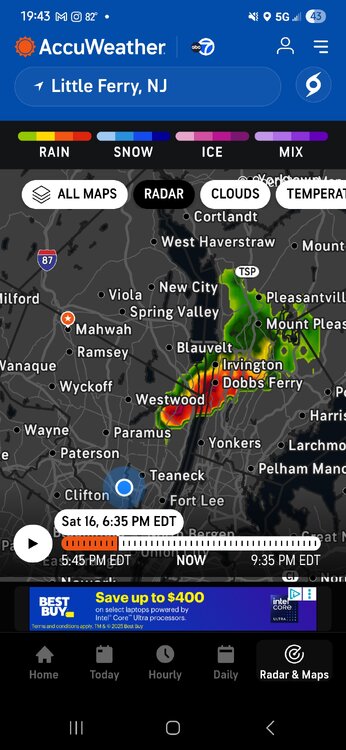

-
Picked up .08" from a small thundershower today to continue our wetness.
-

2025 Short Range Severe Weather Discussion
A-L-E-K replied to Chicago Storm's topic in Lakes/Ohio Valley
Apparently parents got rocked, mom said it looks like a bomb went off, waiting for cary#s to confirm -

Hurricane Erin: 150 MPH - 934mb - W @ 15
PSLwx replied to BarryStantonGBP's topic in Tropical Headquarters
Seems unusually small: Hurricane-force winds extend outward up to 30 miles (45 km) from the center... -- NHC 8pm advisory -
2025 Short Range Severe Weather Discussion
A-L-E-K replied to Chicago Storm's topic in Lakes/Ohio Valley
Landed in cedar rapids -

NEW DISTURBANCE: Central Tropical Atlantic (0/20)
BarryStantonGBP replied to BarryStantonGBP's topic in Tropical Headquarters
Quote from another forum Members 1.6k Weather Preferences:Long, hot and dry summers with lots of thunderstorms mixed in Posted 5 minutes ago Way too far out right now but the GFS has a Hurricane Fernand making multiple landfalls across the Caribbean/Florida in around a weeks time with potential major hurricane status. Atmospheric conditions here would be much more favourable for a US landfall than with Erin, still very far out and models still iffy on formation but one to watch closely. -
Yeah, went from foggy and zero wind at 6am to blasting north wind (gusts 60+) by noon under deep blue skies. One of the more incredible weather days we have seen in our life times. I remember walking up the beach into sand blasting gusts and having to hold on to my board for dear life.
- Yesterday
-