All Activity
- Past hour
-
I'm curious to know why we have three recon planes flying all the way out to a tropical storm in the middle of the ocean, which isn't going to affect any land.
-

September 2025 OBS-Discussion centered NYC subforum
Sundog replied to wdrag's topic in New York City Metro
The EURO, EURO AI and GGEM all have a big rain event from Thursday into Friday next week. -
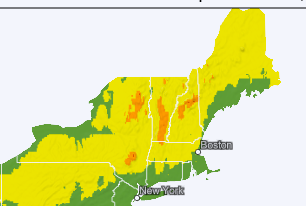
This made me want to see fall foliage currently and forecast. I went to this Web site: https://www.explorefall.com/fall-foliage-map It's pretty cool, with the slider at the bottom for forecast foliage. I have been to other sites on previous years, but have not yet seen this one. And cropped New England, kinda small, but I find this useful!
-
Yeah, there’s no surface moisture to try to offset these mixed down dews this evening. The NNE pits will radiate really well.
-
000 WTNT62 KNHC 201753 TCUAT2 Tropical Storm Gabrielle Tropical Cyclone Update NWS National Hurricane Center Miami FL AL072025 200 PM AST Sat Sep 20 2025 ...HURRICANE HUNTER AIRCRAFT REPORT THAT GABRIELLE IS FARTHER EAST AND A LITTLE STRONGER THAN INDICATED IN THE PREVIOUS ADVISORY... Reports from NOAA and Air Force Reserve hurricane hunter aircraft data show that the center of Gabrielle is located about 30 miles farther east than indicated in the previous advisory. The maximum sustained winds have increased to near 65 mph (105 km/h). The next full advisory will be issued at 500 PM AST (2100 UTC). SUMMARY OF 200 PM AST...1800 UTC...INFORMATION --------------------------------------------------- LOCATION...25.2N 58.7W ABOUT 595 MI...960 KM NNE OF THE NORTHERN LEEWARD ISLANDS ABOUT 615 MI...990 KM SE OF BERMUDA MAXIMUM SUSTAINED WINDS...65 MPH...105 KM/H PRESENT MOVEMENT...NW OR 325 DEGREES AT 13 MPH...20 KM/H MINIMUM CENTRAL PRESSURE...996 MB...29.41 INCHES $$ Forecaster Beven
-
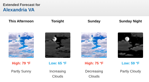
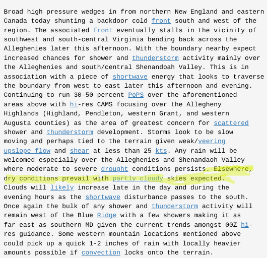
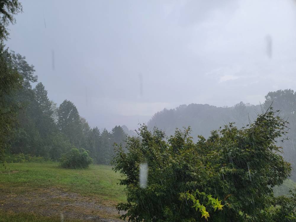
Welp, planned to mow the front lawn early-mid afternoon, started getting Rain Alarm alerts almost an hour ago. I scoffed at them...because I sometimes get false-positives from that particular app (e.g., fog, low lying clouds, etc.) plus, it's supposed to be gorgeous this afternoon, and has been all morning and (up until) the past hour: Get about two passes in on the front lawn...and the sky opens up, heavy downpour, can't hardly see across the street. That started about 40 min ago. Call me a cynic, but I didn't see this reflected above, nor in the morning disco, at least not for close-in NoVA burbs: These are the kind of whiffs in forecasting that really piss me off. Can I mow tomorrow, or early next week? Yeah, I can likely fit it in with all of the other life crap. But c'mon, mets...can we get at least a bit more of a heads-up in the disco (which is usually what *I* pay attention to)?? Yeah, precip might not happen (and THAT'S usually in hard winter around here)...but this is annoying. Ironically, we had a small picnic planned for our back patio/yard for midday today but had to cancel last-minute...thank God we did, or it would've been one helluva fire drill. P.S. -- it's STILL raining almost an hour later.
-

2025 Lawns & Gardens Thread. Making Lawns Great Again
dendrite replied to Damage In Tolland's topic in New England
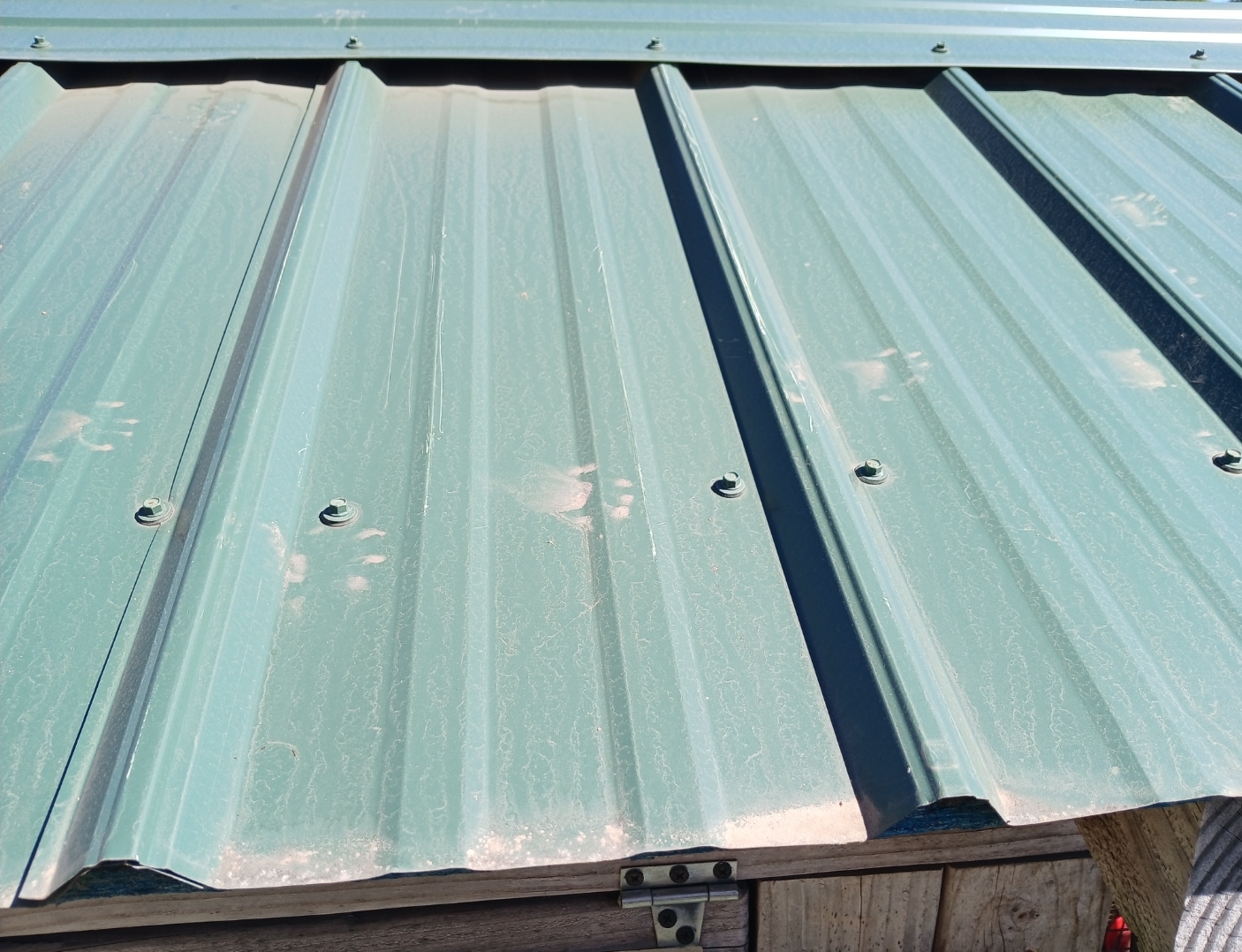
Man I don’t know. Obviously it had dirty feet, but I’m not sure how that would necessarily translate to the flat roof panels. How tall is your coop? What’s the length apart on those raised ridges on them? 8-9”? Are there any prints on the ground? It could be one and there just wasn’t enough pressure to make a mark with the entirety of the toes. Those rear paw pads look to be about 1.5-2” wide? Other option…maybe a fisher? -
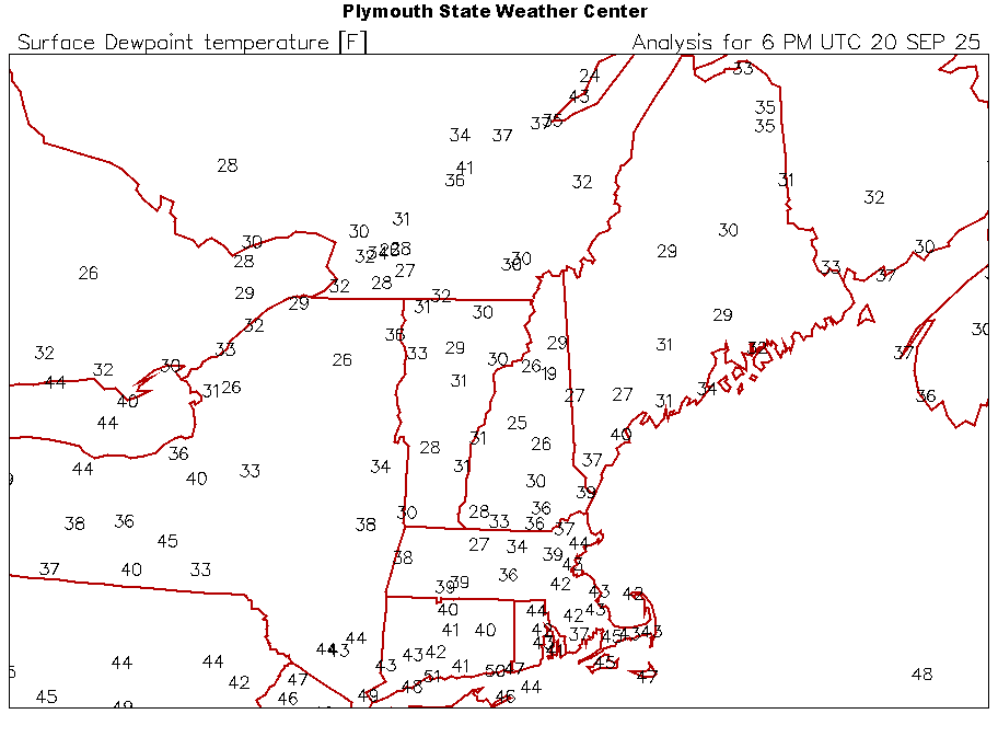
Tonight is going to be crisp. If yesterday was 67/38 and we hit 32F... this afternoon is 61/28. Afternoon dew points are a decent barometer for potential here and we are upper 20s right now. We should have no problem decoupling solidly into the 20s tonight. If afternoon dews are sub-freezing, it’s going low tonight.
-
It is now, at 2pm, 68 degrees with a dewpoint of 40 degrees. It is cool and refreshing in the shade and downright hot in the sun. It's my favorite fall weather! Well, except for fall cold fronts with heavy rain, but this is kind of almost late summer/very early fall. Oh well...
-
We COC!
-
12z a little interesting
-

2025 Lawns & Gardens Thread. Making Lawns Great Again
tunafish replied to Damage In Tolland's topic in New England
@dendrite Had a critter snooping on the roof of my coop overnight. Probably raccoon?
-
I had over an inch of rain yesterday and I'm getting hammered again. Sent from my SM-G998U using Tapatalk
-
Gabrielle is getting its act together today. Recon shows the pressure down to 997 mb. The wind has not caught up, yet.
- Today
-
Today’s weather makes me not eager for winter.
-

2025-2026 Fall/Winter Mountain Thread
ncjoaquin replied to Buckethead's topic in Southeastern States
I agree with this! -
an extended late summer and early fall right into Mowvember is what I hope for, followed by 2-3 months of cold and snow. In reality we'll get 7 months of April
-
Have been invited to play Manchester Country Club tomorrow. Anybody play there?
-
Was freezing for this mornings tee time.
-
Niña's don't always act like niñas, like last year.
-
 There are two typhoons, Neoguri and Ragasa. Neoguri as at 95 kt, and Ragasa is at 100 kt and heading toward the strait of Taiwan, eventually towards Hong Kong as a large storm. It is expected to reach peak intensity of 135 kt (category 5) at the strait of Taiwan, so I'd expect a large amount of rain is heading for Hong Kong. The WPAC has been very below normal ACE.
 -
Saw my first lantern fly in Deep Creek unfortunately. Stomped the fcker.
-

September 2025 OBS-Discussion centered NYC subforum
SACRUS replied to wdrag's topic in New York City Metro
Records: Highs: EWR: 92 (1983) NYC: 93 (1983) LGA: 90 (1983) JFK: 85 (1997) Lows: EWR: 44 (1979) NYC: 44 (1993) LGA: 46 (1979) JFK: 41 (1979) Historical: 1845 - A tornado traveled 275 miles across Lake Ontario, New York and Lake Champlain. (Sandra and TI Richard Sanders - 1987) 1909 - A large and deadly Category 3 hurricane made landfall near Grand Isle, Louisiana during the late evening hours. The states of Louisiana and Mississippi showed catastrophic damage resulting in 371 deaths and $265 million in damage 1909: A large and deadly Category 3 hurricane made landfall near Grand Isle, Louisiana during the late evening hours. The states of Louisiana and Mississippi showed catastrophic damage resulting in 371 deaths and $265 million in damage (2010 USD). 1926 - A hurricane which hit Miami, FL, on the 18th, pounded Pensacola with wind gusts to 152 mph. Winds raged in excess of 100 mph for four hours, and above 75 mph for 20 hours. (The Weather Channel) 1953: A strong upper level ridge was responsible for record highs across Texas & parts of Arizona. Midland set their all-time September record high with 107°. Other daily record highs included: Phoenix, AZ: 105°-Tied, Wichita Falls, TX: 103°, Dallas, TX: 102°, Dallas (DFW), TX: 102°, San Angelo, TX: 102°, Abilene, TX: 101°-Tied and Waco, TX: 100°-Tied. (Ref. Wilson Wx. History) 1961: Hurricane Esther, a Category 4 storm off of Cape Hatteras, NC began to slow down as it moved north-northeast well off the Jersey shore. The storm continued to weaken as it did a 5 day loop south of Cape Cod, MA then moved across Cape Cod and into Maine on the 26th. (Ref. Wilson Wx. History) 1967 - Hurricane Beulah moved into South Texas, and torrential rains from the hurricane turned the rich agricultural areas of South Texas into a large lake. Hurricane Beulah also spawned a record 115 tornadoes. (David Ludlum) 1969: On this date through the 23rd, heavy rain over several days brought extensive flooding to the Apalachicola River at Quincy, Havana, and Blountstown; and much of Franklin, Gadsden, Leon, Calhoun and Quincy Counties in the Florida panhandle. Havana 23.42", Quincy reported 18.41" of rain and Blountstown 10.41". Several funnel clouds and waterspouts were reported from northwest Florida to the Keys on the 22nd and 23rd. (Ref. Wilson Wx. History) 1972: Downpour in Duluth, MN with 5.50 inches of rain falling in ten hours. (Ref. AccWeather Weather History) 1980: Much of northwest Iowa received violent severe weather. In O'Brien, Clay, Monona, Crawford and Buena Vista counties, high winds and hail pounded crops and buildings. Winds of 70 to 75 mph blew trees down on power lines, houses and cars. Hail up to the size of baseballs severely damaged crops with over $10 million dollars in losses. In Ricketts, every north and west window was broken from the hail. The strong winds destroyed many farm structures in these counties. In addition, a strong tornado touched down in Spencer completely leveling several metal warehouse buildings in an industrial park. (Ref. Wilson Wx. History) 1983 - The temperature at West Yellowstone MT plunged to six degrees below zero, while the temperature at San Francisco CA soared to 94 degrees. (The Weather Channel) 1986: A slow moving quasi-stationary front produced flash flooding occurred in parts of central Illinois, primarily from near Peoria and Lincoln eastward to Bloomington, as rainfall amounts ranged from 3 to 7 inches. Bloomington reported 7.12 inches in 4 hours during the overnight, causing significant flooding. (Ref. Wilson Wx. History) 1987 - Afternoon and evening thunderstorms produced severe weather in Oklahoma and west Texas. In Oklahoma, a thunderstorm at Seiling produced three inches of rain in one hour, golf ball size hail, and wind gusts to 60 mph which collapsed a tent at the state fair injuring nine persons. (The National Weather Summary) (Storm Data) 1988 - Showers and thunderstorms produced locally heavy rains in central Wyoming, and snow in some of the higher elevations. Casper WY reported 1.75 inches of rain in 24 hours, and a thunderstorm north of the Wild Horse Reservoir produced 1.90 inches of rain in just forty minutes. 1989 - Hugo jilted Iris. Hurricane Hugo churned toward the South Atlantic Coast, gradually regaining strength along the way. Tropical Storm Iris got too close to Hugo, and began to weaken. A cold front brought strong and gusty winds to the Great Basin and the Southern Plateau Region, with wind gusts to 44 mph reported at Kingman AZ. (The National Weather Summary) 1995 A strong late summer storm brought the season’s first snow to parts of the Rockies. Denver, CO reported 4 to 8 inches of heavy wet snow that damaged millions of trees and downed power lines into Boulder leaving 100,000 people without electricity. It took a week to fully restore power to all areas. Total insured losses in the Denver area was $6.5 million dollars. Record cold followed the storm as the low at Denver dropped to 27° the next morning followed by an afternoon high of 36°. Further north, 2 to 8 inches of snow was reported at Cheyenne, WY. Record cold accompanied the storm. Record lows included: Glasgow, MT: 20°, Great Falls, MT: 24°, Havre, MT: 24°, Grand Island, NE: 32° and Pueblo, CO: 32°. Viroqua, WI set their all-time record low for September with 20°. (Ref. Wilson Wx. History) 1998: Hurricane Georges reached its top strength of 155 mph sustained winds when it was 420 miles east of Guadeloupe early this morning; top winds were 115 miles an hour at landfall on Puerto Rico on the PM of the 21st. 28,005 homes were destroyed but only 12 deaths were reported in Puerto Rico due to preparedness. (Weather Guide Calendar with Phenomenal Weather Events 2007 Accord Publishing, USA) Georges' Track - Weather Underground (Ref. AccWeather Weather History) 2000: An F4 tornado devastated some of the same portions of Xenia, OH that were damaged in the April 3, 1974 twister. No tornado warning was issued when the storm struck, raising the ire of local residents. Record heat prevailed across parts of the southwest courtesy of a large upper level heat ridge. Record highs included: Death Valley, CA: 116°, Palm Springs, CA: 115°, Borrego Springs, CA: 110°, Victorville, CA: 104°, Stockton, CA: 101 °F. (Ref. Wilson Wx. History) 2002: A F2 tornado touched down WNW of Washington, IN. It destroyed/damaged several homes. The tornado lifted/tossed a vehicle 1/8th mile; the conservation officer inside survived. (Ref. Weather Guide Calendar with Phenomenal Weather Events 2011 Accord Pub. 2010, USA) 2005 - Hurricane Rita tracked through the Florida Straits and just south of the Florida Keys. Winds were sustained at tropical storm force at Key West, where peak winds gusted to 76 mph. -

September 2025 OBS-Discussion centered NYC subforum
Stormlover74 replied to wdrag's topic in New York City Metro
And hopefully some rain Tuesday night -
Ensembles are well into Octorcher