All Activity
- Past hour
-
Interesting dude but a very, very good met. Interned with his group at the Boston air traffic control center my senior year of college.
-
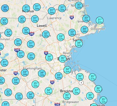
At least for inside 128, not feeling a surprise >3" snow: DPs: Still an 850 tongue on 0z NAM 6z: Station: KBOS Latitude: 42.37 Longitude: -71.02 Elevation: 37.29 Press Height Temp Dewpt Dir Spd SFC 1023.6 37 0.5 0.1 51 13 M 1000.0 224 -0.8 -1.1 57 26 S 950.0 633 -1.7 -2.0 86 32 S 900.0 1065 -0.2 -0.5 87 22 M 850.0 1523 0.3 0.0 112 13 S 800.0 2009 -0.1 -0.4 147 9 S 750.0 2526 -0.4 -0.7 201 16 M 700.0 3077 -1.9 -2.3 229 25 9z: Press Height Temp Dewpt Dir Spd M 1000.0 214 -0.7 -9999.0 53 24 S 950.0 624 -0.4 -0.7 91 28 S 900.0 1057 -0.1 -0.4 96 23 M 850.0 1515 0.2 -0.1 123 13 S 800.0 2001 -0.5 -0.7 158 9 S 750.0 2517 -0.7 -1.0 239 16 M 700.0 3067 -2.2 -2.5 261 25
-
That guy’s twitter bio is a nightmare
-
32.4/30, rain locally seems like ~500’ is the freezing level
-
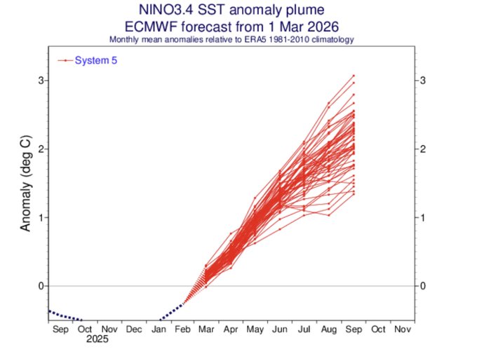
Whew. All signs are increasingly pointing to a significant, if not strong to very strong, El Niño event. I'll have more to say in coming weeks & months, but for now I'll just say that this is increasingly likely to become a major regional-to-global climate driver in 2026-2027. https://twitter.com/Weather_West/status/2029694752199754045? My thoughts on this newest Euro 3.4 prog: - They’ve generally been getting stronger the last few months. -This run implies a super Nino peak. -Keep in mind, however, that this is a prog of ONI, not RONI. RONI currently is ~0.5C lower. So, this implies Aug RONI to be near +2.1 -0.5 = +1.6. -Keep in mind that the Euro has a warm bias in 3.4 of several tenths. So, a bc prog of RONI would very likely be only in the low +1s range in Sept.
-
that line wasn't as impressive in the flesh as it looked on radar. but it had some deep thunder rolls and 15 minutes of good rain.
-
Bedford NH runs from 100 to 800', possible its snow on the west side
-
29.0° SN Just talked to my mom and it’s snowing on the north end in Manch.
-
Some flakes mixing in here. Quite the glaze as well.
-

Central PA Spring 2026 Discussion/Obs Thread
canderson replied to Voyager's topic in Upstate New York/Pennsylvania
Had some thunder but didn’t notice lightning. -
Yes we need this extended soaking rain to wash this salt away. These mist and drizzle days wasnt really doing it.
-
Don't you get enough heat and humidity the other 8 months of the year.
-
Light-mod snow at 32/30. Coated up.
-
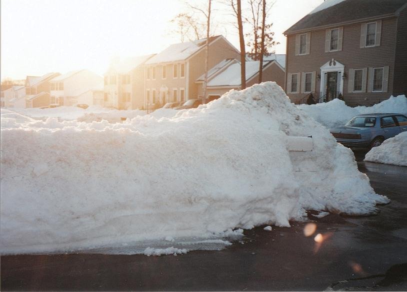
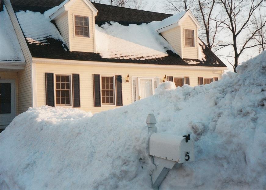
These two pictures were taken March 8, 2001 in ORH. There would actually be another storm the next day that dumped 6-10” from interior MA up into CNE. Coastal MA got some too but more on the lower end.
-
Wow this line is electric. Two close strikes, thunder shook the whole house. I am in an interior TH so takes a lot to shake the house.
-
Still pinging. Going to watch the Bruins on DVR....Will report tomorrow with the bust snow report.
-
I don't think this looks bad up here....yea, I wouldn't be thrilled in Weymouth. I should get at least 3".
-
81.5 IMBY today.
-
Very foggy again tonight. Visibility was about 1/5 of a mile during my dinner break.
-
Yea.
-
32.5/32.2 I'll be ripping by 11pm.
-
Decent look for NE IL and N IN, too, for tomorrow evening on the HRRR.
-
Weir https://x.com/4castrnh/status/2029729896675823681?s=46&t=dhcbvkjmRcyBVQtDxJ3lRg
-
All snow in lebanon, currently dusting on my car.
-
Yeah ripping sleet now