All Activity
- Past hour
-

Winter 2026-2027 Speculation
Prismshine Productions replied to 40/70 Benchmark's topic in New England
Doing a bit of math here... Last month was at -5.5", converting that new map to inches and adding... Well, shit, -1.5" Sent from my SM-S176V using Tapatalk -
low grade remnant showers looking increasingly likely for some of us
-
Yeah me and a buddy were going to that game and watched the snow instead from our balcony . About 1.5” in Beltsville with huge amounts out in Skyline
-
Car batteries know that it's real, but only in the lower levels - go up 100 yards and the temp would be significantly higher. When we lived on sloping ground at 970' asl in the back settlement of Fort Kent, after calm clear overnights we'd see the smoke layer above the sawmill cone burner across the St. John and would know that it was 10°+ colder than our place at the riverside office. It's a similar "fake" when growing season transpiration brings tall TDs - in each case the extreme conditions aren't the same as the overall airmass. Temp had dropped into the upper 30s by 10 PM last night, so I expected mid-upper 20s. Maybe the wind returned, as our low was 33.
-
it's a badge of honor thing to some to see how late they can go without flipping the heat on. Kinda weird but whatever floats your boat
-

2026-2027 Record-breaking El Nino
GaWx replied to Stormchaserchuck1's topic in Weather Forecasting and Discussion
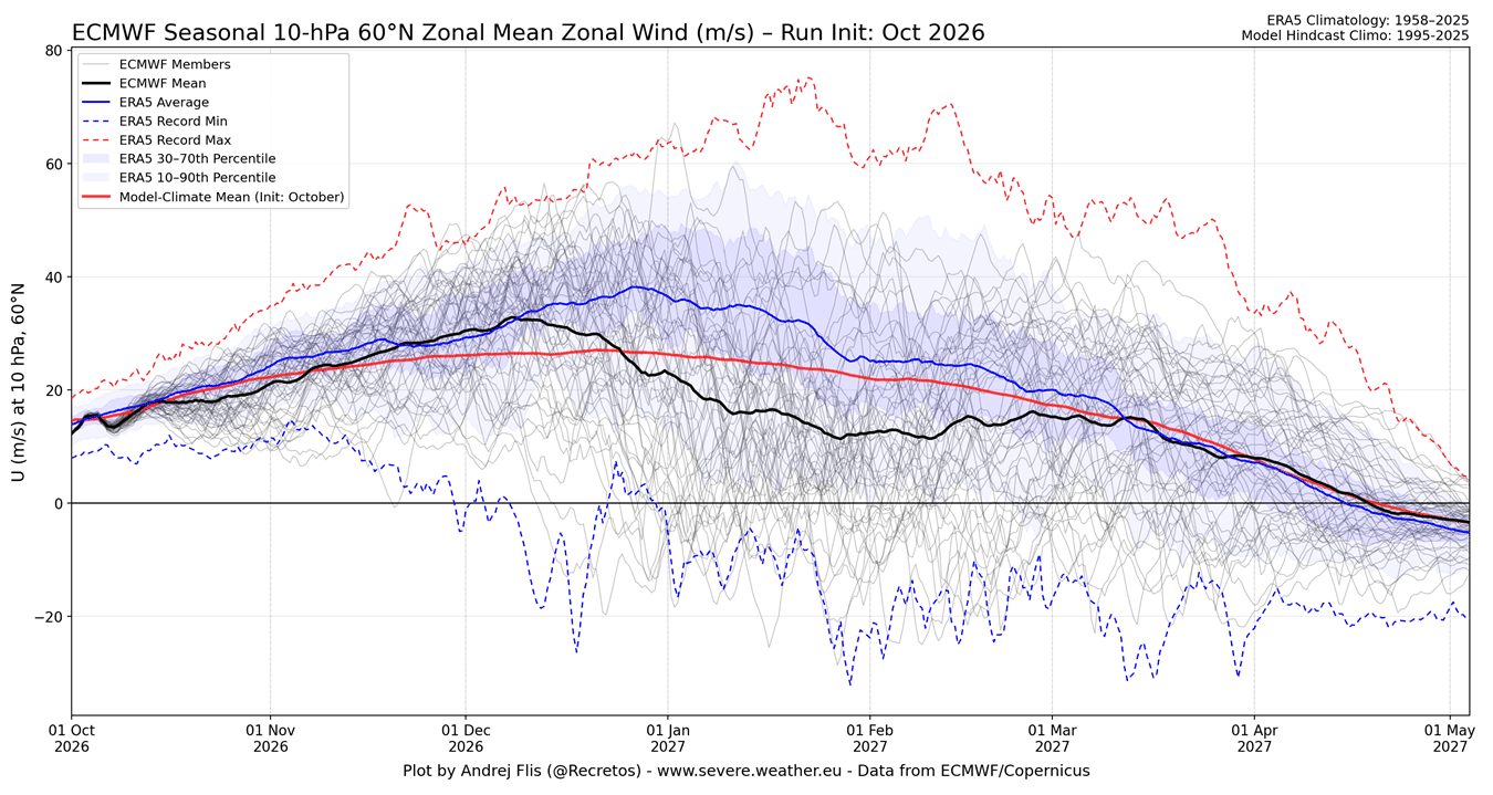
Any comments about what this graph implies? Why is prog of ERA5 avg (blue) so much higher than prog of ECMWF mean (black)? Isn’t ERA5 produced by ECMWF? Is ERA5 its own projection model? Any explanation would be appreciated.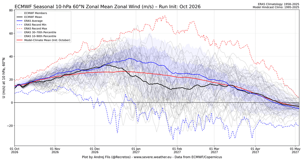
-
We are going to be very good this winter. 2002-03 keeps showing up. That means the general pattern more than one huge storm but such storm is not discounted I also look at first half of October as to how far off NWS and others are in predicting below average temps in the 5+ day prior to. This cool shot prediction had DC in upper 50’s for highs initially which verified more like 63-64 so about 5/6 degrees off .
-
it's amazing how the universe finds a way to get to entropy. like ...keep using oil, the temp rises to the point where you don't need to use any oil. problem solved. lol
-

2026-2027 Record-breaking El Nino
bluewave replied to Stormchaserchuck1's topic in Weather Forecasting and Discussion
RONI is not meant to be used for the absolute intensity of this event. It’s more about gradients and storm tracks. With something this historic, it’s the absolute temperatures and water vapor increase that matter which is better reflected by ONI. -
Well since I saw AvDave mention February, thought I’d start the thread lol. Here’s hoping I can bust droughts too .
-
Well I see it’s that time again…. .
-
What’s everyone’s gamble on timing? App kicks off homecoming at 1 pm. Selfishly hoping we get a rain free game for our passing attack lol.
-
Weirdly, I think everyone is getting smoked. I may be 100% wrong, but with that flow, we’ll be getting not only the southerly fetch from the gulf, but the Atlantic will get tapped into as the storm gains latitude. There’s certainly going to be max’s to the west and east of the piedmont but this is your classic, squeezing every last drop out of the clouds type of setup for the Carolinas. Also one of those situations where the moments of blankness on radar are still producing heavy drizzle/light rain.
-
heh...that region in the NE US looks like the (superstorm 1993 + climate change)/2
-
I'll never understand how cold could be "fake"
-
All of the globals and their AI brethren drop an inch of rain ish, or more, on the region sunday into monday. Getting into deterministic range soon though as others have said that doesnt mean much these days lol
-
No clue. I have a wife and kids and I want them to be comfortable. Maybe it makes people feel tough?
-
Very good chance of severe weather across the south given the combination of a tropical system interacting with a strong jet and dry air shooting in the backside. Probably a tornado outbreak for the south
-
Must be tough keeping the MIL in line when she attempts to dabble with the heat
-
38 glorious degrees for a low.
-
Yup. This is a hard rule. No getting the oil burner fired up until Nov 1 or after. With that being said, we do have supplemental heat with the new mini split ac unit that was installed a few years ago. Since my wife's elderly mother lives with us, she does turn it on every so often during cooler mornings. It really only heats the area she is in.
-
A prolific tornado set-up which probably will be a high impact event.
-

2026-2027 Record-breaking El Nino
LakePaste25 replied to Stormchaserchuck1's topic in Weather Forecasting and Discussion
I won’t count chickens before they hatch, but *at least so far* the Euro has been the most correct with how E based it is compared to the others. -
If it was September, maybe. But we're now in October, so I think at most, only one more named storm. There's no way we get 3 more named storms after this point, especially in an el nino. Recent history says this will probably be the last storm of the storm. In the last 15 years, several seasons ended with the last active storm being the biggest (Sandy in 2012, Iota in 2020, and Melissa last year come to mind).
-
With this set up potentially happening, my gut tells me that somehow, someway the piedmont will get screwed on the rainfall. Similar to last Feb winter snow, except that was a dry slot and totally different set up. This just doesnt sit well with me for an inch+ of rainfall here. Im hope Im wrong though