All Activity
- Past hour
-
Yeah today is central MA to NH. Stein S and E of there through tomorrow. Weekend decent. Figured it would be ok as I saw the Stein and it opened up my eyes I saw the Stein.
-
Well Summer was fun. Might not hit 80 again for nearly a week.
-
My high was 88. Lots of cirrus clouds yesterday.
-
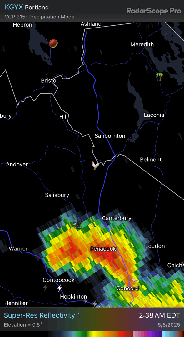
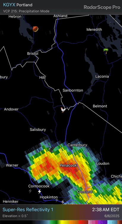
You can see how today’s going to go right? North of rte 2 is porked by morning stuff for later.
-
Howie looking? Sent from my SM-A515U using Tapatalk
-
Topped out @ 91 here yesterday.
-
Thunder here. Light rain.
-
Big cracks here, looks like it'll take the slip lane though, as always.....
-
Had a few rumbles an hour or two ago. two tenths of rain this morning so far.
- Today
-
Nevermind died on approach
-
Got home late from work yesterday, so I forgot to check, but my high was 93.
-
Thought I might have time to cut the grass this morning. Guess not
-

Chester County PA - Analytical Battle of Actual vs. Altered Climate Data
chubbs replied to ChescoWx's topic in Climate Change
We have thousands of weather stations in the US making it very easy to separate station changes from weather. Year-to-year temperature changes are correlated for hundreds of miles. If West Chester is 2F cooler one year, Coatesville will also experience similar cooling. Why? every station in Chester County and the region experiences the same weather. The effect of the Coatesville station move is very clear in the chart below. Other than the move years of 1946 and 1947, both stations have the same year-to-year temperature change. This illustrates the close correlation in the between nearby stations when there are no station changes. However Coatesville cooled significantly relative to West Chester in 1946 and 1947. Proof that a big station change occurred in that period. Station changes are permanent. The rural Coatesville Doe run location (1948 and later) is always cooler than the West Chester town location and the city of Coatesville (1945 and earlier). That's why the city of Coatesville gets an big positive adjustment every single year. Similarly before the 1970 move, West Chester always gets a large positive adjustment because it is warmer than the post move West Chester location. This isn't rocket science. Every NOAA adjustment that we have looked at has been spot on based on the raw data and other evidence. Is there something about the chart below you don't understand?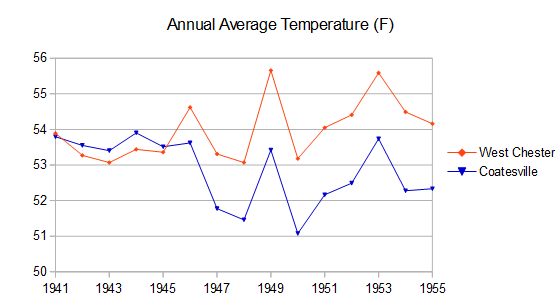
-
Looks like a north of CT border special today . Outside looking in here. I’ll hear thunder for hours with nada
-
Hazardous Weather Outlook National Weather Service State College PA 407 AM EDT Fri Jun 6 2025 Hazardous Weather Outlook National Weather Service State College PA 407 AM EDT Fri Jun 6 2025 PAZ004>006-010>012-017>019-024>028-033>035-037-041-042-045-046- 049>053-058-070815- Warren-McKean-Potter-Elk-Cameron-Northern Clinton-Clearfield- Northern Centre-Southern Centre-Cambria-Blair-Huntingdon-Mifflin- Juniata-Somerset-Bedford-Fulton-Tioga-Northern Lycoming-Sullivan- Southern Clinton-Southern Lycoming-Union-Snyder-Montour- Northumberland-Columbia-Schuylkill- 407 AM EDT Fri Jun 6 2025 This Hazardous Weather Outlook is for central Pennsylvania. .DAY ONE...Today and tonight. Strong to severe thunderstorms with gusty winds are possible. Brief heavy rain could lead to minor flooding problems. .DAYS TWO THROUGH SEVEN...Saturday through Thursday. Strong to severe thunderstorms with gusty winds are possible, and brief heavy rain may also lead to minor flooding problems on Sunday. .SPOTTER INFORMATION STATEMENT... Spotters are encouraged to report significant hazardous weather. PAZ036-056-057-059-063>066-070815- Franklin-Perry-Dauphin-Lebanon-Cumberland-Adams-York-Lancaster- 407 AM EDT Fri Jun 6 2025 This Hazardous Weather Outlook is for central Pennsylvania. .DAY ONE...Today and tonight. Strong to severe thunderstorms with gusty winds are possible late today and tonight. .DAYS TWO THROUGH SEVEN...Saturday through Thursday. Strong to severe thunderstorms with gusty winds are possible Saturday and Sunday. Brief heavy rain could lead to minor flooding problems on Sunday. .SPOTTER INFORMATION STATEMENT... Spotters are encouraged to report significant hazardous weather.
-
Heh. I’d be livid if I needed rain. Jfc. The thunder woke me up. 0.00”
-
What? It’s June 6. We lose daylight (slowly) but climo peaks in late July. Backswing by mid August.
-
ECMWF and Australian BOM models (amongst other seasonal models) suggesting a Central Atlantic NIno developing. This, along with portion of the very warm anomalies west of Europe gradually bleeding SW the Canary Islands and eastern tropical Atlantic, could help ramp up activity in the deep tropics, particularly west of 40W. https://x.com/yconsor/status/1930624747382964591
-
Sneaky wind threat on Saturday? Its a MRGL on the new day 2... but its all we've got for now
-
I now do not think we'll see a 90 at Central Park before June 18th and probably not until after the 23rd if in June at all. WX/PT
-
As always, predict the highest temperatures to be expected this summer at the four airports: DCA IAD BWI RIC and I will start the ball rolling with 101, 101, 102 and 100. Contest deadline 06z June 23 2025 (end of weekend 21st-22nd) Tie-breaker details: lowest errors break ties, order of entry the last level separating ties For example, 0 1 1 1 beats 0 1 2 0. ... 2 1 1 1 beats 2 2 1 0. ... June 12th beats June 15th. ___ DEFENDING 2024 WINNER: Jebman ___
-
Goguac Lake in Battle Creek. All-sport lake. Good fishing. Little bit of everything and walking distance from home.
-
Finally dropped below 80 in the Park and still 80 at LGA and EWR. 69 here and feels warm
-
a lot of creepy bugs outside my window tonight in this very uncomfortable humid night for early june.