All Activity
- Past hour
-

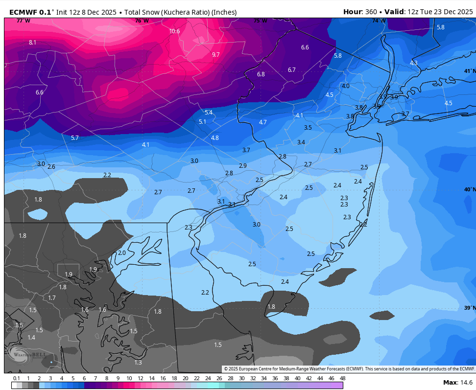
December 2025 regional war/obs/disco thread
weatherwiz replied to Torch Tiger's topic in New England
If this piece of PV energy that's closed off could even dig into the base of the trough just a tick earlier this would allow for LP to explode just south of Long Island. Might actually be some room to get the Cape a decent whack out of this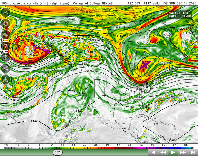
-

December 2025 Short/Medium Range Forecast Thread
John1122 replied to John1122's topic in Tennessee Valley
It snowed here for about 30 minutes around 10 to 10:30 this morning. MJO is active with KW in 6, so the weather is reflecting that on modeling. Not sure what pattern reshuffle we will get, but unless we can get the EPO to move west, and get that death vortex out of the GOA we are going to be watching systems fly by to the north of us. Good news for the NE Kentucky, Va and north. On runs where the ridge in the west sharpens and Western Canada goes from -PNA to +PNA the cold gets unleashed. -
EPS is similar - just less interested in both. But still appearing on the means.
-
(002).thumb.png.6e3d9d46bca5fe41aab7a74871dd8af8.png)
E PA/NJ/DE Winter 2025-26 Obs/Discussion
ChescoWx replied to LVblizzard's topic in Philadelphia Region
Euro not so enthused
-
That would be sweet.
-

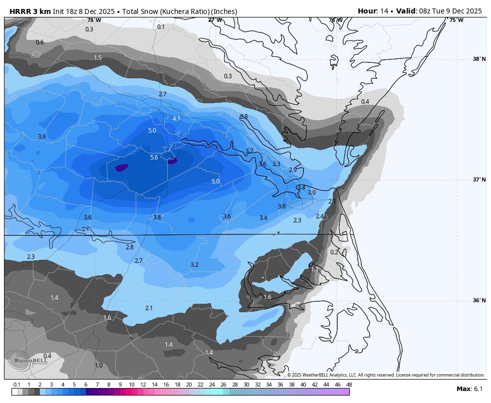
Richmond Metro/Hampton Roads Area Discussion
migratingwx replied to RIC Airport's topic in Mid Atlantic
Latest HRRR, fwiw.
-
Wow, okay, I would maybe put downtown at .5" Watching the plows circle around down here with nothing to plow.
-
And for stores that sell ChapStick.
-
Define big totals? I think 3-4 inches (only in the grass) could be the big winner with this system. Timing was bad. Middle of the day, rates weren't super heavy, weak system. I'm sure those who got a nice snow globe day are happy. I would be too.
-

The Monday wintry event potential (12/8/25)
NorthHillsWx replied to GaWx's topic in Southeastern States
Been stuck in a rain snow mix for a couple hours and back edge is here. Thought we might have a chance at a coating but oh well. Congrats Va people what a start yall are having -

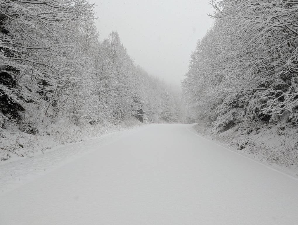
2025-2026 Fall/Winter Mountain Thread
Tyler Penland replied to Buckethead's topic in Southeastern States
Just measured 3.5" here at the store in Blowing Rock. Can only upload one Pic at a time on my phone but I hopped up on the Parkway this morning before I had to come in. I was the only one up there and it was absolutely gorgeous. Sent from my Pixel 10 Pro using Tapatalk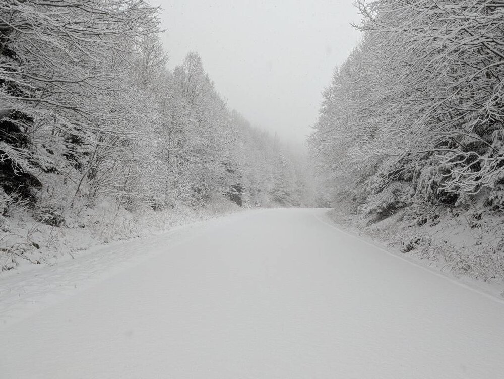
-
although some can survive anything-the spotted lanternfly egg nests can survive down to -20.
-

Winter 2025-26 Short Range Discussion
A-L-E-K replied to SchaumburgStormer's topic in Lakes/Ohio Valley
ready 2 glaciate -

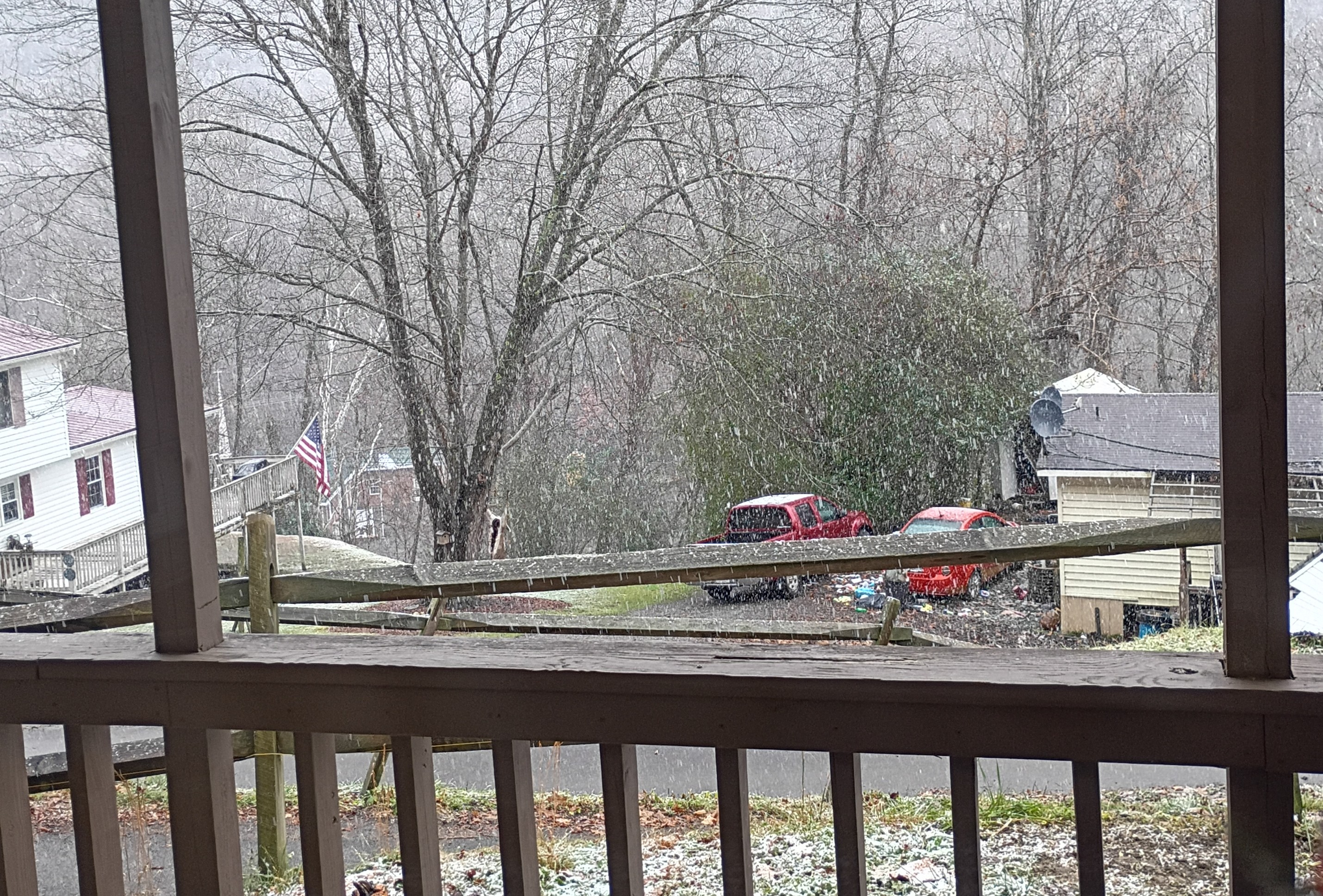
The Monday wintry event potential (12/8/25)
BornAgain13 replied to GaWx's topic in Southeastern States
2" here now. Still coming down. Probably have 2 hrs or so left to go before it winds down -
sun breaking out in west AVL.
-
Hey neighbor, 3.1" on the 'high heights' in Clifton Forge (top of Jefferson) at 1pm.
-

Richmond Metro/Hampton Roads Area Discussion
Conway7305 replied to RIC Airport's topic in Mid Atlantic
About 2 inches on deck in Short Pump -
Also good to naturally control garden and tree pests, especially sans snow! .
-

Pittsburgh/Western PA WINTER ‘25/‘26
jwilson replied to Burghblizz's topic in Upstate New York/Pennsylvania
Some flizzard yesterday, but now it's looking like the next discrete event is Saturday into Sunday. Evolution looks pretty similar to the one on the 2nd. Another quick hitting 2-4" event. Initially, it looks a little colder than the last system, so perhaps there's less concern for mixing in the southern areas. Fairly decent agreement amongst the major models for a synoptic event at this range, though. The smaller details will have to get worked out later. -
Down to the magic 32 here.
-

December 2025 Short/Medium Range Forecast Thread
BuCoVaWx replied to John1122's topic in Tennessee Valley
Had rain here all morning. Changed over to a mix around 11. It's changed to all snow and pretty good sized flakes for the past 30 minutes.
-
There was much more accumulation already in the Bon Air neighborhood south of Richmond. Back in the city proper, it’s still a heavy coating, and the snowflakes are large in quantity, but very, very tiny otherwise. .
-
Hope that’s coming our way! It’s very, very light here in Carytown. .
-
Nice
-
Its lightened up for now. Hope it picks back up