All Activity
- Past hour
-
I don't envy Mike or the mets at Mt Holly. There's potential, so you want the public to have plenty of warning. BUT...
-
Last February my gauge recorded .15” total. So far for this Feb I am at .33” with more precip likely coming today. Last January came it at only .35”, and this January at .13”. Very comparable. All in all it was a decent spring here last year following Jan and Feb, so there is hope.
-
If this were trending like 5 days out then maybe but NW ticke in this range are welcomed
-
The surface low couid be 25 miles of ACY and the coast would still be snow.
-

SWFE. Feb 20-21. Good BETTER Best
Prismshine Productions replied to HoarfrostHubb's topic in New England
Yep, another system that looks good on paper but me and you get hosed by elevation Sent from my SM-S166V using Tapatalk -
I went from 0.000000000 to about 10 inches on the NAM. Pretty wild for a storm 60 hours out.
-
imagine going from a miss to talking about mixed precip in 24 hrs...oh wait we did that on 1/25
-
Oh please Mother Nature, no “warm nose” this time!
-
As Jim Ross would say "Business has just picked up"
-
Winter storm warning here?
-
Just going on the strength of the SLP will want to get this west a bit.
-

Feb 22nd/23rd "There's no way..." Storm Thread
WxUSAF replied to Maestrobjwa's topic in Mid Atlantic
3k NAM looks like it’s really starting to crank as it ends. Temp drops fast the last couple hours of the run approaching 0z Monday. Shows snow for a lot of the area all day Sunday but with temps of 35-36…that won’t do it. So white rain during the day except for coldest spots and then accumulating after 22-0z. -
They sometimes hoist blizzard warnings in the plains just for blowing snow, even if there's nothing falling.
-
Hi RU, I like your posts, and the fact that you are just to my NW. The forecasts in text this morning for the two areas were exactly as I wrote. Since then, Mt. Holly downgraded it to this for Perth Amboy: Sunday Snow likely, possibly mixed with rain before 7am, then snow. High near 38. East wind 5 to 15 mph. Chance of precipitation is 80%. New snow accumulation of around an inch possible. Sunday Night Snow likely. Cloudy, with a low around 30. Chance of precipitation is 70%. However, Upton, for Staten Island, has increased the inches in their text forecast: Sunday Snow likely, possibly mixed with rain before 7am, then snow. High near 37. East wind 10 to 15 mph. Chance of precipitation is 80%. New snow accumulation of 1 to 2 inches possible. Sunday Night Snow likely. Cloudy, with a low around 30. Chance of precipitation is 70%. New snow accumulation of 2 to 4 inches possible.
-
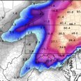
Central PA Winter 25/26 Discussion and Obs
pawatch replied to MAG5035's topic in Upstate New York/Pennsylvania
39 degrees and rain. Not much rain overnight .21” Appears first line of storms last night was a big miss. Hows the rivers and the ice? Anybody having any problems yet? Models are being the models again. You think in this day and age there would be more consistent models…terrible! -

“Cory’s in NYC! Let’s HECS!” Feb. 22-24 Disco
RUNNAWAYICEBERG replied to TheSnowman's topic in New England
Pretty consistent if one is being truly objective. -

Central PA Winter 25/26 Discussion and Obs
Mount Joy Snowman replied to MAG5035's topic in Upstate New York/Pennsylvania
FWIW, the FV3 at range also spits out a preferred coastal track. -
It would benefit us more
-
Parents live there. I may do it
-
Yea it’s possible, totals don’t matter for blizzard warning so you can have 4-8 6-12 and still have a blizzard
-
At some point those of us NYC south and east don’t want this thing too much closer. Seen this movie before.
-
Blizzard criteria is very hard to meet these days. I don't see no watches or warnings for the B word being raised. We get Winter Storm Warnings and that's it.
-
No. Even if a blizzard is likely, the criteria do not allow for a blizzard warning at the lead time involved. A Blizzard Warning means that the following conditions are occurring or expected within the next 12 to 18 hours. 1) Snow and/or blowing snow reducing visibility to 1/4 mile or less for 3 hours or longer AND 2) Sustained winds of 35 mph or greater or frequent gusts to 35 mph or greater. There is no temperature requirement that must be met to achieve blizzard conditions. https://www.weather.gov/lwx/warningsdefined#Blizzard Warning
-
I’ll be honest….we here near dc need to wait for nighttime for any real shot.
-

Central PA Winter 25/26 Discussion and Obs
pasnownut replied to MAG5035's topic in Upstate New York/Pennsylvania
as stated earlier, NAM early into storm range often seems lost for a run or 2. Not surprised at all. Not saying it is final solution, but its just the NAM doin its NAM thingy

