All Activity
- Past hour
-
@buckeyefan1can you pin this and unpin our winter.
-
Topped out around 68-69F
-
58/49
-
Grass is green already man.
-
64/52 with late day sun. Amazing.
-
Nothing says green up like late evening highs.
-
 DCA: +2.0 NYC: +2.3 BOS: +2.5 ORD: +2.5 ATL: +3.5 IAH: +1.5 DEN: +3.0 PHX: +3.5 SEA: +12.5
 -
Yes sorry im making my forecasts now been a wild few days for me
-
Found the last remnants of snow in our complex.
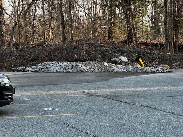
-
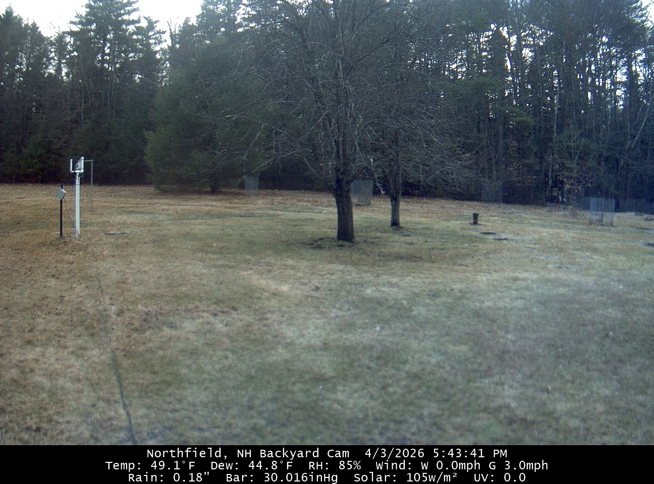
55/49. warming up even as we lose the diurnal max a midnight high is a positive on a Friday so we’ll take that win as well. NAM and Euro guidance did well today.
- Today
-

E PA/NJ/DE Spring 2026 Obs/Discussion
PhiEaglesfan712 replied to PhiEaglesfan712's topic in Philadelphia Region

-
Everything is greening up! Or it would if we could get some rain. Sent from my SM-S908U using Tapatalk
- 1 reply
-
- 1
-

-
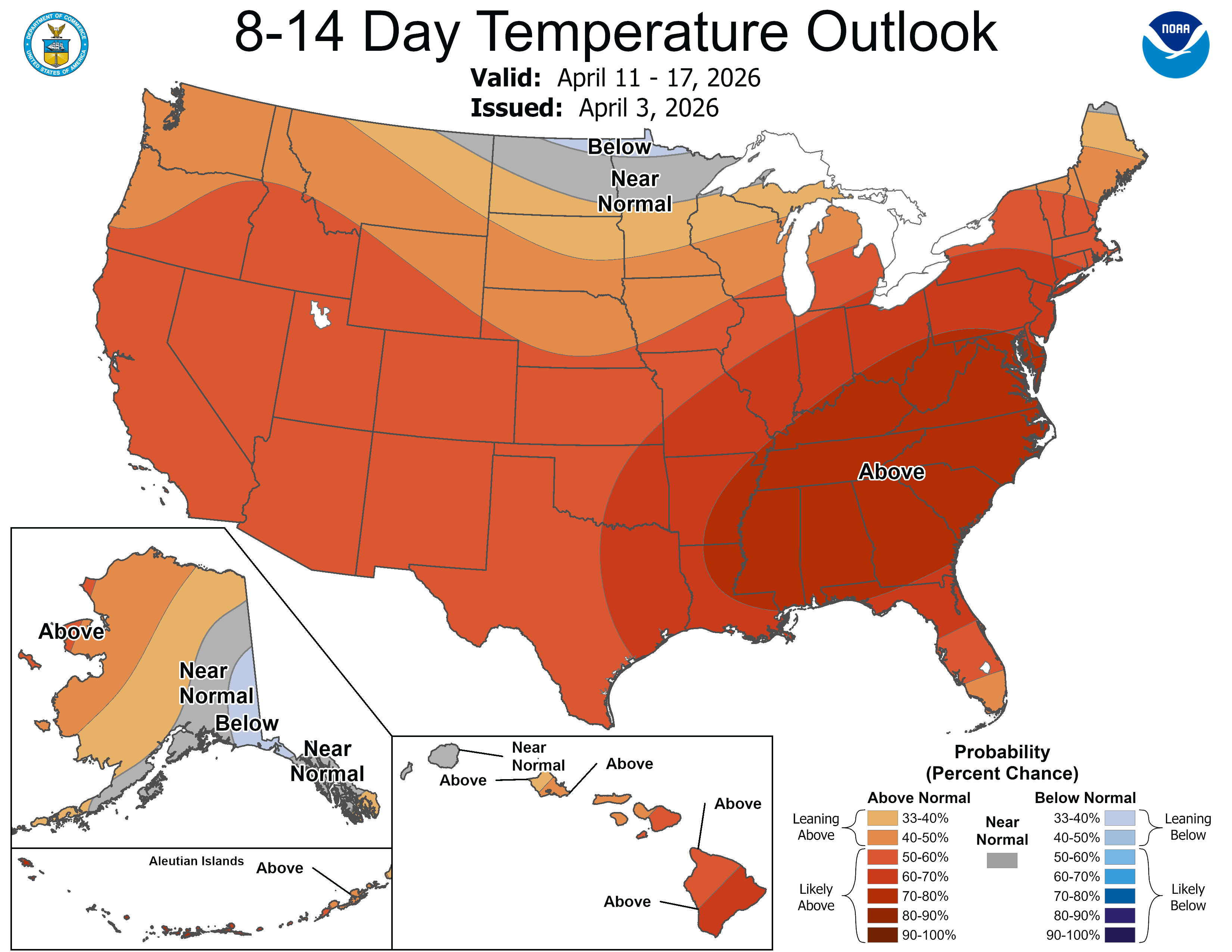
Tomorrow and Sunday will remain mild with highs in the middle and upper 60s. Some spots could reach 70° or a little warmer. However, a cold front that will bring showers or a thundershower late Sunday or Sunday night will result in cooler conditions returning to the region on Monday. Temperatures through midweek will likely top out in the 50s. The ENSO Region 1+2 anomaly was +1.3°C and the Region 3.4 anomaly was +0.2°C for the week centered around March 25. For the past six weeks, the ENSO Region 1+2 anomaly has averaged +1.25°C and the ENSO Region 3.4 anomaly has averaged -0.02°C. Neutral ENSO conditions will continue through at least mid-spring. The SOI was -4.90 today. The preliminary Arctic Oscillation (AO) was +1.917 today.
- 122 replies
-
- 1
-

-
- april showers bring may..
- rain
- (and 2 more)
-

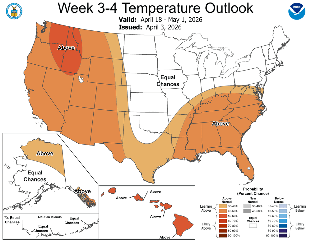
2026-2027 El Nino
Stormchaserchuck1 replied to Stormchaserchuck1's topic in Weather Forecasting and Discussion
SOI has been negative 10 days in row, albeit lightly negative. -
If you haven’t temp problems, I feel bad for you Brian. Igot 69 problems but the temp ain’t, one hit me.
-
69.
-
So naked. So free.
-
53/48
-

Central PA Spring 2026 Discussion/Obs Thread
Voyager replied to Voyager's topic in Upstate New York/Pennsylvania
Surprisingly, the warmest temps, and the only real sun I've seen today is in the least likely place.... Hazleton. -
It's sunny here but windy and 52°. Sun not doing much with SW winds off the frigid bay
-
There’s definitely a rule of thumb with these for early spring. Need the southwest flow to kick in on/before 12z to have clearing well ahead of sunset. You can probably add an hour for May and then again in June. If it happens after like 15z fawgetaboutit.
-
Sun peeking out now as it sets behind the western trees. 47.8°
-
Someone make a spring/summer thread
-

Central PA Spring 2026 Discussion/Obs Thread
Itstrainingtime replied to Voyager's topic in Upstate New York/Pennsylvania
Alaska has had a lot of un-Alaska like winters lately.