All Activity
- Past hour
-

Spring 2026 Pattern Discussion Thread
Carvers Gap replied to Carvers Gap's topic in Tennessee Valley
Dwagner....that is crazy insane. Well, you all can thank me for the copious amounts of cold weather incoming. My tomatoes and peppers arrived in the mail yesterday. They are about to be on the struggle bus in about 7 days. Thankfully, rain appears to be on tap. Now, let's go watch some NFL Draft. -
*Almost* perfect for working outside, today
-
So you don’t watch any TV? Or listen to any radio? Wow…hmm.
-
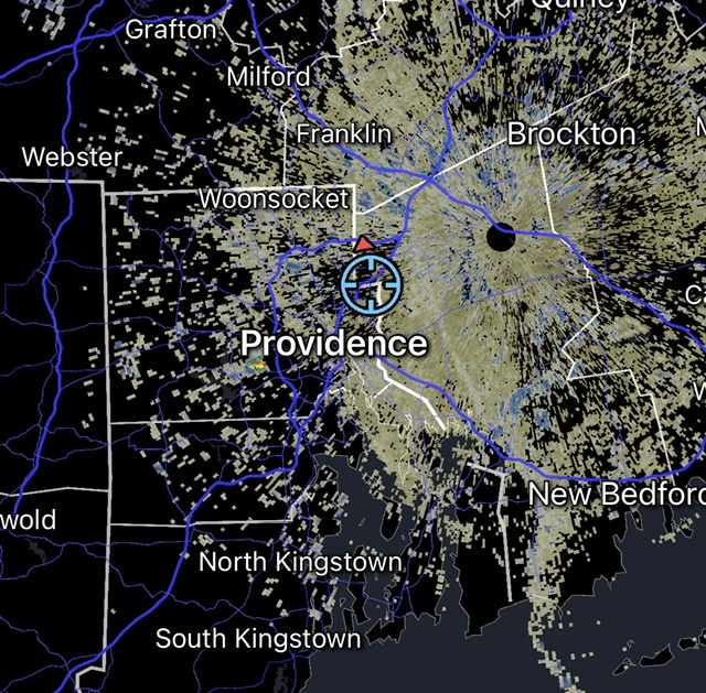
lots of rotation on the live cam
-
Topeka Kansas about to get hit good https://www.ksnt.com/weathercam-network-west-topeka/

-
@MN Transplant and any other hydrologists, is there a way to determine water table depths for a specific location? And I mean very specific. A friends backyard in the neighborhood is very wet and there’s no pipes in that area of the yard.
-
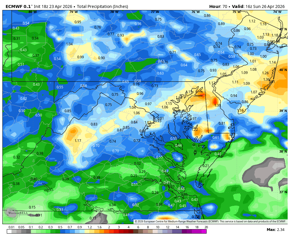
18z came in wetter on most models for the Carolina’s this weekend
-
Now this I can get into. Actually more than a half inch. I'm at barely 1.25" in the past 30 days.
-
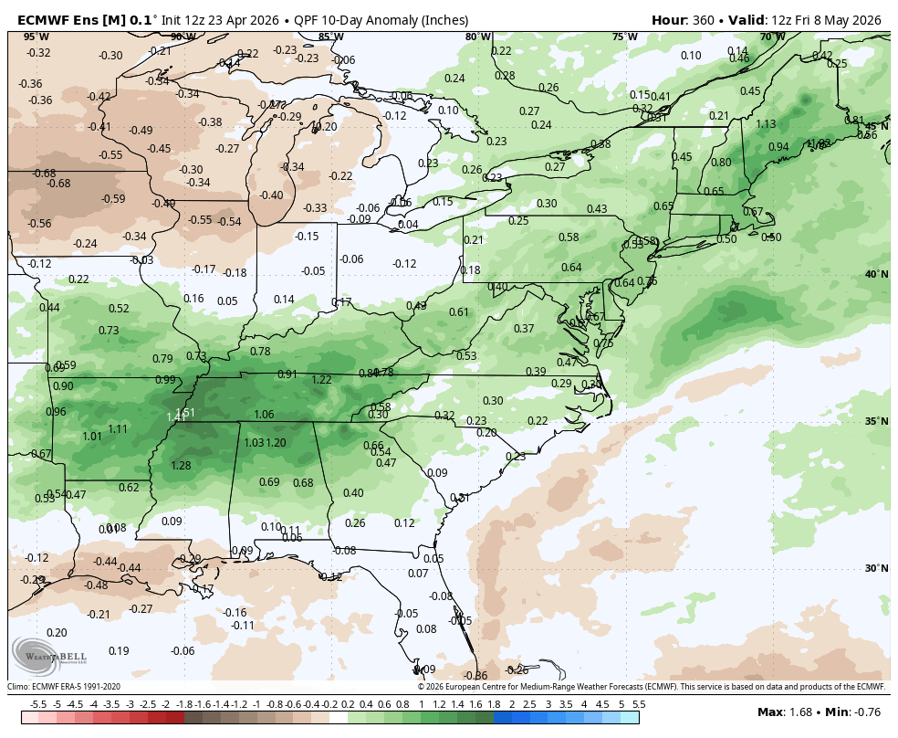
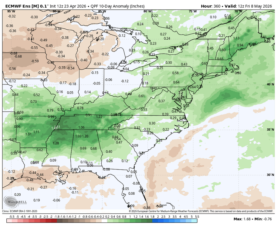
WB 12Z EPS....10 day period ending May 8. Cool and wet outlook.
-
I find it disgusting that this information gets tossed out there from the “media”. This has nothing to do with you or I or anyone else. This is entirely between vrabel and his wife. It’s no one else’s business. Why I’ve stopped watching or listening to radio or tv
-
Not quite weather but can see a huge fire in DC. Hope folks are alright - sounds like it was in one of the tunnels, which can’t be great.
-
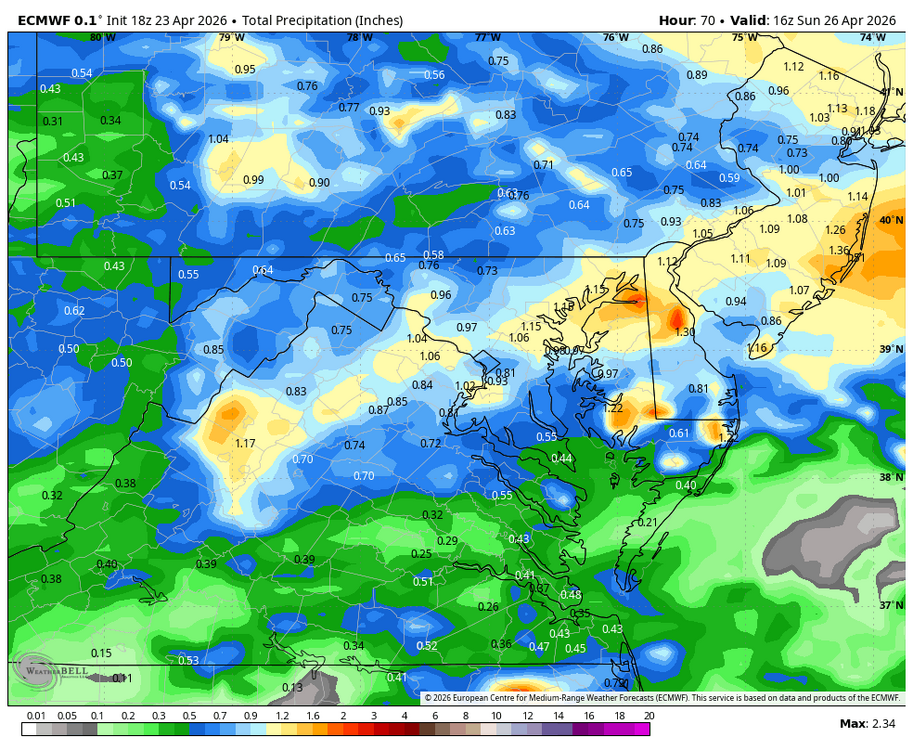
WB 18Z EURO for weekend.
-
The low level smoke has cleared up in the area thanks to a SE sea breeze. A temp of 79 F with a very dry 37 F dew point despite a steady SE sea breeze at KSAV is surrealistic. I took advantage of it with an enjoyable evening walk.
-
I mean at this point a half inch the next week would obviously be better than nothing.
-
They've got as many playoff wins in the last 5 years as Vrabel has illegitimate children.
-
Party looks to be ending soon as coastal front pushing west
- Today
-
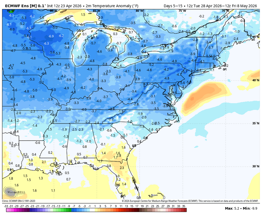
Following today's balmy temperatures, it will turn cooler tomorrow with temperatures topping out in the lower to perhaps middle 60s. The weekend will be even cooler with highs in the lower 50s on Saturday and middle and upper 50s on Sunday. Periods of rain are likely on Saturday into Sunday. Rainfall amounts of 0.50"-1.50" with a few locally higher amounts are likely across the region. Beyond the weekend, temperatures will likely remain generally below normal for the remainder of April. May could also open with cooler than normal conditions. The ENSO Region 1+2 anomaly was +1.8°C and the Region 3.4 anomaly was +0.5°C for the week centered around April 15. For the past six weeks, the ENSO Region 1+2 anomaly has averaged +1.43°C and the ENSO Region 3.4 anomaly has averaged +0.15°C. El Niño conditions will likely develop during late spring or early summer. The SOI was -2.74 today. The preliminary Arctic Oscillation (AO) was -0.985 today. Based on sensitivity analysis applied to the latest guidance, there is an implied near 90% probability that New York City will have a warmer than normal April (1991-2020 normal). April will likely finish with a mean temperature near 55.4° (1.7° above normal). Supplemental Information: The projected mean would be 2.4° above the 1981-2010 normal monthly value.
- 813 replies
-
- 1
-

-
- april showers bring may..
- rain
- (and 2 more)
-
Please send more of these days plz
-

Central PA Spring 2026 Discussion/Obs Thread
mahantango#1 replied to Voyager's topic in Upstate New York/Pennsylvania
83 for the high today here. -

Central PA Spring 2026 Discussion/Obs Thread
canderson replied to Voyager's topic in Upstate New York/Pennsylvania
Hit 80 here. -
Low of 53, high of 88. Dew points in the low 50's made it tolerable.
-
73 today.
-
First 70 of the season! Snow continues to melt and I'm gonna bet inland lakes will be ice free this weekend.
-
Saturday is going to be a nasty day. Thankfully Savannah bananas moved Saturday night game to tomorrow night.


.jpg.6483076c7e809d19ce947d89fd8c552d.jpg)