All Activity
- Past hour
-

2026-2027 Record-breaking El Nino
Winter Wizard replied to Stormchaserchuck1's topic in Weather Forecasting and Discussion
Makes sense. Here was today's date in 2015 for reference...much worse on the West Coast but majority of the CONUS was drought free.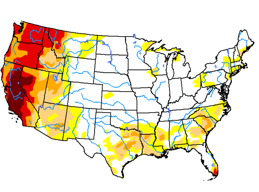
-
You’ve got some 70s in your point forecast all of next week. Could be a decent streak of 70s to close out the summer season for you guys in the UP. Maybe even one last 80. The Annual SEP Torch spares no one!
-

Augdewst 2026: Summer's Last Stand
Typhoon Tip replied to Prismshine Productions's topic in New England
I've noticed that too over recent seasons... I suspect ( not intending to impugn any organization ) that it's largely cultural/institutional reliance on modelling. When and if a TC is born out of an invest, if/when it occurs ahead of the modeling, that's when we get the jump - because they can't wait for the models, if the TC is there, it's there. Along these lines, the model reliance is also why sometimes you look out there and see an impressive wave that even appears to be closing off a circulation, yet NHC has the basin in a nada status. It's because no model has it developing. The models went through an evolutionary upgrade over the last 10 to 15 years. Katrina and Maria's sort of lit a candle under the ass of R&D. Proven in their forecast statistics. They became objectively better at initialization, improving over human intuition and monitoring of prior generations. I don't personally have any issue with the model reliance - their performance is what it is. They may not be ideal with aspects like RI this or shear that after the fact, but in so far as putting the TC on the map - -
facts don't care about your feelings
-
Interesting rain shower this morning in Adelphi driving the kids to school. It came out of nowhere. Looking at the sky you just saw cirrus clouds and blue. We weren't under any nimbus or low deck clouds. Just blue sky with wispy clouds and it was a moderate rain shower for like a few minutes. You could see the rain in the sky but above and around it was blue and cirrus. First time I experienced that.
-

2026-2027 Record-breaking El Nino
forkyfork replied to Stormchaserchuck1's topic in Weather Forecasting and Discussion
check out the climate disaster that just happened in nepal. how many more is this nino going to unleash? -
YEP that was some serious noise and water that took place
-
-
Stormy morning
-

E PA/NJ/DE Summer 2026 Obs/Discussion
Birds~69 replied to PhiEaglesfan712's topic in Philadelphia Region
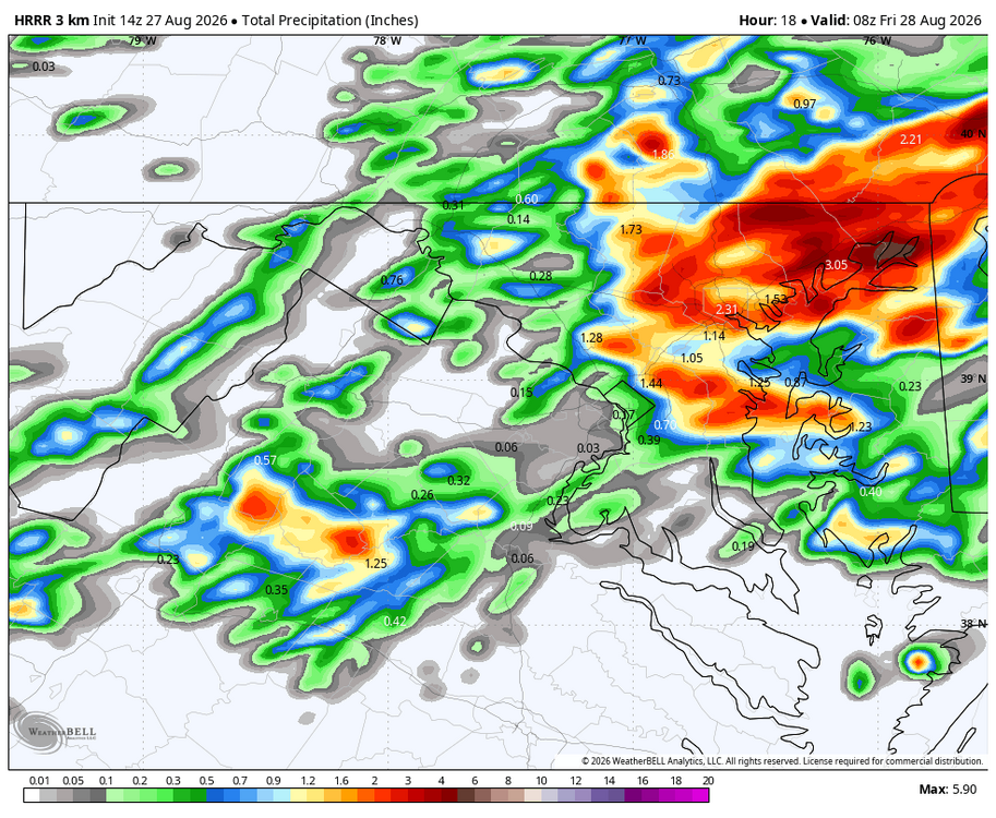
It just looks and feels like downpours will happen at some point. Thinking 2"+... 72F/DP 71F -

2026-2027 Record-breaking El Nino
LakePaste25 replied to Stormchaserchuck1's topic in Weather Forecasting and Discussion
The plains drought forcing the pattern is Eric’s theory as well. -

Augdewst 2026: Summer's Last Stand
weatherwiz replied to Prismshine Productions's topic in New England
What's with this recent uptick of tropical systems going straight from Invest to Tropical Storm -
As always with CC it was warmer than normal cause of high dews causing overnight lows a degree or two warmer than normal. It did not "feel" like a warmer august in the slightest.
-
I love that her name is Dolly. Get some heavy remnants into Pigeon Forge and I might have to change my spiritual beliefs.
-

Augdewst 2026: Summer's Last Stand
Cyclone-68 replied to Prismshine Productions's topic in New England
Unbelievable….. -
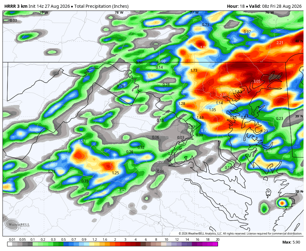
WB 14Z HRRR
-
2026-2027 Record-breaking El Nino
Winter Wizard replied to Stormchaserchuck1's topic in Weather Forecasting and Discussion
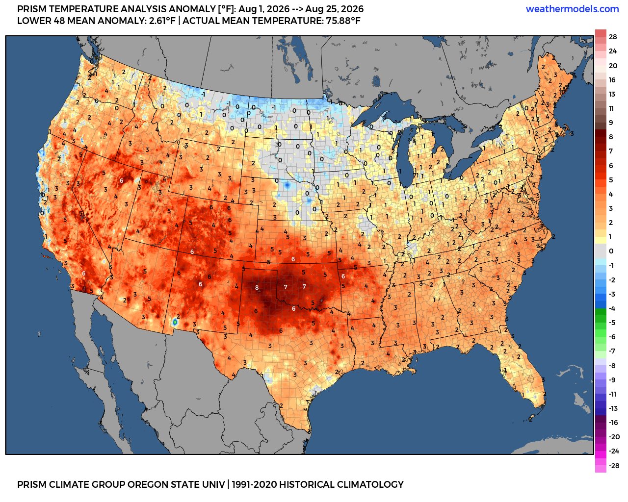
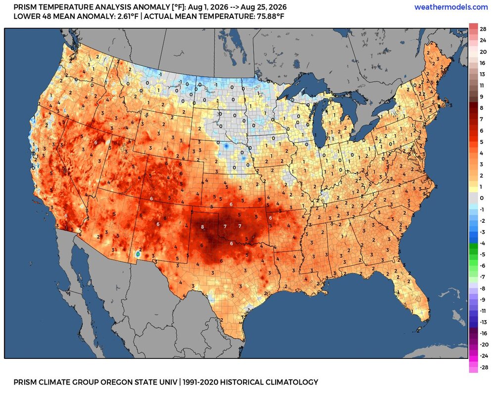
I'm not sure what, if any implications, this will have going forward or exactly what the root cause is but it's pretty clear August 2026 behaved much differently than other Super Nino cases (1982, 1997, 2015) and was essentially a hotter version of 2023. I don't think there was anyone in the industry who predicted anything close to a recor Right away, you could probably attribute it, at least in part, to much higher national drought coverage than we've seen in other Nino cases since 2000.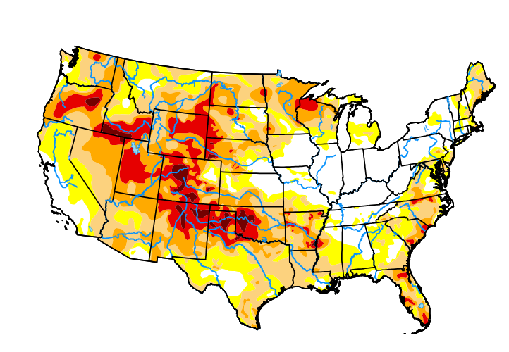
-

E PA/NJ/DE Summer 2026 Obs/Discussion
soadforecasterx replied to PhiEaglesfan712's topic in Philadelphia Region
Ended up with 1.11" with that storm that rolled through. -
 Check this out: Clomid tips - very detailed.
 -

Augdewst 2026: Summer's Last Stand
CoastalWx replied to Prismshine Productions's topic in New England
NW CT and Berks. Yawn. -
Augdewst 2026: Summer's Last Stand
weatherwiz replied to Prismshine Productions's topic in New England
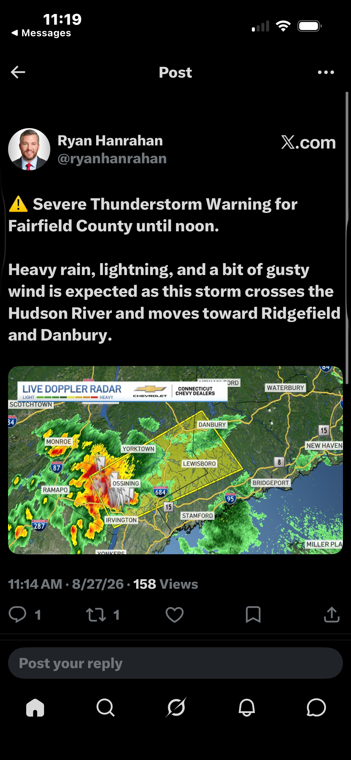
Nice mid-level meso on that cell headed towards Fairfield County. -

Augdewst 2026: Summer's Last Stand
Damage In Tolland replied to Prismshine Productions's topic in New England
In shocking news …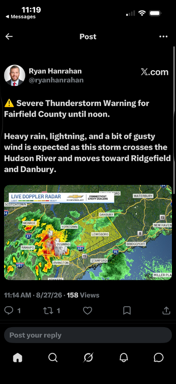
-
August was warmer than normal for most of the area using the warmest 1991-2020 climate normals.
-
I've said that one way to cheat our way into a good winter is to get something like Dec 1997 pattern (pretty close to normal temps that month) but instead of Feb 1998, we get a more classic Nino Feb.