All Activity
- Past hour
-
All frozen is good.
-

White Christmas Miracle? December 23-24th
ORH_wxman replied to Baroclinic Zone's topic in New England
Not optimistic. There’s an area of forcing knifing SE that is supposed to blossom Some snow for eastern areas later on this evening…that’s what could give a quick burst of actual half-decent rates. But it could also stay too far northeast. The dying WAA tries to rejuvenate some weaker echoes this afternoon but I am not counting on anything from that. For far eastern MA, they might try and sneak a piece of the IVT tomorrow….but that is low probability. -
That's at least half sleet south of Rt. 78. Put that 6" line from Rt. 80 in northern Jersey, NYC, and mostly all of Long Island. As of right now. Things will almost certainly change a bit by Friday.
-

E PA/NJ/DE Winter 2025-26 Obs/Discussion
Duca892 replied to LVblizzard's topic in Philadelphia Region
I try my best to understand these. So if you are sandwiched between the red line from mid PA to the blue line in NE PA that is a cold rain? -

White Christmas Miracle? December 23-24th
Great Snow 1717 replied to Baroclinic Zone's topic in New England
Why are you asking???...you wrote that 1-4 has been guaranteed for days... -
Time to move on
-

December 2025 regional war/obs/disco thread
Kitz Craver replied to Torch Tiger's topic in New England
EURO is pretty meh. Tries to hang some moisture back, but it’s light and diffuse looking. -
 4W Middletown is now up to 6.1".
 -

E PA/NJ/DE Winter 2025-26 Obs/Discussion
Birds~69 replied to LVblizzard's topic in Philadelphia Region
From the NYC subforum...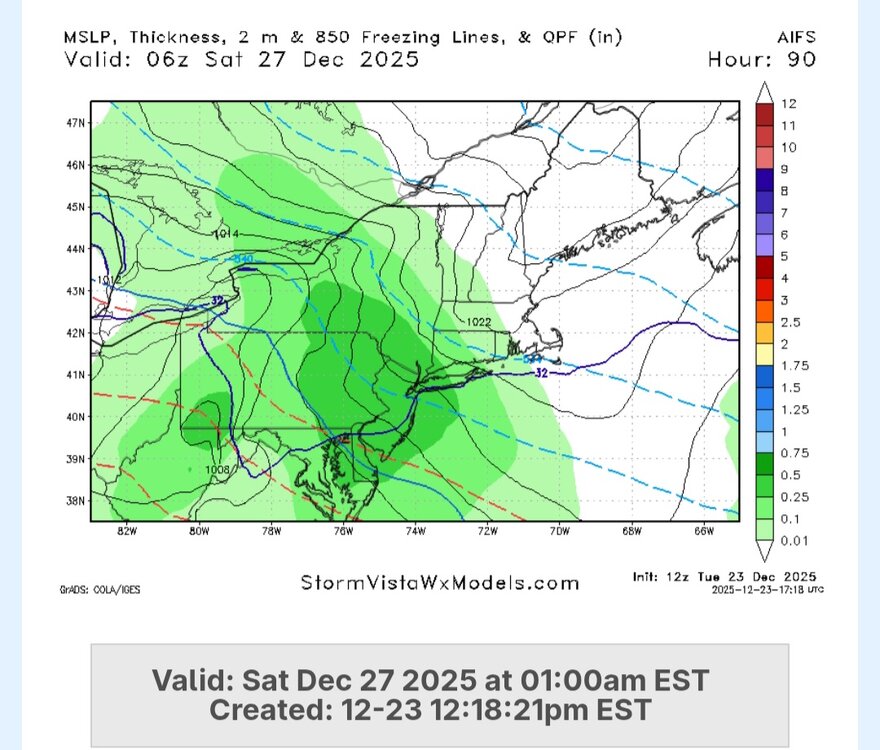
-
We had about 12” in the 2/4/95 storm and then I think the next biggest storm all winter was maybe 2” or 3”. It was close to being historically awful if it weren’t for that one Storm.
-

White Christmas Miracle? December 23-24th
Damage In Tolland replied to Baroclinic Zone's topic in New England
Thoughts on rest of today / evening? -
There’s a dedicated thread for Friday
-
Not going to know until go time.
-
Can we name the thread something else… (The lambs are still screaming )
-
When I was at Killington last year I recall seeing something about the Skyeship gondola being retired - is it just the original cabins? Anyone know if the Skyeship will be running this year? Just took a look at their website and it says they try to open it in late December but wasn't sure if that was simply historical info or current year expectations.
-
Euro is still fairly light precip. 2 to 4" for most
-
It looks to me like it says naa, here's a few rain showers. Enjoy the drought lol
-
No winter events (in fact, it's been an unusually dry month(, although the month did start off well below average temp-wise.
-
Same with the GEFS and GEPS. I posted this in the main ENSO thread. In order to get really cold these days we need some kind of record warmth in the Arctic. If we can just get the storm track to shift south to a benchmark position in January which looks possible, then maybe this can be our bounce back snowfall year which we have been hoping for.
-
Euro is pretty nice for far SW CT for Saturday. Rest of SNE is light snow that is probably getting shredded…prob 1-2” type deal.
-

Central PA Winter 25/26 Discussion and Obs
AccuChris replied to MAG5035's topic in Upstate New York/Pennsylvania
12z Euro AI 10:1 24-hour snowfall . -
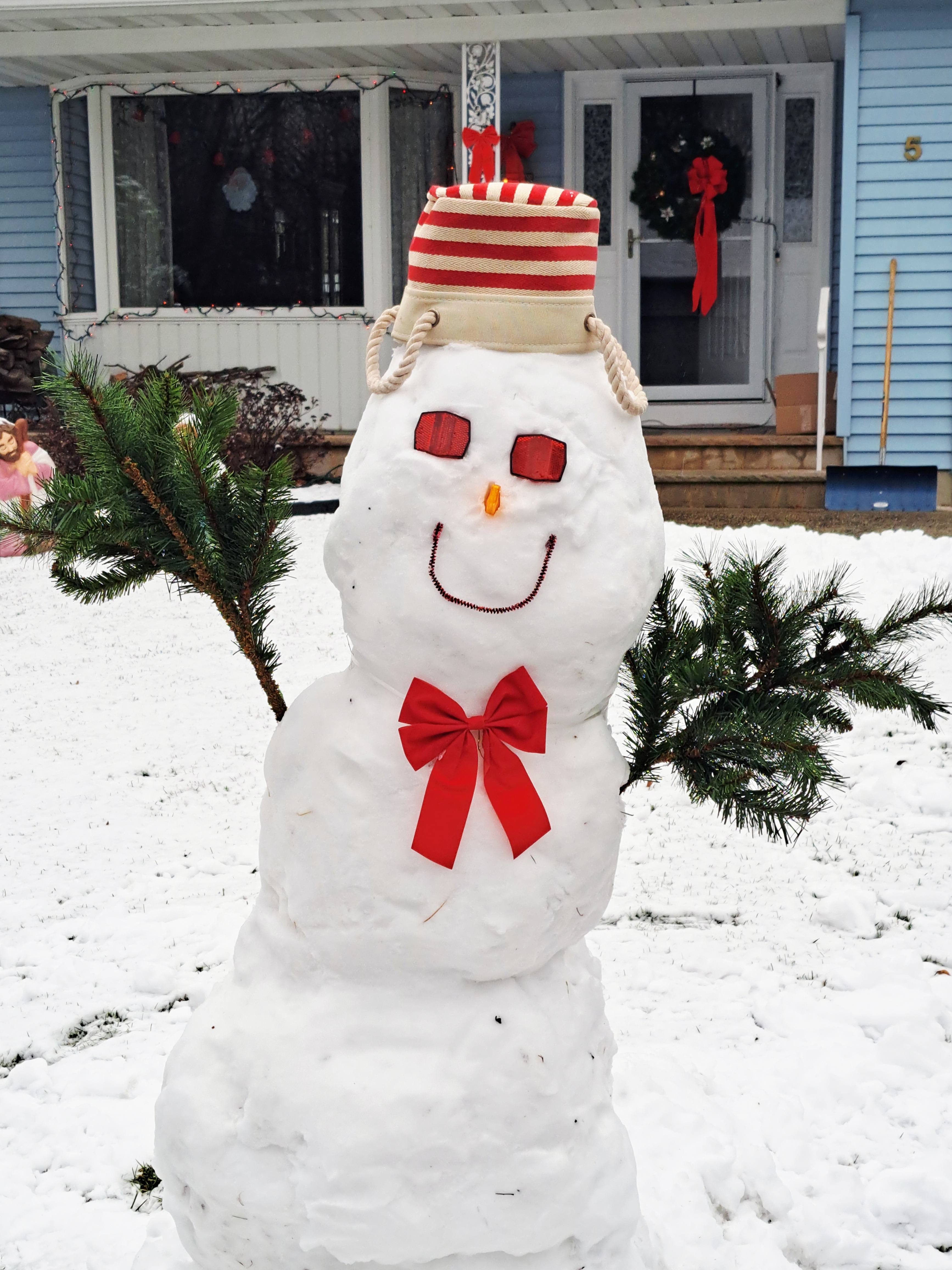
 Maybe my last snowman. Not bad fer 1" of snow. Moving to Morristown Tennessee in the spring...
-
Regular euro says nah just ice
-

December 2025 regional war/obs/disco thread
DavisStraight replied to Torch Tiger's topic in New England
60s too had a lot of snow days, also on frigid days the boiler at school broke down and they sent us home in the morning. -

Central PA Winter 25/26 Discussion and Obs
Itstrainingtime replied to MAG5035's topic in Upstate New York/Pennsylvania
@MUweather I know these are operational models in the long range, but yikes! Any run-to-run consistency is, well, non-existent. Ensembles haven't been much better. We're at a crossroads in the numerical modeling world. Just pathetic!