All Activity
- Past hour
-
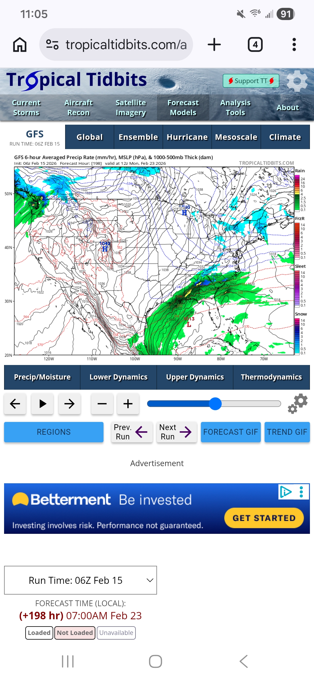
GFS trying for next Monday but this run will be wide right. That’s the one to watch. There’s advisory potential on the earlier events but upside is limited. The Monday system would have more upside.
-
Too much dairy maybe? Not sure either but either way loose stools will be the result
-
Awesome. Will share w/ other mets I know!
-
Completely agree. I have been actively comparing 2020 onwards to 1970 through 1999 and until now we are actually ahead of 1970 through 1976 for snowfall and above average snowfall winters. Also that period had 4 above average snowfall winters in 30 years, which was pretty bad living through it like I did (80s onwards). I distinctly remember the patterns were cold dry/warm wet for the majority of the winters (outside of the furnaces of the late 80s/early and lat 90s and the cold and dry early and mid 80s). So far outside of 2020/2021 we have seen either the furnace or cold and dry with the same overall storm track of the 1970 through 1990s. The similarities between 1955 and 1969 and 2000 through 2018 are also incredible. So like you stated, given that the last snowfall drought was a whopping 30 years we will need to wait until the mid 1930s to see if we have fared worse that that period. I would also like to leave the door open for INCREASED snowfall if the waters around the MJO phase 8 region also warm and allow for better storm tracks/increased warmth leading to larger snowstorms and less suppression. Some positive observations are: Still getting snow to the gulf Still getting benchmark storm tracks Still getting late season snow (May a couple of years ago) Still getting multiple below average temperature winter months The return of the clipper. The return of non-se ridge linking NAOs The hindrance of continuous phass 3 through 6 due to warm water pac waters The recent negatives are lower benchmark tracks and general increased global temps. Will be interesting to say the least.
-
What’s a legit thread?
-
Nice jump up on the UK...(and a small bump up on the CMC, which looks just like the RGEM, of course).
-
The first(?) March storm was my first snow memory. My mother walked to our elementary school at the end of the block to take me home. Do not remember rest of March.
-
It's coming . Hope it rains hard , I need my car washed too
-
The hundred dollar donator dude is paying for your umbrella if we get .5”. Enjoy it.
-
Gfs looks mixy down there but decent QPF
-
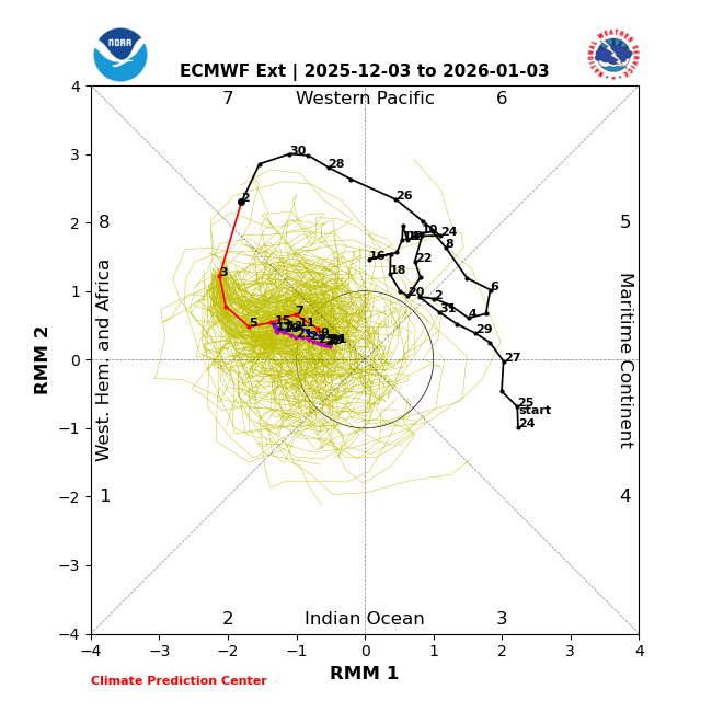
Anthony absolutely did but at least he’s not denying it. And he’s absolutely right about it being forecasted (several times in fact). Here’s one of several ext-EPS runs forecasting a 30+ straight day phase 8: this one (12/3 ext-EPS run) had it at 32 days (12/3-1/3) and on top of that showing no sign of it ending on 1/3 thus being a great example of why the models should be taken with a grain for the MJO and in general
-
Are we making this a legit thread? Would be nice. Winter ain't over yet, but the NFL is.
-
Only 38.6 here
-
Would def rather roll the dice.
-
Rainmen??
-
I’m in nyc. Can’t wait to get home and build rainmen
-
Ends up pushing SE, but the 23rd is still the time frame for something. Maybe the last shot.

-
GFS nice hit . Let's do that
-
Where are these trolls coming from? What's funny about our entire Chesapeake Bay watershed being destroyed? The word poop, maybe. I guess poop is funny when your super low IQ and don't understand anything beyond the funny word, poop.
-

Early Monday morning 2/16 last minute event OBS/Discussion
JTA66 replied to The Iceman's topic in Philadelphia Region
Looks like the 12z GFS just bulls eyed you and Kamu -
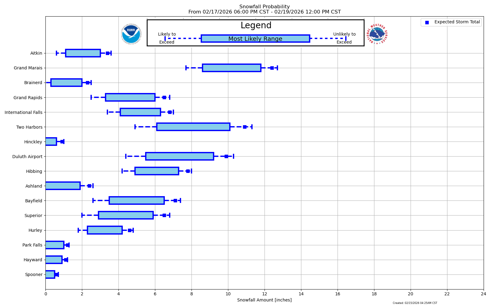
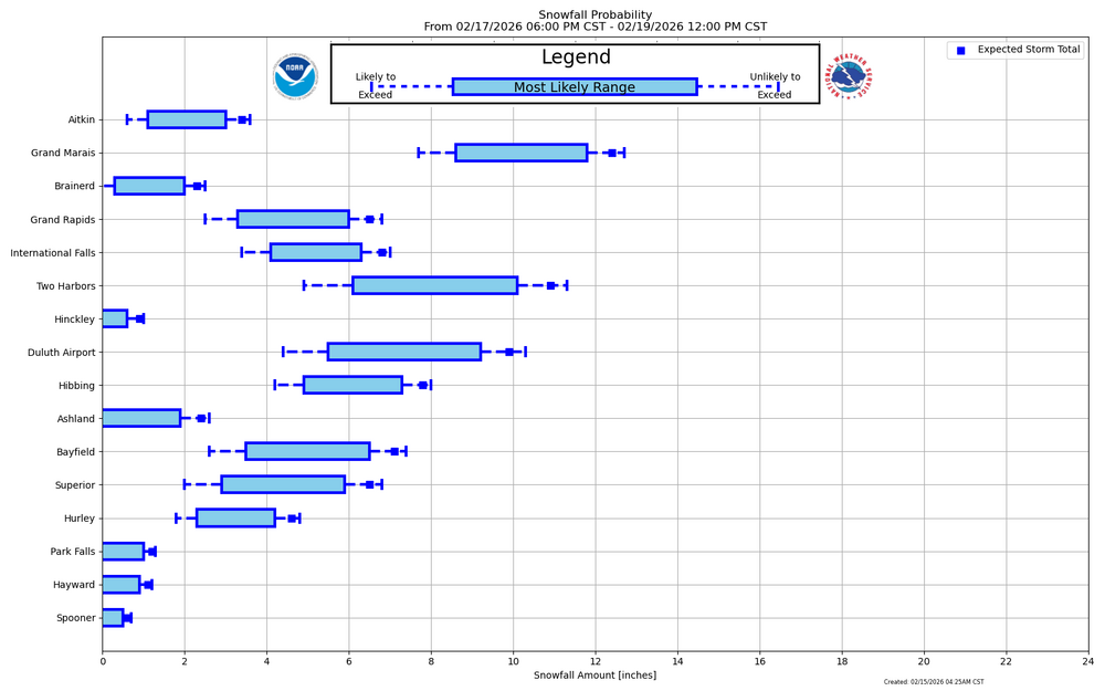
Looking good. With lots of ice floating around the W side of L Superior, the temps over the Lake will be colder with warmer air running over the top (WAA) during the early part of the stm. Dry air might be an issue to start tho. Always do well along the shoreline with these conditions. Inland should do really well with oro lifting along the ridges. Strong E winds at the surface with strong SE winds at the mid level. LP weakens with a trough lingering, and a new LP moving in to the S sub, will keep an ENE to NE flow off the Lake, so lighter snows should linger thru Friday. Possible LES banding is in the mix then, and wherever they form could be a significant hit.
-

Central PA Winter 25/26 Discussion and Obs
canderson replied to MAG5035's topic in Upstate New York/Pennsylvania
Man this morning might the be last below 32 temp in Harrisburg over the next 9-10 days. -
Late winter storms are the best. Snow, followed by AN temps typically meaning melt off is fast and residual ice is rarely a problem. Longer days also meaning less work at night.
-
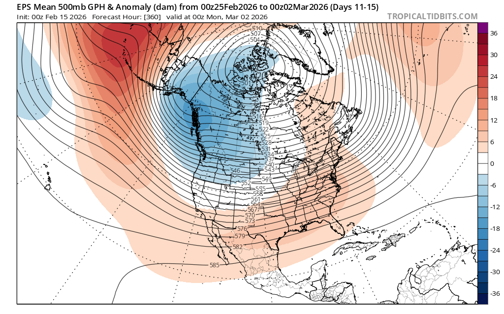
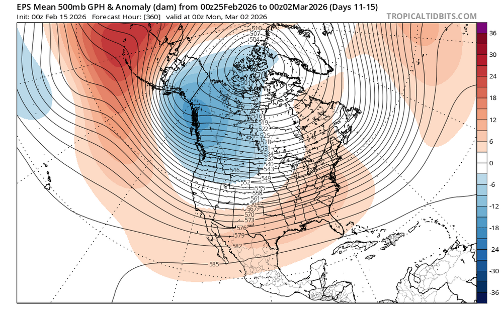
If we want to make a run late month or early March I’d like for this to change.
-
Snow depth 12 with 2.68 w/e


.thumb.jpg.f0d4bc69c0baaceecd7d96541f839c25.jpg)