All Activity
- Past hour
-
40F no regerts
-

September 2025 OBS-Discussion centered NYC subforum
bluewave replied to wdrag's topic in New York City Metro
I had 1.78 spread out over 3 days. My wettest single day was only .76. The last 1.02” in a day was way back on May 5th. 3-23-24 was my last 2.92” in one day. This was my 5th driest summer at only 4.99”. It was also my 4th warmest summer here. So all the vegetation and grass was on the brown side. But July 99 back on the South Shore of LI still holds the record for the brownest vegetation that I have seen. Nearly all the lawns and the parkways were completely brown. Time Series Summary for NEW HAVEN TWEED AP, CT - Jun through Aug Click column heading to sort ascending, click again to sort descending. 1 2000 3.02 65 2 1966 4.15 0 3 2022 4.29 0 4 2017 4.76 3 5 2025 4.99 0 6 1957 5.26 0 7 2016 5.28 0 8 1949 5.83 0 9 1965 5.93 0 10 2014 6.23 2 -
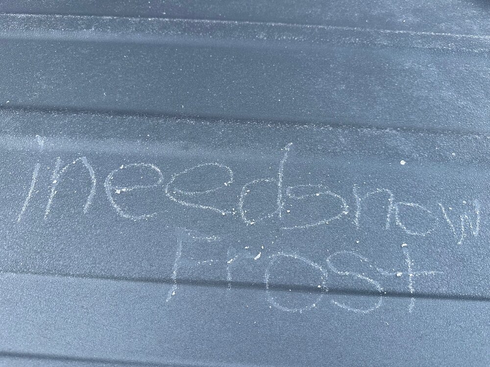
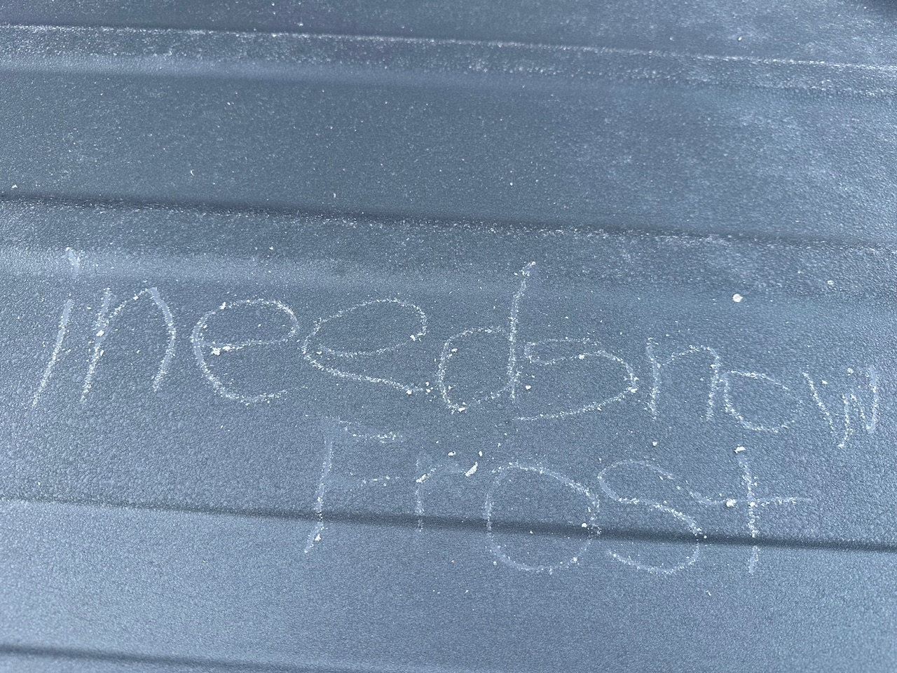
We hard frost. Grass is white. 30F.
-
41.5F low. Same as yesterday. Lol a couple of spots in town in the upper 30s (Hubbardston MA)
-
Man, it’s in the 30s all around me. 45.4 here right now.
-
36.1° Had this on top of the car
-
I forget if HVN was on Scoot’s watch list.
-
Well that was awkward down in Calvert yesterday LOL. We visited for a b-day dinner at a restaurant on the bay and I was saying all week "oh yeah we can sit outside - it's gonna be perfect weather." I'm thinking what the heck is this as we drive south thru a heavy shower around Dunkirk, then it proceeds to rain much of the afternoon. That was unexpected!
-
6z GFS closer but meh
- Today
-
50.9. May drop a bit
-
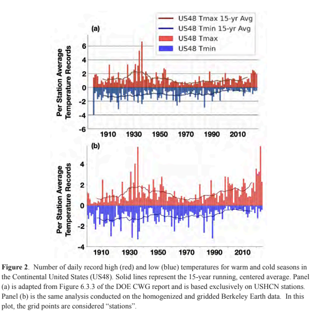
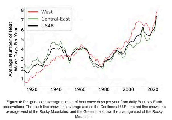
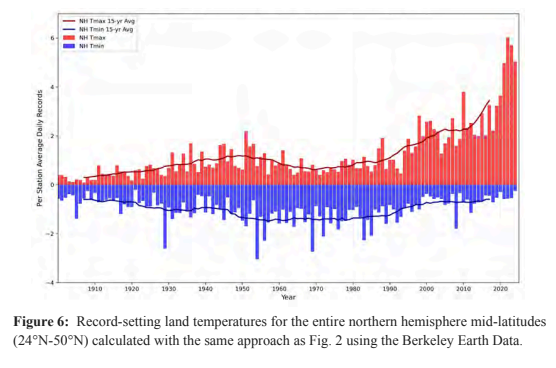
Some charts from the recent climate experts review of the recent DOE CWG report. The first chart shows how misleading taking an average of GHCN stations is because: 1) the stations are not spread uniformly across US and the 2) station network has changed with time both equipment and station locations. The second chart shows that a proper analysis shows heat wave days are increasing in the US and are now well above 1930s levels. The final chart shows that mid-latitude extreme temperatures are increasing much faster outside of the US. https://drive.google.com/file/d/1knIpC4vGrZXDsrF13RC2CujCjhbILgaa/view?usp=sharing
-
36.3° Hopefully that’s it.
-
@Stormchaserchuck1 IMO we are on the verge of finally going into a -AMO cycle
-
@Gawx
-
Still waiting for my first 40's here...
.thumb.png.483e83446d0ab03339d89ca78596f389.png)
-
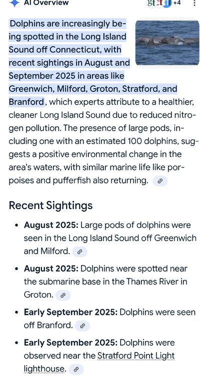
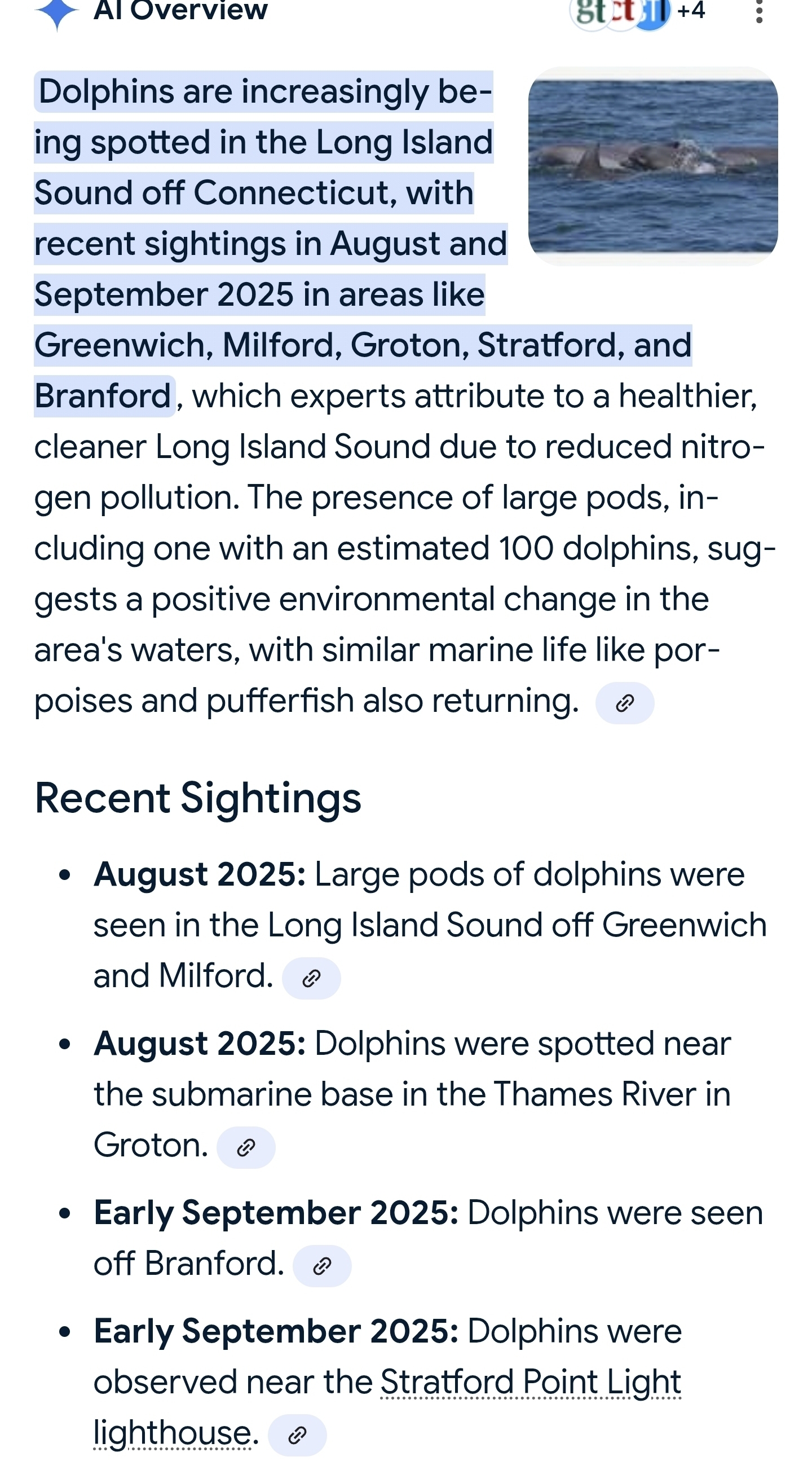
What an extended summer here on the shoreline. Was out on the boat last night and there has been a pod of around 50-100 bottle nose dolphins hanging out in Branford harbor.
-
Yesterday was a top 5 day of the year in E CT; currently down to 43F
-

Pittsburgh PA Fall 2025 Thread
ChalkHillSnowNut replied to TheClimateChanger's topic in Upstate New York/Pennsylvania
I was at my camp just 20 some miles from home but my daughter was home and said it was pouring with huge drops for an hour, then a break then more of it! Totally needed….it barely hit me where I was in confluence…. -

Occasional Thoughts on Climate Change
LibertyBell replied to donsutherland1's topic in Climate Change
I don't mind maximum temperatures Don because using maximum temperatures removes urban heat island from the equation. Also it's useful to compare hot weather by maximum temperature only because higher amounts of humidity will also increase minimum temperatures, which is why H20 is considered a greenhouse gas even more potent than C02. An example: tropical rain forests are extremely warm because of their very high mean temperatures, but the extremity of hot can't hold a candle to the kind of extreme heat you get in parts of the Middle East or Death Valley for that matter. I find our biggest heatwaves occurred in the 1940s and 1950s, the 1930s did not have the kind of extreme and long heatwaves that years like 1944, 1948, 1949, 1953, 1955, etc. had. The total number of 90 degree days was eventually exceeded, but not until 1983 and then 2010 did this take place. Our climate for our local area anyway seems to warm in stair steps. The summers are getting hotter, but not a straight line. There is an extremely hot summer and then many summers below that threshold before the next big increase occurs. Meanwhile the length of heatwaves of a summer like 1953 has still not been approached. Or the number of 100 degree days for that matter (tied between 1953 and 1966 at 4.) -
Most surprisingly this has turned into a legit stormy overnight down here.... Over 2 hours now of continual thunder and vivid lightning... Occasional rain about 0.4 now..
-
Put this on pile
-

September 2025 OBS-Discussion centered NYC subforum
psv88 replied to wdrag's topic in New York City Metro
75 today. Beautiful -
50.7° At WxW1 and a balmy 38.8° here at WxW2. The color is moving quickly in the Adirondacks. It’ll be interesting to learn the SLK climo lol. Maybe @powderfreak and I will become upslope buddies?
-
Perhaps... after taking a closer look I see they do not emulate my version of IntelliStar. The most "advanced" version of IntelliStar. https://www.twcarchive.com/wiki/IntelliStar_2_XD https://kaosfactory.github.io/desktopX1.html I also have this... https://kaosfactory.github.io/wxblox/geo.html But this is really good work... https://xl.weatherstar.dev/ Still kinda jealous.
-
Models are not exactly sold on any meaningful rain for most of New England in the next 10 days.


.png.e7455e2ce724380f816ca996325440a4.png)


.thumb.png.4150b06c63a21f61052e47a612bf1818.png)

