All Activity
- Past hour
-
The Euro Weeklies mean today is flat out frigid from just after Thanksgiving (onset TBD) to Christmas), and then hinting at the trough pulling west. I feel like I have seen that movie before! The control is the opposite! So, beware of shoulder season Weeklies. However, that is a really cold mean at this range. Yesterday's GEFS Weeklies were similarly cold. Looks like a PNA or EPO driven cold snap. It will be interesting to see if we can get November BN for temps...gonna be a close race.
-

2025-2026 Fall/Winter Mountain Thread
Buckethead replied to Buckethead's topic in Southeastern States
Oh that's kewwwwl. Sent from my SM-S908U using Tapatalk -
Early score!
-
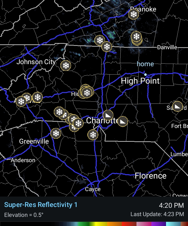
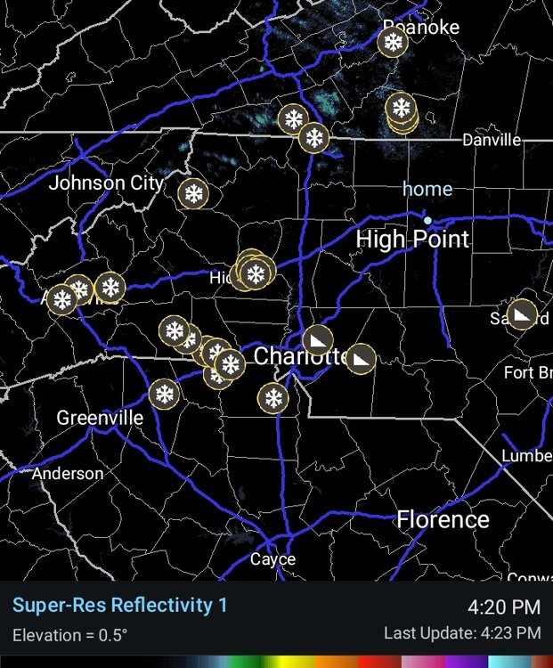
Yep some decent returns around CLT right now.
-
Yeah. Oddly, looks like a front moving South through Kentucky and West Virginia as well; a deformation band of sorts. That area has had solid light snow with it with an area of moderate to heavy from extreme east ky through Charleston WV. They got dumped on in that tather narrow solid area.
-
Yes. Flurries in Forest City. First time I seen snow this early since November 91. Great day!
-
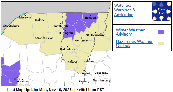
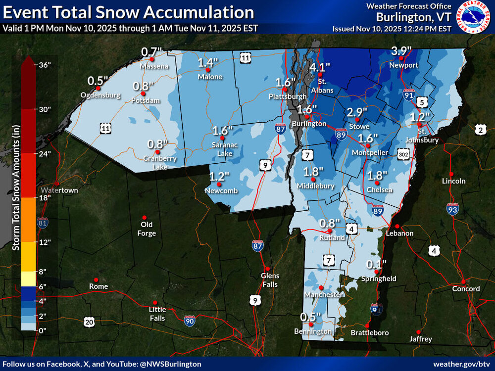
Over in the Adirondacks they’ve already had some advisories from one of our recent storm systems, but I think these are the first notable winter weather alerts over on this side of the lake. I’m seeing a lot of 2-4” snowfall forecasts for the valleys around here in the Chittenden County area on the west side of the Greens, and the shading on the projected accumulations map seems in line with that, but the projections increase as you head north toward the international border. The current BTV NWS maps are below.
-
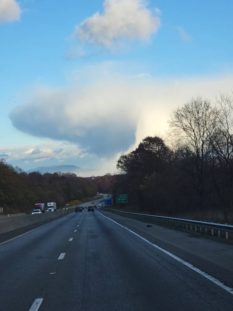
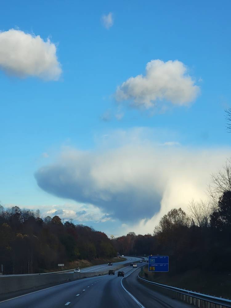
This snow shaft is freaking amazing looking in Buncombe county. Sent from my SM-G998U using Tapatalk


-
We picked up 1.25" in 20 minutes awhile ago. Before that the heavier showers missed here with just a few dustings. Norton and Wise picked up 1-2 inches last night. Not heard from anyone there this Afternoon.
-

November 2025 general discussions and probable topic derailings ...
dendrite replied to Typhoon Tip's topic in New England
BOX lighting up. Should pour even up here this evening. -
Major snow squall in northern Haywood.
-
Largely based on how I think that the stratosphere will behave....PV is probably going to rebound quickly by the new year given that we are likely to have a reflection event mid January, the precursor pattern for which is a Pacific trough....implies Arctic low and Pacific trough for early January. Then SSW in February for a colder finish.
-

2025-2026 ENSO
michsnowfreak replied to 40/70 Benchmark's topic in Weather Forecasting and Discussion
The absolute lack of any warm signal in December from the Euro Weeklies day after day, especially in an era when longrange models often climo-correct themselves/lean warm, is a great sign. Im surprisingly in agreement with snowman in that it is textbook La Nina. Ive said it many times, historically December is a great winter month in a La Nina in the Great Lakes, and last December was on the mild side and very underwhelming, despite my having high hopes initially. Then again, Feb was cold, constant deep winter, another unusual month that didnt follow the La Nina textbook. Ill roll the dice and gamble on a cold, snowy December and worry about February when it gets here lol. -
Anyone else feel like fall colors have been especially vivid this year? Also seemed to come 2ish weeks earlier than ive seen in recent years. Of course this has actually been a fall with some actual cool/cold nights, so that might explain it.
-
Grey and blustery in West Lincoln. Temp 37 with wind chill of 20 and Virga storm on top of us for last hour.
-
Very light, but yes, hitting the ground. .
-
Topped out at 44, some 5 to 10 degrees lower than forecast. Growing season very likely to end tonight, but wind will prevent temp from dropping far below freezing.
-
 Not there right now but it’s currently 26.2° with SN at WXW2. Been below freezing since 4am.
 -
Flurry reports coming in ahead of schedule
-
Lots of flurries this afternoon down here! 35.4 .
-

11/8-11/10 First Snow and Lake Effect Event
luckyweather replied to Geoboy645's topic in Lakes/Ohio Valley
Hey man, I know you and the team are literally doing this unpaid right now, yet you’re still in there grinding. Just wanted to say I appreciate you, sincerely. -
Yes
-
Subseasonal cycle? You mean the progression, ie mild January?
-
Nothing ever made it to the ground here. Sun is out. I can see the mountains to the west getting theirs. JEALUOS TBH.
-
Down to 47 here