All Activity
- Past hour
-
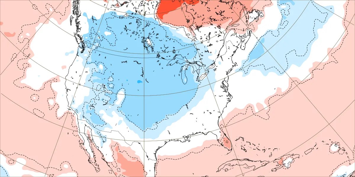
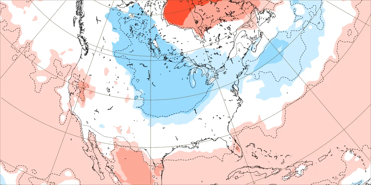
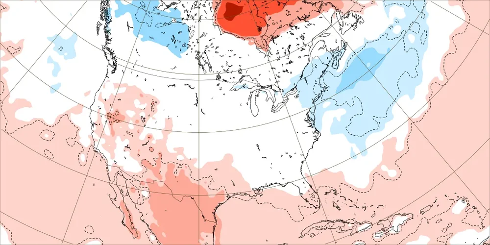
This is what I was looking at directly from ECMWF: Dec 1-7: coldest MW to Rockies vs mainly NN NE/SE Dec 8-14: coldest MW to N Rockies; slightly cold NE; NN SE Dec 15-21: slightly cold NE, NN SE

-
 Currently using 35658 observations from 5253 unique global stations over the past 3 hours. Last Updated: Tue Nov 11 20:31:19 UTC 2025 0 stations reporting wind gusts 70kt or stronger0 stations reporting wind gusts 60-69kt2 stations reporting wind gusts 50-59kt KISP: Islip, Long Island Mac Arthur Airport, NY, United States [51kt, 26m/s] 35 stations reporting wind gusts 40-49kt since Noon today. KACY: Atlantic City, Atlantic City Intl Arpt, NJ, United States [40kt, 21m/s] KAOO: Altoona, Altoona-Blair County Airport, PA, United States [45kt, 23m/s] KBWI: Baltimore, MD, United States [42kt, 22m/s] KFRG: Farmingdale, Republic Airport, NY, United States [44kt, 23m/s] KHPN: White Plains, NY, United States [46kt, 24m/s] KILG: Wilmington, New Castle County Airport, DE, United States [41kt, 21m/s] KISP: Islip, Long Island Mac Arthur Airport, NY, United States [42kt, 22m/s] KJFK: JFK Intl Arpt, NY, United States [40kt, 21m/s] KJRB: Manhattan/Wall Street Heliport, NY, United States [40kt, 21m/s] KLGA: New York, La Guardia Airport, NY, United States [42kt, 22m/s] KLNS: Lancaster, Lancaster Airport, PA, United States [42kt, 22m/s] KMIV: Millville, Millville Municipal Airport, NJ, United States [40kt, 21m/s] KMTP: Montauk, Montauk Airport, NY, United States [41kt, 21m/s] KORH: Worcester, Worcester Regional Airport, MA, United States [49kt, 25m/s] KPHL: Philadelphia, Philadelphia Intl Arpt, PA, United States [41kt, 21m/s] KPNE: NE Philadelphia, PA, United States [46kt, 24m/s] KPVD: Providence, RI, United States [40kt, 21m/s] KRSP: Campd David, MD, United States [43kt, 22m/s]
 -
See a few stray flakes up here in 21057 will very light returns on radar
-
No No No... I am only 10 minutes from Fallston, but I am in Baltimore County So good news for me... bad news for @Stormchaserchuck1
-
45 for a high at 2pm and sun could do no more 10 degrees colder than my previous low max i remember these Arctic fronts blowing thru at this time of year and staying windy all night. Good things usually follow for 45 or so days
-
Flurrying in Shrewsbury PA
-
Violently agree.
-
-

November 2025 general discussions and probable topic derailings ...
ineedsnow replied to Typhoon Tip's topic in New England
HRRR with a nice burst of snow tomorrow morning -
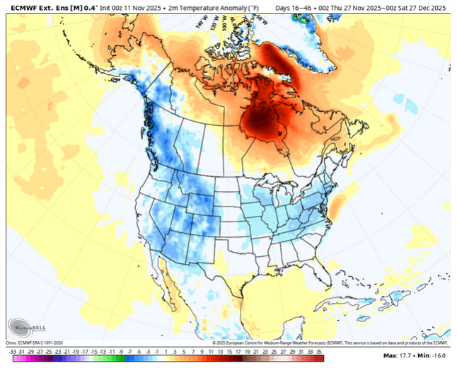
Today’s Euro Weeklies for Dec 1-21 are still showing consistent strong cold largely avoiding the E and especially SE due to a neutral PNA to -PNA not driving the coldest anomalies far into the SE. The Midwest to N Rockies are where the coldest anomalies remain concentrated.
-

E PA/NJ/DE Autumn 2025 Obs/Discussion
Ralph Wiggum replied to PhiEaglesfan712's topic in Philadelphia Region
First flakes of the year in Telford. 38F -
Almost got to 50 today. Will be 70s by Thursday/Friday.
-
.thumb.png.4150b06c63a21f61052e47a612bf1818.png)
November 2025 general discussions and probable topic derailings ...
HIPPYVALLEY replied to Typhoon Tip's topic in New England
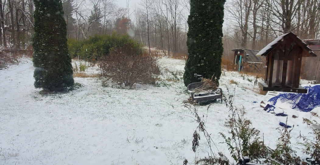
Coworker who lives in Hawley Mass just sent me this. He’s at about 1500 feet, sort of on the backside of Berkshire East.
-
I would say this is at least a few days behind. There are some trees peaking in the triangle now but the main peak has already faded and the winds have resulted in a lot of leaf drop now.
-

November 2025 general discussions and probable topic derailings ...
RDRY replied to Typhoon Tip's topic in New England
First upslope of the season really singing in Lenox/Pittsfield.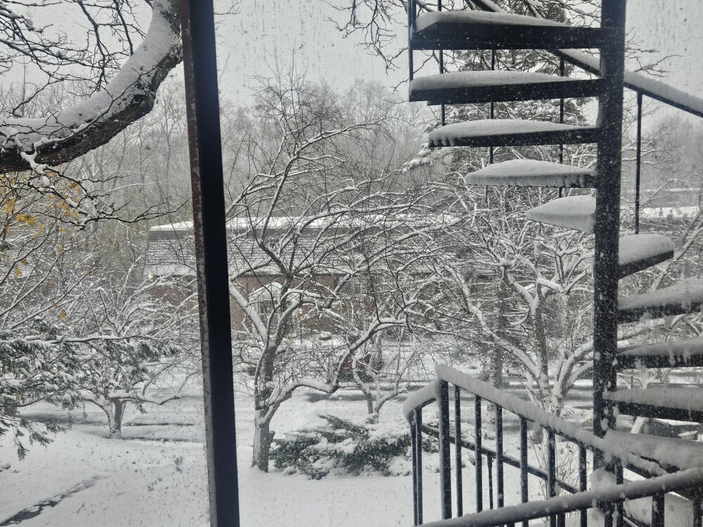
-

November 2025 general discussions and probable topic derailings ...
kdxken replied to Typhoon Tip's topic in New England
-

November 2025 general discussions and probable topic derailings ...
klw replied to Typhoon Tip's topic in New England
-
Saw where 1981-82 and 2000-01 are being batted around alot due to similar SST Profiles and PV Strength. 81-82 was a great Winter here. Several Arctic blasts and above avg Snow. 2000-01 was cold but rather dry with below average Snowfall. 1968-69 Analog is also on the Table. Great cold and snowy Winter.
-
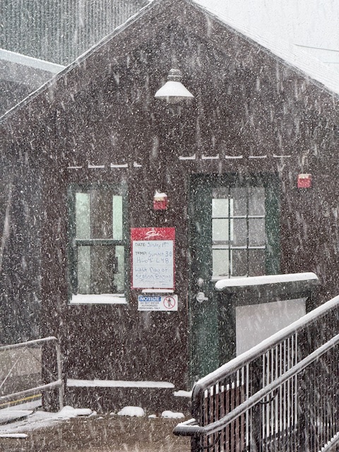
 Finally seeing a real snow shower after just some random flurries earlier
 -
 There were a LOT of 33s area wide this morning
 -

E PA/NJ/DE Autumn 2025 Obs/Discussion
RedSky replied to PhiEaglesfan712's topic in Philadelphia Region
First flakes and solar storm upgraded to G4 But like clouds clouds clouds and overnight forecast is increasing clouds Tomorrow night however the final solar blast expected to be the strongest a chance there of less clouds -
So is death, are you waiting for it with baited breath?
-
Been snowing hard for a while but windy and hard to really tell if it’s accumulating much. Kind of funny, visibility has been under 1/2 mile or even 1/4 mile for a while (can’t see across Over Easy) but it just seems a bit too windy to really tell or stack. Its like whiteout snows but doesn’t necessarily seem to be verifying ground truth… though it has to be ending up somewhere.
-
Snowfall reports from Lee County: Rose Hill 4 inches . Ewing 3". Jonesville 1.6". Pennington gap 1". No Reports from Keokee in Northern Lee. Less than a half inch in Dryden in Northeastern Lee.