All Activity
- Past hour
-
 Tracking anomalies and projected end of month ... _____________________________ DCA _NYC _BOS __ORD _ATL _IAH ___DEN _PHX _SEA _____ (anom 1-16) __________ -9.2 _ -8.7 _ -7.7 __-10.7 _-4.9 _-3.2 __+8.3 _ +5.1 _ +6.4 _____ (p anom 1-31) ________ -5.0 _ -4.5 _ -4.0 __-6.0 _-2.5 _-1.0 __+6.0 _ +3.5 _ +2.5 (17th) _ A more variable regime will cut into large negative anomalies in eastern and central regions. It will stay generally mild in the western regions but SEA will have a larger reversal as arctic air builds in for a while later in the month.
 -
It’s def a weird pattern. If we can retrograde that ridge/trough couplet about 200 miles west (not really that large in the scheme of things beyond 200 hours), we’d prob get a pretty damned wintry stretch even if no true biggies. On the flip side, we know how ugly it could get if everything shifts a little east.
-

December 2025 regional war/obs/disco thread
DavisStraight replied to Torch Tiger's topic in New England
I had 3 inches of icy snow before the last 3 inches, too bad, could have been the start of a nice pack. -
The EPS has the best look in the NA(legit -NAO) heading into early Jan with a flattened flow underneath, despite the awful look out west. At least leaves open the possibility for something to track south of us.
-
Interesting food for thought, was having a discussion with ChatGPT about NJ climo during the LIA. It feels 40-60” per year would’ve been meteorologically plausible during the peak mid 16th-18th century years. Less boundary layer issues of course, probably less intense benchmark systems overall but less that are rain and many more nickel dime events throughout the winter. January thaws happen but much less regularly. Peak winters are 3-5F colder with some much more so, especially following the biggest eruptions that caused MAJOR climate perturbations like Huaynaputina 1600. Also of note it felt that if you transplanted 1/29/22 back into a peak LIA year and shift it 50 miles west, it’s a “storm of the century” type deal. I do recall the dynamics of that system being nuts. Eh, just in the spirit of banter - grain of salt, unprovable anyhow, etc.
-
Yes they can occur. But not often. When there's arctic air in our backyard, storms stay to our south mostly. We almost need to be the transition zone/ baroclinic zone to get that big daddy....
-
Our criteria are different. I think grabbing a beer with beavis would be alot more fun and entertaining than with you hoss.
-
That’s basically it. However this pattern hasn’t really existed over our last shitty several winters so as you say….we just don’t know. lol.
-

December 2025 regional war/obs/disco thread
CT Valley Snowman replied to Torch Tiger's topic in New England
Despite only 3.5" on the month here, there has been close to continual snow cover from Dec 2nd through today and along with the cold and frozen bodies of water it has been deep winter. Sucks that we couldn't cash in more with a bigger snowfall. At least we have a chance of a white Christmas, although I wouldn't call it a high chance, depending on how these shortwaves traverse around the big ridge in the central CONUS. -
Strong winds also up here, with resultant power failure after trees came down on power lines. Near blizzard conditions in southern Alberta, major highway multi-vehicle pile up north of Calgary. We have lost our thin snow cover during recent mild spell, quite cold in the wind but it cleared up shortly after a couple of brief flurries, still quite windy, 35 F.
-

December 2025 regional war/obs/disco thread
WinterWolf replied to Torch Tiger's topic in New England
Nothing is a permanent issue. Will seems to think there will be plenty of shortwaves careening through in this flow…just whether or not we are on the right side of things. And I asked that of Will, because yesterday he said he expected some changes coming over the next few days in modeling due to the volatility of the projected pattern…so I was not confused. -

December 2025 Short/Medium Range Forecast Thread
*Flash* replied to John1122's topic in Tennessee Valley
I think the January thaw can be overly used sometimes, almost in almanac-y fashion. Even the best winters had their patented patterns relax a time or two; granted, I get how a transition into pause can be unsettling. Apart from present timing, I'm not bummed about a reload due to its necessity. If the warm spell is overhyped, I could see most monthly temps verifying close to average, maybe a little above average for west/middle TN. Also, I agree with the idea we'll flip cold at some point in January. May not be seasonal climax level but perhaps the start of a stairstep into glory. I know for me, times like these latch my hopes to analogs. For instance, if you like second half loaded winters, our latitude is a place to be as we've seen plenty of them the past decade (I.e. 2014-15 and 2020-21). Those examples saw some gnashing of teeth in the first half before things went gangbusters in the second. Not to suggest this winter is like anything like what we've seen the past decade. Certainly, this year feels unique already withour closest saving grace being on the Atlantic side, not the Pacific. Go back and review past winter threads and you'll see how PNA/WPO/EPO were highly discussed along with the MJO. Whatever transpires in the short term, let the record show I don't ask for much but amplification, volatility, and any west-based retrograding on those strat/Atlantic teleconnections. Winters with trackable systems within multi-week ebb and flows are my favorite. -

December 2025 regional war/obs/disco thread
H2Otown_WX replied to Torch Tiger's topic in New England
I feel like this pattern is similar to recent years where we can't get the -PNA to eject s/w's at us...instead we get huge cutoffs in the desert SW and by the time they ever migrate towards us they just get shredded because of how zonal the flow is over the eastern US. Idk, I'm probably talking out of my arse but that's what I see. Nothing is ever able to amplify and it's starting to feel like a permanent issue. -
Except there’s shit at the end of it instead of gold
-
GFS and CMC Extended are a carbon copy of the Euro Ext(weekles), maybe even a little better. Nice to see that the pattern progression heading into mid Jan is in agreement among the big 3.
-
-
Most will probably be gone but maybe we get lucky.. still a good amount otg
-
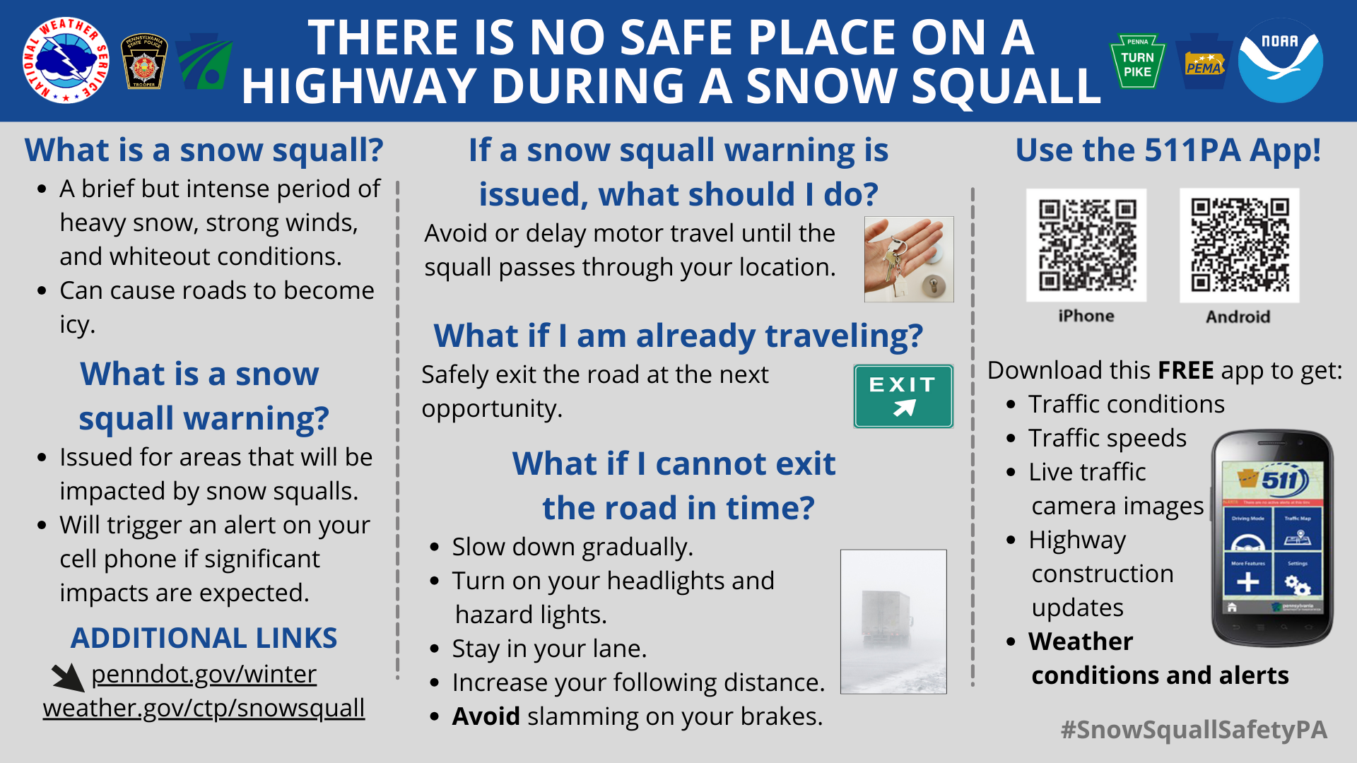
So, snow squall warnings have been in effect since 2023. I don't recall any issued for 20 miles around NYC. I would hate to see any issued for this particular area. While we have seen squalls laying a quick coating, I would be bold enough to say it would be nothing like what the warning was intended for, for severe squalls coming off the lakes. However, it seems these things are relative. To me, an actual snow squall creates true whiteout conditions, where you can't see 10 car lengths ahead of you, and/or snows a few inches in a matter of minutes. NYC immediate metro will probably never see one of these. The ferocity almost always wanes as it passes the Appalachians and then the Watchungs. Areas like White Plains or NW Jersey may have seen something like that. Peopel will rationalize, "well if it warns people of an impending light squall, people will be better prepared and perhaps avoid traveling at that time", then it is okay to issue the warning, no matter how minimal it is. I just don't want to see it issued here. Most of us have never experienced TRUE whiteout conditions. I couldn't imagine not being able to see my hand outstretched in front of me because of snow. - Crochety Old Fart -
-

E PA/NJ/DE Winter 2025-26 Obs/Discussion
Birds~69 replied to LVblizzard's topic in Philadelphia Region
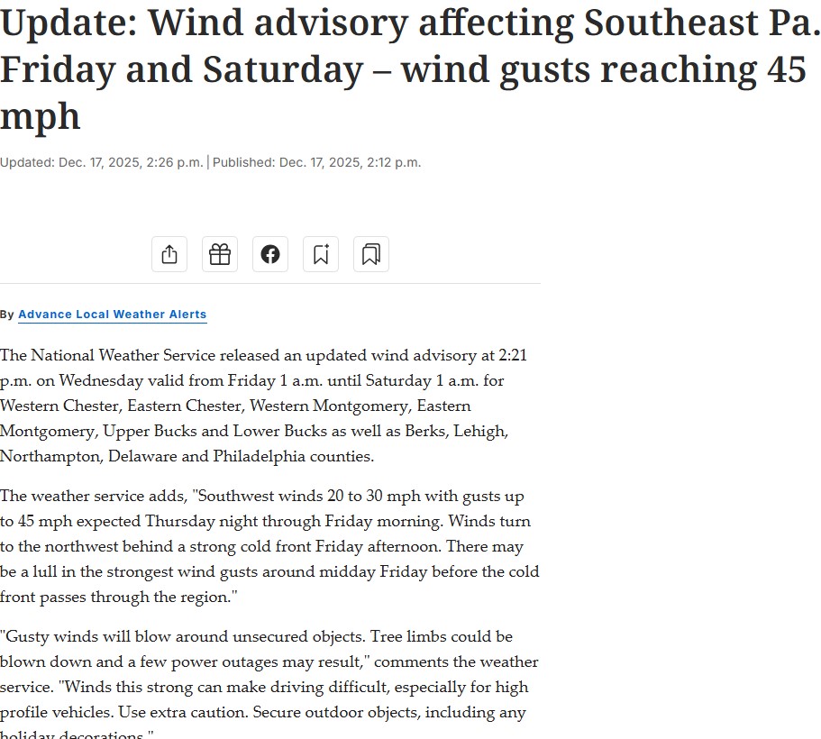
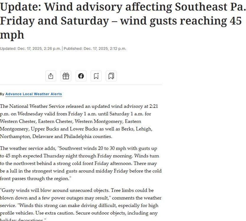
Possible freezing fog tonight....big fan of that stuff! Winds Fri/Sat... 39F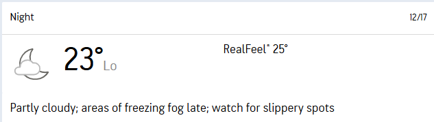
-
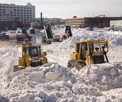
Well there was the boston snow mountain 2015 melted in July. Outside our region but still amazing. The "South Boston Snow Farm" refers to temporary piles of cleared snow from Boston's record-breaking winter of 2015, dumped in a South Boston lot, creating a massive, slow-melting mountain of snow
-
As Ji said, I don't pay much attention to the colors esp on these extended products. Follow the flow. With the EPO ridge and the TPV in that position, that's a cold look.
-
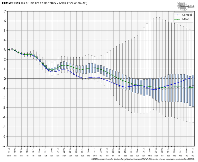
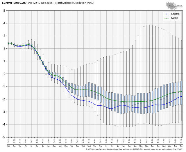
AO and NAO on the eps
-
it actually looks like a ridge lol
-
December 2025 regional war/obs/disco thread
WinterWolf replied to Torch Tiger's topic in New England
I just meant next week…7-8 days from now. -
Looks like a big rainbow over the central US lol