All Activity
- Past hour
-
oscar5764 changed their profile photo
-
Central PA Fall Discussions and Obs
MAG5035 replied to ChescoWx's topic in Upstate New York/Pennsylvania
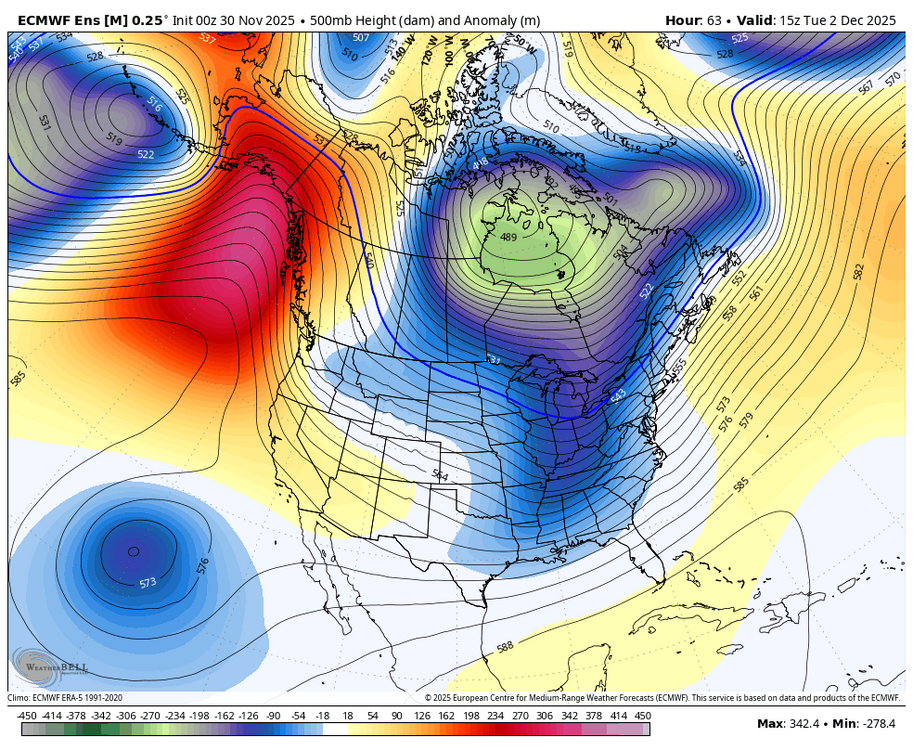
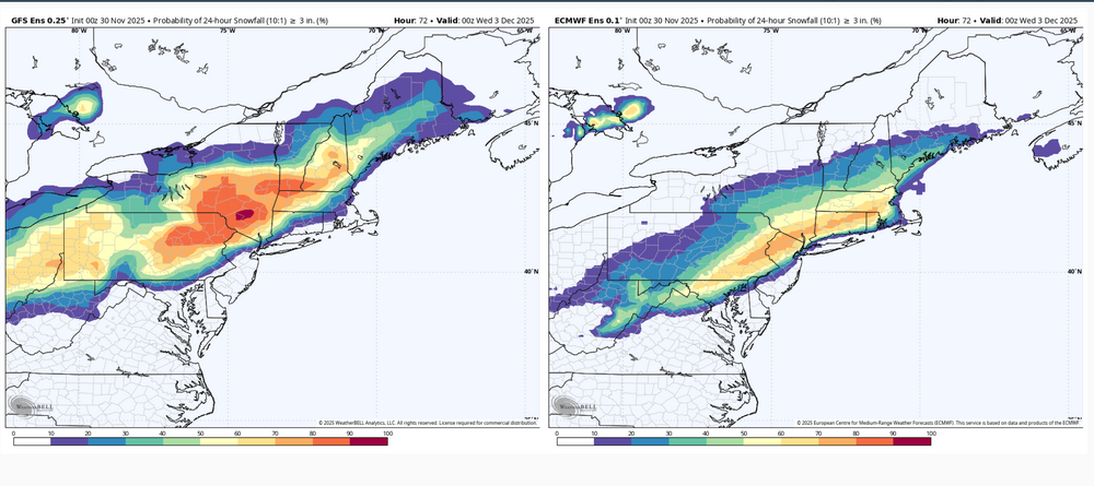
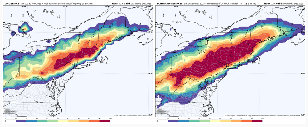
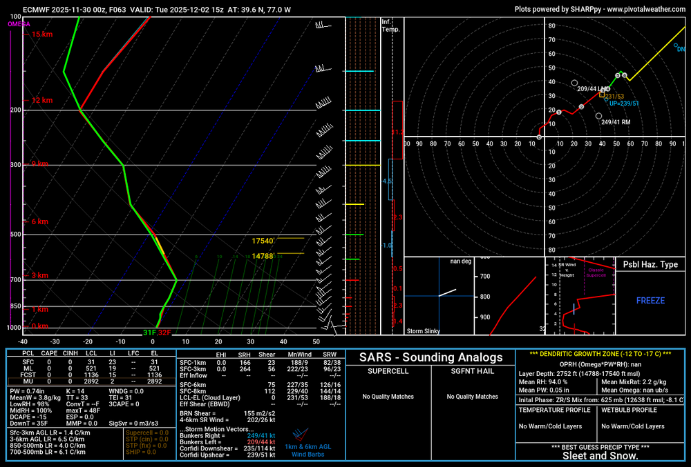
Overviewing all the model/ensemble stuff the last few runs I would think most if not all the subforum is looking good for the first widespread synoptic snowfall of the early winter season. I’m not really concerned about any P-type issues except for the LSV near the MD line, and even there I think there’s a good chance of advisory type snowfall or even a mostly snow event presuming we don’t trend the surface low NW much in the next 36 hrs. Think the ceiling in our area is likely to be 5-6” but mostly a 3-5” type event. Main issues I see to sort out at the moment is axis and width of the swath of heaviest snowfall. The regular Euro suite has been a bit more disjointed upstream developing the shield of precip. It seems to be the most progressive of the major stuff to include the GFS and Canadian suites, as well as the AI Euro. This makes for a late blossom of the precip shield over the majority of C-PA and a more focused swath as the coastal low deepens and moves NE. Basically everyone still sees snow but it’s a lot more 1-2” or so with a tighter swath of 3-5” type amounts… which is the furthest SE with that getting a couple inches all the way into DC. It’s reflective in the associated ensembles too. Might as well show them all. 0z GEFS vs Euro EPS 24hr probs of 3”+ 0z Canadian ensemble vs Euro AI ensemble for 24hr 3”+ probs, actually a pretty good match on swath axis The other end of the spectrum is the 3 and 12km NAM being the furthest NW, most wound up solution (no surprise) still as of 6z this morning. I’m sure thats the type of solution the MU guy is envisioning as the end game of what this system does in terms of the boundary being north. Which is certainly possible but I don’t see the amp in the pattern to bend this up in a Chesapeake Bay to NYC to Southern New England trajectory as deep as it has the low developing. And honestly that’s about the only kind of track I would entertain detrimental p-type issues reaching far up into southern PA and the Sus Valley. Otherwise I think this pattern setup we’re in is plenty cold enough to overcome early season climo. Yea the ridge axis is just off the Pacific Coast, but the PV is also anchored over Hudson Bay. Look at the 500mb anomalies for storm time. The only detriment of a +NAO in this setup would be a progessive pattern. -

Winter 2025-26 Medium/Long Range Discussion
HillsdaleMIWeather replied to michsnowfreak's topic in Lakes/Ohio Valley
Euro also has the system for next weekend now, if the storm today, the duster Monday night and this new storm come to pass we could all have one hell of a snowpack -

Nov 28-30th Post Turkey Day Winter Storm
HillsdaleMIWeather replied to Chicago Storm's topic in Lakes/Ohio Valley
Final total here is 9 inches. Very memorable storm, thankfully with less blowing and drifting than our last big November storm -

First Winter Storm to kickoff 2025-26 Winter season
dendrite replied to Baroclinic Zone's topic in New England
NAM is still very amped. Nice model battle. Back to bed. - Today
-
Who remembers the huge ice storm we got the first week of December 1989? I was in Wilson Co.. Sleet was like 6 inches deep...ice cycles were a foot long but like 6 inches wide? No power...the WRAL tower collapsed! Man I miss those storms we used to get!!
-
First NWS snowfall map - looks like the NBM, i.e., a compromise between most of the models showing little to no snow along/SE of 95 and the Euro/AIFS camp which are obviously more bullish on 95 snowfall.
-
Nov 28-30th Post Turkey Day Winter Storm
patrick05 replied to Chicago Storm's topic in Lakes/Ohio Valley
-

E PA/NJ/DE Winter 2025-26 Obs/Discussion
RedSky replied to LVblizzard's topic in Philadelphia Region
0z euro congrats Ralph lucky 7" Doylestown -
.thumb.png.4150b06c63a21f61052e47a612bf1818.png)
First Winter Storm to kickoff 2025-26 Winter season
HIPPYVALLEY replied to Baroclinic Zone's topic in New England
Man, NAM is out to lunch but I would take my chances riding those dynamics in Greenfield, despite my low elevation. -
.thumb.png.4150b06c63a21f61052e47a612bf1818.png)
December 2025 regional war/obs/disco thread
HIPPYVALLEY replied to Torch Tiger's topic in New England
You’re back! I wasn’t worried, just disappointed in your prolonged absence. I think it will be a fun winter for all in SNE. Especially inland. -
Nov 28-30th Post Turkey Day Winter Storm
TheNiño replied to Chicago Storm's topic in Lakes/Ohio Valley
Still going here in Kenosha at 1am. LES adding to the totals. Wind was ripping earlier and was actually kinda worried about my flag pole. My bird feeder isn’t doing well lol. But now it’s so peaceful. What a great fucking long duration storm this has been. -

First Winter Storm to kickoff 2025-26 Winter season
WinterWolf replied to Baroclinic Zone's topic in New England
I’m no MET, but that’s not a bad look at this juncture imo. Thank you for posting Will. -
Nov 28-30th Post Turkey Day Winter Storm
frostfern replied to Chicago Storm's topic in Lakes/Ohio Valley
Making up for the slow onset by avoiding the dry slot. Good night! -

First Winter Storm to kickoff 2025-26 Winter season
ORH_wxman replied to Baroclinic Zone's topic in New England
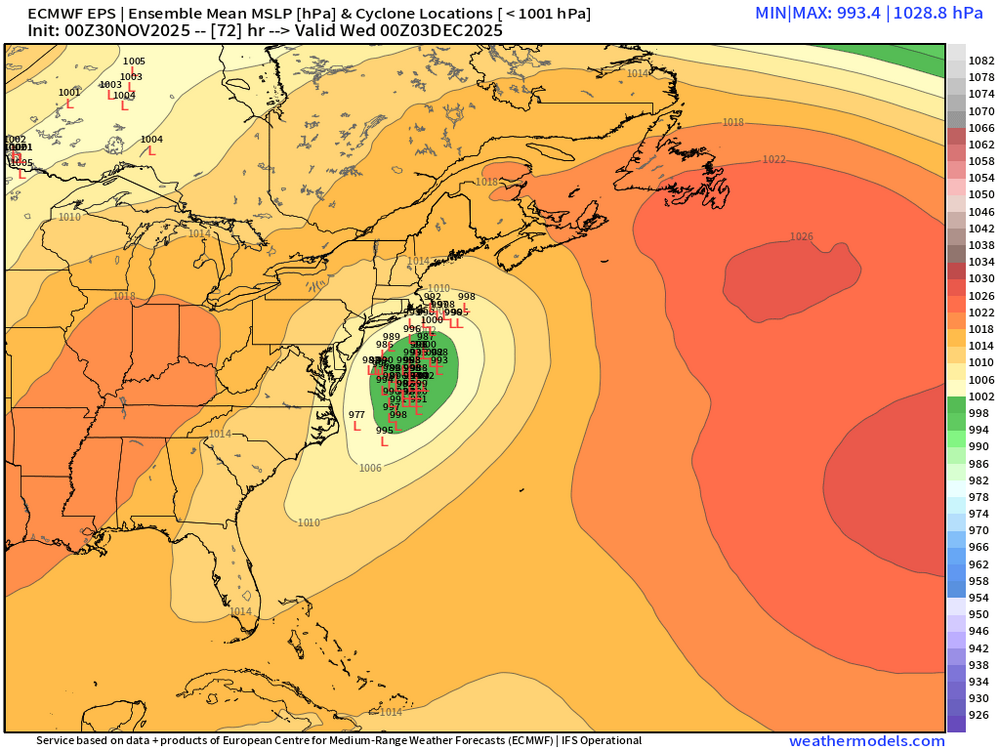
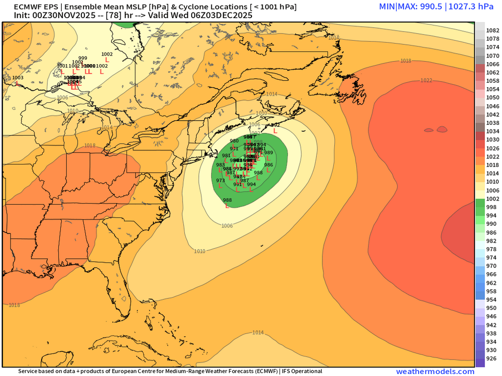
They look a bit juicier than the OP in terms of amplification but not by much. But that’s prob a good sign we’re gonna see model convergence. Betting OP is still a bit too flat -
35/24 here in the nw bronx. Might we see some flakes before dec?..it feels like snow outside rn.
-

First Winter Storm to kickoff 2025-26 Winter season
WinterWolf replied to Baroclinic Zone's topic in New England
How does the EPS look? -

First Winter Storm to kickoff 2025-26 Winter season
ORH_wxman replied to Baroclinic Zone's topic in New England
Euro AI itself is a massive hit for us in the moderate interior. But trusting any OP right now is asking for trouble. I think we’d take a model blend right now and run. -
-

Nov 28-30th Post Turkey Day Winter Storm
Chicago Storm replied to Chicago Storm's topic in Lakes/Ohio Valley
8.7" here at home as of midnight. -
I know man. So close but so far. Always the case. Hopefully things trend colder for us in future runs.
-
Nov 28-30th Post Turkey Day Winter Storm
thomp2mp replied to Chicago Storm's topic in Lakes/Ohio Valley
Flew into Bishop from Nashville this evening (pretty smooth flight given the circumstances). Probably under 2" on the ground at FNT when we landed around 9:45 but boy was it a slick drive home. Took an hour to get to Waterford from the airport via 75 and Dixie Hwy. Kept it around 40mph the whole way to Exit 93; two tracks at best on the interstate and snow-covered mainline roads. Still barfing snow out, NWS DTX reported 3.1" at 1AM in White Lake, I'll go out and measure in a bit after this titillating ND/Stanford game -

Nov 28-30th Post Turkey Day Winter Storm
HillsdaleMIWeather replied to Chicago Storm's topic in Lakes/Ohio Valley
Last little burst coming through here, what a lovely storm. -

First Winter Storm to kickoff 2025-26 Winter season
H2Otown_WX replied to Baroclinic Zone's topic in New England
Do we value them? Is AI doing better than the regular Euro?


