All Activity
- Past hour
-

Central PA Summer 2026 Discussion/Obs Thread
pawatch replied to Voyager's topic in Upstate New York/Pennsylvania
I complained and picked up .28” of much needed rain -
We've been clouded over so hard today. It seems like the PA activity is getting some enhancement from the terrain up there to offset the marginal surface instability.
-
100.0F right now (4:48PM) at my home!
-
That southern PA activity gonna make it here and clip us or no?
-
I think I missed rain to the south and east about every day this week, except for one day where it missed to the north! Maybe this weekend we can all cash in.
-
.thumb.jpg.6a4895b2a43f87359e4e7d04a6fa0d14.jpg)
Central PA Summer 2026 Discussion/Obs Thread
Yardstickgozinya replied to Voyager's topic in Upstate New York/Pennsylvania
There was so much grass and hydrilla uprooted from these last storms thet It's kind of a nightmare out there for a jet drive or fishing in certain areas. -
My (Canadian) Dad (RIP) made a very similar report at the same time; pushing our neighbor's car in thunder-snow in Howard County. Said it was the heaviest snow he'd ever seen. (And, he was a guy who had seen a lot.)
-
I was a young then but I remember it vividly. Lived in Carroll county back then. It was basically just the Feb blizzard after an overall mild winter, but got very cold leading up to it and then rapidly warmed up right after and ended winter. That's the type of deal we could see this coming winter, the way things look right now. Similar to 2016.
-
Saw the dark clouds to my northwest but not one drop imby
-
Getting dark to my south again
-
Make sure to be on the lookout for back-to-school sales as well. I'll say by July 25+ or so. Definitely by Aug 1st...
-
Yeah I just got hit by that small downpour. It weakened as it moved in though. Just a tenth of an inch.
- Today
-
Pretty good downpour up in Warren
-
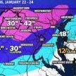
4" of snow at BWI between Noon and 1pm with constant thunder and lightning in the February blizzard. And I was out in with my brother pushing my uncle's van down the road so he could get home 5 miles away. Idk how he made it, but he did. Yeah, I remember it vividly!
-

Central PA Summer 2026 Discussion/Obs Thread
canderson replied to Voyager's topic in Upstate New York/Pennsylvania
That rain totally missed me somehow -
I was driving back from Bridgewater and had to pull over. Quick, but torrential. My house got .24" in about 4 minutes.
-
That one missed me to the south by a few miles. I see one more downpour a little to my NW -- maybe that one will get me.
-
Light showers im sure they bounced off the ground in Stephens City and back up into the atmosphere
-
They actually did the poles around here last year and even the giant high voltage ones. But yeah you're right, many are old
-

Pittsburgh PA Summer 2026 Thread
Mailman replied to TheClimateChanger's topic in Upstate New York/Pennsylvania
It must rain everyday. -
Had a monster 5 minute downpour
-
Can confirm sharp cutoff - I'm about 2 miles ESE of the Prince Frederick Mesonet and only got about a quarter inch
-
Very light showers moved through. About .03.
-
 Missed a good downpour by a half mile earlier. It was pouring right down the road and by the time I got home it was dry.. looks like we might get a quick downpour now though
 -
Thank you! I do appreciate your interest in this. I have followed the Drought Monitor closely for years and have had faith in its veracity until in recent months. I closely monitor water and soil conditions for some rather large agricultural interests, both topsoil and underground water table. Back in late February when our Augusta water table was 21 ft. below normal, the U.S. Drought Monitor placed Augusta in moderate drought. In late June when our water table had recovered to only 2 ft. below normal after a very wet May, the drought Monitor placed us in severe to Extreme Drought. Go figure On May 19, Augusta was all extreme. Northern Va. was all severe. On June 30, most of northern Va. down to central Rockingham had been downgraded to moderate drought. Augusta was and remains in severe to extreme. I can no longer trust the U.S. Drought Monitor as a reliable source of information.