All Activity
- Past hour
-
So, after all that it indeed, was weak ass.
-
What goods there are, are down in your 'hood. My WWA was canceled although I have what I would describe as a heavy dusting (less than 1/2") with very light snow continuing. I'd love it if you got a couple inches!
-
-

Is we back? February discussion thread
40/70 Benchmark replied to mahk_webstah's topic in New England
Funny, 2000-2001 actually had very hostile forcing...it's in the Modoki composite, but it's not a huge deal since it was weak and had the huge east QBO/Solar max attributed blocky polar domain. -
Max 20f ... Min 5f ... Snow : 0.4
-

Central PA Winter 25/26 Discussion and Obs
Jns2183 replied to MAG5035's topic in Upstate New York/Pennsylvania
Brrrrrrrrrr Sent from my SM-S731U using Tapatalk

-
I see it's showing the my Lee County in the light area again thanks to the bad Data going into the Model's.
-
It dumped it once you get up around Marion on to Blacksburg VA too. Blacksburg NWS shared some Pics on X.
-
Is we back? February discussion thread
40/70 Benchmark replied to mahk_webstah's topic in New England
Most great months do. -
Is we back? February discussion thread
40/70 Benchmark replied to mahk_webstah's topic in New England
Yea, I mean its bette than a pure Modoki type composite, which is nowhere near 8. -
I’m close as well. Wet bulb is 31.6°. I could certainly get below freezing here in a bit.
-
You guys jonesing for snow? Check this out!
-
Oh yea The schools will freak out
-
I agree, just meant it helped more vs destructive interference.
-
Crazily enough, that month left some on the table too.
-

WxUSAF's weak ass frontal passage thing.
PrinceFrederickWx replied to dailylurker's topic in Mid Atlantic
Radar:
-
Is we back? February discussion thread
40/70 Benchmark replied to mahk_webstah's topic in New England
Here is the money-week... -

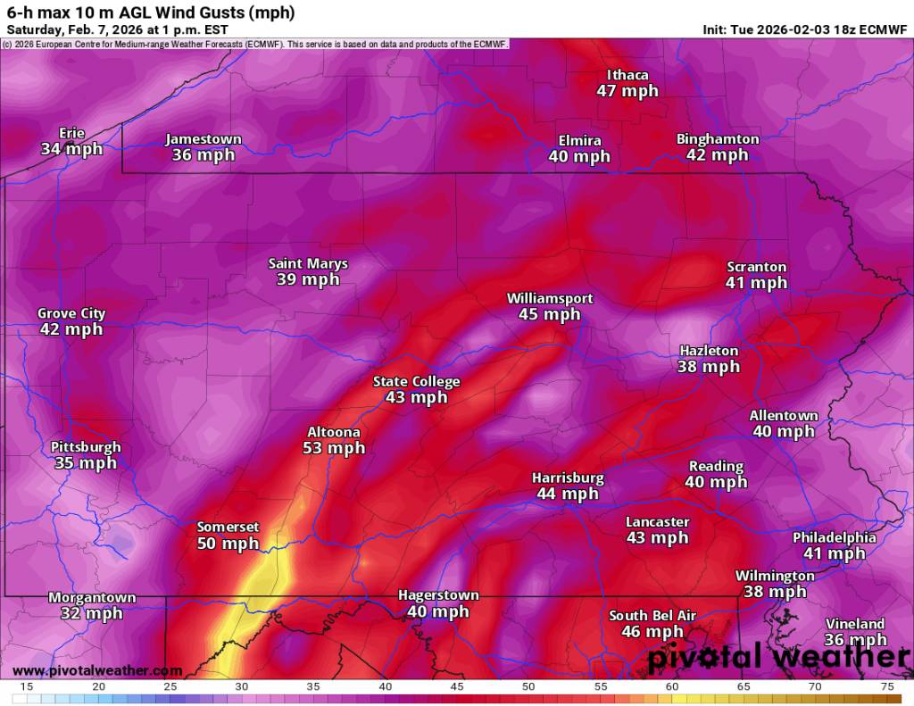
Friday February 6 FROPA / WINDEX small event
TauntonBlizzard2013 replied to HoarfrostHubb's topic in New England
Looks like it wants to pop a weak coastal. Thats the only shot this has at producing anything widespread IMO. If you don’t get some version of that you’re just going to get hit and miss squalls -

WxUSAF's weak ass frontal passage thing.
WesternFringe replied to dailylurker's topic in Mid Atlantic
32° and still light snow. Accumulating on the driveway and on ice. NW of Staunton in Augusta County -
With temps crashing into 20s I have a feeling this gets an advisory for a decent chunk of NC due to travel issues Thursday morning even if accumulations are light
-
-
Is we back? February discussion thread
40/70 Benchmark replied to mahk_webstah's topic in New England
I'd hit it. -

WxUSAF's weak ass frontal passage thing.
IUsedToHateCold replied to dailylurker's topic in Mid Atlantic
Some weak stragglers trying to make the long mountain journey. Maybe I'll make 0.1 inches.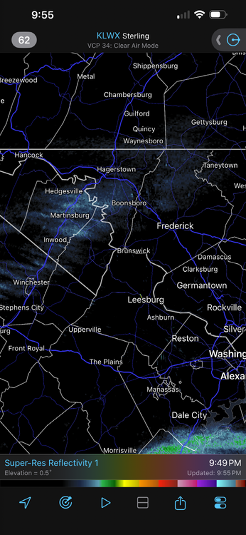
-
Is we back? February discussion thread
40/70 Benchmark replied to mahk_webstah's topic in New England
Eh...really skirting 8..was centered 6-7...but MJO wasn't much of a factor IMO. -
Does he post somewhere else or have Facebook? I learned so much through his morning updates.

.thumb.JPG.418e8a9a2902ae687ec35ff4bc0e038e.JPG)