All Activity
- Past hour
-

December 14th - Snow showers or Plowable snow?
BrianW replied to Sey-Mour Snow's topic in New England
Nice band setting up HVN east along the shoreline. Radar shows a couple of bands of relatively heavier snow. One has remained centered offshore, but appears that it could shift into at least eastern Long Island, and possibly get into Nassau County and NYC as well before all is said and done. Another somewhat weaker band is heading into NE NJ and probably impact parts of the Lower Hudson Vally into SW CT - could clip NYC as well. Subsidence noted in between the 2 bands, and hi-res CAMs favor the offshore band being maintained, owing to its proximity to stronger frontogenetic forcing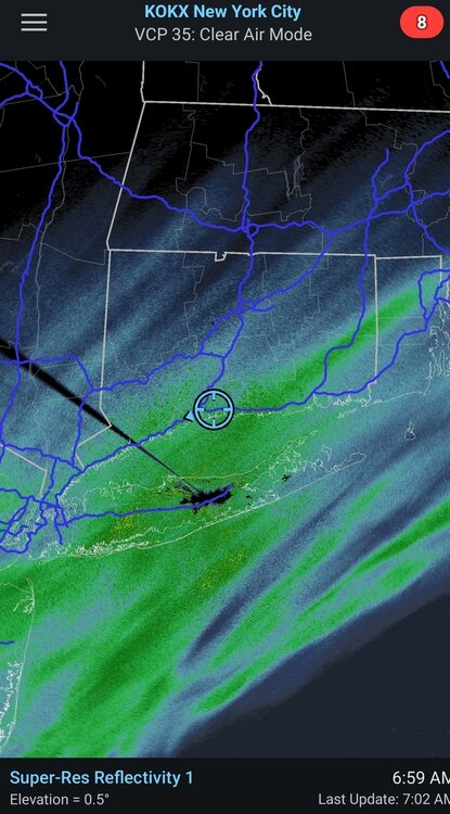
-

Central PA Winter 25/26 Discussion and Obs
Voyager replied to MAG5035's topic in Upstate New York/Pennsylvania
So it appears that I finished up with 5.5" with my unofficial sidewalk measurement. Definitely an overachiever here. I captured WGAL's forecast map from yesterday, and they had me at C-1 and CTP had me at 1-2. As for quitting drinking, the thing I appreciate the most is not waking up with a hangover headache the next morning. -

Saturday night/Sunday 12/13-12/14 Jawn
The Iceman replied to Ralph Wiggum's topic in Philadelphia Region
5” Levittown at 7 am. We may make a run at 6”. Been moderate heavy snow since at least 3 am. -

-
Stop. You already claimed the month over. Come back in january.
-

Southern MD / Lower Eastern Shore weather discussion
SnowtoRain replied to PrinceFrederickWx's topic in Mid Atlantic
Wind is also starting to pick up some, colder air must be filtering in some -

OBS and Totals-12/13-14 Snow Event
CPcantmeasuresnow replied to jm1220's topic in New York City Metro
A very surprising 4.2 new inches on the ground as of 6:30 am. They never even gave Orange County a WWA, not that I care. Day 13 of snow cover and counting. 28.2° light/moderate snow -
I’m not sure that’s the case. If you look at the radar, this thing is moving pretty fast. Should only be some light snow for a few more hous and then done
-

Central PA Winter 25/26 Discussion and Obs
canderson replied to MAG5035's topic in Upstate New York/Pennsylvania
Awesome! To be fair I didn’t have a problem really - just need to get back into shape and lose some weight and all. Cutting out liquor and beer is an easy kickstart. -
Enjoy the snow because the rest of the month looks rather mild and wet. Friday's storm looks quite potent, strong rain/wind potential Maybe signs things turn around late December.
-
2.6”
-
Central PA Winter 25/26 Discussion and Obs
canderson replied to MAG5035's topic in Upstate New York/Pennsylvania
I wanted to use my new snowblower or at least leaf blower again. Oh well, better luck next time. Congrats to all who cashed in!! A live look! -
Southern MD / Lower Eastern Shore weather discussion
SnowtoRain replied to PrinceFrederickWx's topic in Mid Atlantic
32, 0.75", snow has gone from big flakes to much smaller ones, still decent rates -
A very surprising 4.2 new inches on the ground as of 6:30 am. Anything after this is gravy. Day 13 of snow cover and counting. Late week high 40's will test things but Christmas week doesn't look anything like the torch the warm mongers had been touting a week ago. 28.2° light/moderate snow
-

12/14: Sunday funday? Will the south win again?
Wxdavis5784 replied to TSSN+'s topic in Mid Atlantic
3.5” a few miles north of the M/D line. Elevation 735’ -

Central PA Winter 25/26 Discussion and Obs
mahantango#1 replied to MAG5035's topic in Upstate New York/Pennsylvania
Late to the party as usual. -

December 14th - Snow showers or Plowable snow?
Chrisrotary12 replied to Sey-Mour Snow's topic in New England
Dusting of powdered sugar -
Just got out to shovel. Measured 6" on the nose. Still snowing. 27.0
-
I just measured im nearing 4” surprisingly on cold surfaces. This band is delivering. Probably end up with 5+ .
-
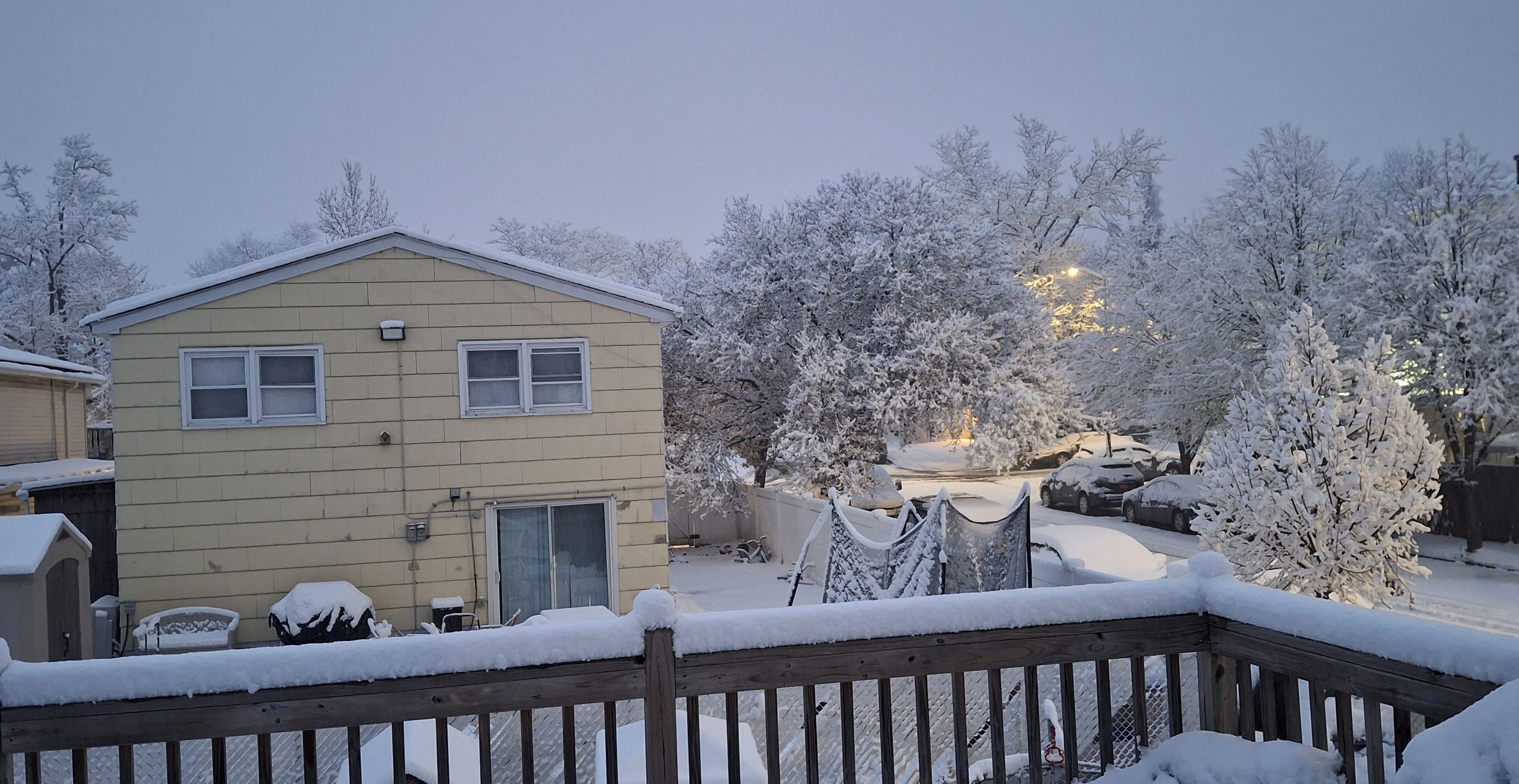
As of 6:00 am we have about 3.6" otg, so 0.6" last hour, and it's still 32F, which is probably why the snow has been a bit wetter than I expected - great packing snow, although not sopping wet, as I just finished my 2nd shoveling of the storm. I think 5" is doable looking at the radar/HRRR model. Here's a pretty pic of the church across the street.
-

December 14th - Snow showers or Plowable snow?
SouthCoastMA replied to Sey-Mour Snow's topic in New England
thinking a floor of 6 here. all depends on this evening -
More official measurement than eyeball is 0.75" in Easton.
-
Underperformed here less than an inch
-

Saturday night/Sunday 12/13-12/14 Jawn
Kevin Reilly replied to Ralph Wiggum's topic in Philadelphia Region
Moderate to heavy snow 32f humidity 97% dew point 32f Total 5.1” I’m starting to get concerned about power outages trees are really loaded. See some reports of power outages on ring bell around here within a few miles -

2025-2026 ENSO
Stormchaserchuck1 replied to 40/70 Benchmark's topic in Weather Forecasting and Discussion
The Euro weeklies and EPS weeklies did warm up long range +days after the move though. I agree though, that it is predictable if you are good at forecasting, from what I've seen tracking it so far. If Jan-Feb end up being cold (which is a chance imo), the price will rebound to over $4 probably. It's not the gospel, but it does accentuate moves more than model runs, which seem a little behind.