All Activity
- Past hour
-
 The PHL Airport recorded 21 days over 90 degrees in July. The average high temperature was 90.5 degrees. Our own little heat island spot at Phoenixville clocked in at a toasty 89.2 average high with 15 such days. The growing disparity between Urban Heat Island stations and more rural stations is best highlighted when looking at the average high temperature comparison looking at the airport since 1970 when the heat island problems began in earnest. Comparing there vs. The Phoenixville Cooperative data vs. All other Chester County average high temperatures since 1970. While Phoenixville (purple line) has shown warming during our current warm climate cycle but they are of course now being surpassed by the PHL Airport (red line). The rest of Chester County (blue line) has warmed much slower than both PHL and Phoenixville.
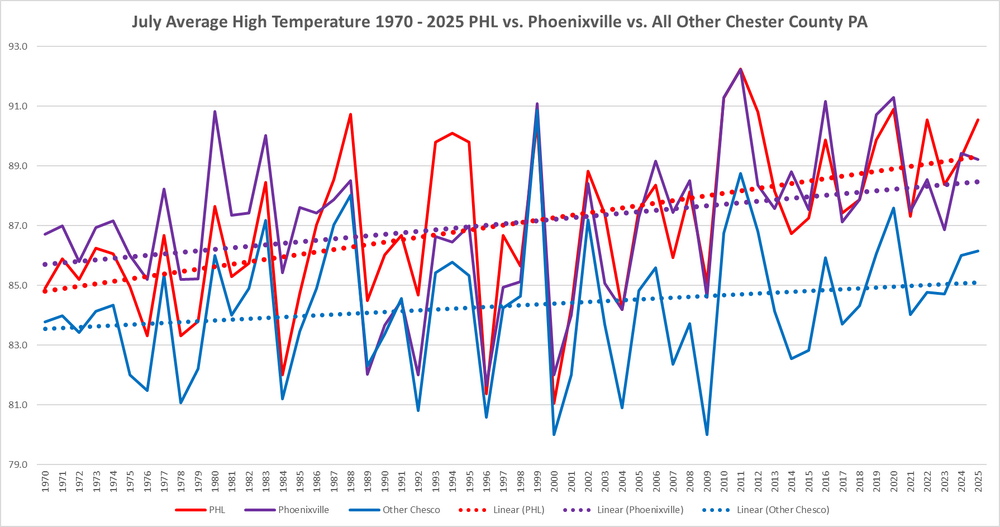
-
Hey Cape don't be afraid of the facts and raw unadjusted data....there is nothing to fear - stay calm!! LOL!!
-
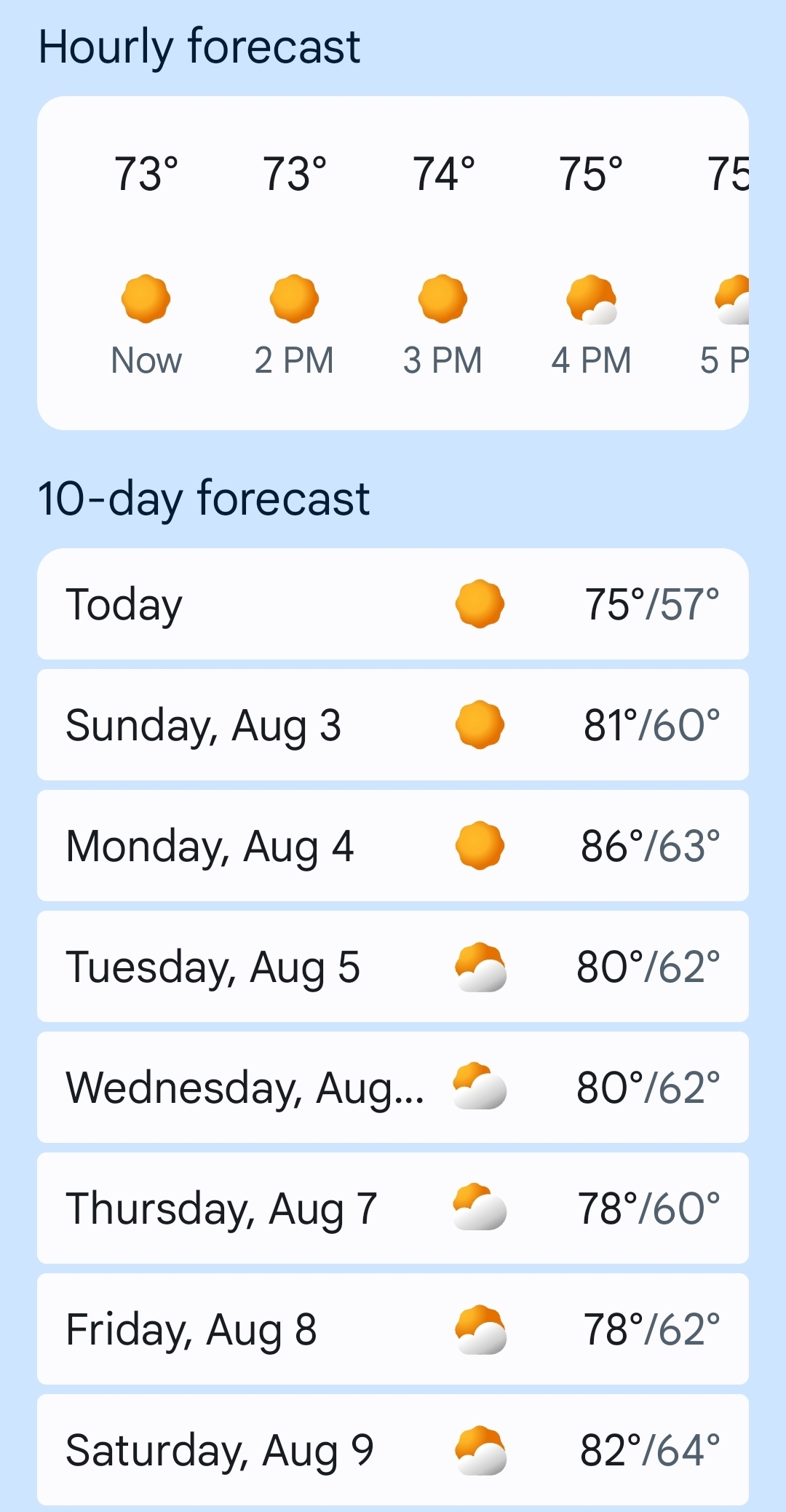
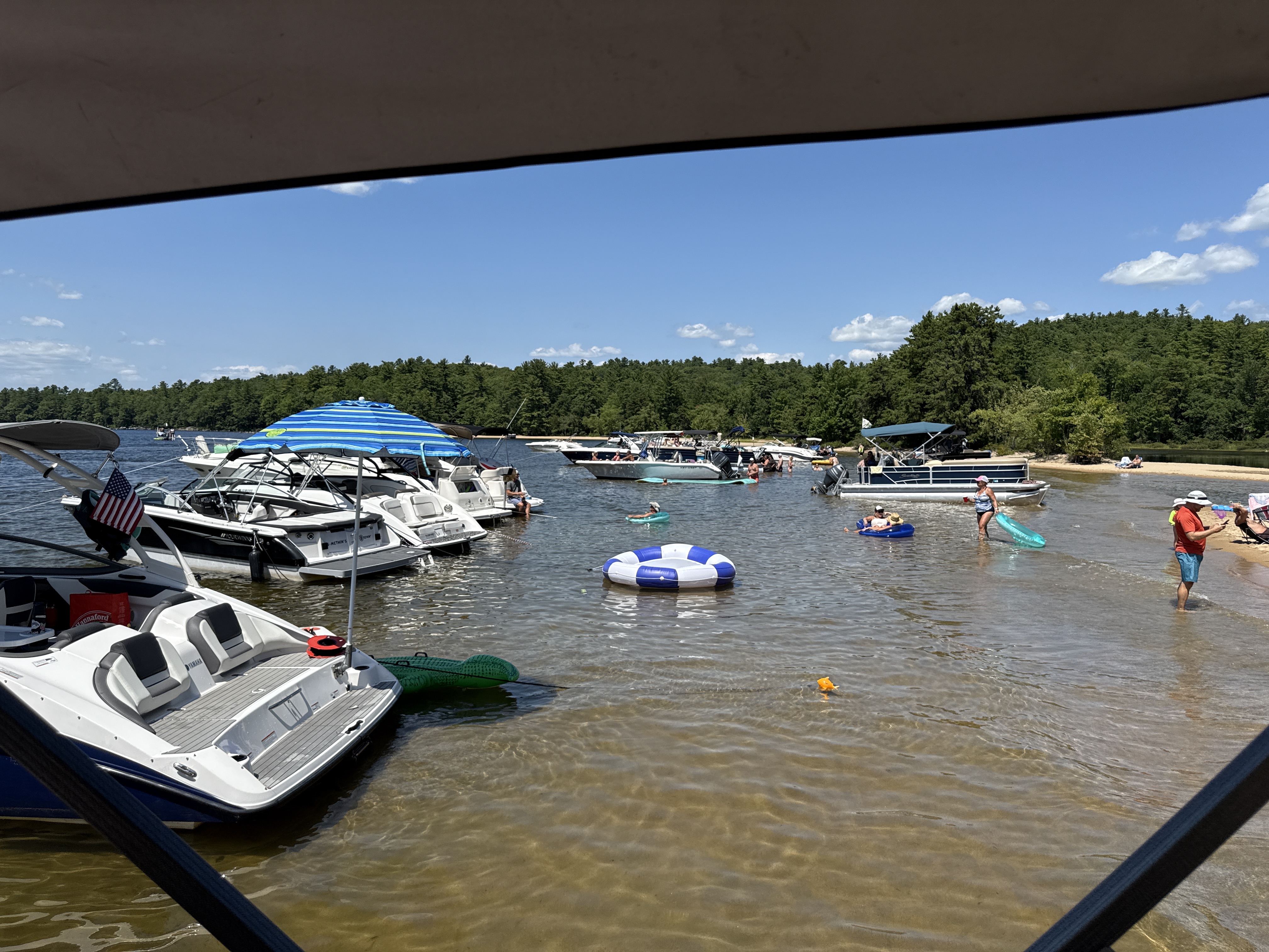
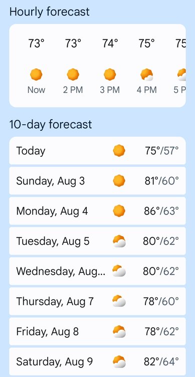
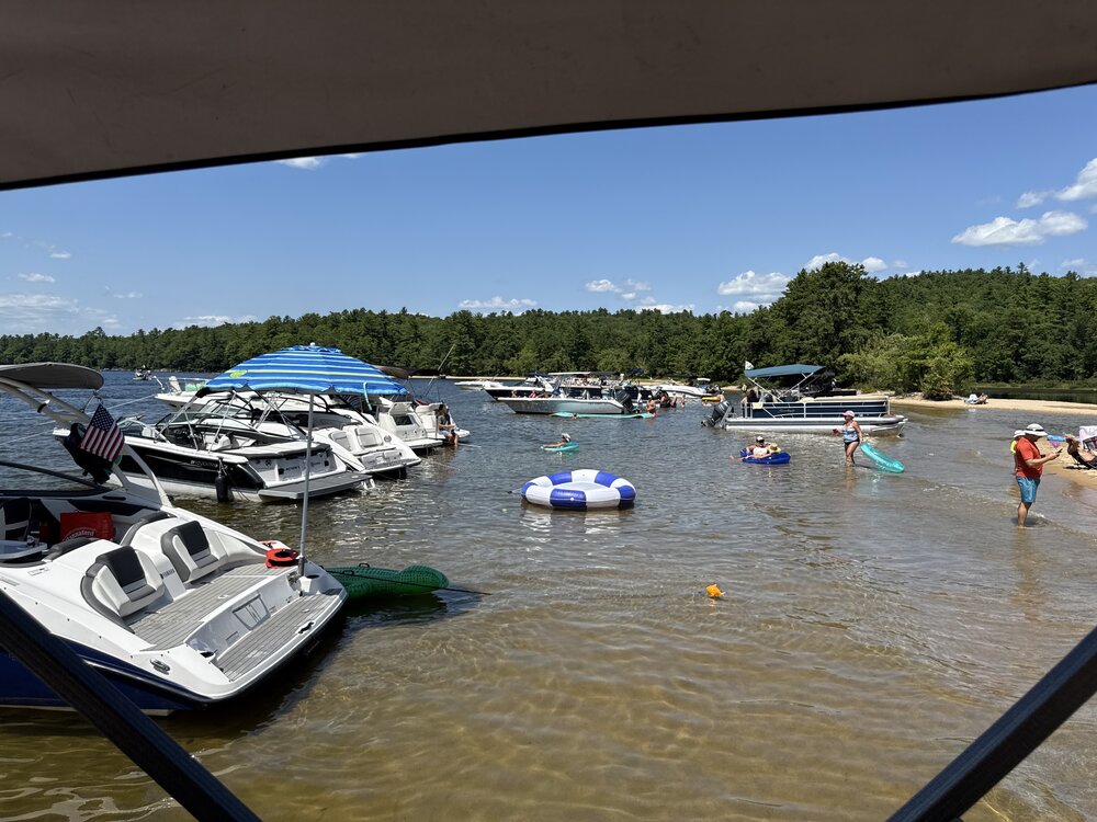
Looks like a top five vacation week as well.
-
What a beauty out here today, Top 10 day.
-
AQI down to 141 in Minneapolis. Feel like I can take the kids to the playground again.
-
Insanely gorgeous Chamber approved
-
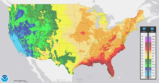
Yes due largely to collisions with seabreeze along with high moisture levels. I’m talking about my home, which is not as far inland as the airport and thus gets slightly more on avg…see darker shading nearer to coast. Our area gets avg summer rain that’s double+ avg winter rain. July/Aug are our 2 rainiest on avg. Normal July rain:
-
 Admittingly, I don't remember as a kid, growing up in the 60's, then all they way up to a few years ago. Maybe I didn't notice?
 -
 Yes. I only remember talking about wildfire smoke one time in my life before the last couple of years, and that was summer 2002 with the fires in Quebec.
 -

2025-2026 ENSO
40/70 Benchmark replied to 40/70 Benchmark's topic in Weather Forecasting and Discussion
-
Not too bad here today but yesterday was like wow. When the wind picked up in the afternoon mixing down the smoke it literally smelled like campfires smoldering. Strong too. I went out back once to make sure my scrap wood pile wasn't burning lol
- Today
-
Euro Weeklies and GEFS Extended in general agreement for August precip. Dry, D.C. east, wet west of D.C. especially up the spine of Apps. Heat Dome likes the 4 corners ( better than Texas, east), with a slight semblance of troughiness for the east.
-
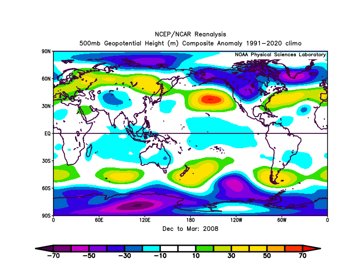
The lowest ACE La Ninas tend to see severe cold dumps / cold waves into the West in Nov-Feb. For whatever reason the trend doesn't hold in the cold neutrals. The recent average ACE in hurricane seasons immediately before a La Nina winter is something like 160. Canadian doesn't really have a La Nina. Inactive September in La Nina can often precede a severely cold January nationally too if you look. My assumption is this entire setup will show up, shoved south in the winter. Unlikely to be the dominant pattern. But as a recurring minor setup. The setup moved far enough south would be +WPO with a +PNA - that's a pretty wet pattern out here in the Fall/Spring if it is in place during those times. Not as good for winter locally. Parts of the look show similarities to the quite hurricane seasons of 2013 and 2022. September 2013 is wettest on record locally, with Feb-Apr 2023 seeing severe cold for the time. We had a low of 21F here in April 2023, all time record for April here is like 18F. If you push everything south its a good pattern Plains like 2013, if you push it southeast, good pattern west like 2022. The high south of South America would be by Greenland and the big low SE of Australia would move to the Western US with the low over Kamchatka and the high off southeast asia instead of east of Japan. This is the southeast movement solution (Feb 1-Apr 7 2023)
-
67.3 F at 12:30 PM on 8/2 is awesome! .
-
Have you ever seen both of us in the same room together?
-
12z UK: 3rd run in row w/MDR TD moving WNWNEW TROPICAL CYCLONE FORECAST TO DEVELOP AFTER 114 HOURSFORECAST POSITION AT T+114 : 13.8N 41.9WLEAD CENTRAL MAXIMUM WINDVERIFYING TIME TIME POSITION PRESSURE (MB) SPEED (KNOTS)-------------- ---- -------- ------------- -------------1200UTC 07.08.2025 120 14.4N 43.3W 1009 280000UTC 08.08.2025 132 16.2N 46.1W 1009 291200UTC 08.08.2025 144 17.6N 49.2W 1010 280000UTC 09.08.2025 156 19.7N 52.0W 1011 281200UTC 09.08.2025 168 21.2N 55.3W 1011 34
-
CTP discussed record heat in today’s discussion. For June + July 2025: Harrisburg: 76.8F average temperature ranks 7th warmest Williamsport: 74.0F average temperature ranks tied 7th warmest Altoona: 73.1F average temperature ranks tied 3rd warmest Bradford: 67.7F average temperature ranks 2nd warmest State College: 73.3F average temperature ranks tied 3rd warmest For July 2025: Harrisburg: 79.8F average temperature ranks 8th warmest Williamsport: 76.8F average temperature ranks tied 9th warmest Altoona: 74.7F average temperature ranks 8th warmest Bradford: 69.5F average temperature ranks tied 4th warmest State College: 76.0F average temperature ranks 4th warmest
-
We somehow only received .63 yesterday while 10 miles SW got 5 to 6 and 6 miles SE got 4-6.
-
Mark, is that you????
-

E PA/NJ/DE Summer 2025 Obs/Discussion
LVblizzard replied to Hurricane Agnes's topic in Philadelphia Region
Mother nature is making up for all those years of storms messing up Musikfest. It’s very possible that the entire 10-day festival will be rain-free this year, aside from “preview night” this past Thursday. -

2025-2026 ENSO
donsutherland1 replied to 40/70 Benchmark's topic in Weather Forecasting and Discussion
The CANSIPS (cool) and CFSv2 (warm) are at odds regarding the fall outcome in the central U.S. It will be interesting to see what the ECMWF seasonal forecast shows when it comes out in a few days. -
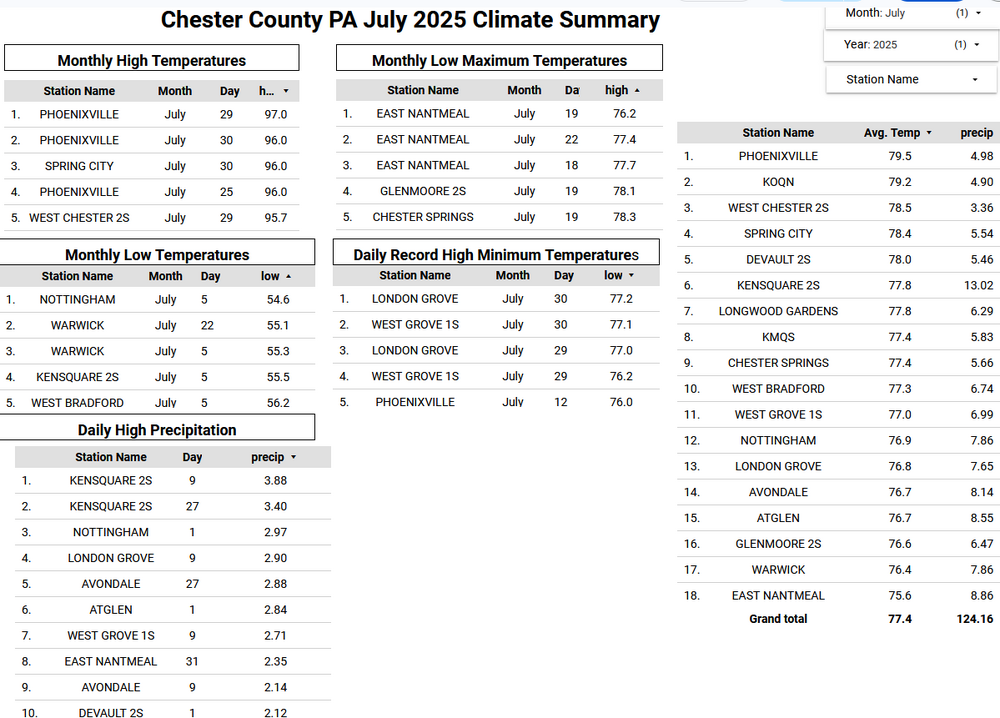
Overall across Chester County PA as if you had to be told it was a hot month! Our average temperature across the county was 77.4 degrees. This is the 10th warmest July on record over the 133 years of climate records beginning in 1894. The top 5 hottest July months were 1999 - 78.6 / 1901 - 78.5 / 2011 - 78.3 / 1955 - 78.2 and 2020 at 78.0. It was also a wet month with an average across the county stations of 6.83" this is the 20th greatest average rainfall in July. The greatest average was way back in 1919 with an average of 11.64" of rain.
-
E PA/NJ/DE Summer 2025 Obs/Discussion
ChescoWx replied to Hurricane Agnes's topic in Philadelphia Region
Overall across Chester County PA as if you had to be told it was a hot month! Our average temperature across the county was 77.4 degrees. This is the 10th warmest July on record over the 133 years of climate records beginning in 1894. The top 5 hottest July months were 1999 - 78.6 / 1901 - 78.5 / 2011 - 78.3 / 1955 - 78.2 and 2020 at 78.0. It was also a wet month with an average across the county stations of 6.83" this is the 20th greatest average rainfall in July. The greatest average was way back in 1919 with an average of 11.64" of rain.
-
Does Accuwx app have it?