All Activity
- Past hour
-

November 2025 general discussions and probable topic derailings ...
WinterWolf replied to Typhoon Tip's topic in New England
Blizzards are not that frequent anyway…but we’ve had a lot over the last 25-30 Years. I don’t think we can say they’ll be less frequent after the run we’ve just had. But whatever. -
This would not at all surprise me that December is cold but with below normal snowfall. Ben Noll @BenNollWeather 1h There are signs that December is going to be particularly chilly this year, but does that mean it's also going to be snowy? It depends where you live. In past years with similar climate characteristics to this year, northern states had the highest odds for above-average snowfall during December. Using history as a guide, regions such as New England, the Great Lakes, Midwest, northern Plains and Intermountain West are favored to be snowier-than-average next month. The Northeast, including the big cities, is more of a question mark and could go either way. The Southeast and Mid-Atlantic might lack moisture, reducing the odds for snow storms.

-
0.33” here
-

2025-2026 ENSO
donsutherland1 replied to 40/70 Benchmark's topic in Weather Forecasting and Discussion
And for context: Low skill for much of the CONUS.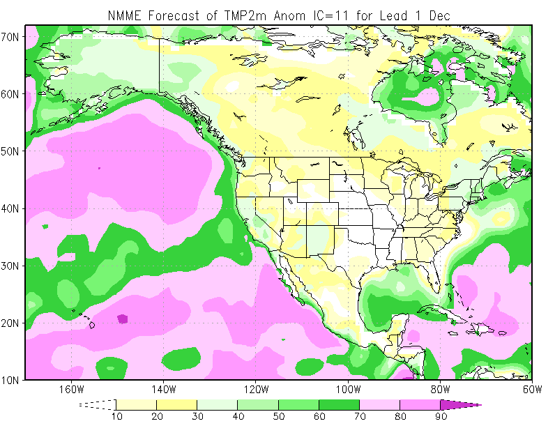
-
Everyone that gets paid by clicks is bullish. Same story each year, rinse and repeat. The CPC and Weather Channel are not bullish on winter in the northeast at all yet. I remain skeptical. I think we will see more snow than the past few years, but that is not a tall order to do. I think we are going to have quick snaps of cold and then moderating throughout December and January. Looking at the continent as a whole so far we are well behind the 8-ball. Fingers crossed we can make up for it.
-
 There will be more blizzards in the next 10-20 years. less frequent, but possibly more violent? wheres George to chime in
 -
Beautiful!! Perfect sleeping weather with windows open.
-
Oakwood dominated by... maples?
-
Looks like CAA with NW winds, I'm not sure if the winds will die for radiational cooling out there. The CAA is one of the reasons the city actually gets below freezing. But sometimes isolated spots have their winds die down anyway.
-
(002).thumb.png.6e3d9d46bca5fe41aab7a74871dd8af8.png)
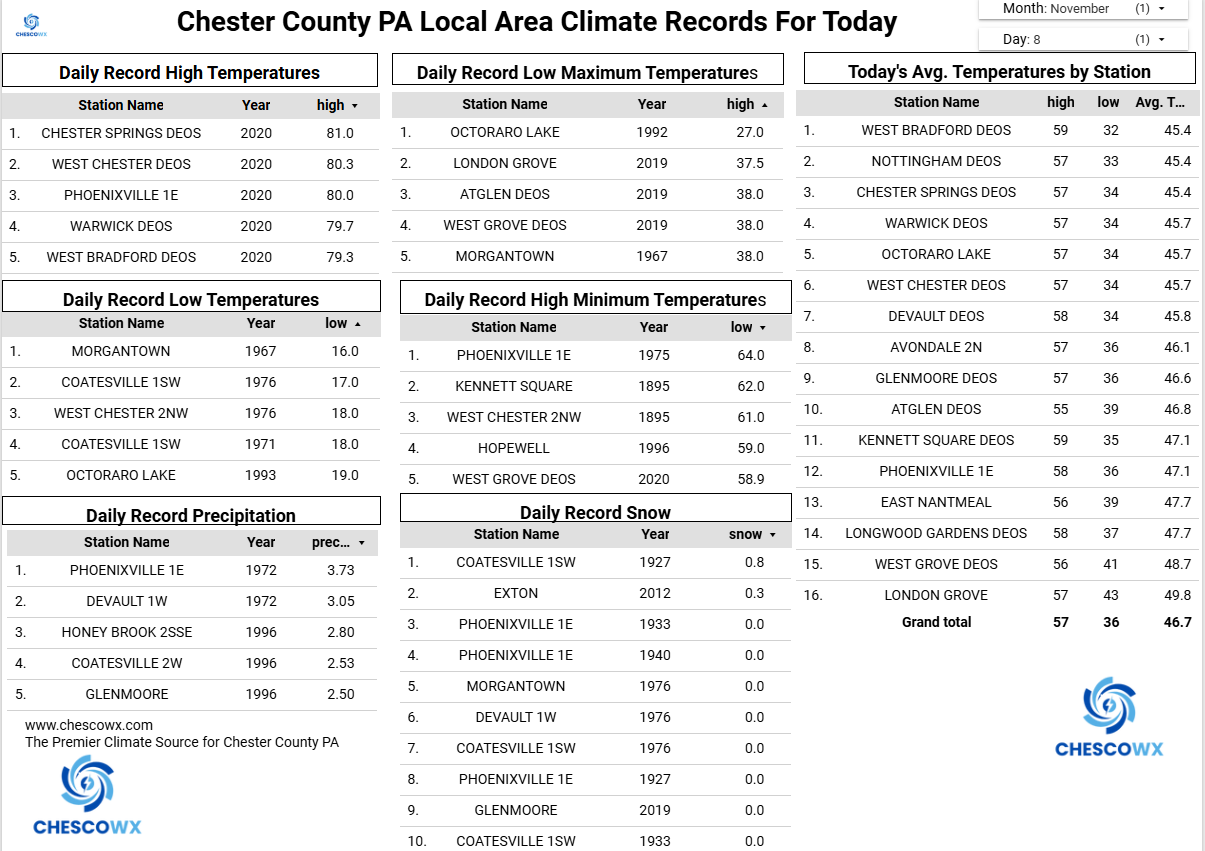
Central PA Fall Discussions and Obs
ChescoWx replied to ChescoWx's topic in Upstate New York/Pennsylvania
We picked up a general 0.20" to 0.30" of rain since last night across the area. Today will be our warmest day for at least the next week with temperatures topping out in the low 60's for most spots. Shower chances increase again tomorrow, and we will likely remain in the 50's for highs across the county. A strong cold front crosses the region Sunday night, and temperatures look to slowly fall during the day Monday reaching the 30's toward evening and the freezing mark by late evening. The NWS has the first chance of snow flurries in the forecast by Monday night into Tuesday morning. The coldest day will be Tuesday with some higher spots struggling to escape the 30's for high temperatures. We turn a bit milder but still below normal by Wednesday and turn a bit colder again to close out the work week.

-
E PA/NJ/DE Autumn 2025 Obs/Discussion
ChescoWx replied to PhiEaglesfan712's topic in Philadelphia Region
We picked up a general 0.20" to 0.30" of rain since last night across the area. Today will be our warmest day for at least the next week with temperatures topping out in the low 60's for most spots. Shower chances increase again tomorrow, and we will likely remain in the 50's for highs across the county. A strong cold front crosses the region Sunday night, and temperatures look to slowly fall during the day Monday reaching the 30's toward evening and the freezing mark by late evening. The NWS has the first chance of snow flurries in the forecast by Monday night into Tuesday morning. The coldest day will be Tuesday with some higher spots struggling to escape the 30's for high temperatures. We turn a bit milder but still below normal by Wednesday and turn a bit colder again to close out the work week.
-
 I've heard that Denver gets snowstorms in April sometimes? Rapid temperature changes and extreme in heat and cold. Sounds pretty exciting to me.
 -
He such is a person.
-
With the issuing of WSW's for Chicago and the N IN lake effect belts, I figured that this event has become thread-worthy. The main storm system isn't that notable, with the warm ground leading to at most an inch or two of accumulation for some higher terrain areas away from the lake. However, after the main system passes through we could have a significant lake effect event for so early in the year, especially on Sunday night into Monday. LOT and IWX have highlighted for the potential of at least several inches of snow wherever a main band sets up for any length of time. Combined with wind and the fact that leaves are still on the trees from the previously very warm autumn, this could be a potentially significant early-season event. Especially considering the possibility that one of the bands may set up into downtown Chicago and points south of the city, and the fact that this really has only become a thing within the last 24 hours.
-
If the winds calm down, east of the city on the N Shore especially could see low to mid 20s and teens for Pine Barrens. Definitely a killing freeze for anything outside.
-

2025-2026 ENSO
michsnowfreak replied to 40/70 Benchmark's topic in Weather Forecasting and Discussion
I would expect nothing less from NMME. if i recall, it was even warmer last winter, and we know how that worked out. -
Oh yeah that would be fun! What a mindf*** that would be. I heard of a town that was hit by an F4 tornado and then later that day a blizzard. Or maybe it was the other way around.
-
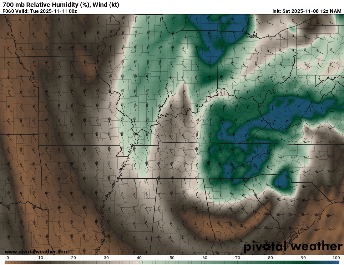
This is a very deep batch of moisture (for NW events) and is more than just your typical NW flow. If the NAM is correct this would bring a few hours of snow across a large portion of the region and not just confined to the NW slopes.

-
It is a sneaky kind of warm out there this morning
-
.20” last night. Quickly climbing up to 60 from a low of 45.5 at 7:04 this morning. Of course Mother Nature is going to stick it to me with the cold next week. Taking care of a friends horses till the following weekend and looks like I am in for it. Her farmette is up on the West side of Furnace Mountain and that cold wind will be brutal.
-
2025-2026 ENSO
michsnowfreak replied to 40/70 Benchmark's topic in Weather Forecasting and Discussion
They jump a lot. And you now have access https://charts.ecmwf.int/products/extended-anomaly-2t?base_time=202511070000&projection=opencharts_north_america&valid_time=202511170000 https://charts.ecmwf.int/?facets={"Product type"%3A[]%2C"Parameters"%3A[]%2C"Type"%3A[]%2C"Range"%3A["Extended (42 days)"%2C"Sub-seasonal"]} -
Yeah, even on this side of the lake you don’t really start getting your hopes up until the band is overhead
-
Definitely seems like today's 12z hi rez models are highlighting the swing of the LE into the IL side for a little. Liking trends, but won't expect it until we see the band on radar. Would be hilarious if the meso low pushes the snow too far west and leaves a gap.
-
Escalated quickly, would be happy with 2-3
-

November 2025 general discussions and probable topic derailings ...
Torch Tiger replied to Typhoon Tip's topic in New England
No MO would be ideal for winter. You can get snow and tors in the same storm at same time