All Activity
- Past hour
-
92/66
-

Central PA Spring 2026 Discussion/Obs Thread
Mount Joy Snowman replied to Voyager's topic in Upstate New York/Pennsylvania
MDT doing MDT things haha.......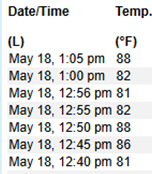
-
Seeing most reports between 55 mph and 65 mph as that line moves through NE IL/NW IN.
-
Low 90s over mid 60s in most places right now. Warm.
-
Question is...who will build it? Actually it seems there has been a renewed interest lately about where it may be...a site in Turkey is being looked at again.
-
GGEM same
-
It’s ok to post “AWT”
-
Nice timing too. Right around 18z plus more westerly flow in the BL vs onshore.
-
The RRFS is decent too, just a bit later with timing
-
Borderline big heat tomorrow. As expected ... headlines now flying. Prooobably 94 to 95? 95+ is sort of the "unofficial" "big heat" criteria. But it probably really should go by the HI values.
-

E PA/NJ/DE Spring 2026 Obs/Discussion
LVblizzard replied to PhiEaglesfan712's topic in Philadelphia Region
About to land in Philly after spending a week in Ireland with mid 50s and a strong breeze. Adjusting to this heat won’t be fun. -
Yeah I thought Nam was decent too. I don’t think it’s widespread, but probably a couple of segments in the line that get strong.
-

Central PA Spring 2026 Discussion/Obs Thread
TheDreamTraveler replied to Voyager's topic in Upstate New York/Pennsylvania
92 already at 1 PM. Dew point around 63 so isn't the worst but definitely a little bit uncomfortable -
We will need a ark if the GFS is correct.
-
Pretty decent agreement on the ensembles for an inch or so of rain over the broad area of the forum, over the next 7 days. Hope it pans out. We need a lot more than that.
-
Currently 82° at home and 84° in downtown Greenfield. What a day, I may need to cut out of work early.
-
Cooking
-
So we just need to string together a few 115s
-

Central PA Spring 2026 Discussion/Obs Thread
canderson replied to Voyager's topic in Upstate New York/Pennsylvania
39 and pouring rain approaching Juneau. -
I think we'll see widespread storms...should see a solid line evolve ahead of the front. Only question is whether damaging wind gust potential is rather isolated or more scattered
-

2026-2027 Strong/Super El Nino
40/70 Benchmark replied to Stormchaserchuck1's topic in Weather Forecasting and Discussion
This is in no way 2009-2010...not remotely relevant. You have brought that up a couple of times...it's moot. It was much weaker and the warmth was relegated to the western flank...not to mention we had just passed solar min with a neg QBO. -
90 yesterday. Currently 85. Let's see if we can pull off another one here this afternoon. Tuesday is a lock and Wednesday looks promising for 90 here. A 4 day May heatwave would be sweet. Hoping for a nice banger on Wednesday and then Stein gets his webbed hands into this weekend. Can't see how anyone would route for cool/wet on MDW, including ACATT.
- Today
-
If Chicago ever fixes housing affordability I'll be back sooner than later
-
Fish says .. Nah
-

2026-2027 Strong/Super El Nino
roardog replied to Stormchaserchuck1's topic in Weather Forecasting and Discussion
So we have a model temperature forecast for 7 months into the future and it's against an 1880-1920 mean. lol


