All Activity
- Past hour
-

December 2025 OBS and Discussion
coastalplainsnowman replied to wdrag's topic in New York City Metro
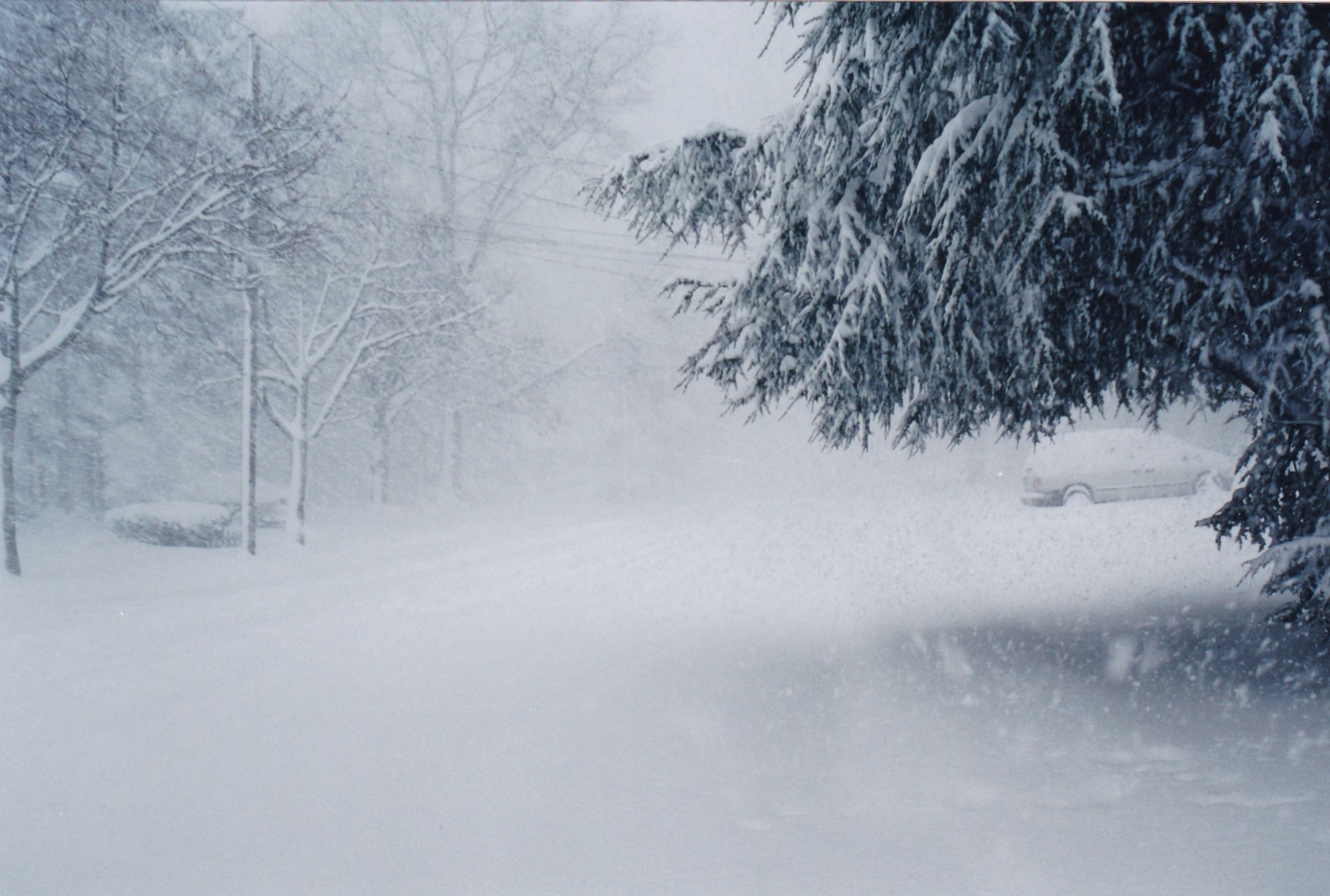
In the pic below, the car on the right is probably 75-80 feet away.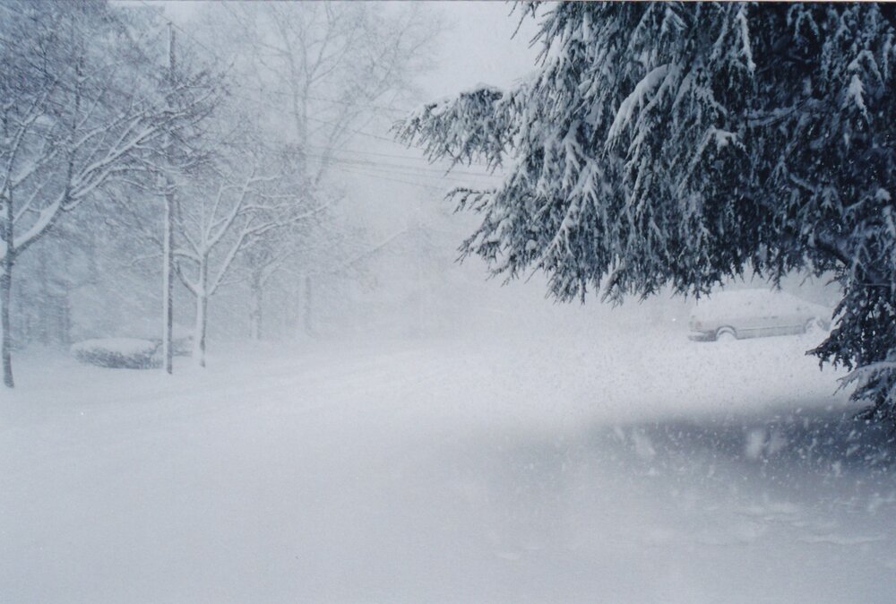
-

January 2026 regional war/obs/disco thread
WinterWolf replied to Baroclinic Zone's topic in New England
Me too. Focus on the here and now. -
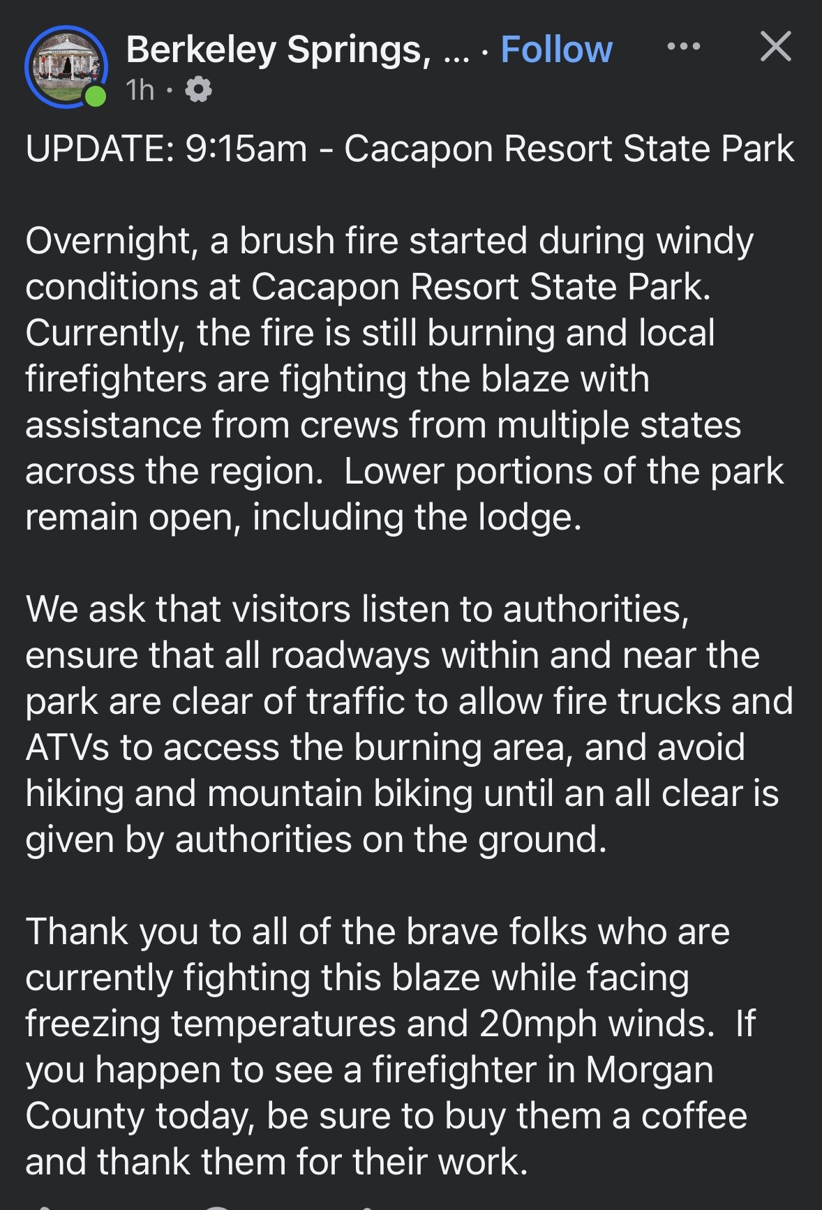
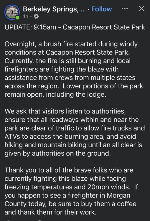
Anyone hear about this.
-

January 2026 regional war/obs/disco thread
Great Snow 1717 replied to Baroclinic Zone's topic in New England
Do research and you will find that New England as a region has warmed.. -

January 2026 regional war/obs/disco thread
Lava Rock replied to Baroclinic Zone's topic in New England
I'd take another 26" like Dec 30, 2016. Biggest storm evah. Pattern looks pretty dry for awhile. -

Pittsburgh/Western PA WINTER ‘25/‘26
colonel717 replied to Burghblizz's topic in Upstate New York/Pennsylvania
-

January 2026 regional war/obs/disco thread
WxWatcher007 replied to Baroclinic Zone's topic in New England
I’m mostly with you…but this logic didn’t work for some of the truly putrid years we’ve had lately. It was unlikely to get worse/likely to be better until it did/didn’t. If we’re in a decadal cycle, we’ll it hasn’t been a decade yet, not that these things fall so neatly. We need a stretch before we can declare things are better. In the whole scheme of things though, I’d rather just focus on this season. -
January 2026 regional war/obs/disco thread
WinterWolf replied to Baroclinic Zone's topic in New England
C’mon..enough now. What’s f’n worse? Really? You just went through the snowiest period in SNE history(granted our records only back 150 years or so). But what is worse? A 4 year bad period? Again, that always happens. And lots of other places in this country have had record breaking winters, while we’ve missed out. And they missed out when we were reaping the rewards. NNE off to the best start…in history possibly. That doesn’t sound like any warming is giving them a problem. And warmth last year, and now this year isn’t a problem. So let’s just get back to our January weather now. -

New Years Day 2026 - 1st snows of the new year possible
nutmegfriar replied to Baroclinic Zone's topic in New England
Time to spend my nickels and dimes on bread and milk. -
Had a dusting starting around the French Broad on 26 when I drove up to Asheville earlier from down in SC. Colder here again than back in MT currently. Ski resorts are taking a beating across most of the west so far.
-
Ice Ice Baby December 28-29 Storm Discussion
Lava Rock replied to Baroclinic Zone's topic in New England
Same here. Had a boiler guy come this morning in a sprinter van and thought for sure I'd need to drop sand and/or tow him up the driveway, but he got out no problem. -
Definitely can't say the storm was boring here. 0.77" of rain. Temps shot up to 60 with dewpoint of 59 (dtw 61/59) late sunday evening, then crashed to the low 20s with wind chills near 0 by sunrise Monday. Snow squalls and nonstop blowing snow all day yesterday, gusts 45-55mph, snowfall amounted to 1.8" here. So snow had been on the ground continuously from November 29 to December 20, melted 5 days before Christmas, and white ground returned 3 days after. Can't make it up.
-

New Years Day 2026 - 1st snows of the new year possible
weatherwiz replied to Baroclinic Zone's topic in New England
Yup...great post. The environment isn't too terribly far off from what you would see with a LES environment. Should actually be some weak instability present...not sure if we're looking at enough to yield thunder potential but I could see a very narrow area of enhanced lift. Someone could def pull off 3-4" on the Cape -
Most places that got over 2 feet did so in like 8 to 10 hours. Just crazy rates. And of course that sharp cutoff sw of Philly. Baltimore and DC completely skunked
-
check out the obs from Buffalo yesterday - hours of snow and wind gusts of 70-80mph.
-

New Years Day 2026 - 1st snows of the new year possible
dendrite replied to Baroclinic Zone's topic in New England
Kinda catching up now…I do see some models trying to pop a secondary near the Cape. -
Yep, that storm is king for me of sheer intensity and thunder snow that morning.
-
December 2025 regional war/obs/disco thread
weatherwiz replied to Torch Tiger's topic in New England
snow flurries falling! -
Pittsburgh/Western PA WINTER ‘25/‘26
colonel717 replied to Burghblizz's topic in Upstate New York/Pennsylvania
Heaviest snow yet. I see more bands building west of Steubenville.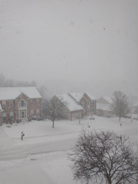
-
4" at the stake, had a coating this morning that blew all over due to the glacier out there, 28/13 currently.
-

Winter 25/26 General Obs
Holston_River_Rambler replied to Holston_River_Rambler's topic in Tennessee Valley
One thing I was wondering about was whether or not the level of the radar beam enhanced the appearance of the returns, but the on the ground truth sure looks like it is a legit band. -
New Years Day 2026 - 1st snows of the new year possible
WinterWolf replied to Baroclinic Zone's topic in New England
Same here. -
New Years Day 2026 - 1st snows of the new year possible
dendrite replied to Baroclinic Zone's topic in New England
The surface low tracks through NNE…this sucker is moisture starved. But SW flow over the ocean waters will help moisten it up for SE MA. -

January 2026 regional war/obs/disco thread
ORH_wxman replied to Baroclinic Zone's topic in New England
I know we were told that the NAO was going to be predominately positive due to global warming….we went through a big +NAO period in the 1980s/1990s and lots of papers came out about it being attributed to global warming. Then we got a huge decadal period of -NAO between about 2000-2001 and 2018 which coincided with the snowiest 15 year stretch on record in many SNE stations. It’s taught me not to have knee-jerk reactions about 5 or even 10+ trends and trying to extrapolate based on those. They just aren’t very predictable. A lot of climate weenies love to undersell the stochastic aspect of many of these patterns. It doesn’t mean we’re not warming…we can measure that we are and the literature is pretty sound about it on the whole…but it means other pattern attributes and sensible wx isn’t necessarily as easily predictable or understood by climate modeling. -
January 2026 regional war/obs/disco thread
Great Snow 1717 replied to Baroclinic Zone's topic in New England
It is not worse??? Lol