All Activity
- Past hour
-
Up to 9.4 for the month at my station.
-
An EF0 and an EF1 Posted the survey results in the Severe weather thread
-
I left my car windows cracked thinking the worst was over My drive home will be slightly moist.
-
 "Event": 0.07" Week: 0.07" Month: 2.11" Year: 21.82" (79% of average)
 -
 Buy Viagra online cheap [url=http://medmennews.com/#]cheap viagra[/url] Generic Viagra online
 -
 Just go and pour bleach in his well
 -
000 NOUS41 KPHI 301140 CCA PNSPHI DEZ001>004-MDZ012-015-019-020-300915- Public Information Statement...CORRECTED National Weather Service Mount Holly NJ 740 AM EDT Thu Jul 30 2026 ...NWS Damage Survey for 07/28/26 Tornado Event... .Overview... Severe storms moved into the region during the afternoon of July 28. One of the storms that progressed through Talbot County Maryland produced two distinct tornadoes in Trappe, Maryland. Multiple witnesses reported the tornado that affected the Backtown Road fully dissipated before the storm crossed over Highway 50. The storm then produced another tornado on the east side of Highway 50 near Tarbutton Mill Road. The NWS would like to thank Talbot County Emergency Management and area residents for their assistance in this survey. .Backtown Road Tornado... Rating: EF-1 Estimated Peak Wind: 90-100 mph Path Length /statute/: 0.15 miles Path Width /maximum/: 30 yards Fatalities: 0 Injuries: 0 Start Date: July 28, 2026 Start Time: 6:12 PM EDT Start Location: 1 Mile N Trappe / Talbot County / MD Start Lat/Lon: 38.6719 / -76.0602 End Date: July 28, 2026 End Time: 6:13 PM EDT End Location: 1.1 Miles N Trappe / Talbot County / MD End Lat/Lon: 38.6734 / -76.0592 Survey Summary: Tree damage was noted behind an industrial park on Backtown Road. The highest estimated wind speeds were from roof damage to one of the large metal buildings in the industrial park. The metal roof covering was blown off and some of the roof trusses were damaged. Next to the industrial park large branches were broken on trees in the yard of a residence. The last damage noted was a distinct convergent damage path through part of a corn field on the north side of Backtown Road. Beginning and end points of this path are estimated due to lack of access. .Tarbutton Mill Road Tornado... Rating: EF-0 Estimated Peak Wind: 70-80 mph Path Length /statute/: 0.34 miles Path Width /maximum/: 30 yards Fatalities: 0 Injuries: 0 Start Date: July 28 2026 Start Time: 6:18 PM EDT Start Location: 1.4 NNE Trappe / Talbot County / MD Start Lat/Lon: 38.6786 / -76.0519 End Date: July 28 2026 End Time: 6:19 PM EDT End Location: 1.6 NE Trappe / Talbot County / MD End Lat/Lon: 38.6792 / -76.0456 Survey Summary: The first damage at this location noted was a large branch broken from a tree. The tornado continued roughly eastward with convergent damage noted in a corn field. At the eastern extent of the damage, two farm outbuildings sustained damage to their roofs. For one building the roofing was completely uplifted, including support beams. For the other building, part of the metal roofing was blown off. &&
-
 He won’t even throw me a courtesy ground wetting today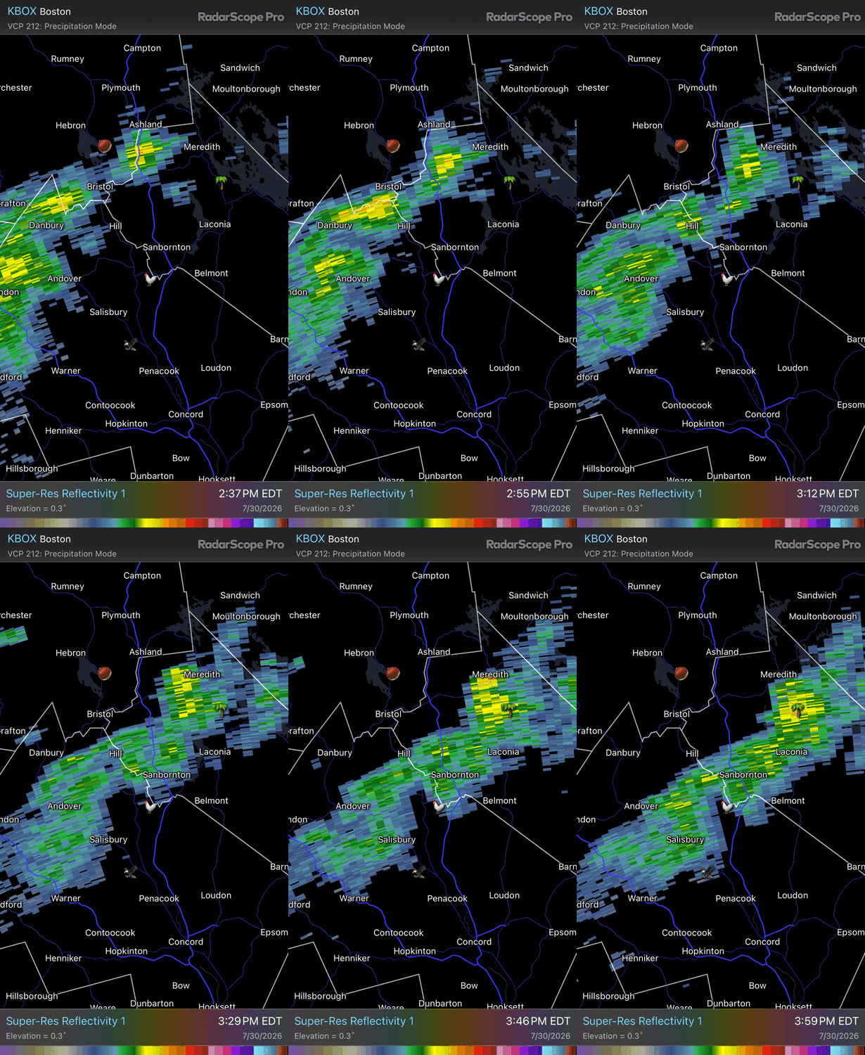
-
I think a bigger concern there 8/12 and later on the ensembles is the WNW flow if the ridge sets up that strong over the Plains/Midwest. That is going to send big time smoke into at least New England if any fires are still burning.
-
Still no dent in the Taunton drought
-
 SAL puts the lid on it for the next 7-10 days, 2nd week of august looks better but El Nino is in full control until further notice so keep expectations muted for now.
 -
 I feel like this is a deliberate attempt to provoke @dendrite
 -
https://medmennews.xyz/# Cheap generic Viagra Cheap Viagra 100mg
-
Order Viagra 50 mg online: over the counter sildenafil - Cheap Viagra 100mg
-
Viagra online price: Med Men News - Viagra online price
-
The snowmelt season and how it impacts Canadian boreal forests is vastly different than for Europe as a whole.
-
The data has to come from somewhere. Find the source and let Claude do the rest.
-
 This site has some great stuff I use all the time: https://www.ospo.noaa.gov/products/ocean/tropical/tcfp/basins.html?basin=al-24 The year over year shear is something Lowry does. Wish I knew how. His data visualization stuff is great. A lot of good stuff here too: https://bmcnoldy.earth.miami.edu/products.html
 -
Showers North of Philly moving South . Mostly cloudy here. Stubborn clearing with this system
-
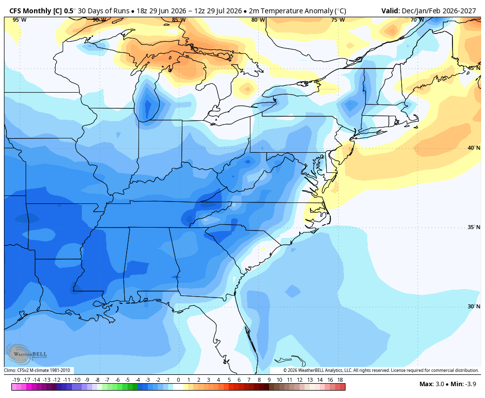
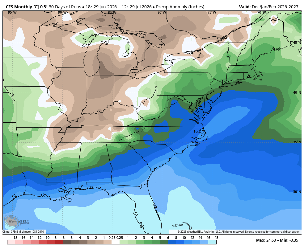
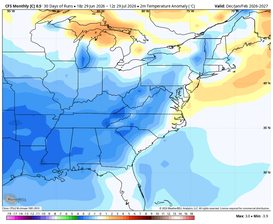
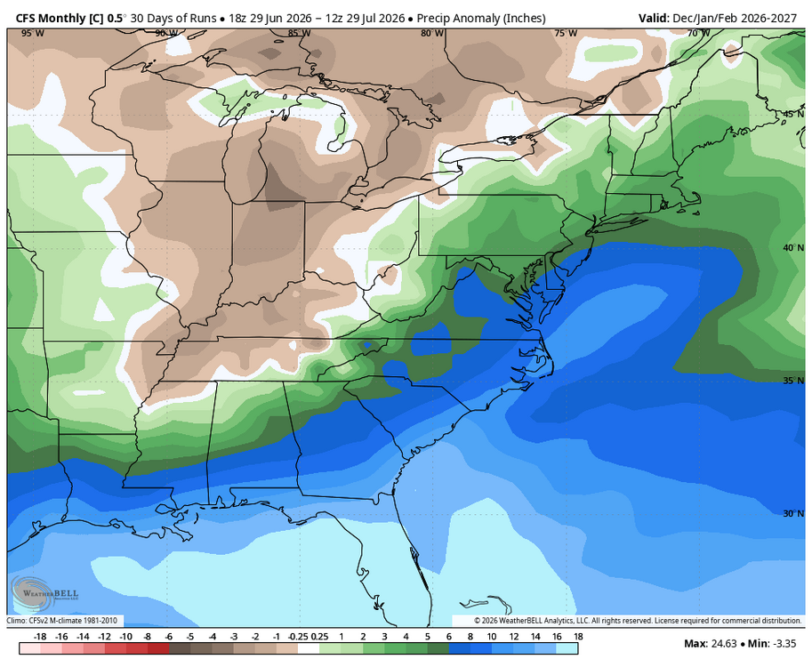
WB CFS 30 day average for Dec-Jan.
-
The generally NN/BN weather this month after the mega torch to start has almost erased the AN anomalies for the month at the 3 airports. +0.7 BWI +0.9 DCA +1.7 IAD As of yesterday
-
 Great stuff, are all these plots from the University of Miami. I love these wind shear/instability plots
 -
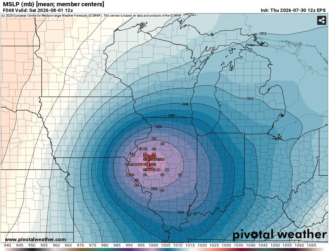
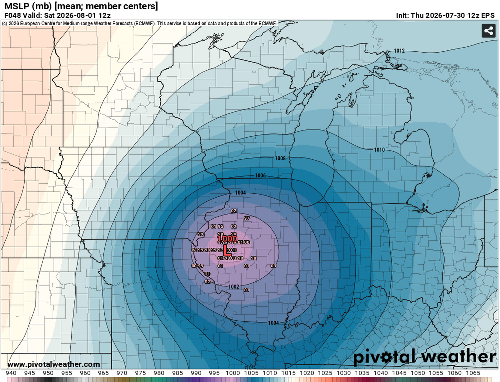
If the EPS mean pans out, it will be a record or near-record SLP for August as it is sliding across central Illinois. Record in that area is 1001-1002mb and EPS mean is hovering around that. https://www.wpc.ncep.noaa.gov/research/roth/AugustRecordLowSLPs.gif
-
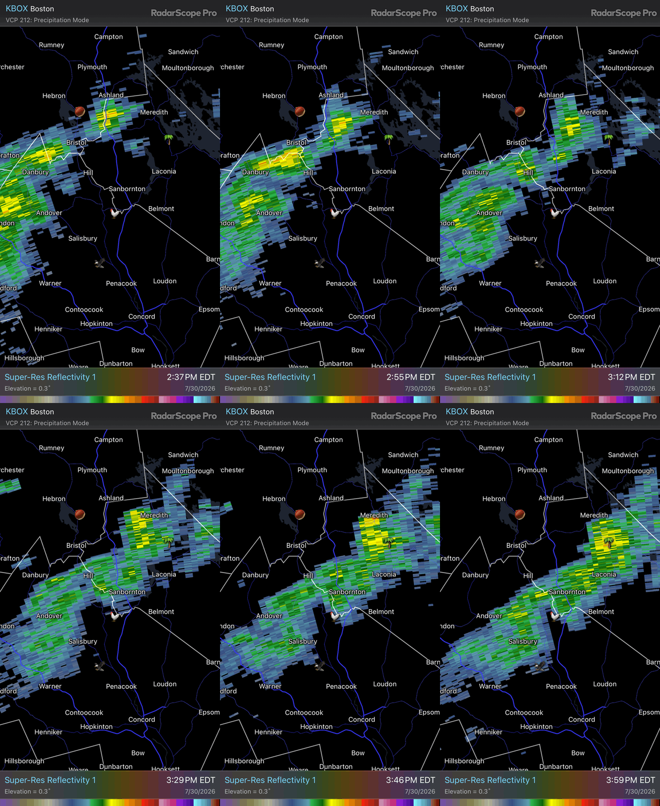
pop up showers everywhere now-just had one roll through-storm just doesnt want to die
-
It might be climo, but even in our worst years there are still windows that open up. The problem this season is that you have numerous hurdles that are much higher than normal due to our strengthening Nino. Not only are MDR SSTa numbers pretty cool, but there's not the same level of OHC that you'd normally expect heading into the climatological peak, even in the Caribbean. That SSTa look above also raises an issue that has been wrecking the MDR throughout the 2020s, subsidence and stability. That warmth in the subtropics screams stability issues. Even in recent hot years, it's taken a lot of effort in the peak season to offset repeated dry air and stability issues in the tropical Atlantic. Alarm bells are already going off with instability well below normal again in the MDR. Dust so far has been near average, so seeing this lack of stability above even with relatively normal dust conditions is a red flag. Then you have shear, which we all know is worse across much of the basin in a Nino year. Well, the graveyard is extra barren right now with an ugly shear look. The images below come from Michael Lowry, who does some awesome tropical work. Shear should drop as we move into better climo, but if we see persistent TUTTs across the basin it's going to be hard to get much activity going, let alone anything high end. So, it's going to be hard. Waves that survive being suffocated by stability may very well get decapitated by shear as they try to get into the Caribbean. Homebrew, especially in the subtropics region well off the East Coast or north of the Antilles seems to be the only way we have decent development this season, which fits strong Nino years.