All Activity
- Past hour
-
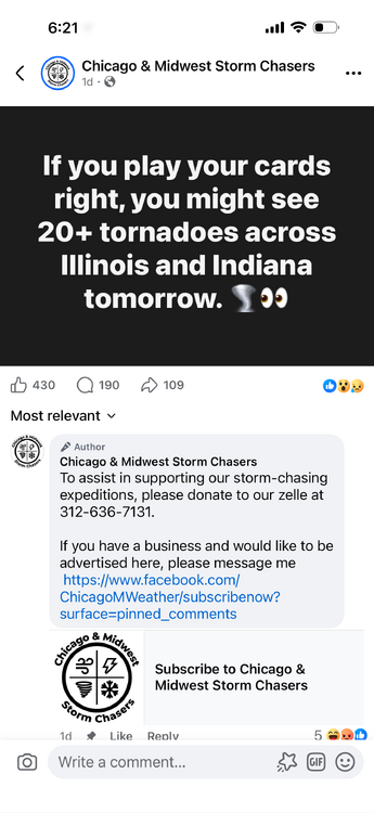
Yes, but you’ll see more tornadoes, if you donate
-
Is CJ really asking for donations? If so:
-
Getting a late start. Do you think I can still see 7-8+? Obviously cards will be played perfectly.
-
Persistence
-
I’ll take that bet. Big time meh day
-
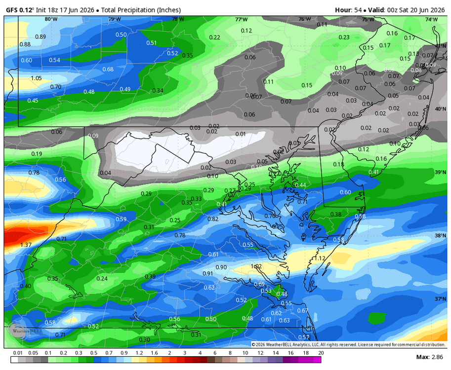
It will turn briefly warmer with a shower or thunderstorm possible tomorrow afternoon or evening. The temperature will top out in the middle 80s. The weekend will feature high temperatures mainly in the lower 80s. Rain is likely on Monday. The potential exists for a general 0.50"-1.50" rainfall. No excessive heat appears likely through at least June 25th. The ENSO Region 1+2 anomaly was +2.6°C and the Region 3.4 anomaly was +1.3°C for the week centered around June 3. For the past six weeks, the ENSO Region 1+2 anomaly has averaged +1.95°C and the ENSO Region 3.4 anomaly has averaged +0.98°C. The ongoing El Niño will continue to strengthen through the summer. The SOI was -0.91 today. The preliminary Arctic Oscillation (AO) was +0.502 today. Based on sensitivity analysis applied to the latest guidance, there is an implied near 78% probability that New York City will have a warmer than normal June (1991-2020 normal). June will likely finish with a mean temperature near 74.0 (2.0° above normal). Supplemental Information: The projected mean would be 2.6° above the 1981-2010 normal monthly value.
-
SPECIAL WEATHER STATEMENT ISSUED: 4:31 PM JUN. 17, 2026 – ENVIRONMENT AND CLIMATE CHANGE CANADA Strong winds, heavy rain and thunderstorms tonight. What: Strong southwesterly wind gusts. Rainfall amounts in excess of 40 mm. Risk of severe thunderstorms. When: Beginning early this evening continuing into Thursday morning. Additional information: Showers are expected early this evening and will intensify as a strong low pressure system approaches the area. There is a potential for severe thunderstorms late this evening and overnight with heavy rain and strong wind gusts being the primary threats. Rainfall amounts of 40 mm or greater are possible as a result of the thunderstorms and showers with this system. Watches or warnings may be issued closer to the event as the path of this low pressure system becomes more certain. First time I've seen in a statement mention on uncertainty with low path, we're only hours away so thats nuts!
-
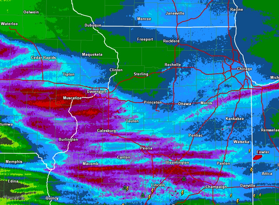
About the extent of the event here. 3-4” reports here locally with rain still falling.
-
KIND had a local convective discussion up for a bit on their page. They mentioned dynamic piping tornado initiation. Haven't heard that squirm in a hot minute lol. Makes me wonder if there's an intern there helping them do write ups
-
-
lol northwest IL.
-

Central PA Summer 2026 Discussion/Obs Thread
TheDreamTraveler replied to Voyager's topic in Upstate New York/Pennsylvania
Got a lot warmer today than was forecast. Was supposed to be 83 but got to 86 -
It’s raining pretty hard here. Kinda neat…
-
you can see the core of hail (up to 3") leans over the updraft near Decatur IL
-
Def going to be some flash flood issues from Springfield to Decatur to Champaign
-
Comical
- 166 replies
-
- 1
-

-
- we got burned
- rugpull central
- (and 1 more)
-
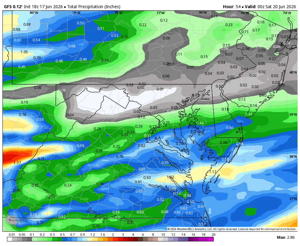
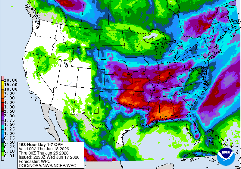
WB 18Z GFS forecasting much needed rain for southern/SE zones by Friday afternoon with frontal boundary and remnants of Arthur.
-
My last measurable rainfall IMBY was May 24.
- Today
-
High of 75.8° low of 49.1°. About perfect.
-

Central PA Summer 2026 Discussion/Obs Thread
canderson replied to Voyager's topic in Upstate New York/Pennsylvania
We probably won’t even get rain tomorrow but it’ll be very windy -
.thumb.jpg.6a4895b2a43f87359e4e7d04a6fa0d14.jpg)
Central PA Summer 2026 Discussion/Obs Thread
Yardstickgozinya replied to Voyager's topic in Upstate New York/Pennsylvania
If nothing else, the cumulus out here are getting taller here this afternoon. -
a drop in the bucket compared to what we really need - soaking rains of 1 to 2 inches every week for a few months
-
Watch that be the biggest tornado of the day.
-

super el nino banter thread
Cobalt replied to forkyfork's topic in Weather Forecasting and Discussion
note the gaps in date
-
possible tornado and 2.5" hail by Decatur IL