All Activity
- Past hour
-
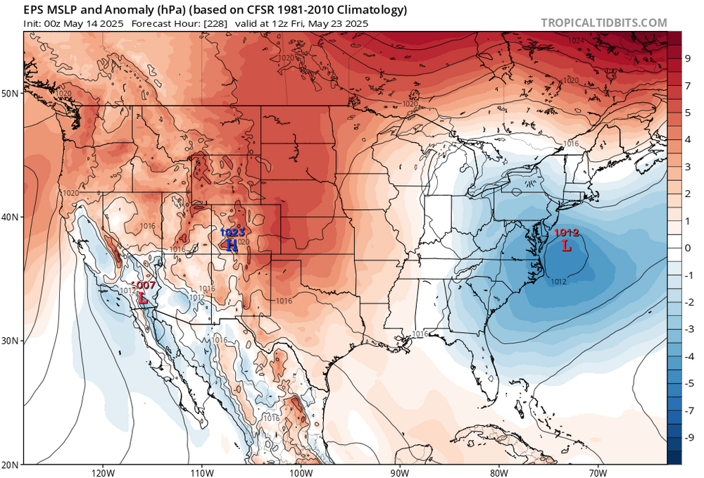
The period May 23 - 28 should shave those positive departures a bit.
-
+1 to +3 over the warmest period on record (1991-2020) is the new normal. The next 30 year climate period coming out in 2031 is going to be an inferno.
-
Euro still not updating in the PSU Ewall site It is more similar to the Canadian in the Day 7-10 (May 21 - May 24)
-
Records: Highs: -- Coolest record highs of the month - 5/14 just isnt hot in recorded history EWR: 86 (1991) NYC: 88 (1900) LGA: 84 (1991) JFK: 87 (1991) Lows: EWR: 36 (1939) NYC: 40 (1878) LGA: 44 (2019) JFK: 39 (1987) Historical: 1686: The inventor of the thermometer Gabriel Fahrenheit was born. 1834: The greatest May snowstorm on record for New England occurred. The hills around Newbury, VT were covered with up to 24 inches of snow and the higher elevations around Haverhill, NH received up to three feet of snow. 1896 - The mercury plunged to 10 degrees below zero at Climax, CO. It was the lowest reading of record for the U.S. during the month of May. (David Ludlum) 1898 - A severe thunderstorm, with some hailstones up to 9.5 inches in circumference, pounded a four mile wide path across Kansas City MO. South-facing windows were broken in nearly every house in central and eastern parts of the city, and several persons were injured. An even larger hailstone was thought to have been found, but it turned out to be a chunk of ice tossed out the window of a building by a prankster. (The Kansas City Weather Almanac) (The Weather Channel) 1985: Severe thunderstorms developed in DeWitt County, located between Bloomington and Decatur, and moved northward. The storms produced a wind gust of 73 mph at the Bloomington airport. In the Marshall County town of Wenona, winds up to 100 mph destroyed several barns and farm buildings. LaSalle County had 2 inch diameter hail and 60 mph winds; in Mendota, nearly every building in town sustained some damage. 1987 - Seven cities across the western U.S. reported record high temperatures for the date as unseasonably hot weather made a comeback. The record high of 103 degrees at Sacramento CA was their ninth in eleven days, and also marked a record seven days of 100 degree heat for the month. Their previous record was two days of 100 degree heat in May. (The National Weather Summary) 1988 - Sunny and dry weather prevailed across the nation. Temperatures warmed into the 80s and lower 90s in the Great Plains Region and the Mississippi Valley. (The National Weather Summary) 1989 - Thunderstorms developing along a stationary front produced severe weather in south central Texas and the Southern High Plains Region during the afternoon and evening hours. Thunderstorms produced softball size hail at Spearman and Hitchcock, TX. (The National Weather Summary) (Storm Data) 1990 - Thunderstorms developing ahead of a cold front produced severe weather from northwest Texas to western Missouri. Severe thunderstorms spawned seventeen tornadoes, including nine in Texas. Four tornadoes in Texas injured a total of nine persons. Thunderstorms in Texas also produced hail four inches in diameter at Shamrock, and hail four and a half inches in diameter near Guthrie. Thunderstorms over northeastern Kansas produced more than seven inches of rain in Chautauqua County between 9 PM and midnight. (Storm Data) (The National Weather Summary)
-
And it has increased since my previous post. I'll update later. Maybe before I go to work.
-
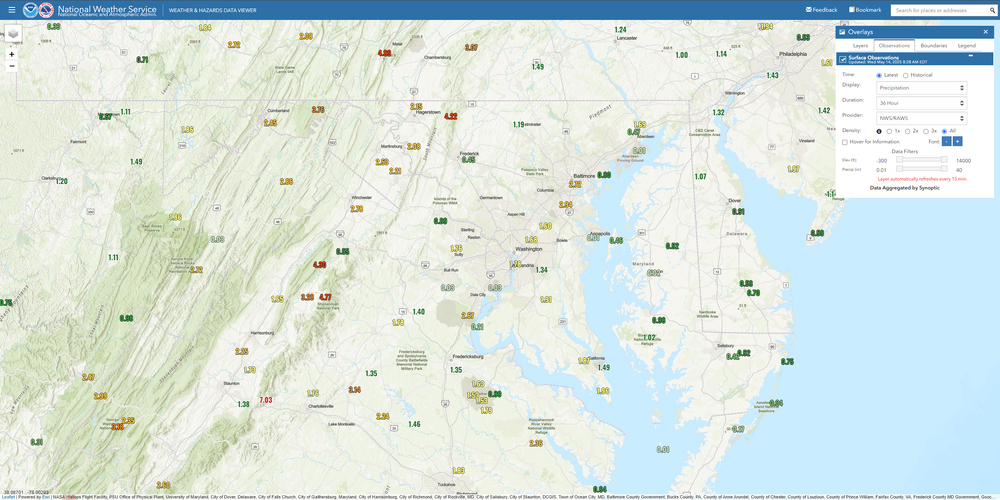
Obviously some of these stations are incorrect, but a majority did a great job capturing the event. The winner was down in the Central BR with over 7" for the primary event (Sawmill Ridge). Those RAWS stations are very reputable and maintained by the Forest Service. BWI at almost 3" is wild. It absolutely dumped buckets there last night.
-
If there is in fact morning activity on Friday, it could be one of those days where the morning stuff lays down boundaries to serve as focuses for afternoon storms to trigger. I wonder if Friday is an example of a type of day where coverage may be quite low but the storms that do form will have A LOT of energy all to themselves. Narrow swath of serious hail under a supercell sort of day? It's seeming like by Saturday the front might be too far beyond most of us to serve as a 2nd severe day - maybe for eastern areas?
-
Next week looks cool and I don’t mean in a Keanu Reeves kind of way.
-

2025-2026 ENSO
40/70 Benchmark replied to 40/70 Benchmark's topic in Weather Forecasting and Discussion
Okay, I agree CC is enhancing this..I thought you were implying that the Aleutian ridge has increased more than ambient heights. My only conention regarding the last part is I still think the +NAO and +WPO are playng a significant role in the low snowfall, but I don't argue that the stronger jet is having some influence as well. But it is has been a shitty pattern, regardless....+NAO/+WPO has never ended well for the east coast snow enthusiast. -
What's crazy is we're still averaging well above normal months (March-May) but the warmth has been so extreme further west that our weather seems cool by comparison.
-
59 / 57 cloudy and light rain. 0.75 in the bucket (so far). Clouds remain and rain should go more scattered today and being the coolest day of the period stuck in the low 60s. Warmer tomorrow with maybe some breaks of sun once the fog burns off and isolated showers and rain. SImilar and yet warmer on Friday with mainly cloudy skies and some scattered showers. Saturday not a wash out and the chance to the warmest day of the next 10 with enough sun could push low - mid 80s in the warm spots ahead of the storms coming with the cold front. Reprieve between the unesettled weather with a sunny dry Sunday - Wednesday - near normal. Next trough begins its cut off and memorial day misery Wed - Sun with more clouds, cool and rain. May be a top 5 ugly weekend. Trough clings to the east and any clinging to heat before June is all but evaporated - no fear for the fans of summer help could be on the way by the first week of next month with the building heat in the west ejecting east in the long range.
-
Picked up .56” of rain yesterday. So far today .11” currently light rain.
-
Higher dews will feel nice next couple of days . Some big bangers Saturday afternoon
-
Yea I'm definitely intrigued about Friday's potential.
-
Columbia east side. Big night of rain. 1.38” since 8:30pm Tuesday bringing total to 2.65” as of 8am Wednesday for event with ongoing drizzly light rain
-
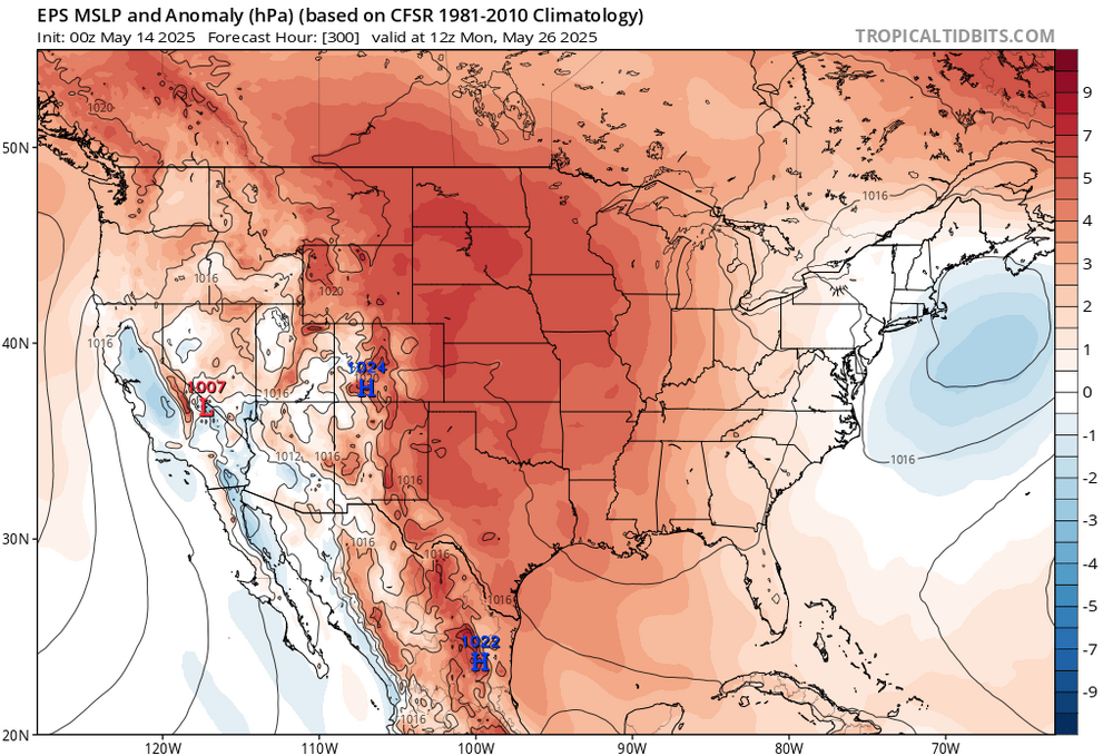
Ensembles continuing with the slow moving cutoff theme for the extended Friday to Monday Memorial Day weekend.
-
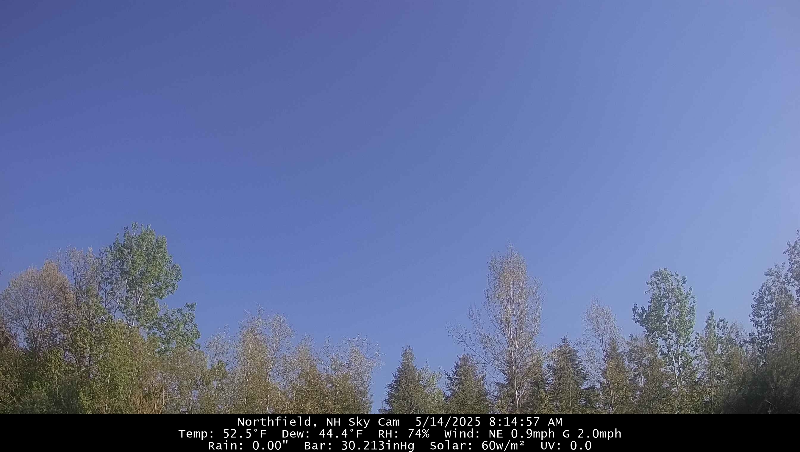
What a morning though. Nary a cloud.
-
Ecosystem changing from desert to savanna
-
Nowadays that’s like the annual rainfall total for Stephen’s City in one storm.
-
Yeah poo poo pattern.
-
Just started raining here again, another slug of moisture coming up from the south on radar.
-
Overcast here-looks like the band of rain is finally shifting NE
-
That’s why this goes beyond the PDO and ENSO. We didn’t used to get these mega Aleutian Ridges and Southeast Ridges during -PDO and La Niña intervals of the past. Plus we are getting new patterns coinciding with the marine heatwaves from the Western to Central Pacific leading to historic 2nd EOFs of the PDO. This is why the ENSO and PDO events of recent years are behaving diffferently and creating different sensible weather patterns for us. The much stronger Northern Stream of the Pacific Jet has shifted the winter storm track through the Great Lakes. So this has created the record low snowfall pattern for us since 2019.
-
1.8 inches near Reston, we’ll see if anything else can get added with a storm or two today
-
Raining here Love it


.thumb.png.4150b06c63a21f61052e47a612bf1818.png)