All Activity
- Past hour
-
Bombing out
-

Richmond Metro/Hampton Roads Area Discussion
wasnow215 replied to RIC Airport's topic in Mid Atlantic
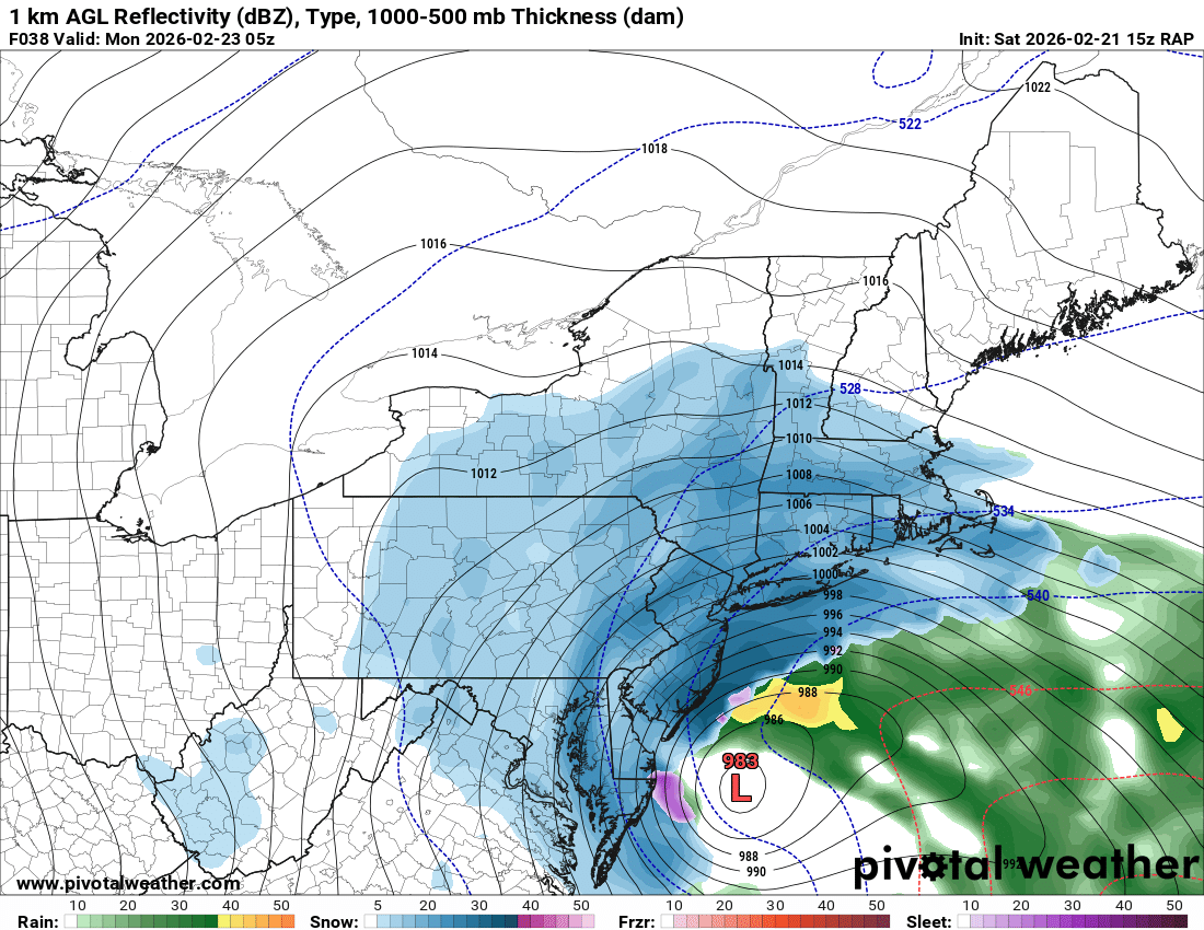
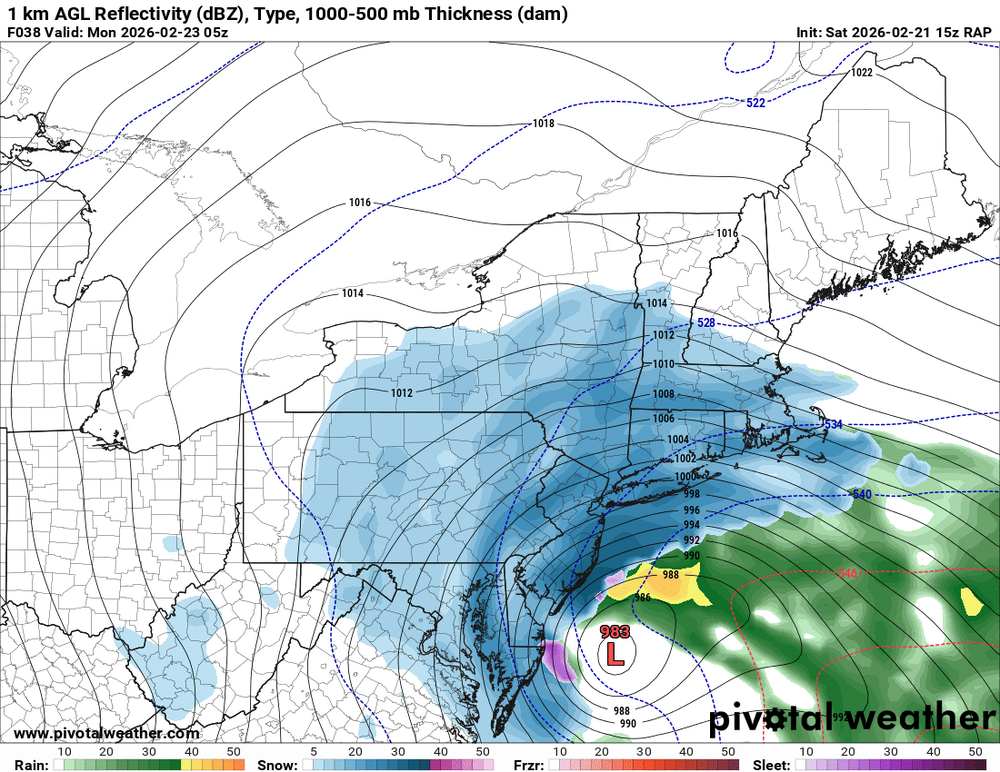
Of course it's predicated totally on the heavier bands falling after dark. The reason why I think we get several inches of snow and not just one or two is because I think a lot of the models are now showing that pinwheel effect still over RVA when the storm starts really winding up. So I really feel we could get 5 inches in spots if that happens, and on eastern parts of the area up to 7 inches but we shall see obviously -
Spoken like an intelligent and prudent Hillsboroughian....
-
IMO it’s all about when the H5 low closes. In Feb 9-10, 2010, it passed under the region. But this time it closes just a little too late for the big totals.
-
That's a real scrape job on the hi-res Canadian. The low only gets to about Wallops latitude before punting east and the CCB doesn't really start cranking until eastern SNE. I do think the NAM is obviously overdone, hopefully the goalposts hold and most end up with a nice warning event.
-
It did, very nice improvement, essentially in line with GFS now
-
Mesos tonight will help us figure out the details. Going to step away for a bit so I don’t go crazy
-
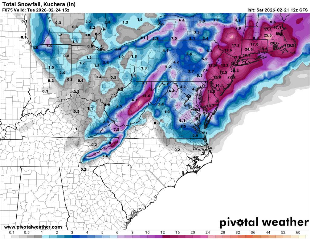
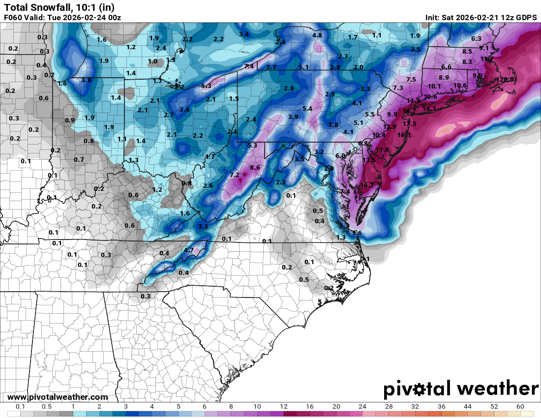
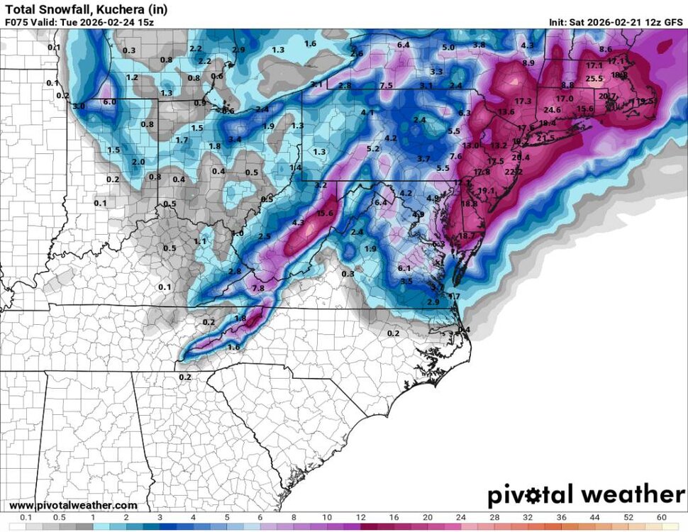
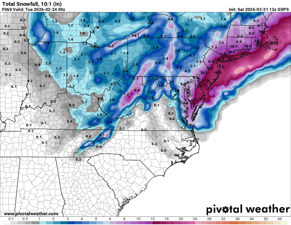
At this point mostly looking at model noise. The exact distribution of the snowfall is going to be a nowcast situation (as almost always) with areas to the east favored...but there will be outliers like the 12Z GFS showing 21" for PHL while the Canadian shows 10". No great reason to pick one depiction over the other, both are plausible in this setup. Storm bears resemblance to Boxing Day 2010 but with a less extreme gradient (as currently depicted in the modeling)...but even in that storm it wasn't purely east-west in the snow totals...and with all the blowing and drifting will be hard to say who gets what, exactly. Right now I'd forecast 10" to 20" across NJ and call it a day unless something really surprises us as the day progresses.
-
GFS is about to be 0-4 in predicting major snowstorms for DC this winter
-

E PA/NJ/DE Winter 2025-26 Obs/Discussion
Ralph Wiggum replied to LVblizzard's topic in Philadelphia Region
12z gfs starting light up for the 27th event fwiw. Close call verbatim but close enough to watch -

Central PA Winter 25/26 Discussion and Obs
Mount Joy Snowman replied to MAG5035's topic in Upstate New York/Pennsylvania
AIGFS ticked the qpf field back to the east a bit as well. -
Tick SE on the AI GFS
-
there’s an equation that needs to be balanced here. Heavier snow near the coast, but tomorrow during the day away from the cement jungle you’re gonna accumulate faster. it all shakes out in the wash, but the further you are from a cement jungle in a snowstorm with marginal temps the better off you are. Once the storm gets going and the sunsets it’s not gonna matter.
-
168hrs out, the gfs was showing a monster storm close to the BM, which looks to verify but the euro wasn't at that time. Its just going to get going north and east of DC imo. Location matters most of the time.
-

Central PA Winter 25/26 Discussion and Obs
Voyager replied to MAG5035's topic in Upstate New York/Pennsylvania
As I said, big concern, only because it has happened before. Hopefully, it's just noise, and perhaps still trends a bit west to help out true central a bit more. -
12z gfs steady as can be. Some wavering here and there but that's to be expected. Sent from my SM-G998U using Tapatalk
-
It def trended better. Euro caves today or tn
-
Yep nice shift west
-
It was but I think 12-18 is better.
-
I thought the Canadian looked great
-
This place isn’t for you.
-
That guy on FB you linked isnt hurricane Schwartz BTW thats noreaster nick
-
was curious about it being called a Miller B. doesn't really look like a B to my eye, seems like the southern wave digs down into NC whereas B would mean it originates in the Ohio Valley right?
-
Man that was the best
-

“Cory’s in NYC! Let’s HECS!” Feb. 22-24 Disco
DavisStraight replied to TheSnowman's topic in New England
I'm with you on that, others may not be.