All Activity
- Past hour
-
yes we also had a pole down overnight, at the entrance of the local school. 2 hour delay
-
Correct. If that trends into something decent…he’ll(and everybody else) will be back faster than a hobo on a ham sandwich. It’s just that simple.
-
Did we just have an earthquake? Huge boom and the office shook. Seemed way to loud for thundersnow.
-
How much did you end up with? .
-

Spring 2026 Pattern Discussion Thread
Carvers Gap replied to Carvers Gap's topic in Tennessee Valley
More snow showers this AM around TRI.- 138 replies
-
- 1
-

-
- severe
- mountain snow
- (and 1 more)
-
 Driving down 15 to Frederick and the mountain tops are all covered white.
 -
That’s a dead as a door nail. Nice. Get rid of the dead wood.
-
.
-
.
-

Pittsburgh/Western PA WINTER ‘25/‘26
RitualOfTheTrout replied to Burghblizz's topic in Upstate New York/Pennsylvania
Hazardous Weather Outlook National Weather Service Pittsburgh PA 439 AM EDT Tue Mar 17 2026 OHZ039>041-048>050-057>059-068-069-PAZ013-014-020>022-029-031-073- 075-WVZ001>004-012-021-509-180845- Tuscarawas-Carroll-Columbiana-Coshocton-Harrison-Jefferson OH- Muskingum-Guernsey-Belmont-Noble-Monroe-Lawrence-Butler-Beaver- Allegheny-Armstrong-Washington-Greene-Westmoreland-Fayette-Hancock- Brooke-Ohio-Marshall-Wetzel-Marion-Monongalia- 439 AM EDT Tue Mar 17 2026 This Hazardous Weather Outlook is for east central Ohio, southwest Pennsylvania, western Pennsylvania, and northern West Virginia. .DAY ONE...Today and tonight. The chance for snow showers is forecast to ramp up this afternoon mainly for western Pennsylvania and northern West Virginia counties. There is a high probability for getting at least another inch of snow in parts of these areas. Eastern Ohio could see measurable snow from the afternoon showers, however, it is likely to remain under an inch. .DAYS TWO THROUGH SEVEN...Wednesday through Monday. No hazardous weather is expected at this time. .SPOTTER INFORMATION STATEMENT... Spotter activation is not expected at this time. $$ Lupo Special Weather Statement Special Weather Statement National Weather Service Pittsburgh PA 849 AM EDT Tue Mar 17 2026 OHZ040-041-050-PAZ013-014-020>022-029-073-075-WVZ001-002-171600- Carroll-Columbiana-Jefferson OH-Lawrence-Butler-Beaver-Allegheny- Armstrong-Washington-Westmoreland-Fayette-Hancock-Brooke- Including the cities of Carrollton, Malvern, East Liverpool, Salem, Columbiana, Steubenville, New Castle, Ellwood City, Butler, Aliquippa, Beaver Falls, Ambridge, Monaca, Pittsburgh Metro Area, Kittanning, Ford City, Washington, Canonsburg, Murrysville, Greensburg, New Kensington, Lower Burrell, Latrobe, Monessen, Uniontown, Weirton, Follansbee, and Wellsburg 849 AM EDT Tue Mar 17 2026 ...SNOW SHOWERS REDUCING VISIBILITY... Scattered snow showers and localized heavy bands of snow will continue this morning. Visibility could briefly be reduced to a quarter of a mile or less in the heaviest snow, with a quick inch or two of accumulation. Additional snow showers and localized heavy bands will be possible through this afternoon. Use caution if traveling. $$ -
Wish I was better about recording all the nickel and Dime events we received this year, I'd be curious to see how close we are to John (definitely less than him) Flurries never stopped and still ongoing with nearly clear skies. Got down to 17 this am, currently 22 and appears we will stay below freezing today. Guessing the snow will dissappear very quickly with the sun angle Ignore the abundance of half completed projects at my house lol
- 138 replies
-
- 1
-
-
- severe
- mountain snow
- (and 1 more)
-
Aww. RIP Roger. You’ll be missed.
-
Nah, this is a good take, Chicago has some of the worst climate in America Absolutely worthless weather from Nov - April
-
Pittsburgh/Western PA WINTER ‘25/‘26
RitualOfTheTrout replied to Burghblizz's topic in Upstate New York/Pennsylvania
Its dumping heavy snow here again. Gotta love these March snow events. Might make it over 7 inches. -
-5 here this morning, house cracking again as the sun came up
-
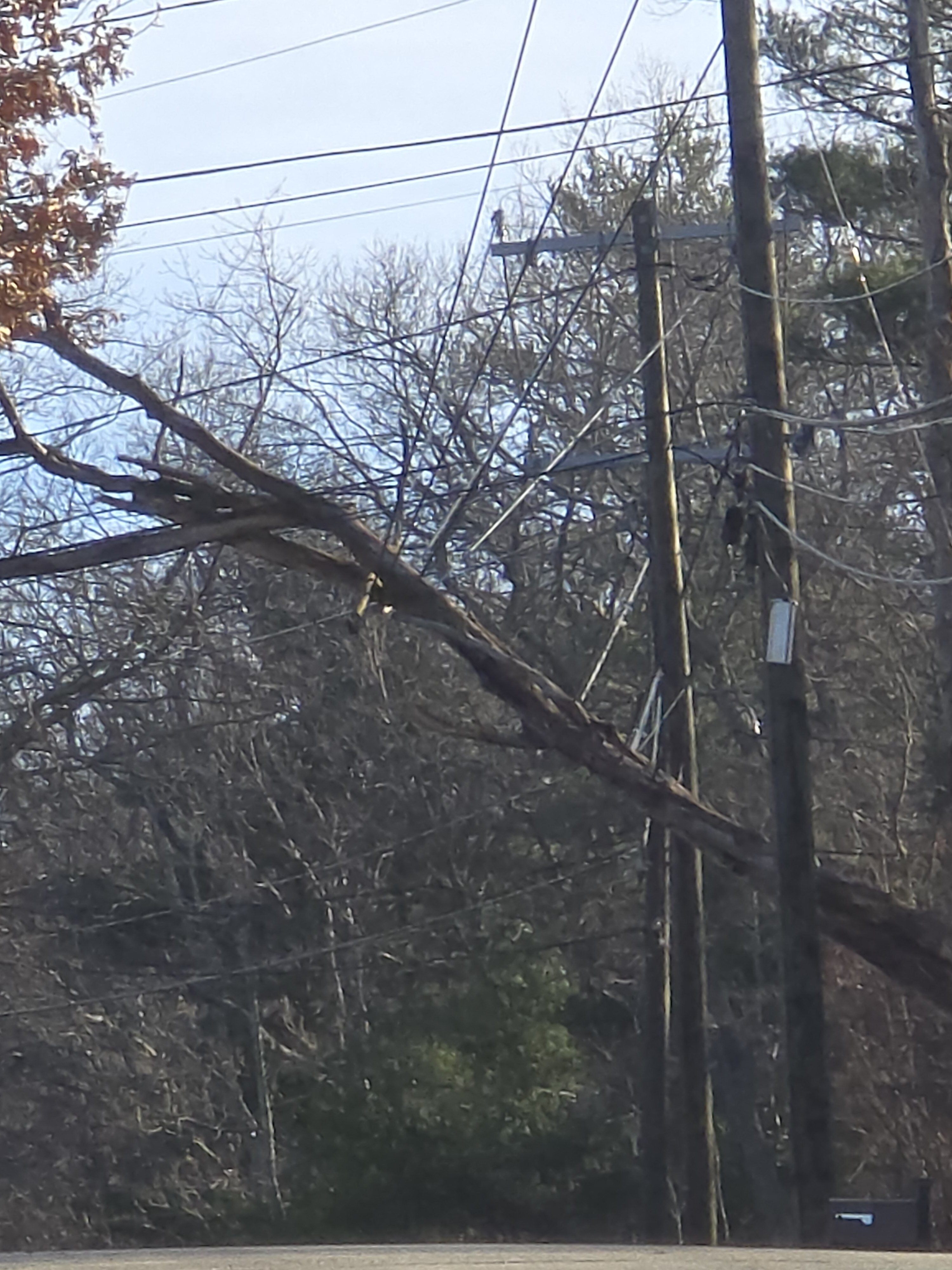
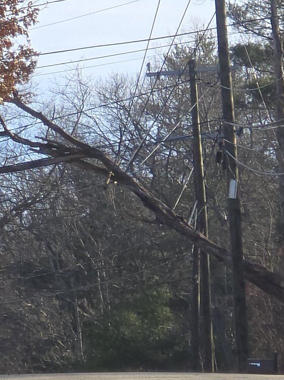
2 houses up my street
-
 The wind was ripping last night. Rattling my aging storm windows in a way we haven't heard for a bit on the second floor. Glad I don't have any big trees in my yard. We kill it with wind
 -
i hope so too, we deserve some of the action over here. i've lived out there/spend a lot of time there/relocating there again and the weird part is heat events like this usually aren't that common, you'll typically see this with santa ana winds, but this event seems to lack the classic desert wind induced madness so im excited to see what its like out there with the heat and little to no wind. for those that don't know, the santa ana winds in southern california can actually mess with your head pretty bad. restlessness, insomnia, increased anxiety. im still not sure if its placebo or if the rumor that the desert spores make you go nuts is true but i can attest that every santa ana wind/heat event i've experienced out there makes it so hard to fall asleep, even if the room your sleeping in is a cold temperature
-
From summery low 90s in some areas just a few days ago back to winter now! It was down to 32 all of the way down to parts of N FL including Cross City, Crestview, and Pensacola! KSAV was 34. Look out tonight for areas that radiate decently to have even colder lows. Some of these areas have freeze warnings for tonight.
-
RIP. Always enjoyed his posts.
-
 That place is so weird lol. That steady roar of the wind ripping through the trees last night was wild. It's been since Sandy since I've heard a steady roar like that. I haven't been out yet but I need hear chainsaws in the distance. That made the event for me. I love the little things. Give me a lion roar front and I'm happy. I'm a simple man.
- 1,041 replies
-
- 1
-
-
- severe
- thunderstorms
- (and 1 more)
-
hoping some of the east breaks off and heads east.
-
 Canaan reportimg 8" new snow this morning and still coming down.
 -
off to san diego tomorrow. will report on the heatwave for all my amwx'ers
-
Yeah overall it truly was a bust yesterday and even on air meteorologists are basically saying the same. They are taking a beating today.