All Activity
- Past hour
-
Kind of what I'm thinking but until we actually get a center to pop this is all kind of minute anyways but these shifts south with the wave are noteworthy. I wonder if the modeled size being so small is a factor in this too
-
That Saturday line is tasty.
-

September 2025 OBS-Discussion centered NYC subforum
SACRUS replied to wdrag's topic in New York City Metro
82 / 56 - warmest day in a while and tomorrow and Saturday (pending on clouds) the warmest since Aug 17th. Scattered showers/storms Fri / Say s front clears. Overall warmer - onshore will keep any chance for heat at bay much of the first part of next week with ridge north again. -
Might pull a 00z euro.
-
Eh. The question moreso is why the qpf output on the GFS is so paltry. Everything else on the same run/model points to a good soaking. GFS is selling well on another bone dry day today but dews really spike throughout the day tomorrow into Saturday. Your bias will change probably when the swamp azz returns…
-

September 2025 OBS-Discussion centered NYC subforum
steve392 replied to wdrag's topic in New York City Metro
When my dog runs around the backyard it's like watching a horse run through the wild west with all the dust and dead grass getting kicked up lol -
GFS was really insistent on the remnants bringing heavy rain/flash flooding into AZ/NM and western TX...oops
-
Too bad we don’t currently have the technology to determine the exact timing for the break up of the WAIS. Since it could lead to an unexpected faster sea level rise. More rapid melting at some point in the coming decades could become one of the big stories even for people that don’t pay much attention to the warming climate. https://www.nature.com/articles/s41586-025-09349-5 Human-caused climate change worsens with every increment of additional warming, although some impacts can develop abruptly. The potential for abrupt changes is far less understood in the Antarctic compared with the Arctic, but evidence is emerging for rapid, interacting and sometimes self-perpetuating changes in the Antarctic environment. A regime shift has reduced Antarctic sea-ice extent far below its natural variability of past centuries, and in some respects is more abrupt, non-linear and potentially irreversible than Arctic sea-ice loss. A marked slowdown in Antarctic Overturning Circulation is expected to intensify this century and may be faster than the anticipated Atlantic Meridional Overturning Circulation slowdown. The tipping point for unstoppable ice loss from the West Antarctic Ice Sheet could be exceeded even under best-case CO2 emission reduction pathways, potentially initiating global tipping cascades. Regime shifts are occurring in Antarctic and Southern Ocean biological systems through habitat transformation or exceedance of physiological thresholds, and compounding breeding failures are increasing extinction risk. Amplifying feedbacks are common between these abrupt changes in the Antarctic environment, and stabilizing Earth’s climate with minimal overshoot of 1.5 °C will be imperative alongside global adaptation measures to minimise and prepare for the far-reaching impacts of Antarctic and Southern Ocean abrupt changes.
-
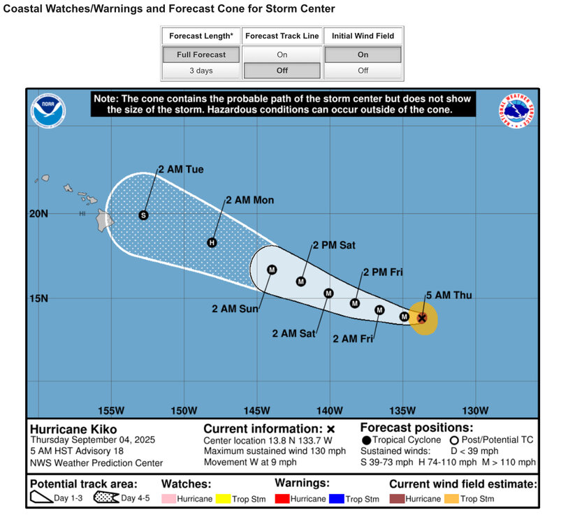
BTW Euro owned NHC and GFS for Lorena in EPAC. Luckily nobody cares.
-
Still early in the run but 12z GFS WAYYYY south with the invest moving across the southern Tropical Atlantic...that is a sizable shift south
-
Even with the GFS coming south to start the run, if I take it's position at hour 78: there have been 20 storms since 1980 to pass within 100 miles of that point in September, of which only 2 made landfall in the US, the rest recurved well east. The two exceptions are Hugo and Georges (1998). Georges moved through the heart of the Greater Antilles hitting every island along the way. It is the furthest south of this grouping in the Caribbean as well, so a track south of the islands would be unprecedented
-

September 2025 OBS-Discussion centered NYC subforum
Brian5671 replied to wdrag's topic in New York City Metro
models already drying up for the weekend as well-mostly N and W of NYC and not much along the coast -
Some strong storms possible this afternoon. Sent from my SM-G998U using Tapatalk
-

2025-2026 ENSO
donsutherland1 replied to 40/70 Benchmark's topic in Weather Forecasting and Discussion
Here's how La Niñas transition (using New York City's data) following cooler than normal and warmer than normal Septembers: In general, warmer Septembers are often followed by milder and less snowy winters. Cooler Septembers slightly favor colder winters (especially January, possibly due to more persistent forcing) with greater snowfall potential.
-

September 2025 OBS-Discussion centered NYC subforum
bluewave replied to wdrag's topic in New York City Metro
You know that we are in a drought pattern when a record upper low digging into the Western Great Lakes can’t manage to produce more than just some scattered convection here through the weekend.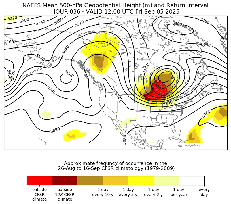
-
I get your drift. I received about 40" of my 18" from both the GFS and EURO.
-
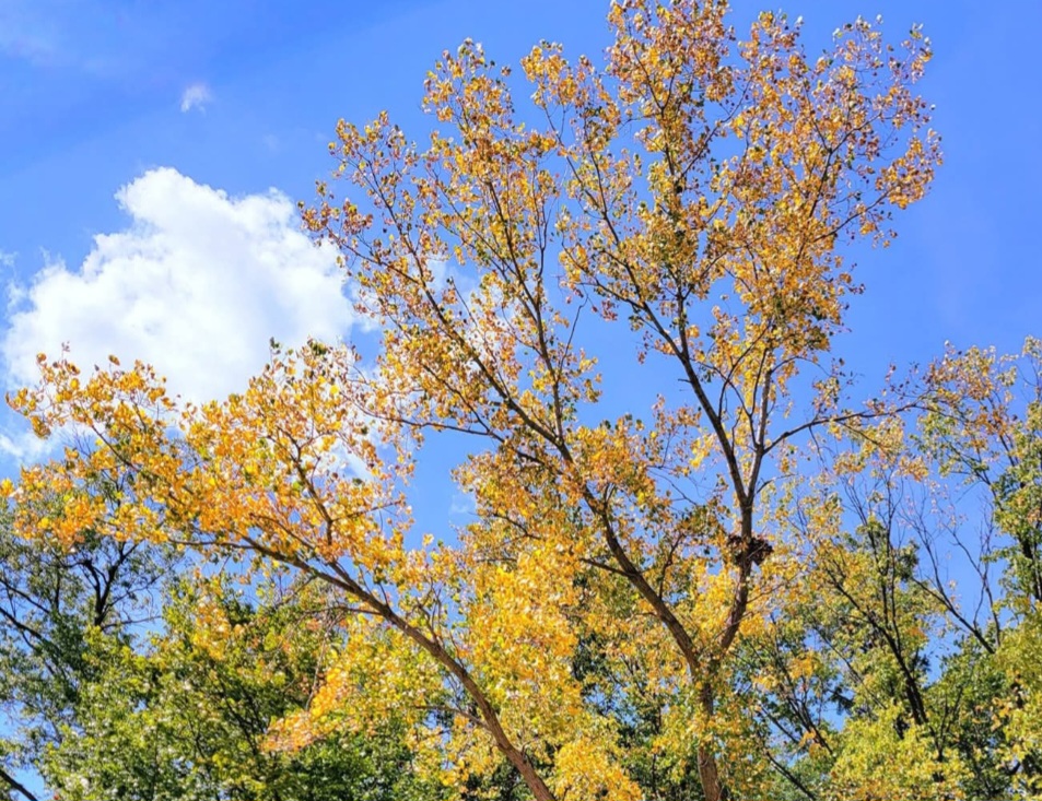
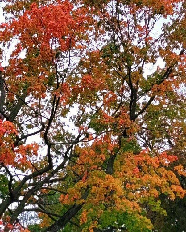
Between the dry August and the recent stretch of cool nights, the color is not wasting time this year.
-
As of this writing, I'm approaching an inch on the Day. Alot of lightning and thunder. Kmrx put a severe t storm warning out for Jonesville. It just missed my local about a mile to my South as Wallen Ridge and Powell Mountain appeared to do their thing of pulling the Storm South with their Lift.
-

2025-2026 ENSO
michsnowfreak replied to 40/70 Benchmark's topic in Weather Forecasting and Discussion
Actually, a snowy Thanksgiving to New Years would be a classic weak Nina in the Great Lakes (not sure about the east coast). The issue in recent years has been Ninas have had a tendency to flip flop Dec & Feb. -

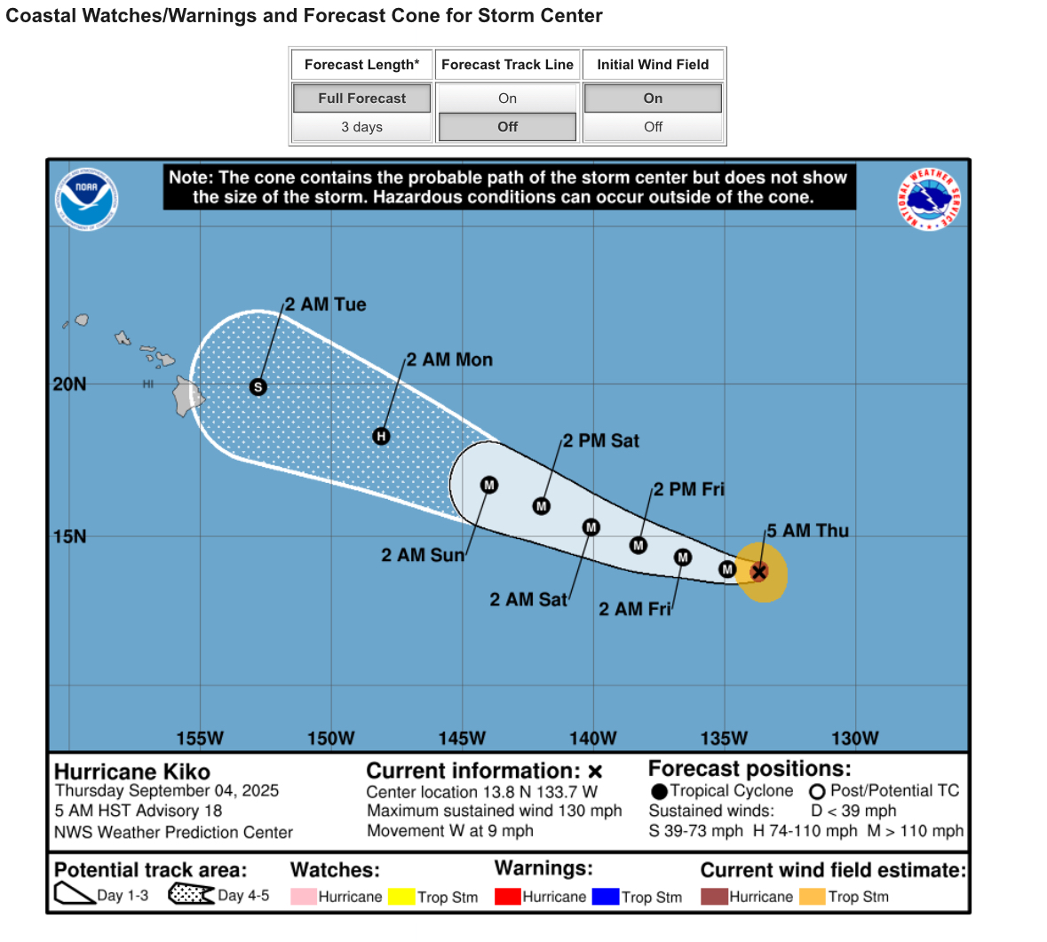
Central & Eastern Pacific Thread
gallopinggertie replied to Windspeed's topic in Tropical Headquarters
- Today
-
Hey! What's this liquid stuff falling from the sky? 64.2/59.0 and things are almost wet now, MAYBE we get a few hundredths??
-
Eric Webb posted some preliminary thoughts. Tl;dr is more canonical Nina look than last winter but with some +TNH flavor. May average AN in the SE (where he focuses on) but with some cold shots and snow.
-
Occasional Thoughts on Climate Change
donsutherland1 replied to donsutherland1's topic in Climate Change
The old record was 40.0C, which was most recently tied at Lytton on September 2 (third such occurrence on record in Canada). -
Ugh, just in time for the start of fall sports. Lets keep the rain confined to the weekdays please
-

2025 Atlantic Hurricane Season
BarryStantonGBP replied to BarryStantonGBP's topic in Tropical Headquarters
mate what are your thoughts now ensembles have been showing a gulf threat every bloody day