All Activity
- Past hour
-
Maybe it’s 24hr snow total reports?
-
Lull 11 - evening
-
First Legit Storm Potential of the Season Upon Us
dryslot replied to 40/70 Benchmark's topic in New England
May not even have to take the tractor out again today, Looks like a bit of a messenger shuffle. -

Rise of the Machines: January 18-19 Winter Storm Obs Thread
Sey-Mour Snow replied to WxWatcher007's topic in New England
It seems to me there were two bands modeled , this one albeit stronger than modeled, then the one to our NW, which still verified, so I feel like it’s going as planned. -
Congrats to everyone getting snow today
-
Meanwhile here around Madison, we just had one of most localized snowfall events we have had in a while. The original forecast for Friday into Saturday was 1-2" Friday morning and then another Friday night. Instead we had a localized Fgen(?) band setup Friday night over the I-94 corridor and just sit for about 18 hours. With some occasionally heavy rates of 1-1.5" of an hour, Madison ended up recording 5" of snow on 1/16 and 5.6 on 1/17, although the snow depth doesn't quite represent that because of settling.. This was a very dry and fluffy snow too, so we could have localized ground blizzard like conditions tomorrow with the cold blast. Thing is, this band was not much wider than Dane County. I have some snow up here, but like 3-4" not 6+. And if you go N to Portage or S to Janesville they may have like 2-3 OTG. This honestly feels like a summer MCS that forms and doesn't move and dumps 5-6" of rain in a night, but just snow instead.
-
Wtf? I mean unless there were a few flakes falling, but I didn’t see anything white. Just wet.
-
It won’t melt. 35 isn’t melting this wet snow
-
Per the radar, that lull is moving in fast but most areas in NYC should snag a total of 1" before precip shuts off. Most of it will probably melt during the lull but HRRR says light snow up until the main action later today.
-
January 18th Back Door NW Trend Snow OBS Thread
Albedoman replied to Mikeymac5306's topic in Philadelphia Region
yep I have just about 3 inches today. 9 inches in 24 hours- I will take. I am not cleaning this stuff until I see what happens this evening- it maybe all for naught. Could have 12 inches by this evening from this two day storm event on the ground the way these storms are going. Somone in the NE is going to get whacked with a norlun trough still. -
28 w/ lgt snow 1.3” new otg
-

Winter 2025-26 Medium/Long Range Discussion
OrdIowPitMsp replied to michsnowfreak's topic in Lakes/Ohio Valley
The GFS keeps Minneapolis below zero for ~72hrs next weekend. Good stuff. -
18 and SN-. Picked up a bit over 2” - heading to Wisp soon to ski for the day.
-
Rise of the Machines: January 18-19 Winter Storm Obs Thread
Typhoon Tip replied to WxWatcher007's topic in New England
this morning's band down there was supposed to be roughly SE NY to SE NH ... it's been in the models, even as near as yesterday. It seems to be situated a considerable error from where it was modeled to be, certainly for just 24 hours - little leery of this being an omen for all this business ending up SE. at this point i have issue fatigue with this event. almost suffice it is to say that i just give a shit what it does anymore. hahaha. no but i think even a 3 or 4" thing is still a relative win - obviously being that it is not a complete whiff, and it would pull those ai solutions back to reality. kind of a compromise we'll see -
Yeah and with the lull coming in soon, we'll all probably warm up a few degrees. Latest mesos took the storm east a bit, and along with it, the best dynamics. But around 4 PM, NYC is expected to start snowing again.
-
1.3 inches of new, 6.1 for the weekend, 24.7 for the season. It's nice to have a December and January that look and feel like Winter is suppose to be.
-
I read that it just changed to all snow at Dublin, GA. The radar looks good, too, regarding what’s falling/coming there. I just read 2” was measured 20 miles ESE of Macon at Jeffersonville near I-16!
-

January 2026 regional war/obs/disco thread
Sey-Mour Snow replied to Baroclinic Zone's topic in New England
@ORH_wxman how was the snowpack in southern New England for the past few arctic outbreaks. I feel like we usually are bare ground lately for them. Will hit different this time with a deep (for SNE standards) snowpack.. -

Pittsburgh/Western PA WINTER ‘25/‘26
colonel717 replied to Burghblizz's topic in Upstate New York/Pennsylvania
At least the WTOD is being depicted more south than GFS. Still 6-7 days to sort this out. Models have all been terrible even short range as you see on Josh's sight yesterday and today. -
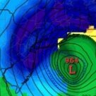
Storm potential January 17th-18th
WeatherGeek2025 replied to WeatherGeek2025's topic in New York City Metro
gm guys about an inch so far probably 3.5 inches so far from today and yesterday here in White Plains -
-3F for the overnight low. Light pixie dust snow now, should pick up around the lunch hour.
-
Nice burst of snow. About an inch down, roads snow covered out but temp has ticked up to 33. from highway cams it’s raining at the beaches and south of montauk highway
-

Rise of the Machines: January 18-19 Winter Storm Obs Thread
Damage In Tolland replied to WxWatcher007's topic in New England
That band over SW CT looks solid heading up -

Storm potential January 17th-18th
CPcantmeasuresnow replied to WeatherGeek2025's topic in New York City Metro
1.3 inches here as of 9:30. I didn't think it was accumulating either but the 26° temperatures and the constant light snow doing it's thing, 6.1 inches now for the weekend. Remember for those of us that had snow yesterday, it's not depth today it's what you accumulate today. I know it sounds silly to remind people but the "official" rules for measuring seem to change every other year.


