All Activity
- Past hour
-
Feel well soon John.
-

January 2026 regional war/obs/disco thread
dryslot replied to Baroclinic Zone's topic in New England
Ripping IMAGES -
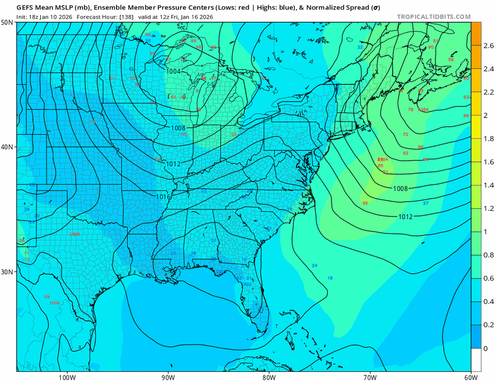
Ridin’ dirty with the gefs:
-
I wouldn’t write anything off yet, especially next weekend. But I also thought the Panthers were going to hang on and upset the Rams so what do I know?
-
I'm at 5" seasonal total in NW Baltimore County. At this point, I'll be surprised if I exceed a foot for seasonal snowfall. Sure it's a La Nina, but the base state over the past decade seems to have become extremely hostile to snow south of Mason-Dixon.
-
That too, but I think we just really need a return of the stj. Met a friend at Charles Town today and noticed the Potomac and Shenandoah looked pretty low.
-
the other ones are what matters . This has always been a light to max moderate event . Whiten things Back up
-
Man, another WC game coming down to the last possession. What a great weekend of football
-
That’s not good. Beer?
-
Too far north for us. Congrats mane snow mobiles
-

Central PA Winter 25/26 Discussion and Obs
mitchnick replied to MAG5035's topic in Upstate New York/Pennsylvania
Euro sux. No 2 ways about it. -
Awt
-
Truth
-
Make the thread Ant If anything. It will clear up the Jan. Discussion/Obs thread.
-
Oof
-
We ALWAYS have wind. We could have a 1050 high right overtop of us and we'd have 20 mph winds.
-
That last part is never a problem at my age.
-
Trough is too far north and east…like always now. But at least we get wind.
-
So, ICON was right once again?
-
We need a southern stream!
-
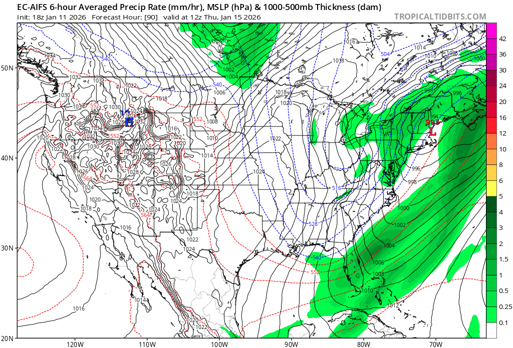
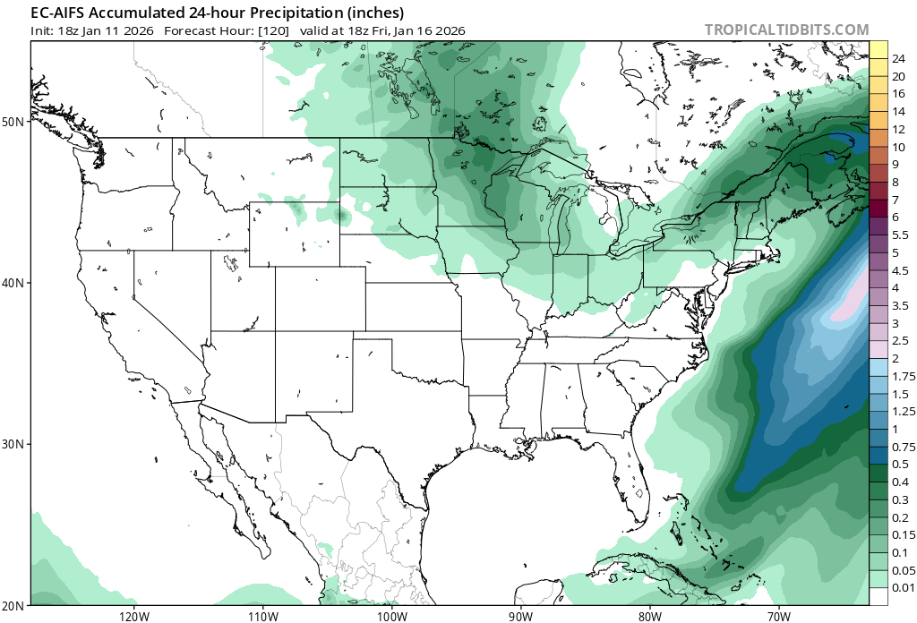
18z euro is basically a non event for next weekend.
-
As a Commanders fan I was hoping he would take over for his Dad but of course Snyder ruined that.
-
After 34 consecutive days during which it was negative, the PNA went positive today (+0.173). Whether a persistent PNA+ regime develops will have important medium- and long-range implications. Following this evenings snow squall and snow showers, modestly cooler air is returning to the region. Through midweek, highs will generally reach the 40s during the daytime and 30s for lows in New York City. Somewhat colder readings are likely outside the City and in areas where strong radiational cooling takes place. After the middle of next week, temperatures will "step down" with highs mainly in the middle and upper 30s in New York City and lows in the middle and upper 20s. Some light precipitation is possible on Friday. Rain showers could transition to a period of snow. A light accumulation is possible. Additional precipitation could arrive on Sunday. No significant Arctic blasts or significant snowfalls are likely through at least mid-January. Afterward, conditions might become more favorable for both cold and snowfall, especially if the PNA remains predominantly positive, as has often occurred following the breakdown of long-duration PNA- regimes. PNA-related developments would have larger implications for snowfall. A persistently positive PNA would have above climatological risk of moderate or significant snowfalls. A mainly negative PNA would favor mainly small snowfalls. It will likely be another day or two before the guidance reaches the high-skill timeframe for teleconnection forecasts. The ENSO Region 1+2 anomaly was -0.7°C and the Region 3.4 anomaly was -0.5°C for the week centered around December 31. For the past six weeks, the ENSO Region 1+2 anomaly has averaged -0.37°C and the ENSO Region 3.4 anomaly has averaged -0.63°C. La Niña conditions will likely continue into at least late winter. The SOI was +20.69 today. The preliminary Arctic Oscillation (AO) was -1.499 today. Based on sensitivity analysis applied to the latest guidance, there is an implied near 55% probability that New York City will have a cooler than normal January (1991-2020 normal). January will likely finish with a mean temperature near 33.5° (-0.2° below normal). Supplemental Information: The projected mean would be 0.9° above the 1981-2010 normal monthly value.
-
Like this?