All Activity
- Past hour
-
 Maybe they’re literally on fire? China interfering with smoke physics?
 -
53.4° Frigid
-
Decent haze and noticeable smell this morning. Similar to a couple years ago
-
66.2 is the warmest morning of the week.
-
Nice low dewpoint though.
-
Over 24 hours in the dense smoke now, noticeably less bird songs this am can't come soon enough
-
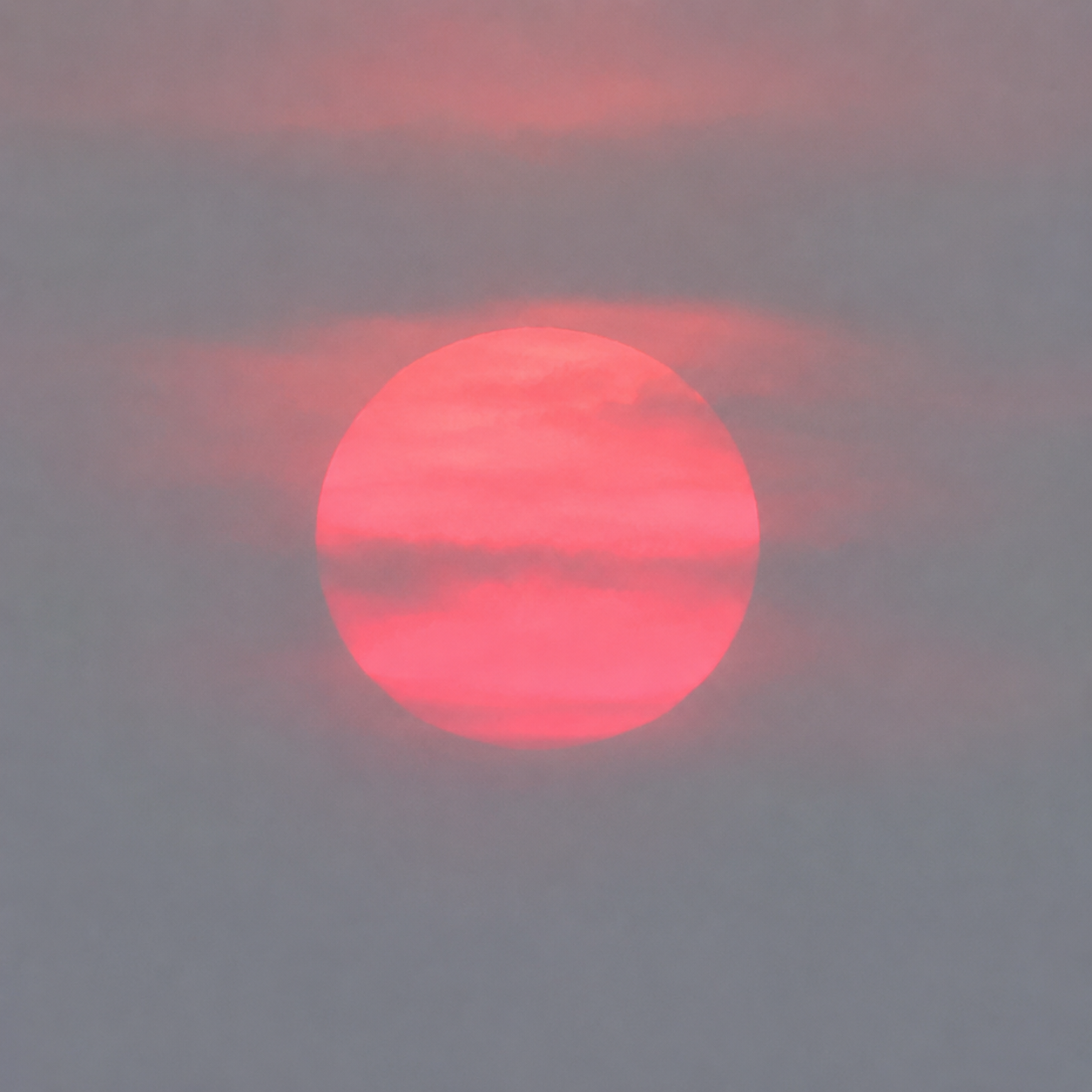
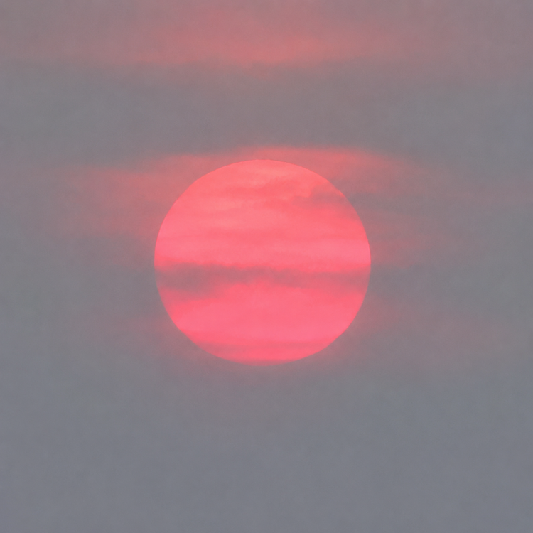
Smoky sunrise.
-
 Blue Hill is probably the best metric you can use. It’s been a torch so far. I looked at BOS. It’s drifted a little warm over the last year but nothing like it did back in 2018. I’ll keep an eye on it as we head into the cold season. That year Logan would report ZR at 34.
 -
 What about Blue Hill and PVD? It seems to lend credence to one ob when there are others supporting it to some extent, no?
 -
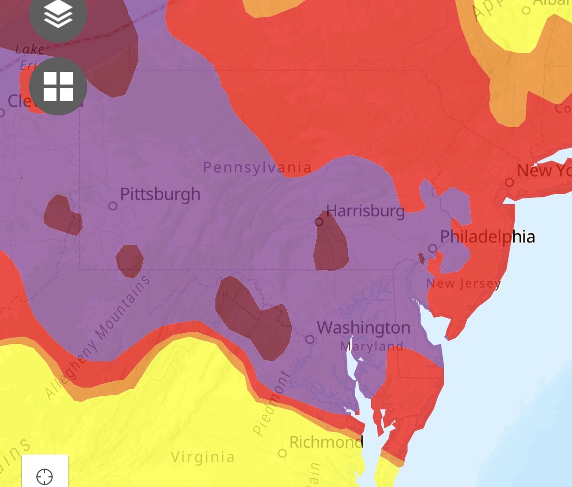
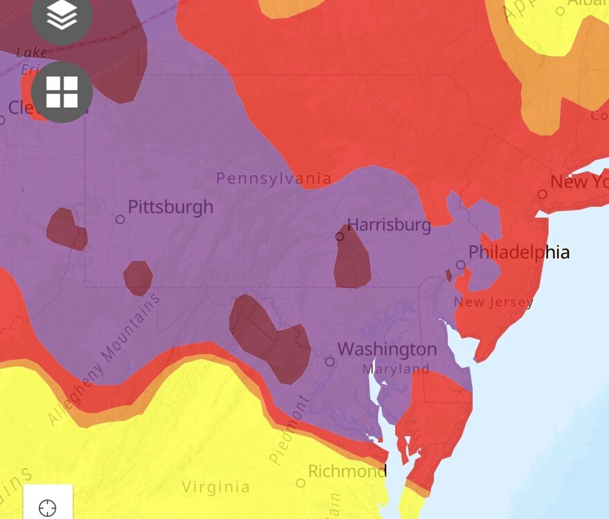
Nasty. Knew we’d go to code purple with spotty hazardous.
-
BWI has a vis of 1.75 miles. Smells like campfire out there.
-
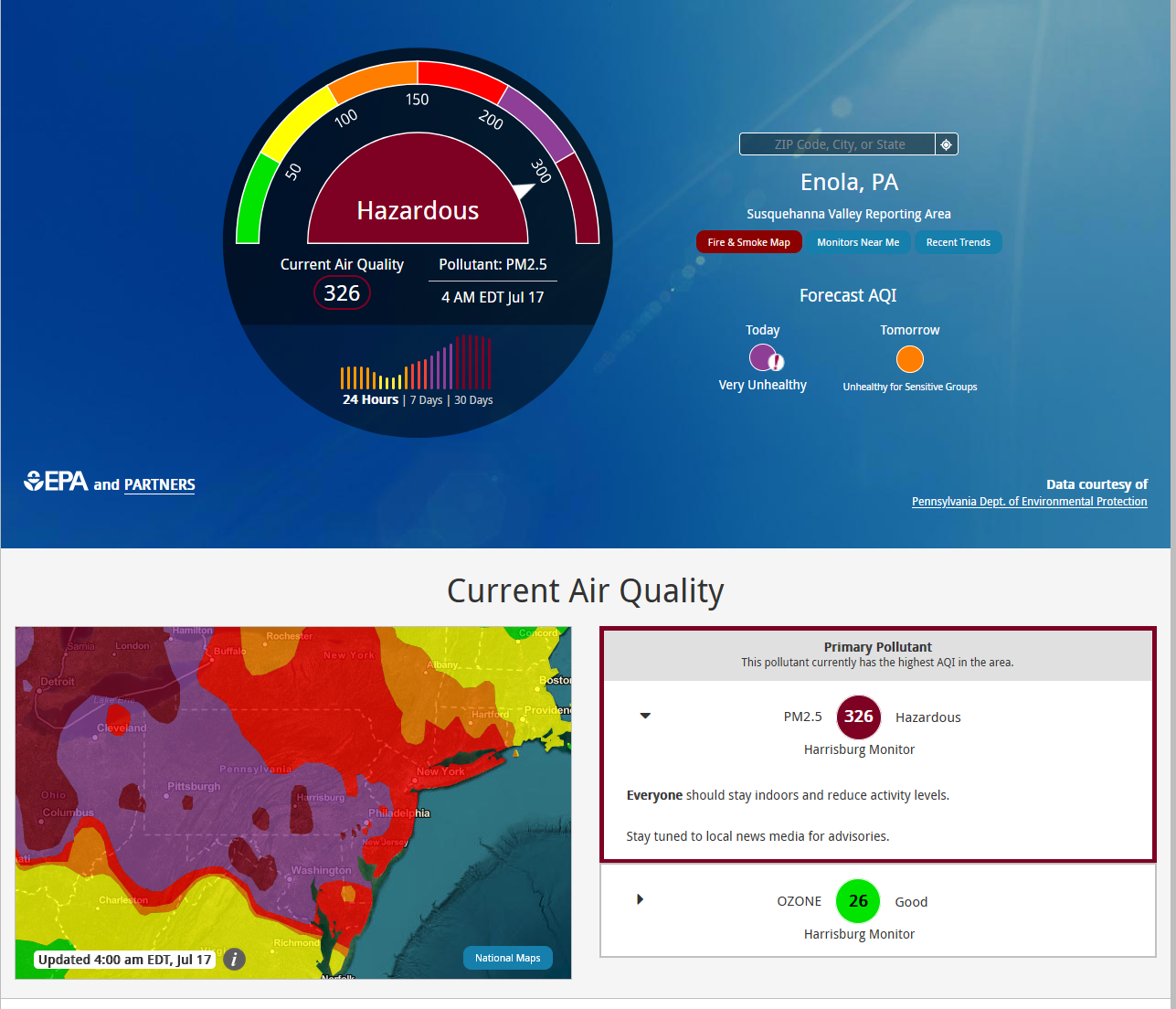
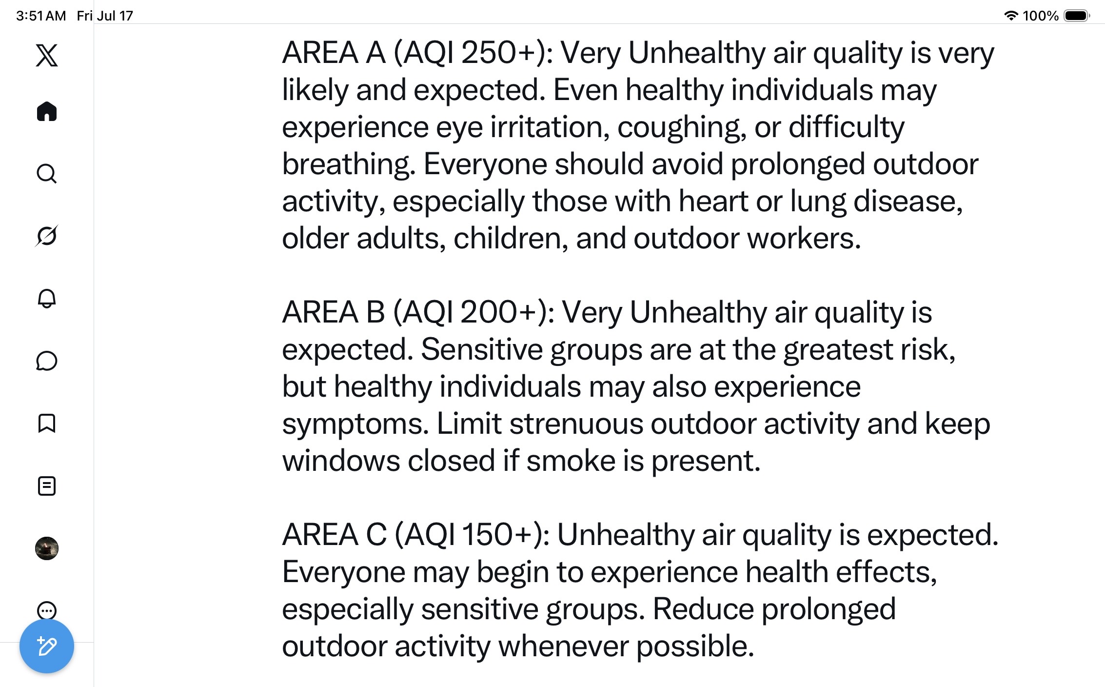
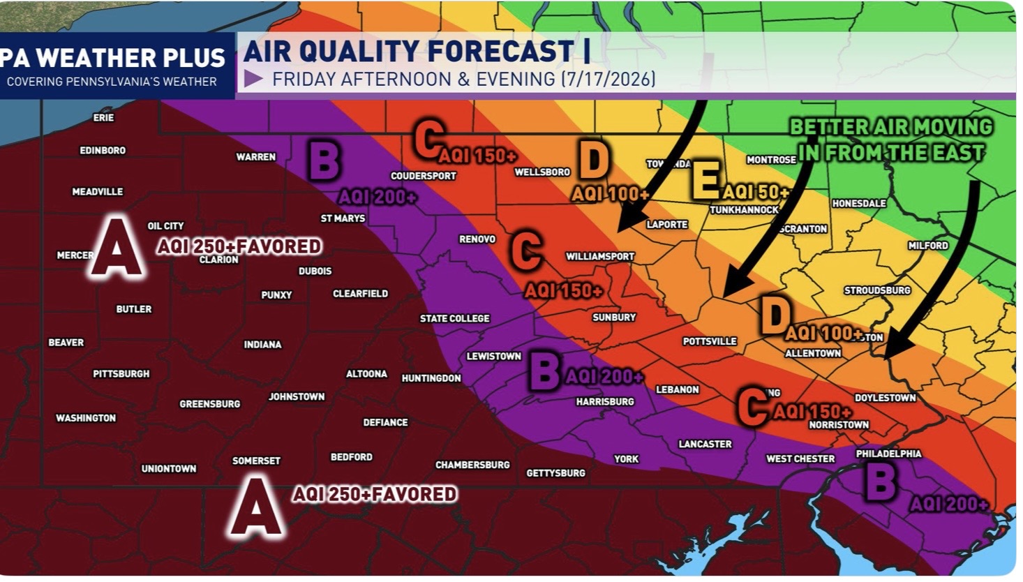
Looks like AQI ranges from 250-350 across the area. It smells horrible out. Not looking forward to working out in this today..
-
 Congrats S coast tomorrow night. That has RI/ SE MA flooder written all over it.
 - Today
-
Smoke doesn’t act like a blanket like clouds do
-
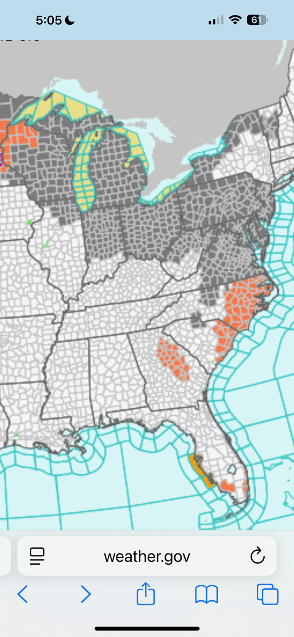
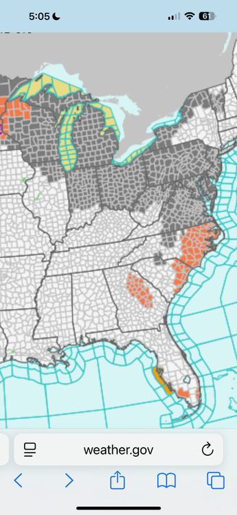
Dense smoke advisory for the Great Lakes. Don’t think I’ve ever seen that before.
-

Central PA Summer 2026 Discussion/Obs Thread
TheDreamTraveler replied to Voyager's topic in Upstate New York/Pennsylvania
Yeah looking like some naders are possible -
Central PA Summer 2026 Discussion/Obs Thread
TheDreamTraveler replied to Voyager's topic in Upstate New York/Pennsylvania
AQI was up to 350 here around 2 AM. That's probably the worst I've ever seen it here.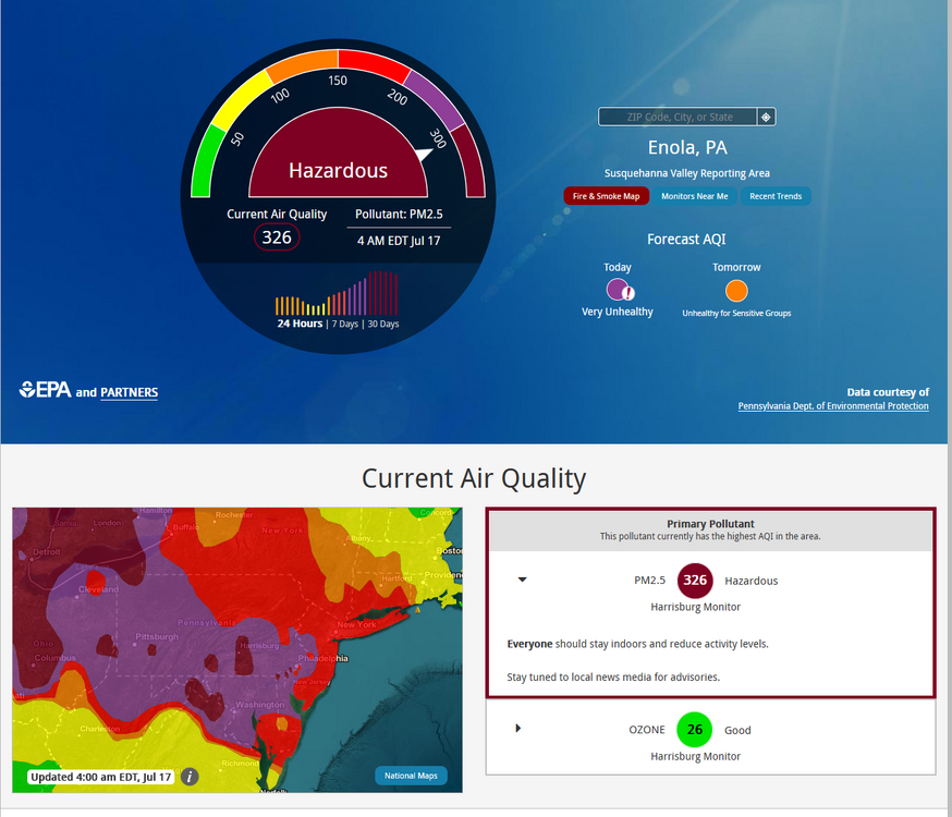
-
i hope you guys get some rain to knock that crap down.
-

Central PA Summer 2026 Discussion/Obs Thread
pawatch replied to Voyager's topic in Upstate New York/Pennsylvania
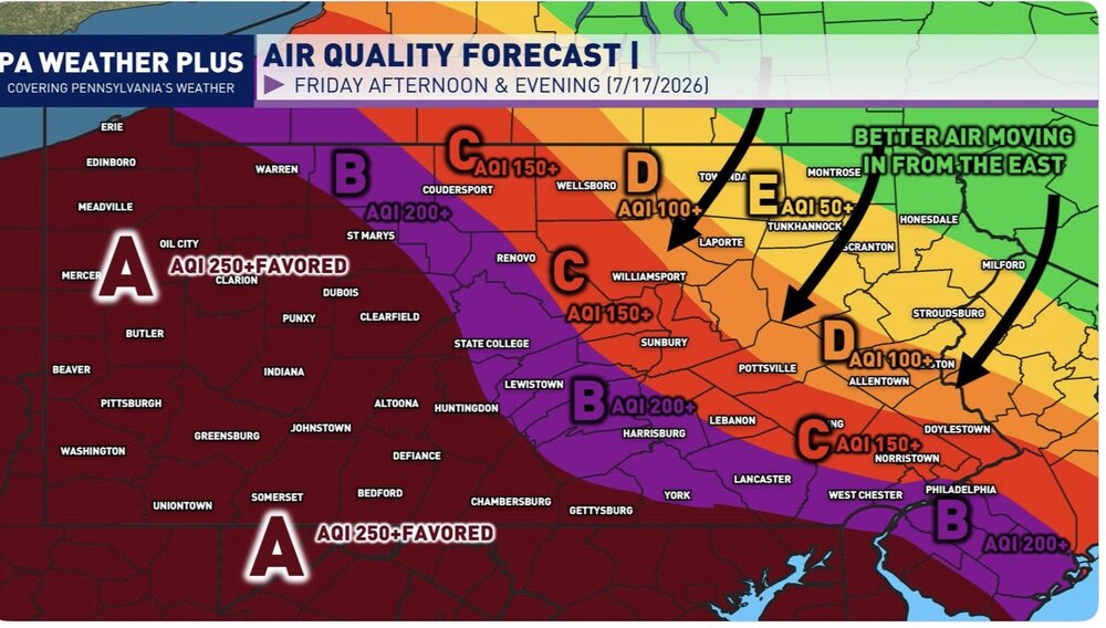
59 degrees this morning Looks like another day of smoke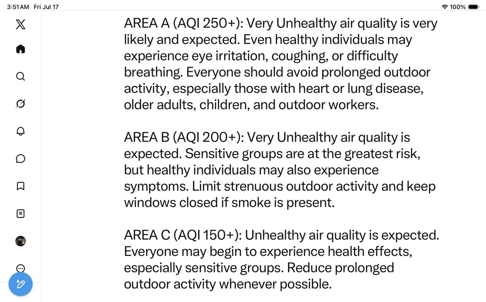
-

2026-2027 Super El Nino
Jebman replied to Stormchaserchuck1's topic in Weather Forecasting and Discussion
February 11 1983 Dale City got to enjoy 17 inches of fresh snow! I remember jebwalking in it to my immense delight! -
Just stepped outside to take the trash out before bed and it smells like straight up roasting plastic. I've never experienced something like this. Throat started scratching up in a few minutes. Wtf
-
2026-2027 Super El Nino
Jebman replied to Stormchaserchuck1's topic in Weather Forecasting and Discussion
Just for shits and giggles: How strong can El Nino get? Can it reach 7 degrees Celsius above the ENSO benchmark, or whatever it is called? I want a 15 degree Celsius Brobdingnagian Nino!!!!!! Why? Because huge amounts of rain is so much fun! I am a rain weenie, lol! For the record: We ended up with 5.9 inches in this storm cycle, I call the Mid July 2026 Storm Cycle. I might start naming the cycles, because we will have so many of them in this Uber Nino! We are now up to 34.3 inches of rain on the year! Normal FOR THE ENTIRE YEAR is 30.0. -

2026 Mid-Atlantic Severe Storm General Discussion
high risk replied to Kmlwx's topic in Mid Atlantic
Early thought is that storms will fire Saturday afternoon along the lee trough in an environment with good shear and at least moderate instability. (The NAM is likely too moist in the low levels, so toss its extreme instability). Severe will definitely be a concern, and the high PW environment may support locally intense rainfall, but the fast storm movement should prevent major flooding concerns. The potential round 2 is highly dependent upon timing. Right now, consensus seems to favor arrival very late in the evening, which leads to significant weakening (and possibly falling completely apart) before arrival. The shear will be increasing further after dark, so severe would be possible, but the timing really needs to speed up to make that happen. -
I was in NYC. Really, really unpleasant, although the smoke nicely kept the temperatures down.
-
 87F in Washington DC at 1am. Gotta imagine the smoke is playing a part in that?