All Activity
- Past hour
-
All these early 70°+ and 80°+ days makes the average days for this time of year feel much colder than they really are especially with onshore flow and clouds.
-
Happy Good Friday. Enjoy the dank, damp and cool it’s the only April ya got.
-
Probably due to the lower local resolution when trying to show regional snowfall. It would be nice if they were able to develop a map with local zooming capability. These types of maps are nice for broad overviews but not necessarily great locally.
-
I'll go with B as well; did eke out one decent snow which is a win in these parts.
-
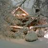
Had a little SHSN here before sunset too yesterday. Then just 32.1° and -RADZ the rest of the night.
-

Occasional Thoughts on Climate Change
TheClimateChanger replied to donsutherland1's topic in Climate Change
-
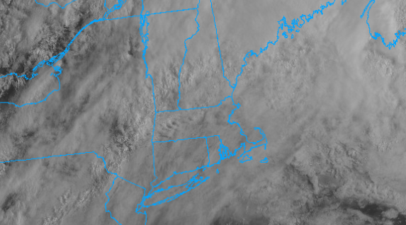
Yes the wedge is holding strong in the satellite. You can see it is starting to erode though.
-
Yeah if it makes it into the 70s here today its probably going to be towards the end of the day and brief.
-
We didn't have anything stick at my house. Rates weren't good. I didn't see much snow after dark, but I wasn't looking much.
-
1000% you could, without question. In terms of winters moving forward, I absolutely think we're in for some better times and we will see majority of winters produce versus not producing. I think too the (decreasing) AMO is going to help big time in this regard as well and may even bring back those good ole fashion NAO blocks...like true blocks in which we benefit from. I would not be surprised though if we still had some dud winters mixed in through the remainder of the decade because who knows how long it will take the atmosphere to truly respond to the large-scale oceanic changes but we should be heading in the right direction.
-
Occasional Thoughts on Climate Change
TheClimateChanger replied to donsutherland1's topic in Climate Change
-
Good luck.
-
Occasional Thoughts on Climate Change
TheClimateChanger replied to donsutherland1's topic in Climate Change
-
Wetbulbs verified a lot cooler than that in the H7-85 layer. Add in some extra cooling with convective lift and I guess it was enough to overcome.
-
I'll bet I could teach a class on that at this point even without ever having earned a met degree...theoretically speaking of course. Wholeheartedly agree on having commenced a Pacific phase shift....better times are ahead.
-
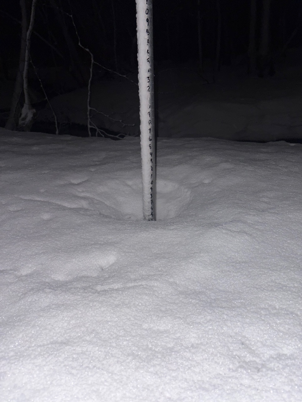
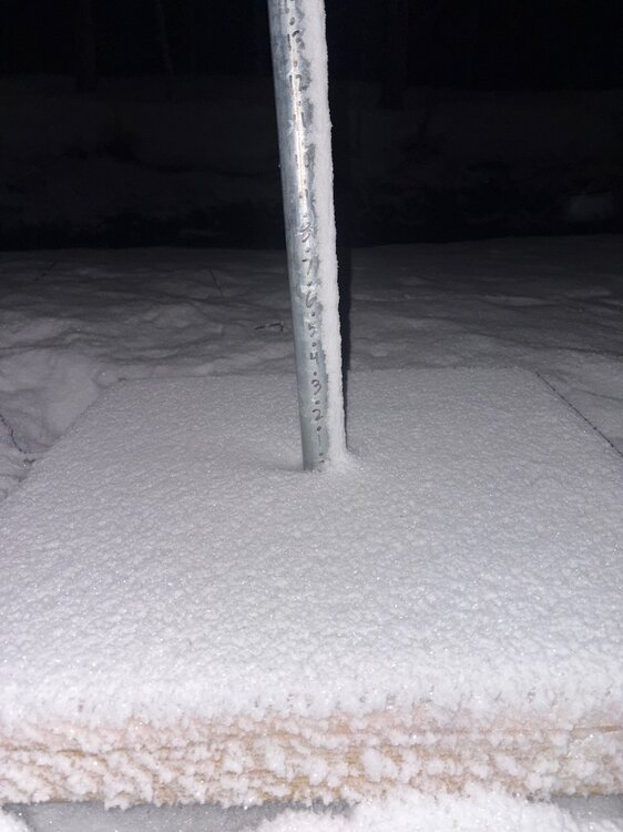
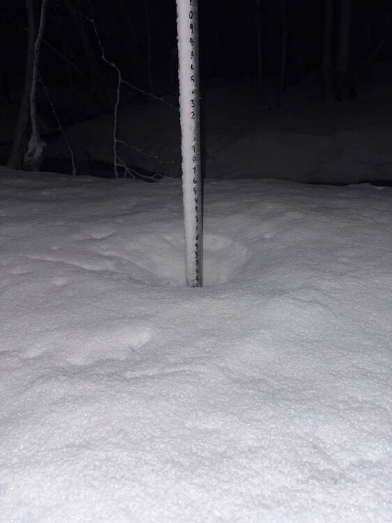
11.6" here which is 2.6" AN
-
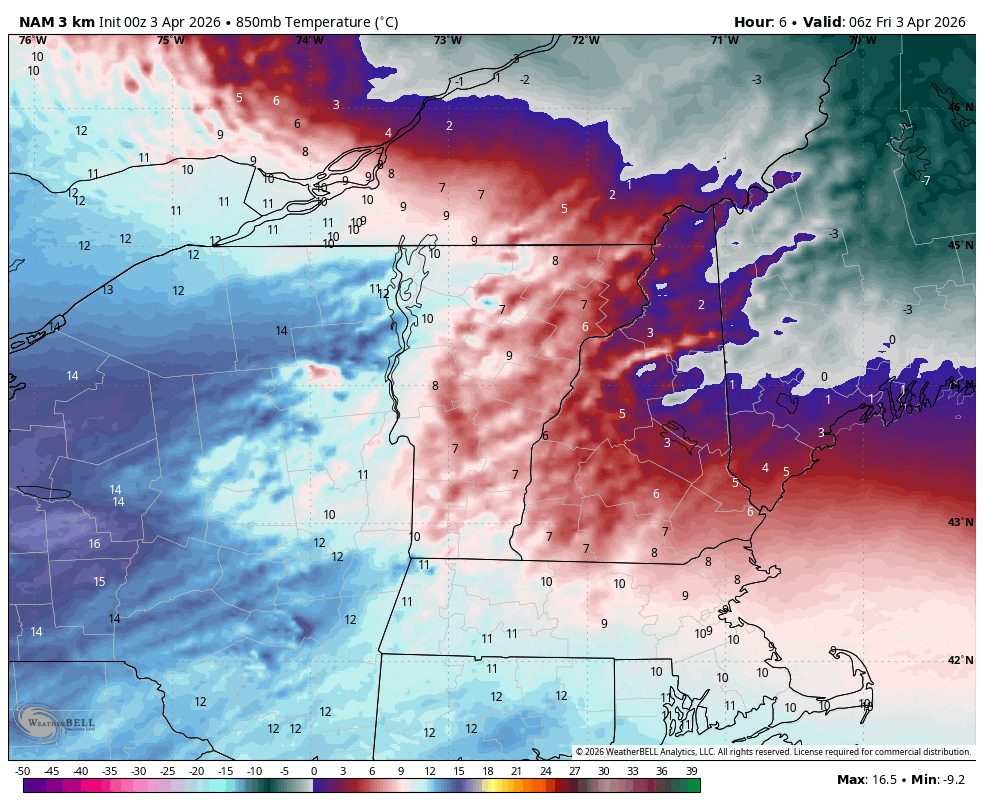
After that discussion last night… despite 850s well above 0C, we got some convection that caused rain to change to pasty snow. I’ve never seen snow fall with soundings like last night. 2am and +7C at 850mb and pounding paste in convection?

-
I have to think that we are in the beginning stages of seeing an improved PAC. But as you stated, with how warm the west PAC is there needs to be some caution in this. I'm having a ton of fun. I can't speak for other programs are, it's totally possible other programs are much more extensive with the math (but it probably depends on what you're seeking). TBH though its been a bit too easy so far, I was hoping for a bit more of a challenge. This isn't to say I am not getting anything out of it, I have learned some techniques with respect to winter forecasting, especially within the medium-range and evaluating models to help with trying to identify potential trends and model weaknesses. The section we're doing in this class though on seasonal forecasting though is really just basic stuff...going over things like PDO/AMO/ENSO/QBO but not in any great depth. But the professor is quite experienced so the real value comes from him sharing his experiences and knowledge. This is what I love most. I actually have the same professor for both classes I'm taking now and he is awesome.
-
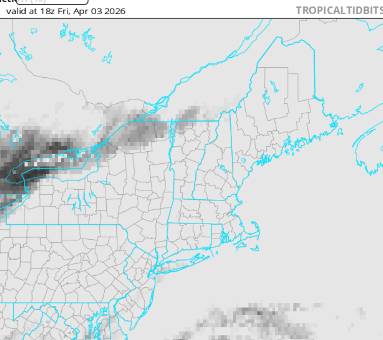
Mixing is key... The models try to warm sector everywhere S of Brian and including his latitude, which agreed ... at the moment challenges the imagination as how in the hell that can actually happen when looking at larger regional synoptic observations. Take this hi res vis loop, https://weather.cod.edu/satrad/?parms=local-Virginia-02-24-0-100-1&checked=map&colorbar=undefined Notice that wedge of very low level cloud arrow heading into interior VA. That's like a latex paint spill on a highway, imagine cloud-cars are gliding over the top of it. We are underneath that paint spill in this metaphor. In order to scour that out, the sun will help... but mixing is really needed for that to happen. Pure speculation, but I suspect that is why the meso models have been insistently cool as they have been, despite the frontal look of the models ( 18 to 00z later on...). They are telling us that there won't be enough mixing. It's like the warm sector pivots across the top never kissing the surface. Need the cold front to clean house. Tomorrow may actually be better than guidance, particularly if it clears. Ample late summer sun quality rising over a scoured out d-slope flow that isn't CAA crazy might actually make conditions anomalously good relative to having an overtop high pressure again building in from Ontario. Which by they ... - I'm just diatribing in general - odds lean away from observing a real and true wholesale warming over the eastern mid lat continent, if/while that PV continues to its relentless re-establishing presence N-E of Hudson Bay. So long as that is apparently never ever ever going to change ... eh hm, we are doomed to those over top high pressures ... almost like back building they are, bullying in and afflicting with NE-E "coldrums"
-
I would love to take a class like that, which focuses on seasonal forecasting and doesn't try to stuff Calculus 8 down your throat.
-
I've seen this forecast before. 85 today or fog and 45. Normally I'd lean towards heat wining because that’s our superpower. The only thing that can beat heat in early April is the ne wedge. Hoodie weather with drizzle it is. Fine by me.
-
1957-1958 is my early leader in the clubhouse, and then I was reminded of it when looking at CANSIPS....but we need to be leery of how the warmer west Pacific interacts with ENSO because I got duped into interpreting 2023 as a Modoki look. That being said, it should be be that bad because the Pac has improved since then...maybe something in between 2023 and 1957.
-
Doesn't look great
-
I have family that live on Fairmount right in that location. The damage was spotty but intense where it dropped down. Rain gauge is showing 2.47" so far this week. We could use a week of dry weather.
-
April 3 1999: An ice storm hits Duluth and the Arrowhead. An 800 foot television tower in Duluth collapses due to the weight of the ice. ^Note: That's the second tower within a decade that falls due to ice^ 1982: A sharp cold front causes the temperature at Lamberton in Redwood County to drop from 78 to 7 degrees. This 71 degree change in 24 hours is the maximum 24-hour temperature change in Minnesota. 1837: A snowstorm rages for four days at Ft. Snelling and dumps 9 inches. For Friday, April 3, 2026 1955 - Record snows fell in north central Wyoming and south central Montana. Billings MT received a storm total of 42.3 inches, and on the 4th reported a record snow depth of 35 inches. Sheridan WY established a 24 hour snowfall record of 26.7 inches. (2nd-4th) (The Weather Channel) 1974 - A "Super-Outbreak" of tornadoes ravaged the Midwest and the eastern U.S. Severe weather erupted early in the afternoon and continued through the next day. Severe thunderstorms spawned 148 tornadoes from Alabama to Michigan, most of which occurred between 1 PM (CST) on the 3rd and 1 AM on the 4th. The tornadoes killed 315 persons, injured 5300 others, and caused 600 million dollars damage. Alabama, Kentucky and Ohio were especially hard hit in the tornado outbreak. One tornado destroyed half of the town of Xenia OH killing 34 persons. Another tornado, near the town of Stamping Ground KY, produced a path of destruction a record five miles in width. A tornado raced through Guin AL at a speed of 75 mph. Two powerful tornadoes roared across northern Alabama during the early evening hours, killing fifty persons and injuring 500 others. Some rescue vehicles responding to the first tornado were 1987 - A storm in the southeastern U.S. produced a trace of snow at Mobile, AL, one inch at Jackson MS, and two inches at Meridian MS, the latest snow of record for those three locations. Birmingham AL received seven inches of snow, and up to nine inches was reported in northeast Alabama. (Sandra and TI Richard Sanders - 1987) (The National Weather Summary) 1988 - A wind gust to 114 mph was clocked at Ann Arbor, MI, during a tornadic thunderstorm. Thunderstorms in Michigan and Indiana spawned five tornadoes that Easter Sunday, and also produced golf ball size hail. (The National Weather Summary) (Storm Data) 1989 - Thunderstorms produced severe weather from the Southern Plains to the southern and central Appalachians. The thunderstorms spawned twenty tornadoes, including one which caused eight million dollars damage at Fort Branch IN. (The National Weather Summary) (Storm Data) 1990 - Rain and snow prevailed in the northeastern U.S., with snow reported in New York State. Boston MA was soaked with 2.91 inches of rain during the day and night, and up to half a foot of snow blanketed the hills of Steuben County NY that Tuesday night. (The National Weather Summary) (Storm Data) 2008 - An EF-1 tornado knocks down numerous tress and powerlines, destroys homes in Leawood and Cammack Village and passes directly over the Little Rock National Weather Service office. Six tornados were confirmed in central Arkansas, but no fatalities were reported.