All Activity
- Past hour
-

Septorcher 2026 Discussion - Endless Summer
40/70 Benchmark replied to Damage In Tolland's topic in New England
Lets get cloudy, cool weekend afternoons with the sound of football filling the airwaves, and the scent of smoke in the nasal passage with rake in hand. -
Septorcher 2026 Discussion - Endless Summer
40/70 Benchmark replied to Damage In Tolland's topic in New England
If I had my way, it would be drizzle and 43 all weekend, so it's fine by me. -
About .4 from the stuff that woke me up overnight. Im still mowing every 5 days-ish and im ready to pour concrete over the whole damn thing and go bronx italian.
-
.thumb.gif.f92b16c631a1d15d405ed77b33f0710d.gif)
Septorcher 2026 Discussion - Endless Summer
Torch Tiger replied to Damage In Tolland's topic in New England
three bong rips and its a 10-er weekend -
82 and totally clear now
-
Best threat over SE Pa or NW? That area is under the enhanced risk.
-

2026-2027 Record-breaking El Nino
GaWx replied to Stormchaserchuck1's topic in Weather Forecasting and Discussion
The NOAA August PDO came in at -1.11 vs July’s -1.35. This is the 2nd month in a row for which the NOAA monthly actually came in less negative than what the WCS dailies suggested (see image below). That is even more the case with August, for which the WCS averaged slightly lower than -1.5. This -1.11 compares to the significantly stronger -PDO of Aug of 2023 of -2.02: https://www.ncei.noaa.gov/pub/data/cmb/ersst/v5/v6/index/ersst.v6.pdo.dat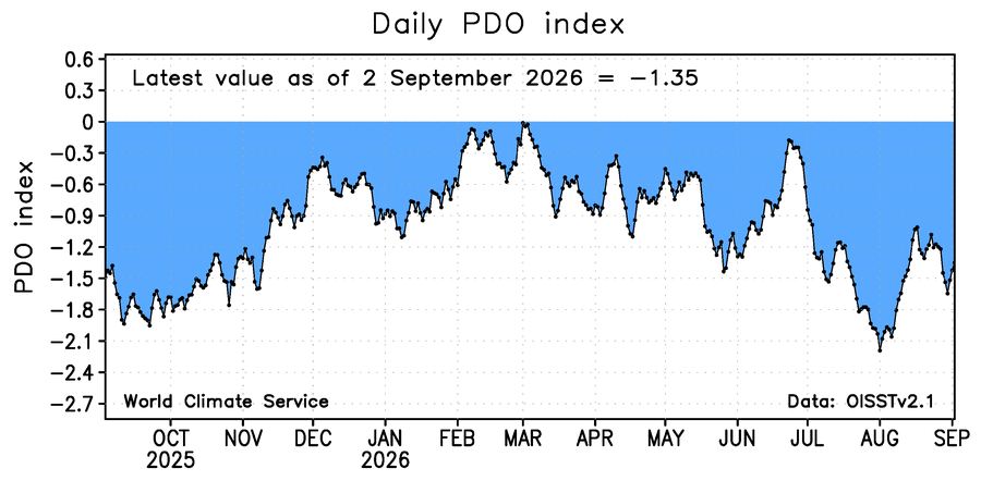
-
its already out boss
-
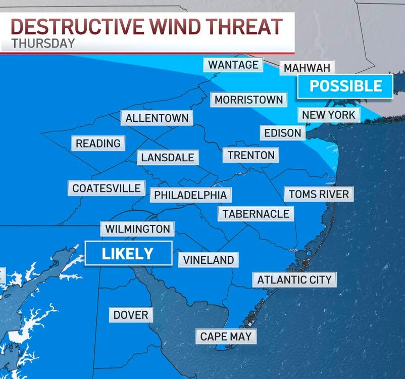
We'll see. Probably mostly south of the area
-
 no prescription needed pharmacy [url=https://quickph.com/#]foreign online pharmacy[/url] and no script pharmacy
 -
Wake me up on Halloween! I have no optimism about winter based on any hot cold flip analog. I'd like to narrow it down to strong+ El Nino years. My thinking is the Atmo is just flooded with warm air. That PDO out of phase only adds it. Probably not SER all winter; that's Nina. Absurdly mild source regions +ABNA and a stormy STJ seem likely. We got a shot at the warmest winter in recorded history. I expect ZERO snow in Chatty, probably not even a trace.
-
I was in Melbourne, Florida when Hurricane David passed over head. Only hurricane I was in the eye.
-
top-rated online pharmacies: QuickPh or best rx pharmacy online
-

2026 Mid-Atlantic Severe Storm General Discussion
high risk replied to Kmlwx's topic in Mid Atlantic
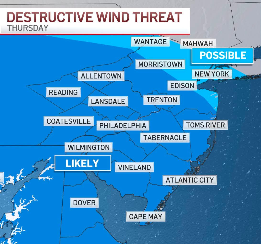
There seems to be growing consensus that an intense MCS will form over northeast OH and western PA late this afternoon and move southeast. While it (shocker) appears that the best threat will be over southeast PA, at least some of the complex should make it into northern MD and potentially into the Baltimore-Washington corridor later this evening or overnight.- 2,400 replies
-
- 4
-

-
- severe
- thunderstorms
- (and 7 more)
-
ENH risk introduced in PA/OH on 1630z OTLK from SPC
-
Thanks for your reply, John. I’m asking anyone but tagged Don only because he’s been about the most involved with me in the discussion about the Nepal disaster and thus wanted to make sure he sees this. Martz appears to be correct in saying that there aren’t going to be many days that go >0C based on my just now seeing what’s down below that I’m quoting from the link below. If ~+1C really is the warmest at 5,364 m or 17.6K feet, is there going to be significant melting way up that high? https://www.quora.com/What-are-the-highest-and-lowest-temperatures-ever-recorded-at-Mt-Everest-base-camp “Highest and lowest recorded temperatures at Everest Base Camp (EBC) depend on which camp and which dataset, but reliable observations come from automatic weather stations (AWS) installed at the South Base Camp (Nepal side, ~5,364 m) and other nearby high-altitude stations. Summary of best-available values (observations and published AWS records, through May 2024): Highest recorded air temperature South (Nepal) Base Camp AWS: about −1.0 °C to +1.0 °C on the warmest days in late spring/early summer (typically May). Many published station summaries and expedition logs report peak values near 0 °C; a commonly cited peak is ~+0.5 °C. Slightly warmer spot measurements in sunlight or lower-elevation tent sites can exceed +1 °C briefly, but sustained, instrumented air-temperature peaks at the official South Base Camp are around 0 °C to +1 °C.”
-
Septorcher 2026 Discussion - Endless Summer
40/70 Benchmark replied to Damage In Tolland's topic in New England
Crap is in the hand of the beholder. -

2026-2027 Record-breaking El Nino
soadforecasterx replied to Stormchaserchuck1's topic in Weather Forecasting and Discussion
Thank you, I am just trying to understand all of this better. So then it looks like things should start to pick up again heat wise over the next week.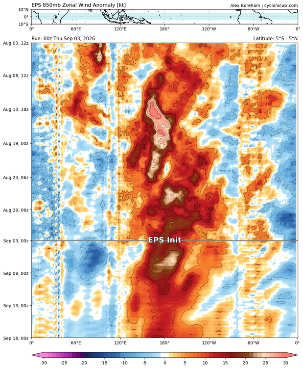
-
Well the radar sure collapsed. What a terrible, pathetic day. It feels like a miserable July evening. Any radar returns here are coming from the mosquitoes, certainly not precip.
-
2026-2027 Record-breaking El Nino
40/70 Benchmark replied to Stormchaserchuck1's topic in Weather Forecasting and Discussion
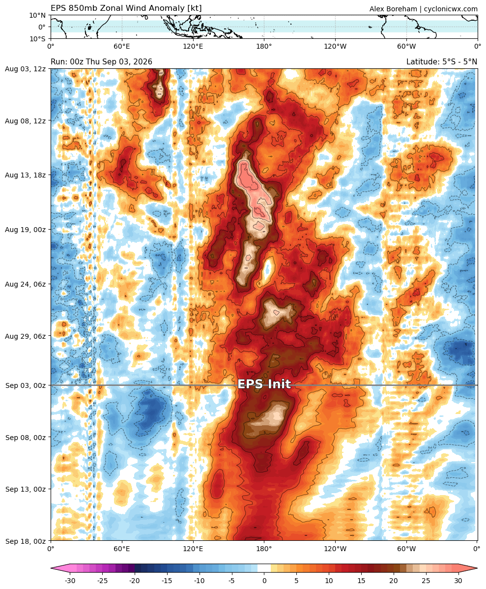
https://cyclonicwx.com/models/hovmoller/ -
0.03”!
-
What a hot mess that site is. You have to wonder if the precipitation readings are also affected as well as the temperatures. Can't tell what the tree canopy looks like but quite possible it could be affecting the rain gauge. Doubt that tree removal makes anything more than a minimal difference in temperature readings. That little plot of land must have its own micro climate going on. Thanks for the picture.
-
Its not going to make it to the forecasted high today with all the cloud cover, even with clearing arriving shortly. Current conditions at Wilmington Airport (KILG) Lat: 39.67°NLon: 75.61°WElev: 72ft. 79°F 26°C Humidity 85% Wind Speed W 14 mph Barometer 30.04 in (1016.9 mb) Dewpoint 74°F (23°C) Visibility 10.00 mi Heat Index 83°F (28°C) Last update 3 Sep 11:51 am EDT
-
Septorcher 2026 Discussion - Endless Summer
Torch Tiger replied to Damage In Tolland's topic in New England
Weekend looks kinda crappy -

Septorcher 2026 Discussion - Endless Summer
amarshall replied to Damage In Tolland's topic in New England
North wind at 18 knots is far from ideal for us beach folk.