All Activity
- Past hour
-
My backyard station confirms a wet bulb of 32. It’s gonna snow whether it accumulates or not.
-
38/22 currently
-
Congrats your wet bulb is below freezing already. I think you get an inch of snow.
-
Tell me more.
-

Central PA Fall Discussions and Obs
Jns2183 replied to ChescoWx's topic in Upstate New York/Pennsylvania
It's suppose to start by 3-4am and be done by 12-1. I'm not feeling the timing plays much into it here Sent from my SM-S731U using Tapatalk -
Dew point is favorable, too
-

First Winter Storm to kickoff 2025-26 Winter season
CoastalWx replied to Baroclinic Zone's topic in New England
Reggie looks a little better for NE MA. Ends as a little snow at BOS. -
There is a reason I let my slightly above average snowfall forecast ride even while many were jumping ship over the last 2 weeks. My gut says something is different. We will see, maybe I just ate something...
-

December 2025 regional war/obs/disco thread
TauntonBlizzard2013 replied to Torch Tiger's topic in New England
I wouldn’t hate it. If we are just going to follow the same pattern as the last several years, an early warmup would be nice -
First Winter Storm to kickoff 2025-26 Winter season
CoastalWx replied to Baroclinic Zone's topic in New England
Not sure I agree with that logic. -
Just to clarify, this is the WCS PDO, which is often ~~0.75-1.00 <NOAA PDO. So, this implies that the equivalent Nov 29th daily NOAA’s is ~-1.25 to -1.50. I estimate Nov’s NOAA PDO will come out to ~-1.75 to -1.90 vs Oct’s -2.40 and July’s -4.16, which would show the strong rise.
-
Thank you for this info
-

First Winter Storm to kickoff 2025-26 Winter season
Snowcrazed71 replied to Baroclinic Zone's topic in New England
Sh&t... At this point I'll take a coating at the end. At least it looks like something happened and it wasn't washed away. -

Central PA Fall Discussions and Obs
Itstrainingtime replied to ChescoWx's topic in Upstate New York/Pennsylvania
I think @Blizzard of 93should still do pretty well...although the mix line often ends up even farther NW than short-term models indicate. The rest of us need a thump, which is still quite possible. -

First Winter Storm to kickoff 2025-26 Winter season
moneypitmike replied to Baroclinic Zone's topic in New England
what's the best site to find soundings? I need to figure if/how much I mix. TIA -
Storm cancel December Cancel Winter Cancel
-

First Winter Storm to kickoff 2025-26 Winter season
ineedsnow replied to Baroclinic Zone's topic in New England
Looks like grid gone here -

First Winter Storm to kickoff 2025-26 Winter season
DomNH replied to Baroclinic Zone's topic in New England
Maybe? I guess if we end up with 5-8'' of paste there could be some isolated outages here and there. Doubt it'll end up being that widespread. -

First Winter Storm to kickoff 2025-26 Winter season
kdxken replied to Baroclinic Zone's topic in New England
Stein with the rain
-
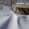
Like a salt shaker outside
-
This is perception bias. It does happen in reverse. The vast majority of our actual snowstorms were not on the guidance 174 hours out. And very often not showing that much snow...even at 72 hours. They trended into something in the last 48-72 hours... just like most of our "fantasy digital threats" trend away form something...because the truth is the odds of the guidance being exactly right from range is low. Very rarely do we get a snowstorm where the guidance nailed it from really far out. The first Feb 2010 storm...January 2016 were rare exceptions not the norm. And the reason it feels like we get way too many "false threats" is also perception bias. We register every potential threat as if "the models say it's going to snow" WHich models? Did they all? And when...did they have a threat at day 8 then lost it by day 6...which day is the one that matters...if we count every day through the whole winter where a couple models spit out a permutation with snow...as a legit threat and expect that snow to happen...that is on us...that is a failure of our perception not guidance. All that said our guidance is not perfect...its flawed...and we need to continue to work to improve our ability to forecast both with models and through other means. But you're compounding this by falling victim to typical perception biases.
-

First Winter Storm to kickoff 2025-26 Winter season
weatherwiz replied to Baroclinic Zone's topic in New England
If a heavy band materializes it will definitely rip...but the key is that lift is going to have to be vigorous enough to get into the DGZ and that could be a tough task given how high the DGZ is. But the problem here still is the thermal profile below the DGZ which would still promote some melting and degrading dendrites. I could see a scenario where radar is looking solid where the beam is intersecting the mid-levels of the storm, but ground truth is, "radar looks great but the flake size sucks". They won't have to worry about this in CNE though. But farther south into Mass it will be a problem. -

Central PA Fall Discussions and Obs
canderson replied to ChescoWx's topic in Upstate New York/Pennsylvania
The fact timing has shifted into a full daylight storm isn’t great either for those who like snow cover down here. -

First Winter Storm to kickoff 2025-26 Winter season
Ginx snewx replied to Baroclinic Zone's topic in New England
Omg snow maps. Call 5-0 -
I'm all good with a refresher snow once a week of 2-3 inches for the remainder of the winter. Pixie dust got a bit stronger in the last 15 minutes. Widespread 1-3 in N IL will hide some of the dirty snow and leaves.