All Activity
- Past hour
-
Hit 91° at ORD and 92° at MDW yesterday. ...2026 90°+ Day Tally... 16 - MDW 15 - ORD 15 - RFD 14 - ARR 13 - PWK 13 - LOT 12 - UGN 11 - DPA
-

Septorcher 2026 Discussion - Endless Summer
vortex95 replied to Damage In Tolland's topic in New England
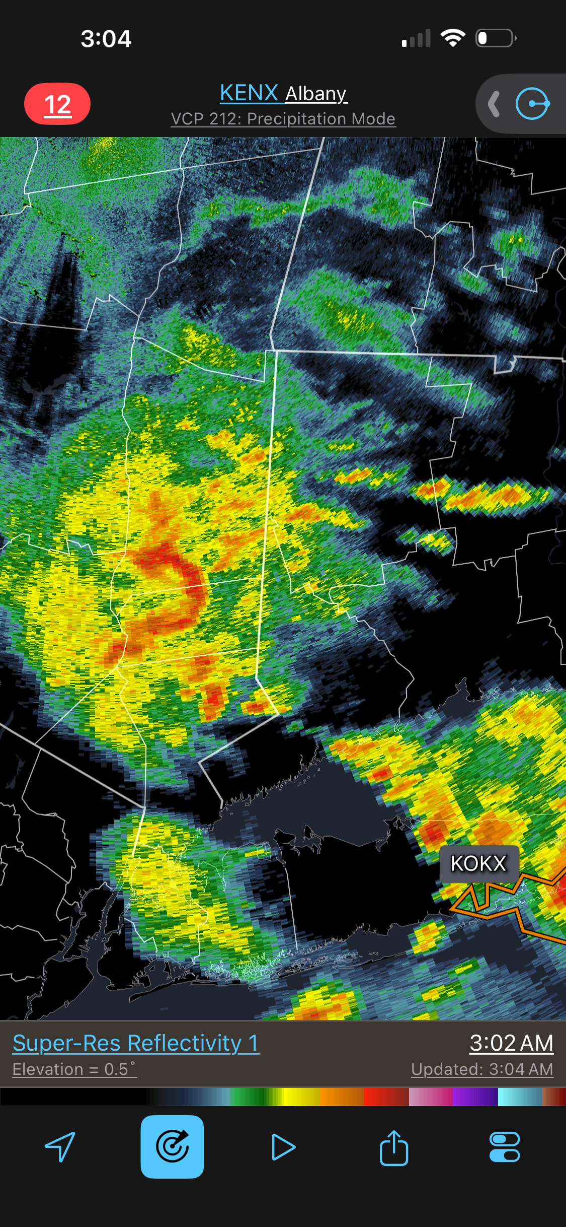
And it continues for swrn CT...
-
Storm woke me up in Setauket . Plenty of lightning and thunder so pretty classic summer tstorm adding to one rainy week in this part of Long Island …
-
 http://quickph.com/# reliable online pharmacy
 -

2026 Mid-Atlantic Severe Storm General Discussion
DanTheMan replied to Kmlwx's topic in Mid Atlantic
Saw a big tree down on the Ffx County Parkway about 1am. Some lights out as well - Today
-

E PA/NJ/DE Autumn 2026 Obs/Discussion
The Iceman replied to PhiEaglesfan712's topic in Philadelphia Region
Great point especially when you consider our last super nino in 2015-2016. That winter would have completely sucked but we got that HECS that brought 20-30” to everyone and that was an above normal winter across the board for everyone despite it being torchy overall. I think this winter will be similar. Lots of warm periods but lots of precipitation and that comes with a larger than normal chance of a big storm. If we get a big storm(12+”) it will be an above normal winter here and if not it’ll be below normal. I like looking at the last 3 supers around here(15-16, 97-98, 82-83), 83 and 2016 had the HECS so they finished above normal, 97-98 we couldn’t catch a break and finished below normal). It’s going to depend on the big dog, we won’t nickle and dime to normal or above normal this year imo. Appreciate the convo you started with GaWx! Will be watching the PDO as we enter fall. -
Disgusting outside. And of course storms falling apart on arrival.
-
Fingers crossed....toes too. Snow forecast difference this year vs what fell in 2025-26 through the end of February 2027. The UK Met Office seasonal Copernicus model, February not included. It's enthusiastic about January.
-

2026-2027 Record-breaking El Nino
ensonerd1233e343 replied to Stormchaserchuck1's topic in Weather Forecasting and Discussion
yea but it will once the aluteian low gets going in mid to late northen fall also even if it didnt that wouldnt meaningfully affect the winter fcst -
2026-2027 Record-breaking El Nino
ensonerd1233e343 replied to Stormchaserchuck1's topic in Weather Forecasting and Discussion
Thank you People are overthinking the winter -
DL is ALWAYS chasin' the Snow!
-
I crave George BM- Grade rain here in Buda! Too damn bad Austin is way too far west for the Record Nino. Maybe next time, in the early 2030s.
-
2026-2027 Record-breaking El Nino
ensonerd1233e343 replied to Stormchaserchuck1's topic in Weather Forecasting and Discussion
https://cyclonicwx.com/ -
Congrats on the Rain, DMV Region! Havin' fun yet? It's September now and the Nino's effects should be growing day by day upon the 500 Millibar pressure surface over the CONUS.
-
2026-2027 Record-breaking El Nino
ensonerd1233e343 replied to Stormchaserchuck1's topic in Weather Forecasting and Discussion
We are -
Is "nice" to you 40 inches of snow per hour?
-
canadian pharmacy world: canadian world pharmacy : online canadian pharmacy
-
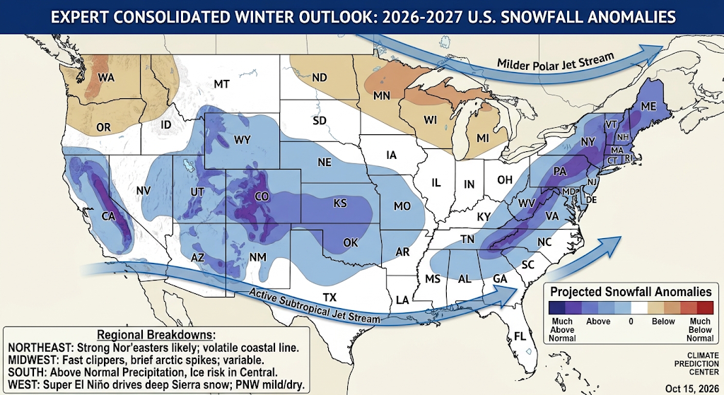
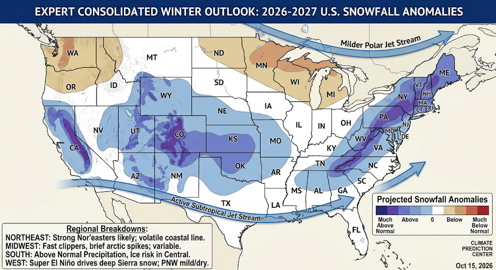
Putting this in banter rather than any actual forecast related thread since it's AI generated (based on real available data though). Just for fun. It'd be nice for many in the SE if true. Generated by AI Sub-Agent Meteorological Data Aggregation Sub-Agent 1: Oceanic & Tropical Teleconnections (ENSO, QBO, IOD) ENSO Phase: Historic El Niño active (+2.5°C SST anomaly in Niño 3.4), powering a roaring, southern-branch subtropical jet stream across the Pacific into North America. QBO Alignment: Quasi-Biennial Oscillation in the easterly (negative) phase, which destabilizes the polar vortex and increases the probability of high-latitude atmospheric blocking. Sub-Agent 2: Atmospheric Oscillations & Jet Stream Dynamics (AO, NAO, PNA) Polar/Subtropical Jet Interplay: Subtropical jet dominates the Southern Tier. The polar jet remains displaced north into Canada, but periodic negative Arctic Oscillation ($\text{AO}$) spikes allow brief arctic air drops into the Mid-Atlantic and Central states. Pacific-North American Pattern ($\text{PNA}$): Positive $\text{PNA}$ ridge over Western Canada suppresses moisture in the Pacific Northwest while carving out troughs over the South-Central and Eastern U.S. Sub-Agent 3: Multi-Model Ensemble Projections (NMME, ECMWF C3S, CFSv2) Thermal Signals: Strong warm anomalies across the Northern Tier (WA, OR, ID, MT, ND, MN, WI, MI, NY, New England). Near-to-below average temperatures across Texas, the Southwest, and the Gulf Coast due to dense cloud cover and persistent storminess. Precipitation Anomalies: Heavy moisture corridor extending from Southern California through Arizona, New Mexico, Texas, up the Gulf Coast, and along the Atlantic Seaboard. Drier conditions across the Pacific Northwest, Northern Rockies, and Upper Midwest. Sub-Agent 4: Synoptic Regional Snowfall Synthesis Sierra Nevada, Southwest & Southern Rockies: Heavy high-elevation snowfall driven by relentless atmospheric rivers hitting the cold mountain caps. Pacific Northwest & Northern Rockies: Below-average overall snowpack with elevated freezing levels and drier conditions. Midwest & Great Lakes: Reduced lake-effect snow totals due to a milder baseline airmass, punctuated by fast-moving clipper systems. Northeast & Mid-Atlantic: Active coastal track producing volatile rain/snow boundaries along I-95, but severe Nor'easters delivering heavy snow inland and along the Appalachians. Orchestrated Forecast Map Generation Combining these synoptic drivers into an authoritative, NOAA-style multi-model forecast map.This long-range forecast synthesis integrates outputs from global dynamical ensembles (NMME, ECMWF C3S, CFSv2) alongside primary teleconnections including the Historic El Niño (+2.5°C ONI), Easterly QBO, and Positive PNA. Multi-Agent Meteorological Synthesis (Winter 2026–2027) Region Thermal Anomaly Moisture Anomaly Expected Snowfall & Synoptic Impacts Pacific Northwest & Northern Rockies Well Above Average Below Average Higher freezing levels in Cascades; reduced seasonal mountain snowpack. Sierra Nevada & Southern Rockies Near to Below Average Well Above Average Heavy mountain snowpack; frequent atmospheric rivers hitting high elevations. Northern Plains & Upper Midwest Well Above Average Below Average Milder baseline airmass; suppressed lake-effect snow totals and fewer arctic blasts. South-Central & Deep South Near to Below Average Well Above Average Energetic subtropical jet stream brings heavy rainfall; severe ice/sleet risk across North Texas/Oklahoma. Central Appalachians & Interior Northeast Above Average Above Average Active storm track producing major Nor'easters; heavy wet snow inland and in high terrain. Mid-Atlantic & Coastal Northeast Above Average Well Above Average Volatile rain/snow line; frequent coastal low-pressure systems with heavy rainfall and slushy mix events. Core Driver Interactions: The record-strength El Niño enforces a stable subtropical jet track along $30^\circ\text{N} - 35^\circ\text{N}$. The easterly QBO phase weakens the polar vortex margin, periodically allowing high-latitude blocking (Negative AO/NAO) to force cold air southward into the Central Appalachians and Interior Northeast, converting loaded southern moisture surges into heavy coastal Nor'easters. What specific sub-region or ski basin would you like a deeper micro-climatology breakdown on?
-

E PA/NJ/DE Autumn 2026 Obs/Discussion
shadow_ replied to PhiEaglesfan712's topic in Philadelphia Region
That had to be the best storm I seen this summer, howling winds torrential rain and crazy lightning show power went out twice from 2 close strikes. I see they put a warning out for it soon as it was passing over. -
"Car wash" rain!
- 2,512 replies
-
- 3
-

-
- severe
- thunderstorms
- (and 7 more)
-

2026 Mid-Atlantic Severe Storm General Discussion
WxWatcher007 replied to Kmlwx's topic in Mid Atlantic
- 2,512 replies
-
- 2
-
-
- severe
- thunderstorms
- (and 7 more)
-
Septorcher 2026 Discussion - Endless Summer
WxWatcher007 replied to Damage In Tolland's topic in New England
But hey at least we’ll get some cute cumulus clouds and pop up showers this weekend -
And now the usual "vehicles stalled/stuck in high water" reports
-
Radar estimates of close to 3" near dca. Not quite enough for a flash flood but pretty impressive.
-
Now seeing an LSR of a tree into a house in the 3000 block