All Activity
- Past hour
-
Going to be awesome
-

Central PA Winter 25/26 Discussion and Obs
Voyager replied to MAG5035's topic in Upstate New York/Pennsylvania
Yeah, the wind I could certainly do without... dammit. -
Oh wow we pray
-
-
NWS has a great page for the storm. Radar loop as well as surface map loop.
-
Hope so . Morch is not a winter month so let’s warm quickly and dry
-

Outta gas and Outta Time: Early March Winter Storm finale
snowfan replied to Ji's topic in Mid Atlantic
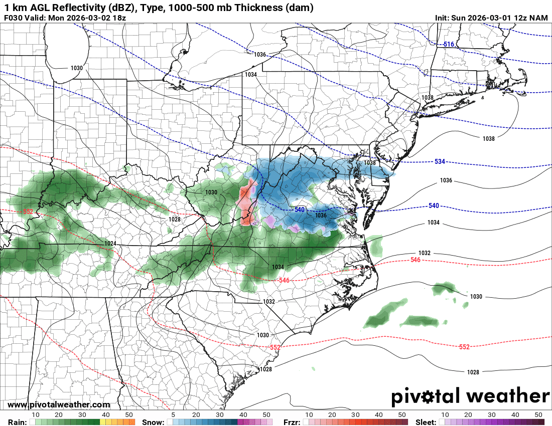
The 12Z NAM twins indicate there may be a narrow swath of light snow somewhere in the region tomorrow afternoon. Favored areas appear to be west of DC for now. This is before a potential light mix overnight into Tuesday morning.
-
Well apparently it is ... because I've been on the conservative side of how warm it will get all along, and you keep dipshittingly misrepresenting what I've been saying.
-
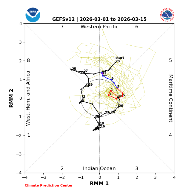
The NOAA Feb NAO will likely come in between +0.35 and +0.60. That would easily be high enough to give us still another winter without low sunspots/not near a solar minimum without a sub -0.25 NAO as I’m projecting -0.13 to -0.20, which I’d classify as neutral. My def. of neutral is between -0.25 and +0.25. It was headed to sub -0.25 as it was ~-0.45 winter to date as of Feb 14th, but the strong +NAO of the 2nd half of Feb raised the average. So although this was the closest call to finally stopping the non-negative NAO non-low sunspot combo streak, it appears we’ll still be able to say that the only -NAO winters since 1980 (only 6 of them) have been during sub 30 sunspot averaged winters.
-
Coldest winter since 2002-03, and likewise with the coldest period since August 1st.
-

Central PA Winter 25/26 Discussion and Obs
mahantango#1 replied to MAG5035's topic in Upstate New York/Pennsylvania
March has arrived with wind. Feels like winter again compared to yesterday. -
Crap. It’s snowing.
-
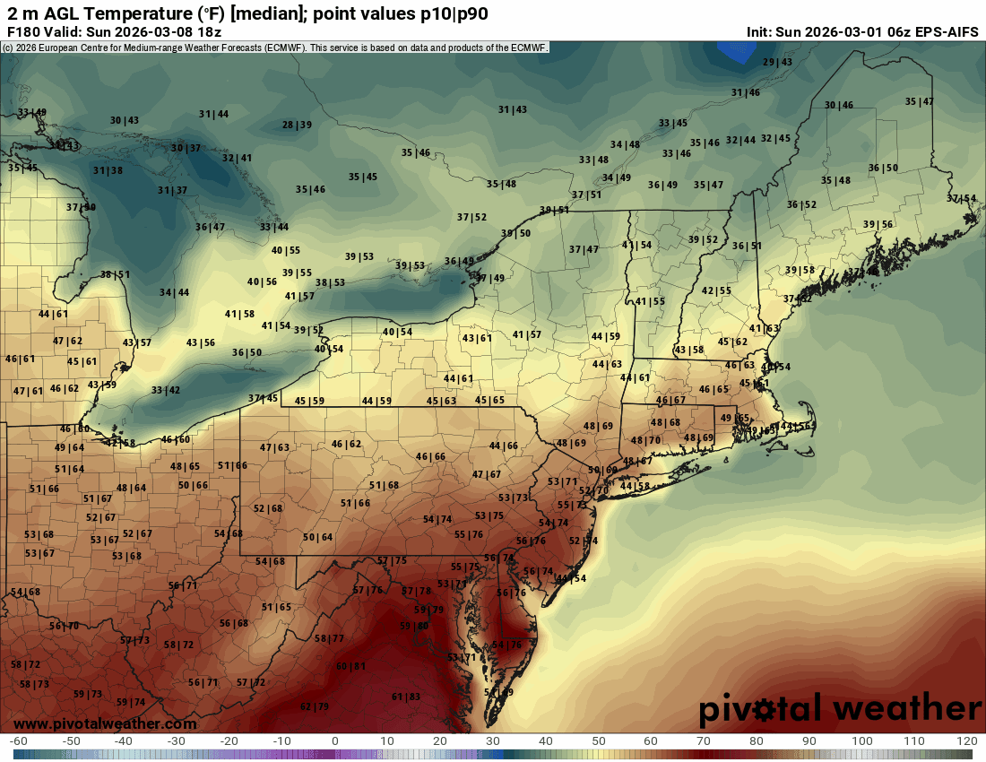
6z eps aifs are still really consistently warm though. Supposedly it’s the best guidance. We’ll see. Still a week out though…seems like we’ve been following it for weeks.

-
Seems like temps may bust high today for those further south of the M/D line? Cold air push associated w the front is still working its way through central pa. BWI is already up to 48 and DCA is at 51, while KUNV is at 30. Enjoy time outside before it arrives.
-

Outta gas and Outta Time: Early March Winter Storm finale
DDweatherman replied to Ji's topic in Mid Atlantic
They have to exist to be able to post em -
-
Like I said the other day…2012 isn’t happening. Even NNE was past mud season for that. That was a unicorn for mid March. It’s definitely going to get tainted at the surface at times even with the big anomalies aloft. I don’t think anyone expected 5+ days of 65-70+. I just think we’ll get a day or two in there where we can get more of a W component…especially SoP where the boundaries like to hang up in Wor county. Could be a dew day in there before the cold front comes through to end the warm stretch. That would eat some snow.
-
I know we've got 1 last fail in us. Let's go!
-
I learned to forecast the weather in the 1980s and 1990s when I went to college for meteorology. FOUS, MOS, gridded data, AVN and the ETA/NAM are some of the things I remember. Ensembles were just starting. How has forecasting changed since then? The AFDs are certainly different now with less analysis and more synoptic descriptions. I see the models now (HRRR, NBM, ensembles, AI) are significantly more accurate than the previous generations. If a forecaster has a different opinion than the model consensus, what tools do you use to formulate your opinion? Can a NWS meteorologist go against model guidance? Is there occasionally a need to go against model guidance? I get the feeling in the past there was more personality and subjectivity in operational forecasting than there is today. Is this true?
-
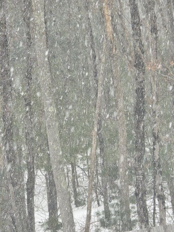
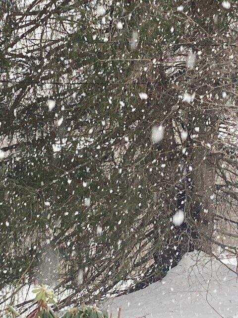
About to start as I head out. Should look pretty for an hour or two anyways.
-
Prob 1-2” per hour stuff right now but it’s gonna lighten up in a few min.
-
Yes so beautiful
-
If I didn't have radar I would be looking forward to a moderate snow storm. Lit up here
-
Seeing snow growth like this is always fun no matter how fleeting
-
Nice quick cover