All Activity
- Past hour
-

Central PA Spring 2026 Discussion/Obs Thread
Jns2183 replied to Voyager's topic in Upstate New York/Pennsylvania
Here are the links to the rest of the radar data from that day. They expire Friday I believe so if you want to download them do it now. I'm probably not going to be able to get to anything analysis wise until later this week because how busy we are. The two links I provided are for the velocity scan at 0.5° and for a longer version of the base reflectivity at 0.5°. https://www.ncei.noaa.gov/pub/has/HAS012685644/ https://www.ncei.noaa.gov/pub/has/HAS012685645/ You manage to download them and building images into a gif before Friday post the link Sent from my SM-S731U using Tapatalk -

2025-2026 Fall/Winter Mountain Thread
Buckethead replied to Buckethead's topic in Southeastern States
14 with light snow at the house. Picked up another .5" this morning. Sent from my Pixel 10 Pro using Tapatalk -
Wow… what was MRX predicting? .
-
25 degrees at work at noon. Very impressive for really any time of the season but especially in mid March when our average is 60 degrees.
-
It won't be once I move to Mars. The lack of water there however, will be a problem for snowfall. Musk has to get that solved.
-

Upstate/Eastern NY Spring Discussion/Obs Thread
gravitylover replied to U_Thant's topic in Upstate New York/Pennsylvania
Thoughts on travel conditions into the Daks on Thursday? I need to make a quick run up to Saranac and back. -
I was outside at the tail end and saw the flurries here. He was a solid poster, always thorough and professional. It's amazing that he posted right to the end and there was no indication of a problem. RIP Roger Smith
-
 Basically no tornadoes in a 15% hatched and no significant wind. It was windy and lot of little reports of a tree limb down, but not a moderate risk. Moderate would have had widespread significant damage. The previous day was only an enhanced and it was more active than yesterday.
 -
 Love the SPC, but wondering how many of those reports occurred with the ending squall line which went through after they dropped percentages. I think they were completely justified in their 4/5 risk (and twitter/public mets retroactively throwing them under the bus suck) but its also fair to say that while justified the forecast failed. A failed forecast is not necessarily a bad one though. You have to warn for the high end in case it happens, hopefully people don't think next time its a boy cry wolf situation.
 -
 lolol of course they did
 -
It's been wild all of 2026!
-

Central PA Spring 2026 Discussion/Obs Thread
pasnownut replied to Voyager's topic in Upstate New York/Pennsylvania
thats about what it looked like Saturday morning as well. We were buckin logs in a frosted landscape. TTFN snow. See you next fall....I hope. -
 Disappointed by the lack of snow pics!!
 -

E PA/NJ/DE Spring 2026 Obs/Discussion
JTA66 replied to PhiEaglesfan712's topic in Philadelphia Region
Yes, severe thunderstorm warnings were issued as the front approached and we were also under a wind advisory until 2am. But again, I think because local news made such a big deal about it (and understandably so, cause the threat was real), most people let their guard down around sunset because not much had happened by then. Of course, us weenies knew until the front came through later last night, we weren't off the hook. -
Two day event total here was 1.33". Trace of snow on the deck this morning. Didn't see it fall but per radar the rain ended as a brief period of light snow or flurries overnight. Winds howled from late afternoon yesterday right up until daybreak. Sad to hear about the passing of Roger Smith who posted in this forum. Always seemed like a gentleman and a knowledgable guy. As someone pointed out he posted up until the day of his passing. We never know when we or someone we love will see their last sunrise or sunset. Embrace the day.
-
I hope you’re right. Actually, I want a Bermuda High. The west coast needs precip anyway.
-
Cold day 34 here in midtown! Not loving the cold, if it's not going to snow anymore I want warm weather
- Today
-
 I’ll be happy to monitor snow showers at home with a green beer in hand.
 -
Not this early. It sucks.
-
(002).thumb.png.6e3d9d46bca5fe41aab7a74871dd8af8.png)
Central PA Spring 2026 Discussion/Obs Thread
ChescoWx replied to Voyager's topic in Upstate New York/Pennsylvania
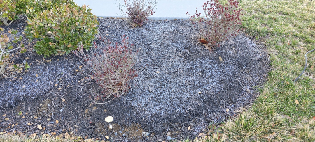
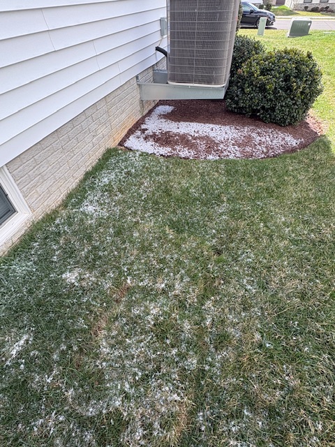
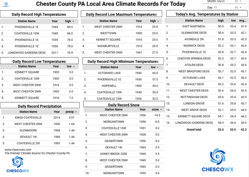
Breezy and unseasonably cold weather today with some snow flurries possible this afternoon into the evening. There will be a hard freeze tonight so protect any plants that you may have put outside already. We will continue with below normal temperatures through Thursday (upper 30's to upper 40's) before we moderate to nearly normal both Friday and Saturday (low to mid 50's). Our next chance of rain or snow looks to possibly arrive on Friday night. We will fall back to below normal temperatures by next Monday.
-
E PA/NJ/DE Spring 2026 Obs/Discussion
ChescoWx replied to PhiEaglesfan712's topic in Philadelphia Region
Breezy and unseasonably cold weather today with some snow flurries possible this afternoon into the evening. There will be a hard freeze tonight so protect any plants that you may have put outside already. We will continue with below normal temperatures through Thursday (upper 30's to upper 40's) before we moderate to nearly normal both Friday and Saturday (low to mid 50's). Our next chance of rain or snow looks to possibly arrive on Friday night. We will fall back to below normal temperatures by next Monday.
-
Anyone else tracking the potential snow showers this afternoon? HRRR seems insistent some make it over the mountains