All Activity
- Past hour
-
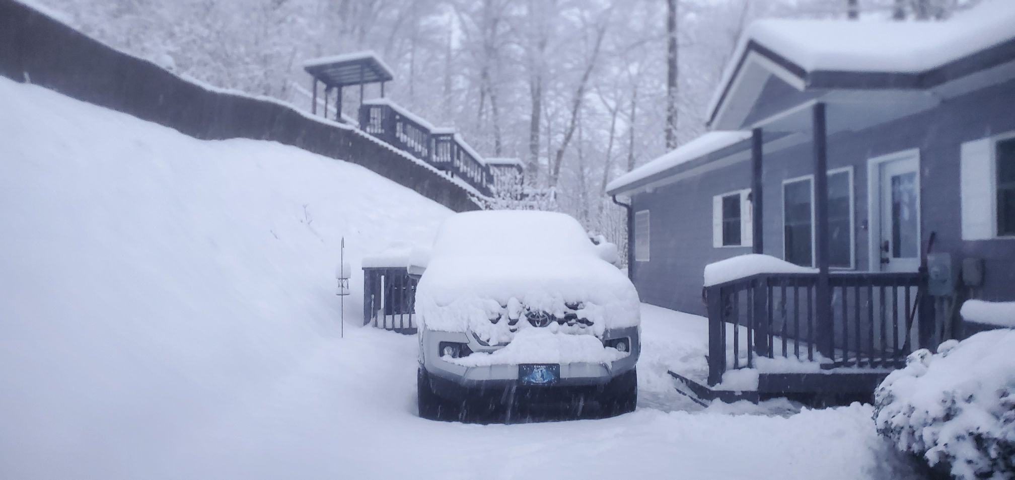
Its cold. Just got back in from feeding all the animals (Horses, Chickens and such). 23 currently with small gusts of wind. should be at an 1" if not more. But its raking with below 1/2 mile vis
-
 Lowpressure1 changed their profile photo
 -
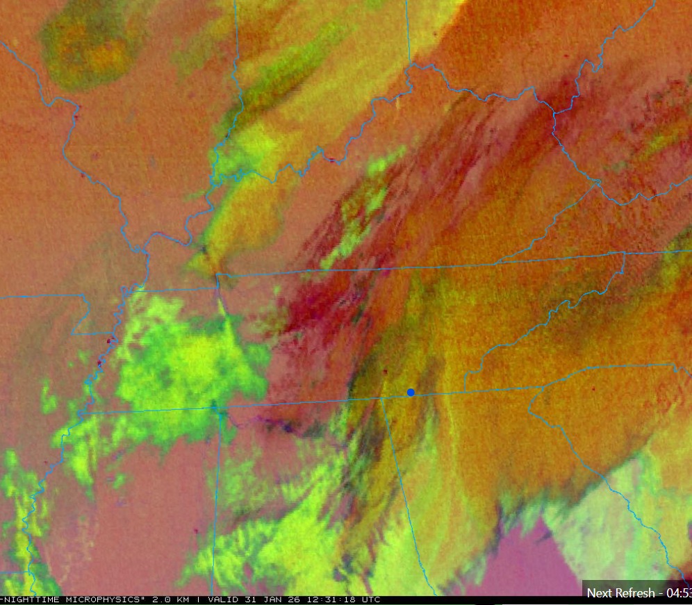
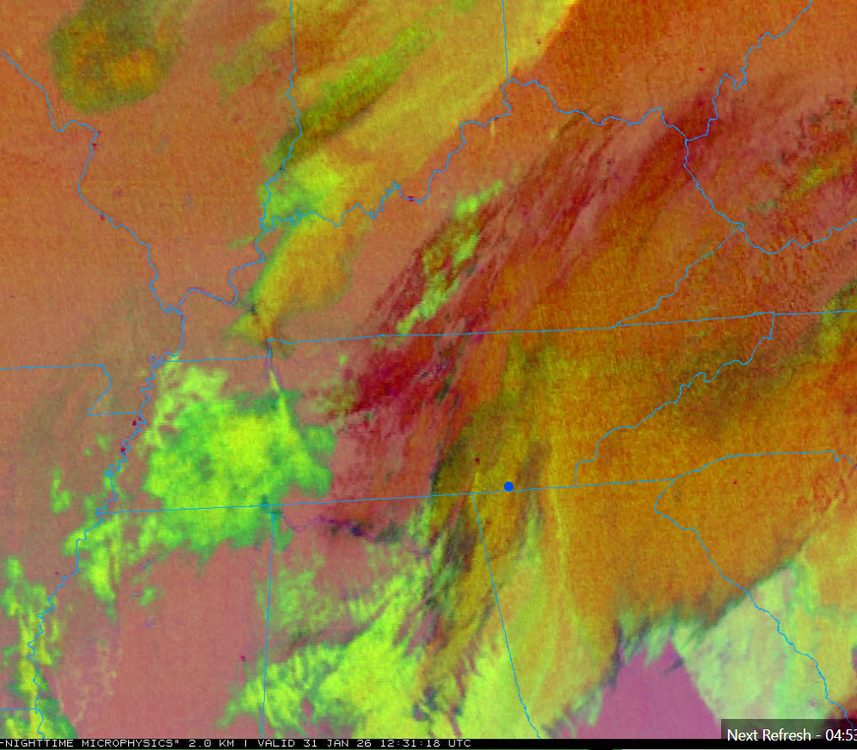
Per OBS thread, KCHA lower elevations has another couple hours as the last lobe on radar comes through. Shows as multi-layer clouds on Satellite (below) just coming in, and following the overnight round now east. Signal Mountain and points north especially the Upper Plateau should have good snow showers all day, some moderate north, in the moist low-level flow beneath cold core aloft. Several hours of steady snow will continue farther east in the Winter Storm Warning areas. Then any upslope areas will have snow showers well into tonight with the upslope half of the event. Mountains will still go hard overnight and probably still have snow showers going Sunday morning. Cold upper-level low is just swinging into northwest Tennessee at this 12:30 UTC shot below. That'll keep things going
-
Also, the pattern on the GFS for the next two weeks looks great. Doesn't look like this will be our only one!
-
Agreed. The atmosphere needs some time to reorganize I guess.
-
Down to 11.
-

January 30th- Feb 1st ULL and coastal storm obs
sakau2007 replied to JoshM's topic in Southeastern States
Henegar in Dekalb County, AL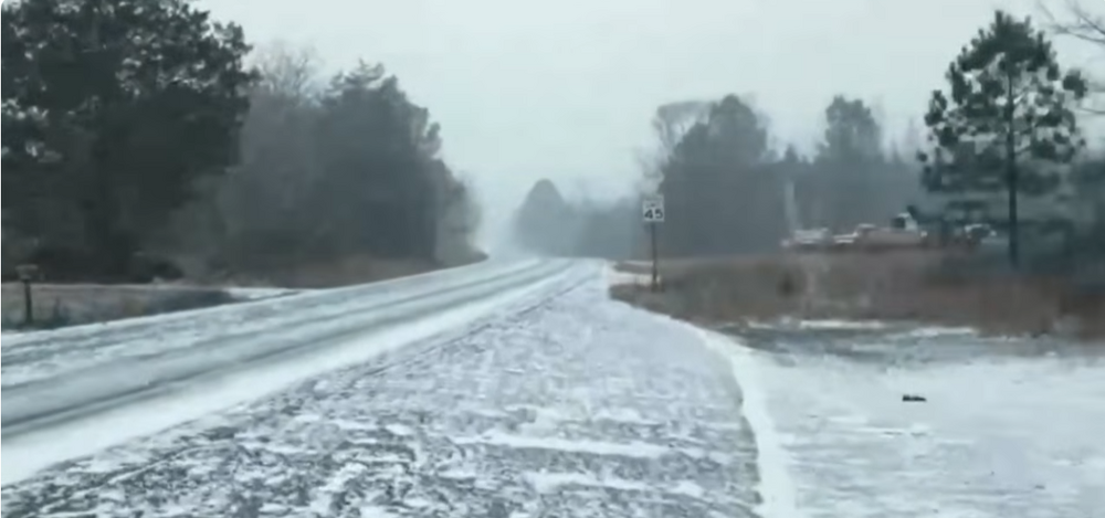
-
January 30th- Feb 1st ULL and coastal storm obs
Lowpressure1 replied to JoshM's topic in Southeastern States
26.7F With streets starting to turn white. Steady light snow. -

2026 Foothills thread
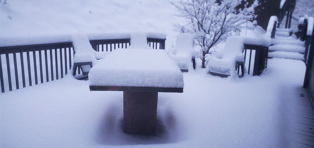
Northern Foothills Snowman replied to strongwxnc's topic in Southeastern States
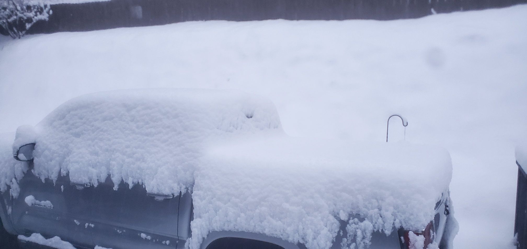
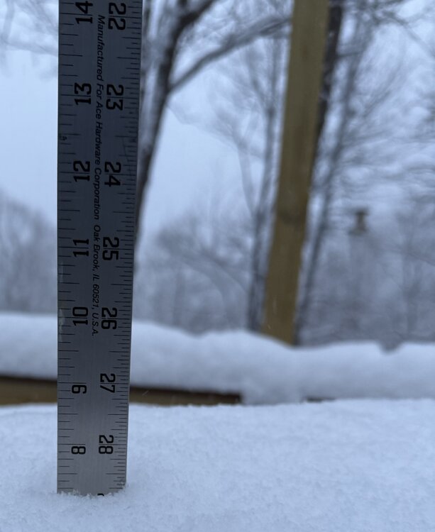
Attached is our front yard and measurement. Almost 5 in and still snowing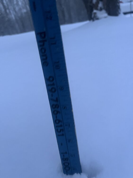
-
This storm is cranking. Snow almost to Southern Alabama. That was on none of the models if I remember correctly.
-
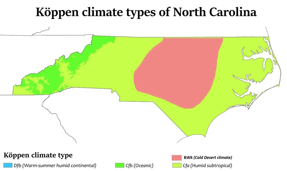
New climate classification just dropped:
-
The “I bring the mojo” Jan 30-Feb 1 potential winter storm
Lowpressure1 replied to lilj4425's topic in Southeastern States
Props to Brad P may be in order for calling out the dry slot-even though not a very popular call. -

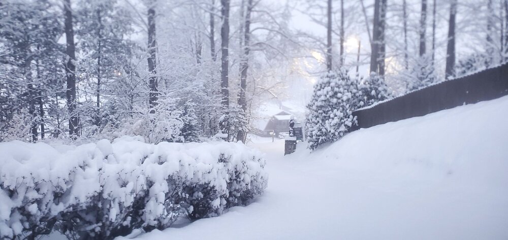
2025-2026 Fall/Winter Mountain Thread
Maggie Valley Steve replied to Buckethead's topic in Southeastern States
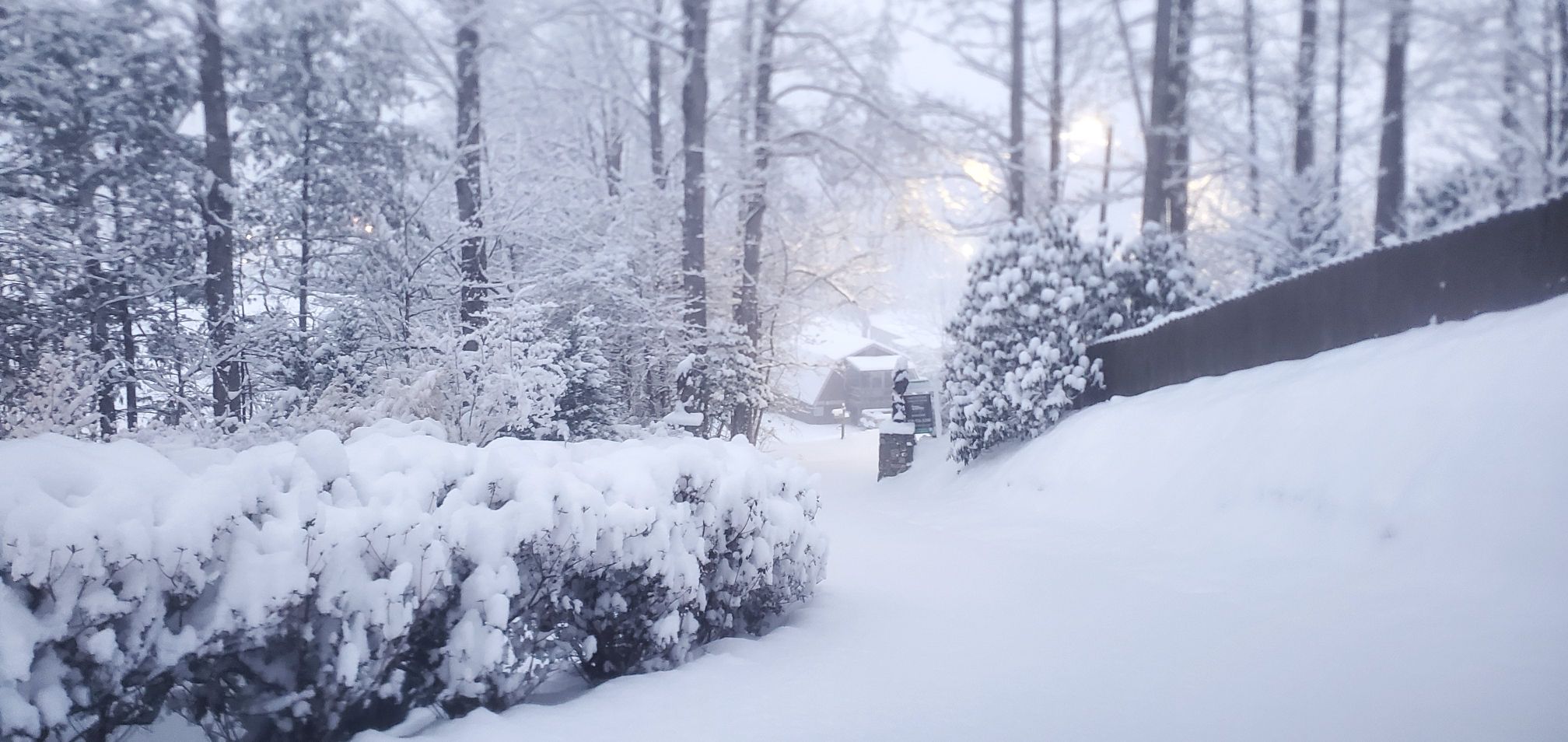
First morning shots. There was no hyping here in the Mountains that's for sure.

-
Models clearly showing some containment breaking later this evening as the flow snow kicks on
-
I think severe have a shot at a foot of snow.
-
I thought we had a chance to get to lower single digits. 10 again.
-
Wake up @calculus1, we’re getting smoked
-
We will see guys. I still think a moderate 2-6 event in VB especially southern vb. The NE wind direction currently keeps me fairly hopeful atm. If nothing else this has been fun to track. Thundersnow possible in our region later?? Even if its to our south is awesome. .
-

Winter cancelled/uncancelled banter 25/26
North and West replied to Rjay's topic in New York City Metro
Is there a bigger list available? I want to show my dad one that includes 1960-1961. . -

Let’s talk winter!! Ohio and surrounding states!! 24'-25'
IWXwx replied to buckeye's topic in Lakes/Ohio Valley
You must be talking about Beau Dodson. I think he still lurks here from time to time. I vaguely remember seeing him post something a couple of years ago. https://beaudodsonweather.com/ -
I shudder to think what'll happen once the pendulum swings, hopefully it's not in the summer.
-
 To go along with jeff's post about the clouds, I thought I'd drop a infrared satellite pic (gif and static) Zoomed out SE GOES : Mesoscale GOES:
 -

The “I bring the mojo” Jan 30-Feb 1 potential winter storm
PackGrad05 replied to lilj4425's topic in Southeastern States
2 to 4 is possible only bc of high ratios. They may save us. . -
I hate it here
-

Central PA Winter 25/26 Discussion and Obs
canderson replied to MAG5035's topic in Upstate New York/Pennsylvania
Busted way high. 7 was my low. -
About 12 more hours of this fellas!